Tongariro Alpine Crossing – A Love Affair with a Volcano
I waffled back and forth on whether or not I would hike the Tongariro Alpine Crossing. It is supposedly New Zealand’s “Best Day Hike.” But then, the Hooker Valley Track also has that moniker. I also have a slight rebel personality. I get it from my dad. For example, my dad hates ketchup purely because most people seem to love it. I have, unfortunately, inherited a tiny bit of this rebel elitism. I refused to read the Harry Potter book series for many many years because everyone else raved about it.
And then I read it in High School, and it was great. So there’s that lesson learned.
So I try to tamp down my initial inclination to dislike something simply because it is popular. Because there is a reason its popular. And also, so what if people like something I don’t like. It doesn’t make either one of us better or more right.
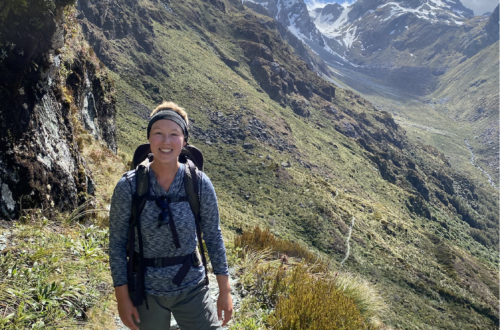
However, there is a difference between reading a book everyone loves and hiking a trail everyone loves. Because you read the book alone, but you might have to share that trail with 3,000 other people. Alternative hikes in Tongariro National Park have far fewer people. But I’m blessed to have an abundance of time in New Zealand, so after I did several alternative hikes in Tongariro, where I hardly saw any other people, I decided I must tackle the Tongariro Alpine Crossing.
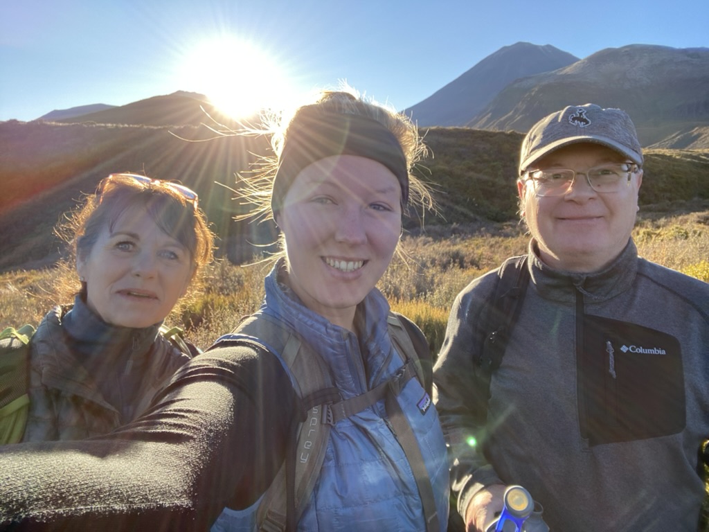
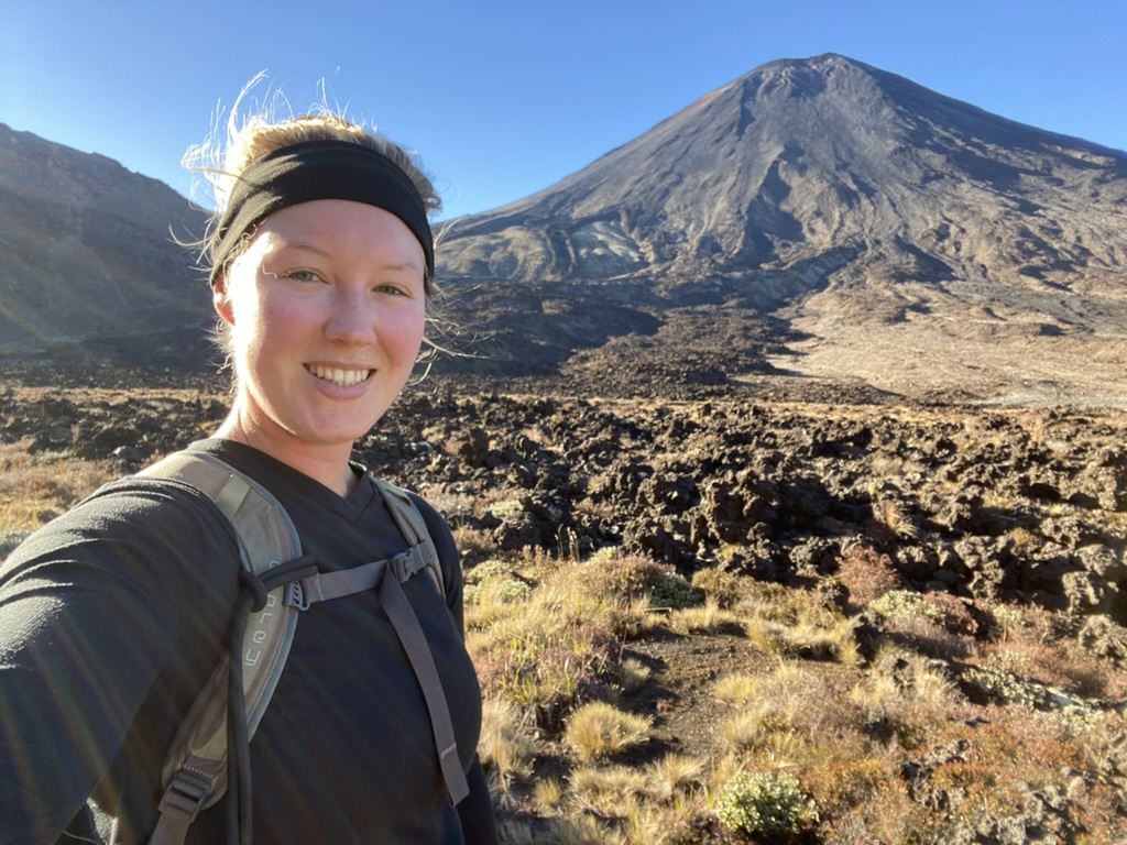
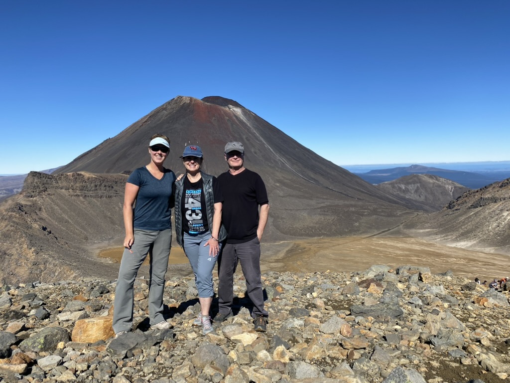
And Curve and Shelley, my last set of visitors to New Zealand, wanted to do it with me.
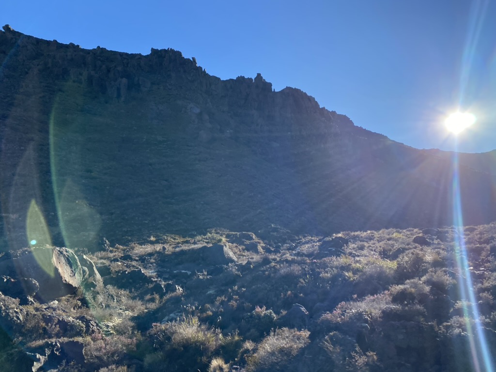
When we went out to the car in the morning, the air was crisp and chilly. A thin layer of ice coated my windshield. I was reminded of Colorado, of pink-nosed mornings watching the sun come up while out hunting. Hardly a cloud threaded the sky.
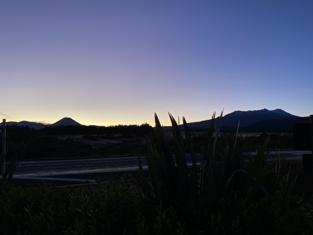
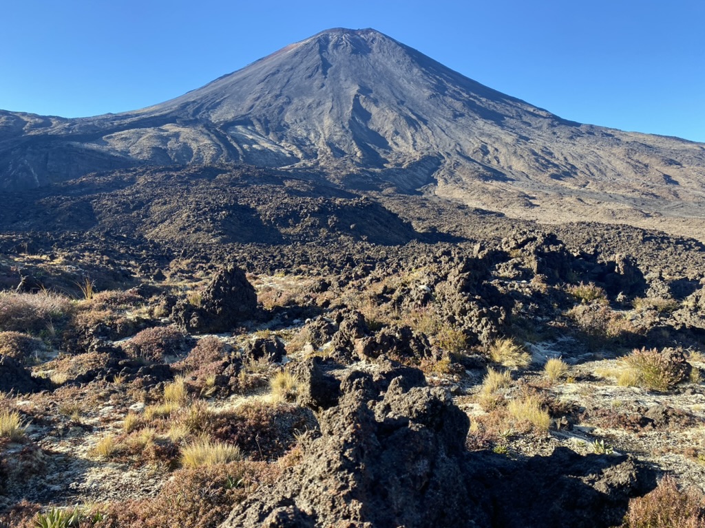
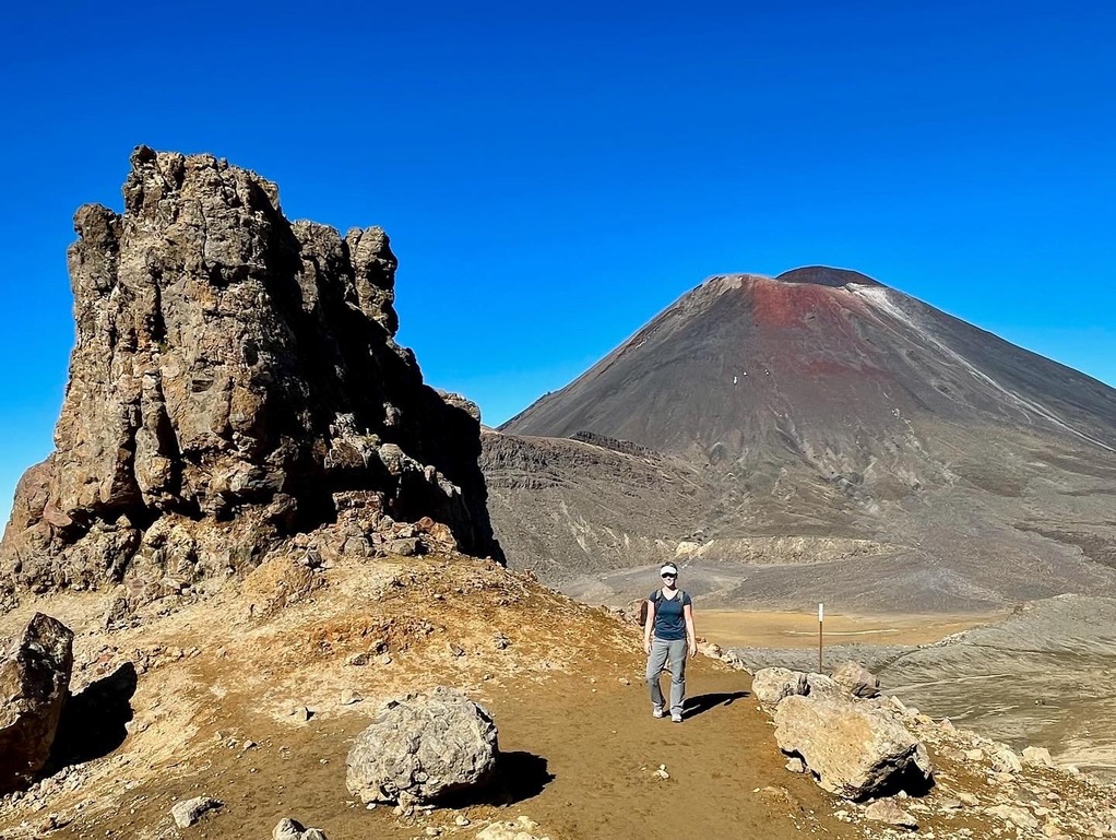
We drove about 20 minutes, skirting around where we would hike later. Snow-capped Mount Ruapehu, the tallest mountain (and volcano) on the North Island, was a stable presence, wide-spread and ridged like wings. Mount Ngauruhoe looked more delicate and more deadly, a symmetrical cone rising out of dark rock, lithified volcanic ash.
We drove to the end of the track where I could park my car and catch a shuttle to the beginning. Shuttles came every minute or two, loading groups of people and scurrying off to deposit them at the start. We arrived at a good time and only had to wait for a few minutes, but the line behind us tripled in size, abuzz with people eager to put boots on the trail.
It was certainly busy at the beginning of the track. I pulled off my hat and a layer of clothes, and we started moving–partly to get ahead of some of the people and partly to start warming up, get that blood flowing.
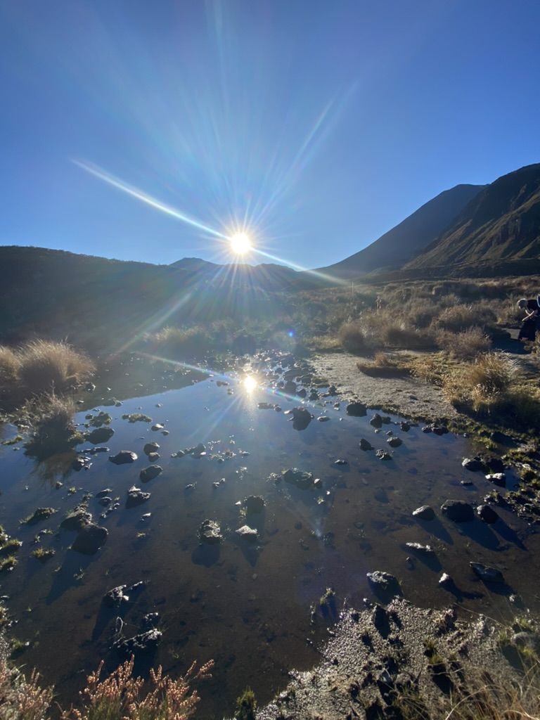
We were hiking into the rising sun, which was good for warming my face, but not great for looking around. Everything was sun-streaked and dark, shadowed so that it was difficult to see the different flora and fauna growing scraggily and tough along the rock. It was difficult to make out amongst the interplay of shadows and light, but the valley has been shaped by both ice and fire. During the last glacial maximum, much of the area was covered in glaciers which moved down the slopes around Mount Ruapehu and Tongariro, so piles of moraine rocks are present. Yet, the characteristic U-shape of a glacial valley is missing. This is because ancient lava flows filled up the valley, forming the surface we are walking on.
The first kilometer felt bursting with people, but as the sun rose higher and finally I could see a little bit more, the crowds got spaced out. Everyone was extremely diligent in stepping to the side to allow others to pass. Once out of that initial bottle-neck, I began to feel more kinship with the other hikers rather than annoyance.
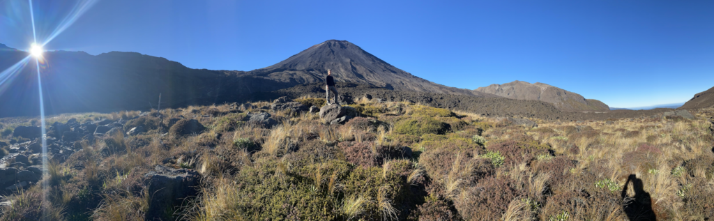
This is about the time that the boardwalk path took us alongside Mount Ngauruhoe. I couldn’t help but feel kinship with the groups of people huddled to the side, taking photos with the giant volcano behind them and maps of Middle Earth stretched open between them, silly grins upon their faces.
If I had been hiking alone, I would have stopped, offered to take photos, struck up conversation, and maybe mentioned how much I love that story. I had loved running into other LOTR’s nerds in Wellington while taking photos of Frodo’s reading tree.
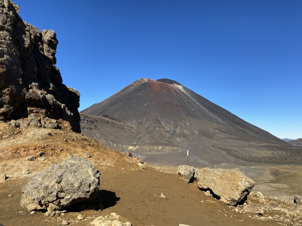
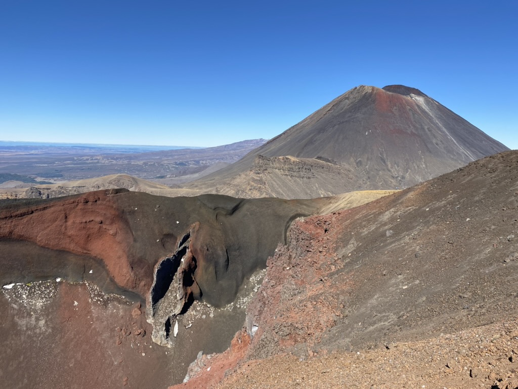
However, while I could appreciate Mount Ngauruhoe for it’s role in the Lord of the Rings, it didn’t feel like Mount Doom. It was big and imposing and had it been spitting fire, I would have been running for my life. But it wasn’t. It wasn’t malicious or violent or dark. It was beautiful. It held a promise of violence, but violent beauty. Powerful beauty. There is something thrilling about the shape of a cone volcano, something unnatural and natural all at the same time.

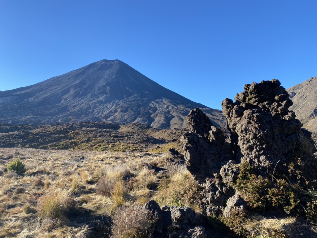
The rocks at the foot of it were equally beautiful, twisted and billowing, as though the ash hardened into rock while still holding tight the memories of being as light as air. The rock was hard, tough, and dark on the outside. But if it split (I found a broken piece on the ground), the inside was white, and powdered away when I scraped at it with a fingernail.
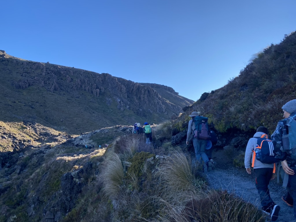
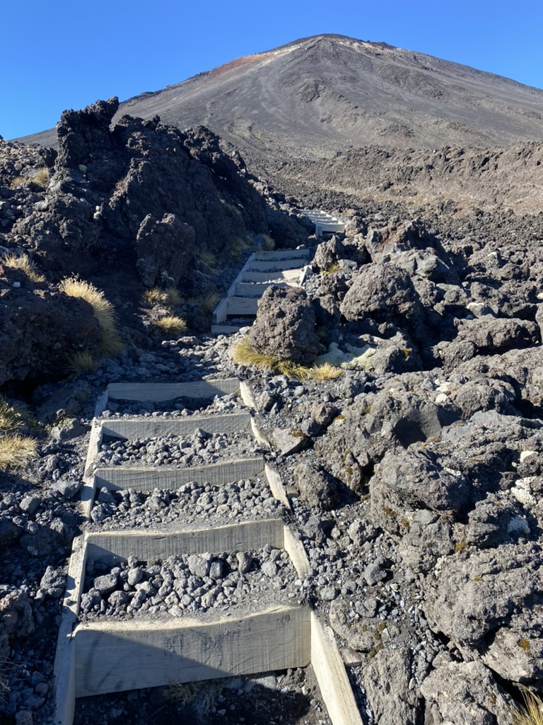
We kept walking. The trail had ever so slightly ascended for the few kilometers, but it was hardly noticeable. After we passed a small bridge, it began to climb more steeply and steadily with steps pounded into the landscape. People littered the sides of the track like rubbish, sitting on rocks, leaning on each other, or milling about and gulping water. But it wasn’t a difficult climb. In fact, it (aptly) reminded me of both the Routeburn Track and Milford Track. Those two Great Walks had elevation gain, but it was in short, steep bursts paired with slight gradations.
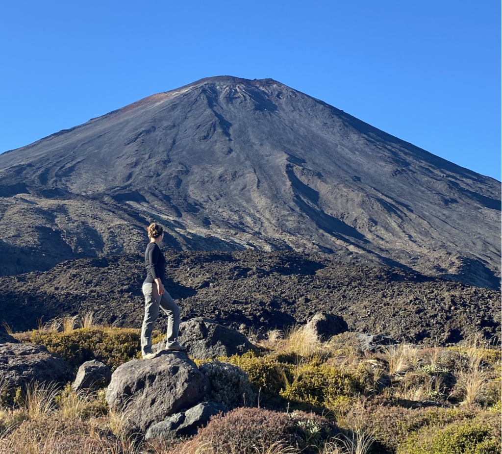
After a short climb, we got as close as we would to Mount Ngauruhoe. Close enough that if the west crater rim decided to crumble, the rocks would slide straight down the slope and sweep up off our feet. Curve, Shelley, and I spotted two people climbing the steep, loose, zigzagging path up the side of Mount Ngauruhoe, but we decided to leave that for another day and continued on.
New Zealand is at the edge of two tectonic plates: the Pacific Plate and the Indo-Australian Plate. In the south, the Pacific Plate rises high, but in the north, the Pacific Plate dives beneath the other. This twisting of plates is the source of Tongariro National Park’s high volcanic activity. The plates rub together, causing friction, causing heat, making magma. That magma is less dense than rick, so rises upward, but it is thick and sticky so if gases get trapped beneath, they can build up until they explode, causing magmatic volcanic eruptions.
The track showcases the best of Mount Tongariro, of which Ngauruhoe is one of twelve vents. Ngaurhuoe is the youngest and most active of Mount Tongariro’s cones with it’s most recent eruption in 1975. The cone was formed only 2,500 years ago (so technically democracy was put into practice in Ancient Greece about the same time that Mount Ngauruhoe began to form).
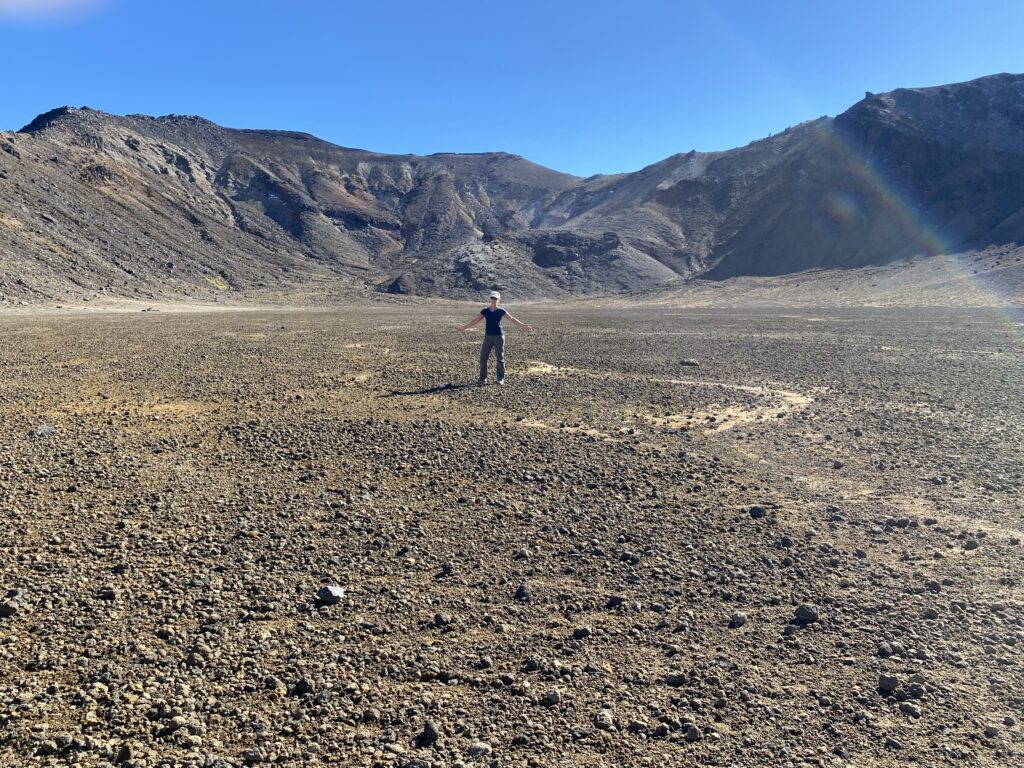
The path evened out and we walked through the South Crater. Not technically a crater, geologists think that it was hollowed out into a bowl shape by a glacier. Eruptions and ash layers in the following centuries as well as erosion from win and rain have helped fill it in. The crater is almost perfectly flat and littered with small, dark rocks as though they were sprinkled from the sky like rain. I ventured off of the well-trod and poled path onto some of the rubble and it was a little bit squishy as though it still had layers of air beneath. The closest thing I can think of is walking on several inches of soft snow compared to walking on packed snow, like no foot had ever trod there before.
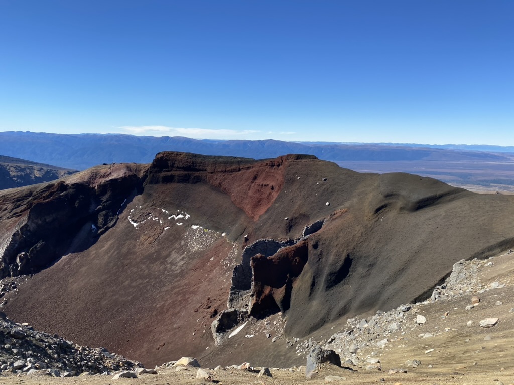
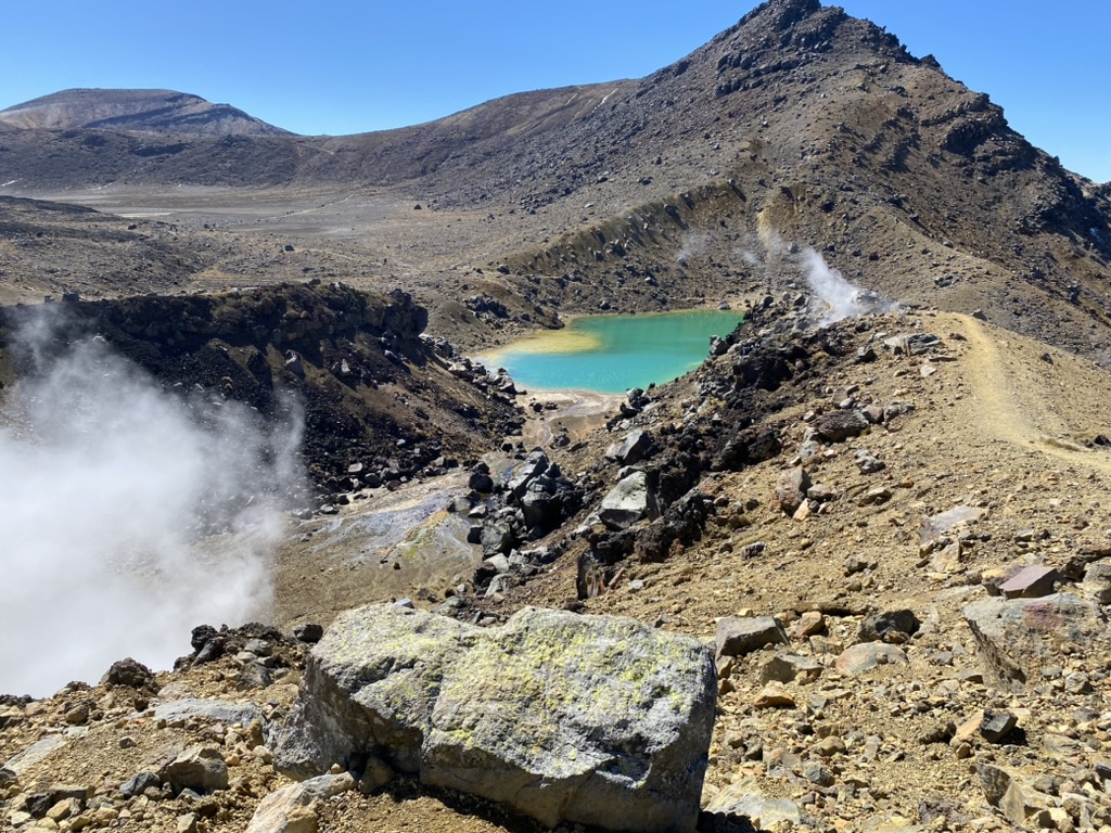
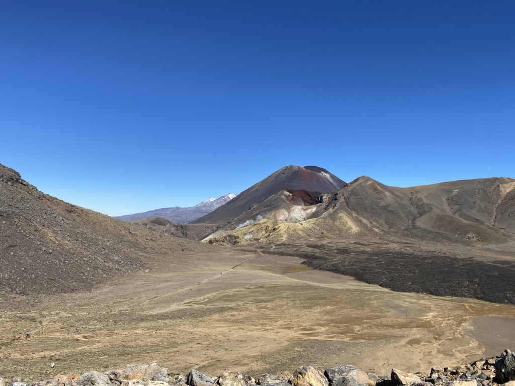
We climbed some more, but not a particularly long or difficult climb and emerged at the edge of Red Crater. This time the crater is correctly named as it is a volcanic crater lined with basalt scoria rock. Scoria is formed from lava that has erupted from a volcano and quickly cooled on the earth’s surface, so it has many small cavities within. Scoria is usually dark grey, but the Red Crater is so named because high heat eruptions have oxidized the iron in the scoria rock, turning it a vivid, rusty red.
A dike emerges from the wall of the crater like one of those giant sandworms from Dune. Except the worm is gone and only a husk remains. What happened is that molten magma moved towards the surface of the earth. The outer surface of the magma solidified while the molten inner lava retreated, leaving an empty husk. The scoria around it has been cleared by eruptions or eroded away, but the hardened magma is much tougher and slower to erode.
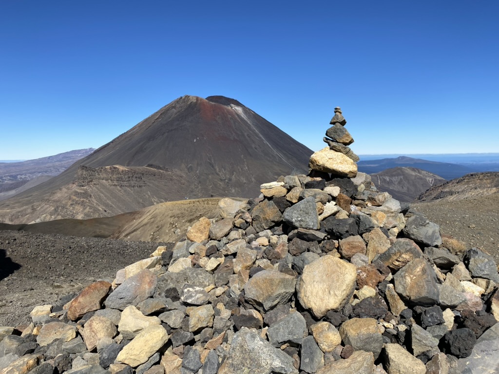
The summit of Red Crater is the highest point of the trek and from here we descended down a loose rubble slope. I did fall once, but it was pretty fun slipping and sliding down the edge of a volcanic crater with a bunch of other people. I got talking to several folks as we windmilled our arms and bent our knees!
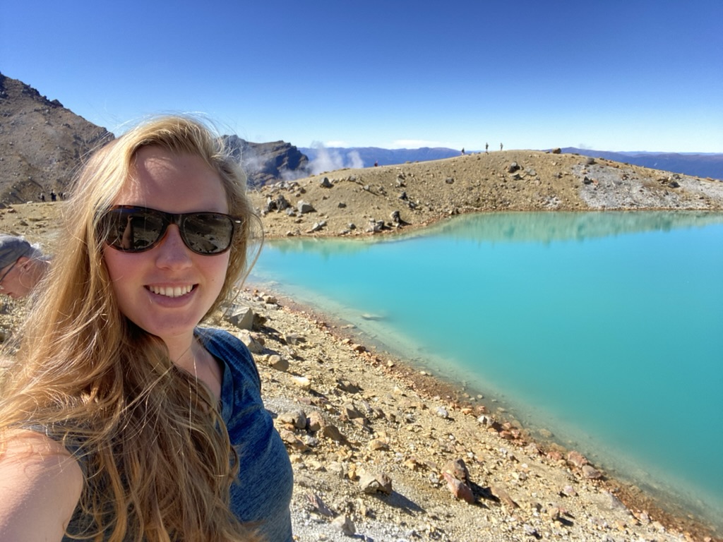
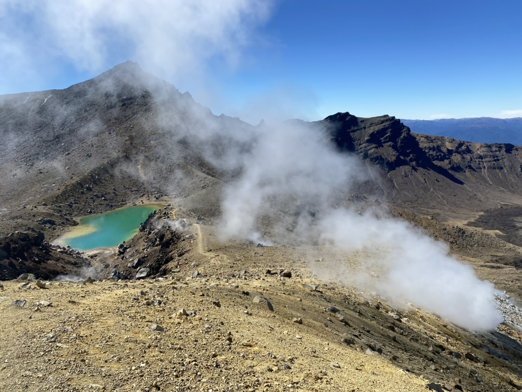
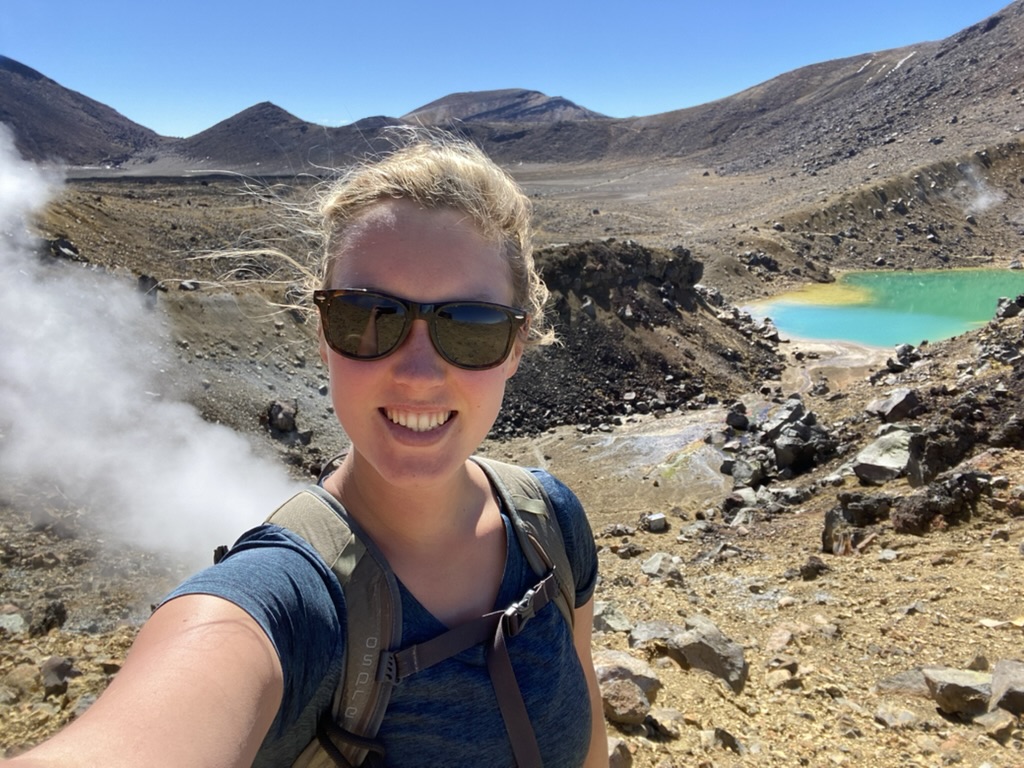
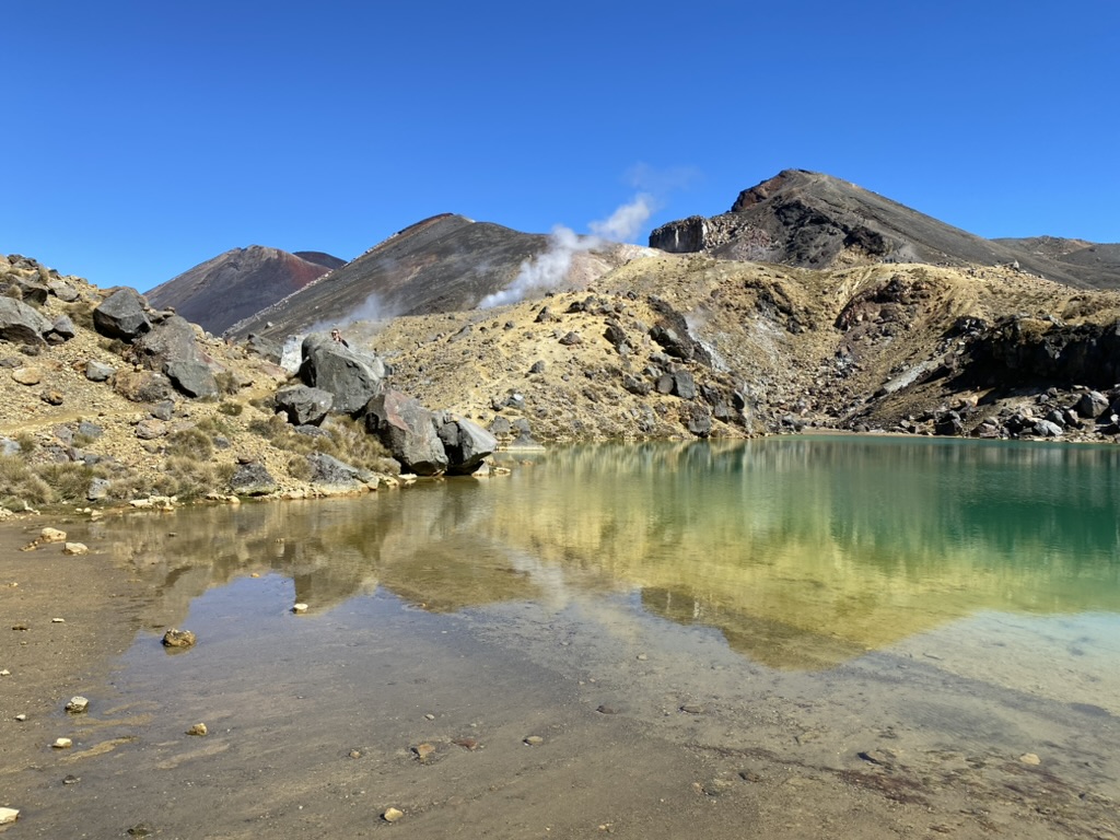
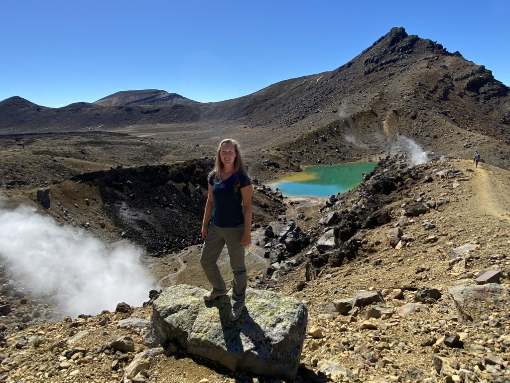
At the bottom of the slope, Emerald Lakes brighten the dark landscape. Fumaroles (steam vents) shoot into the sky, draping the area in mist and sulfur stench. The lakes are old explosion craters from about 1,800 years and the color comes from sulfur seeping into the water.
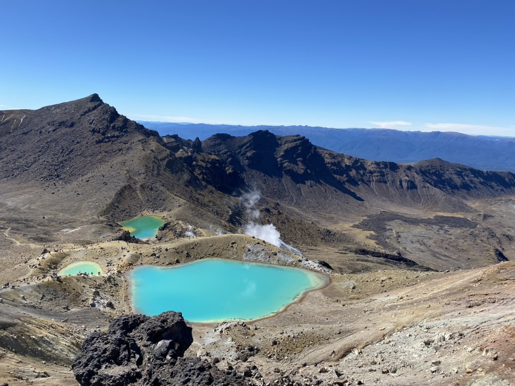
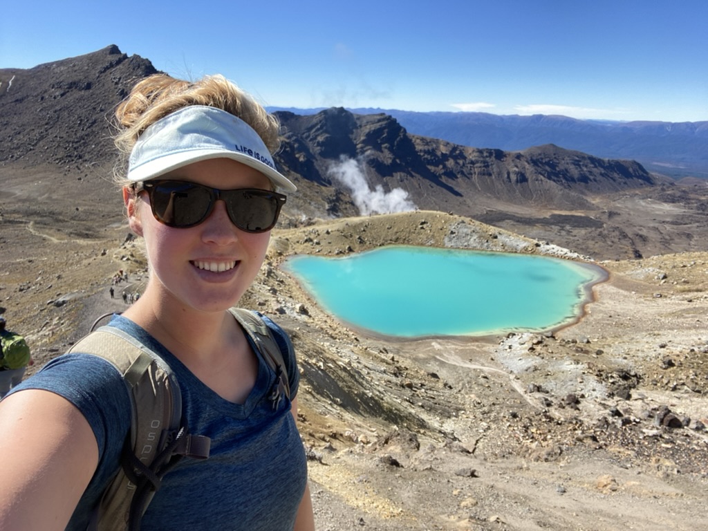
The lakes are acidic and cold (which I discovered by touching them, as I assumed that there would be a sign if they were going to boil the flesh from my fingers). Later, I looked it up and they are always cold. They freeze in the winter… I wonder if the ice is tinted blue…
We climbed down the hill a little ways to eat lunch in a little bubble away from other people and out of the sulfur gusts. Looking out over one of the Emerald Lakes toward steaming vents, we could have been alone.
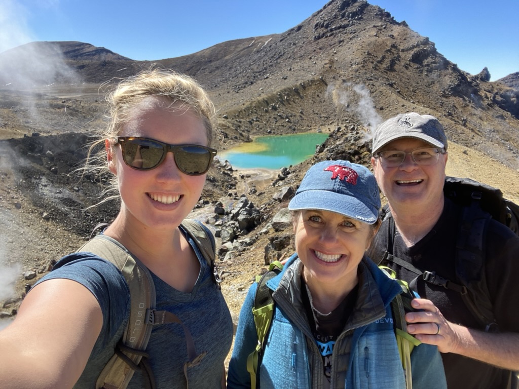
Content with already having done most of the climb, we spent over an hour hanging out in that beautiful spot, laughing at other hikers trying to do handstands and failing, running over here to take photos and then over here and then delighting in the rock formations and the colors and the steam and the white sulfur smeared across the rocks.
I could have stayed all day, especially as more and more people got up to go and fewer arrived.
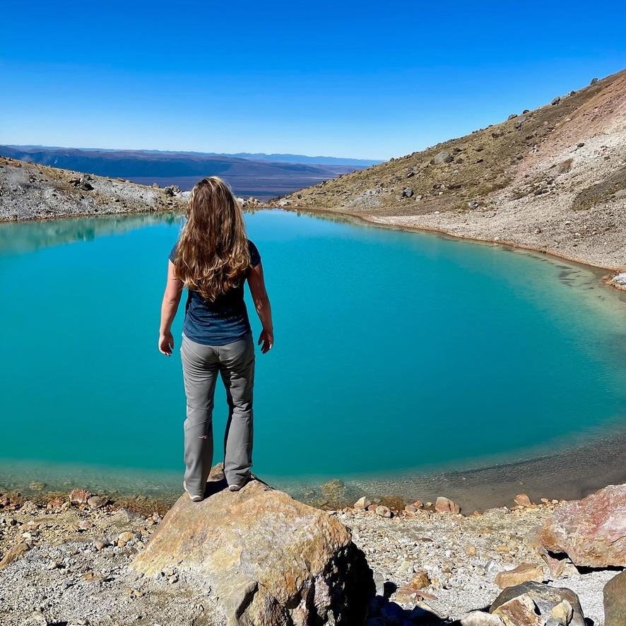
But we weren’t even halfway yet, so we got up and crossed Central Crater (again, not a volcanic crater but one formed from a glacier). A lava flow cuts through the south side of the crater. Blue Lake sits above it in a volcanic crater.
And thus ends the best part of the walk, but we’re only halfway.
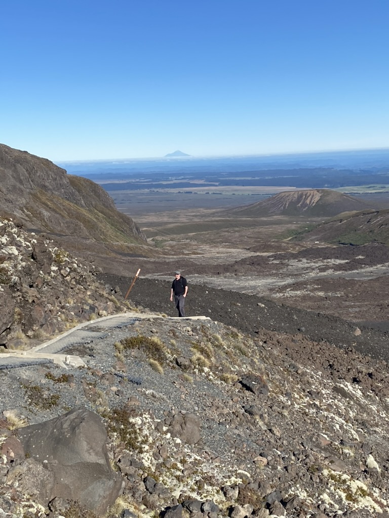
The second half is all downhill, but it is somewhat endless as we descend the northern edge of Mount Tongariro. The Te Maari craters shoot steam into the air at a rapid pace. The area last erupted in 2012 sending great plumes of smoke and steam into the air and threw rocks (one as big as 3 tons) over 2km away. But the seismic activity stopped so they eventually reopened the track. Then out of the blue, another eruption shot ash into the air. Supposedly quite a few hikers were walking the trail at the time, but the wind was blowing away from them so none were injured. But I bet they ran!
You can also see several impact craters near the track, from where giant rocks landed on the ground. In fact, there used to be a hut in this area of the track, but it was hit by such rocks and so closed down and never rebuilt.
Further down the trail, a sign warns of lahars, which are mud flows common in volcanic areas. They can occur when high heat melts a lot of snow or when the edge of a crater lake falls away. Lahars can move very quickly and destroy everything in their path. In 1953, a lahar destroyed a railway bridge, which was only discovered when a train came. 151 people were killed.
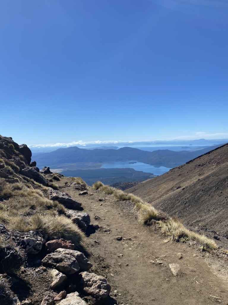
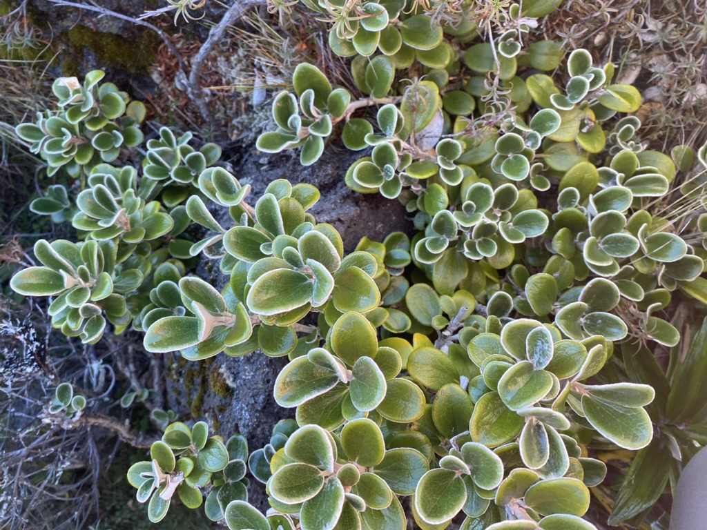
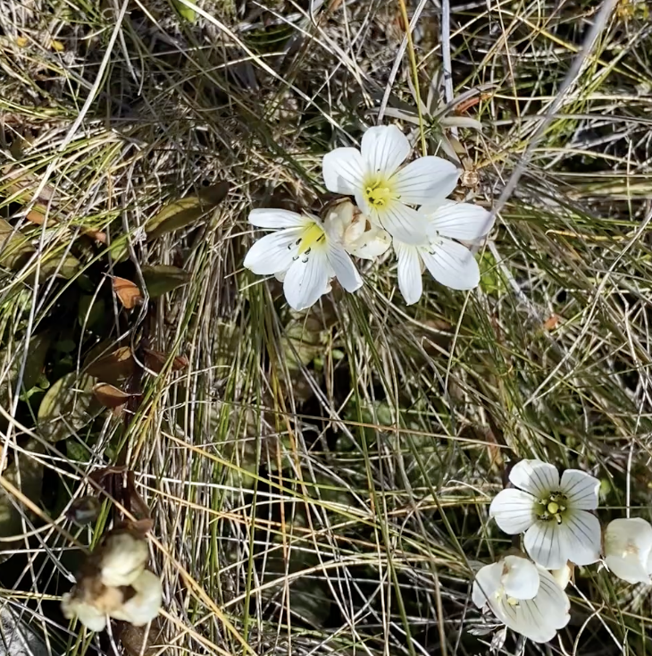
But we had no such incidents…just sore feet as we descended for about six miles on a gorgeous, clear day with views of Lake Taupo in the distance and steaming vents from Te Maari and Ketetahi Hot Springs on each side of the track. While the hillsides appear barren from a distance, they were actually alive with tough alpine plants and flowers, showing how flora creep back into a space even after such upheaval.
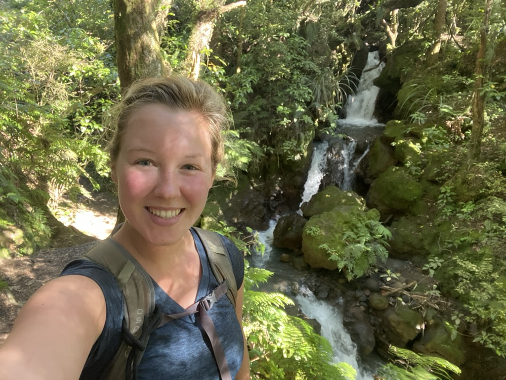
For the last kilometer of the track, we entered a forest–the first trees we’d seen on the whole track–and a waterfall rewarded us right before the end, a rejuvenating scene to propel us the last few hundred meters back to the car.
So, there were a lot of people, but beyond the first forty-five minutes, I found that they didn’t really bother me. Everyone was there to appreciate the scenery, to delight in the volcanic landscape, and to enjoy the fine weather day, so we were all united in a mind-set of respect and sharing, and so I didn’t mind having them around. In fact, with twelve miles of hiking, you find your speed, and so do the people around you. For there being hundreds of people on the track, it actually ended up feeling a lot more like a Great Walk by the time I finished as I would continually encounter the same people. We’d nod, we’d say thanks, we’d comment on how beautiful the day was. In the end, it didn’t feel crowded, only congenial.
It was an absolutely stunning and gorgeous day walking among a strange, mysterious, deadly, and beautiful landscape. One that I couldn’t help but fall in love with… along with all the other hikers on the trail.


2 Comments
John Mathews
The Tongariro Crossing was absolutely amazing. Thank you so much for being our New Zealand guide for two weeks Maddie🤠
Maddie
Anytime Curve!