The North of the South: Picton to Golden Bay
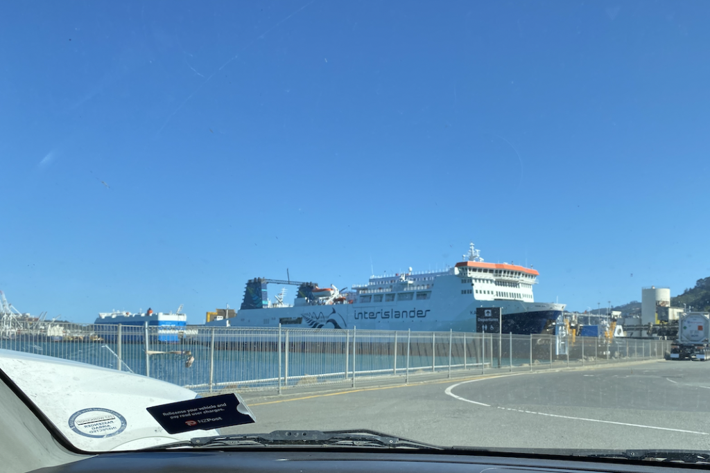
Crossing the Cook Strait between the North Island and the South Island felt like embarking on a completely new adventure. Perhaps it was the high expectations. After all, nearly every person I’ve spoken to, Kiwi and traveler alike, told me the South Island was the best island, that it would blow my mind, that it was far more beautiful. All of these expectations bubbled in the back of my mind like a boiling pot even as I tried to suppress them. High expectations often lead to disappointment.
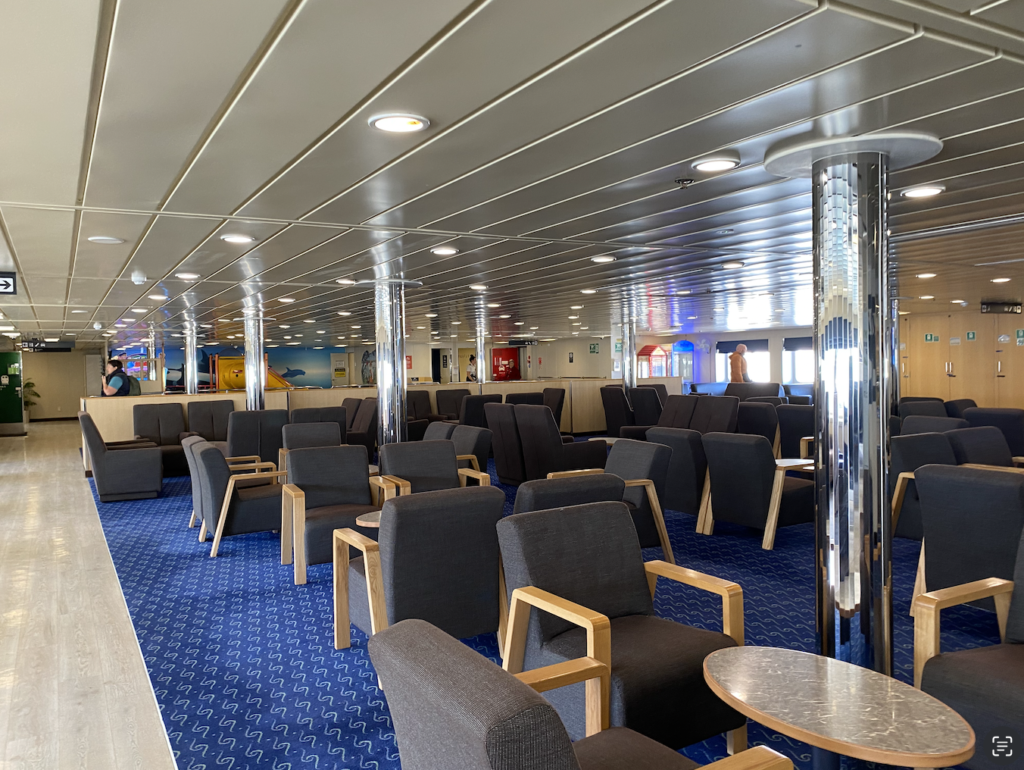
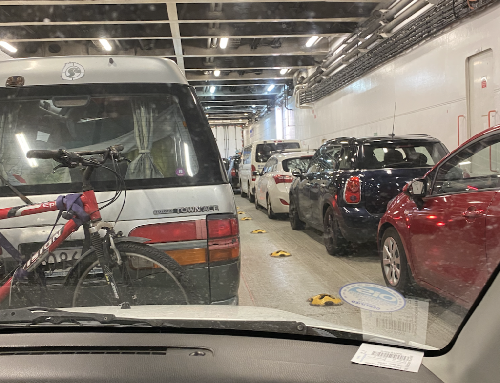
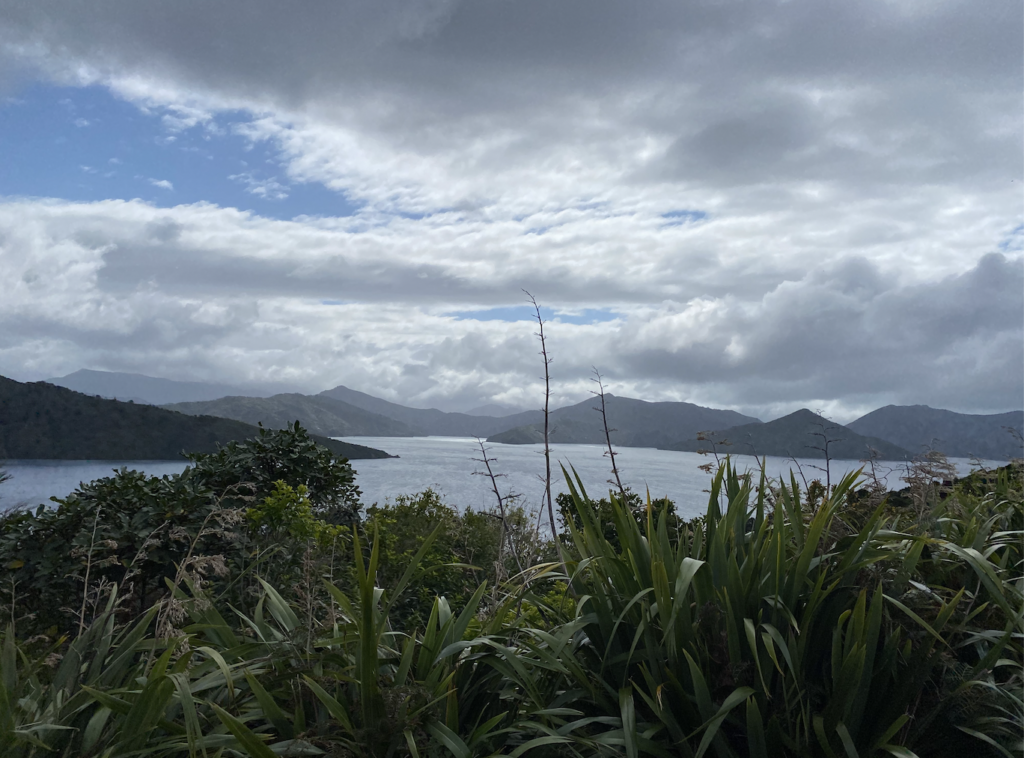
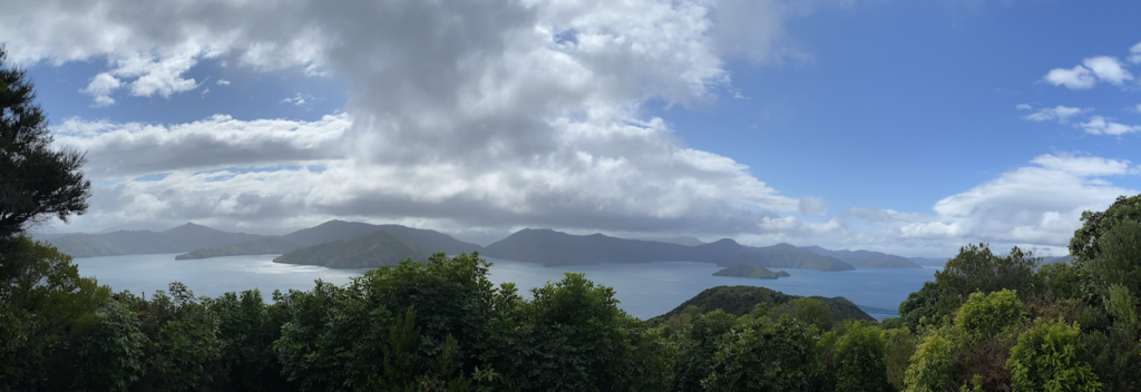
But the ferry crossing, though windy as heck, was beautiful. First, there’s some open water to cross, but almost the moment the boat left the Wellington harbor, the mountains of the South Island were already hazy promises on the horizon. The last hour of the ferry ride winds through part of the Marlborough Sounds–green, mountainous islands and narrow fingers of land that rise out of the sea with no warning.
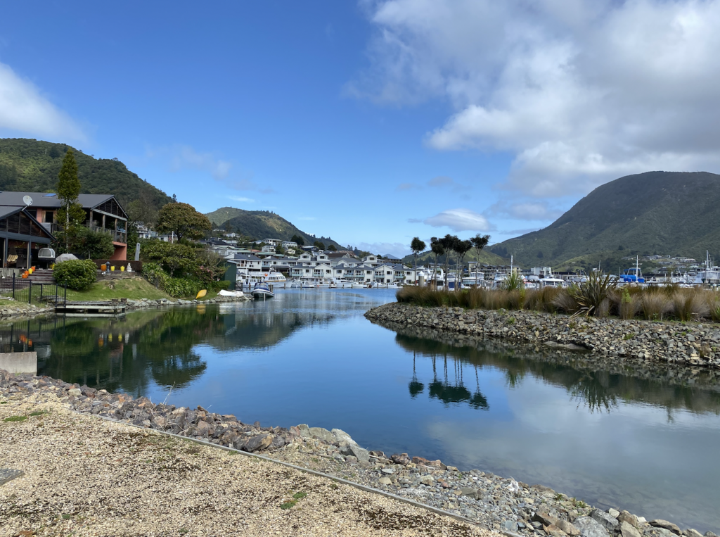
My first stop, as is anyone’s who takes the ferry, is the tiny town of Picton.
Picton
I arrived in the evening, driving off the ferry at dusk and winding through the short streets of Picton in search of my accommodations. I stayed at The Villa, a cute backpackers situated in an old house. For being a ferry-town, The Villa was quiet, just what I wanted after a full day of travel.
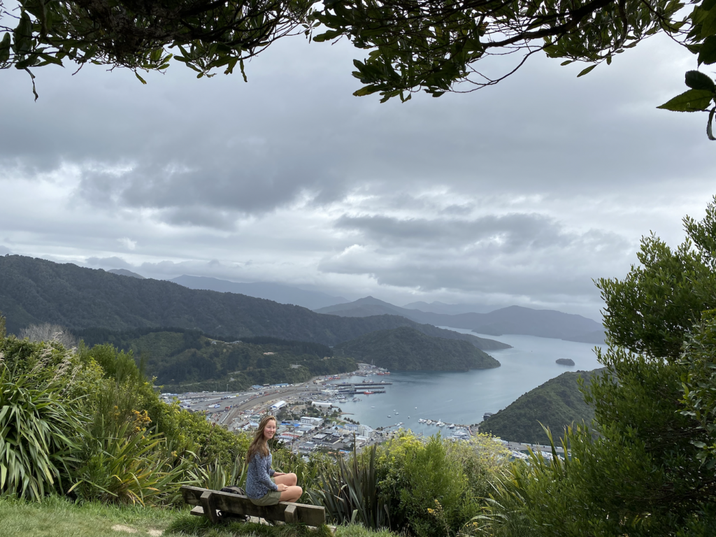
The next day I was determined to see the area.
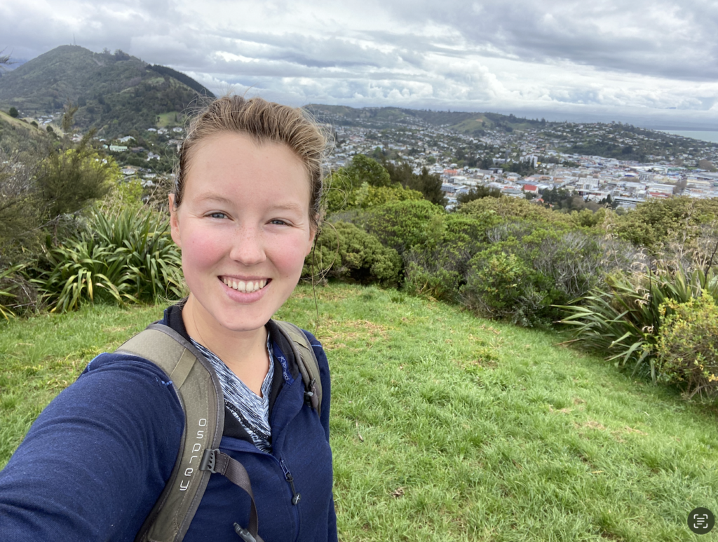
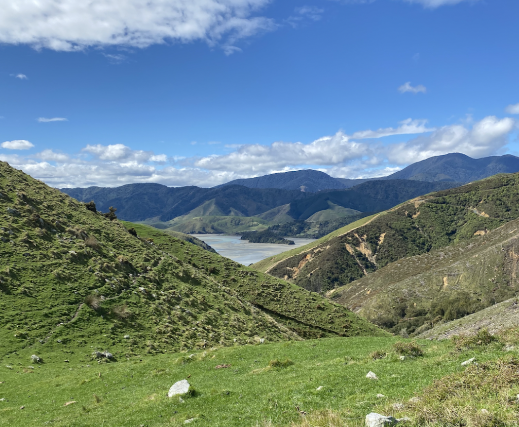
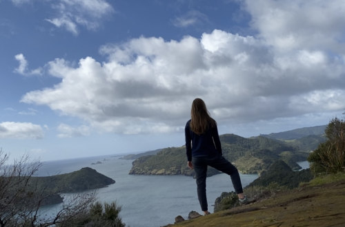
I set out on a hike above the town, so I could get some good views of the area. After hiking through forest that looked a lot like what I’d found on the North Island, I emerged out of the trees. The view was nice: the little town of Picton situated in the curve of the bay, the sounds rising in layers in the distance. But, it wasn’t mind-blowing. The expectations I’d had were higher. But that’s ok, because, from there, it only got better.
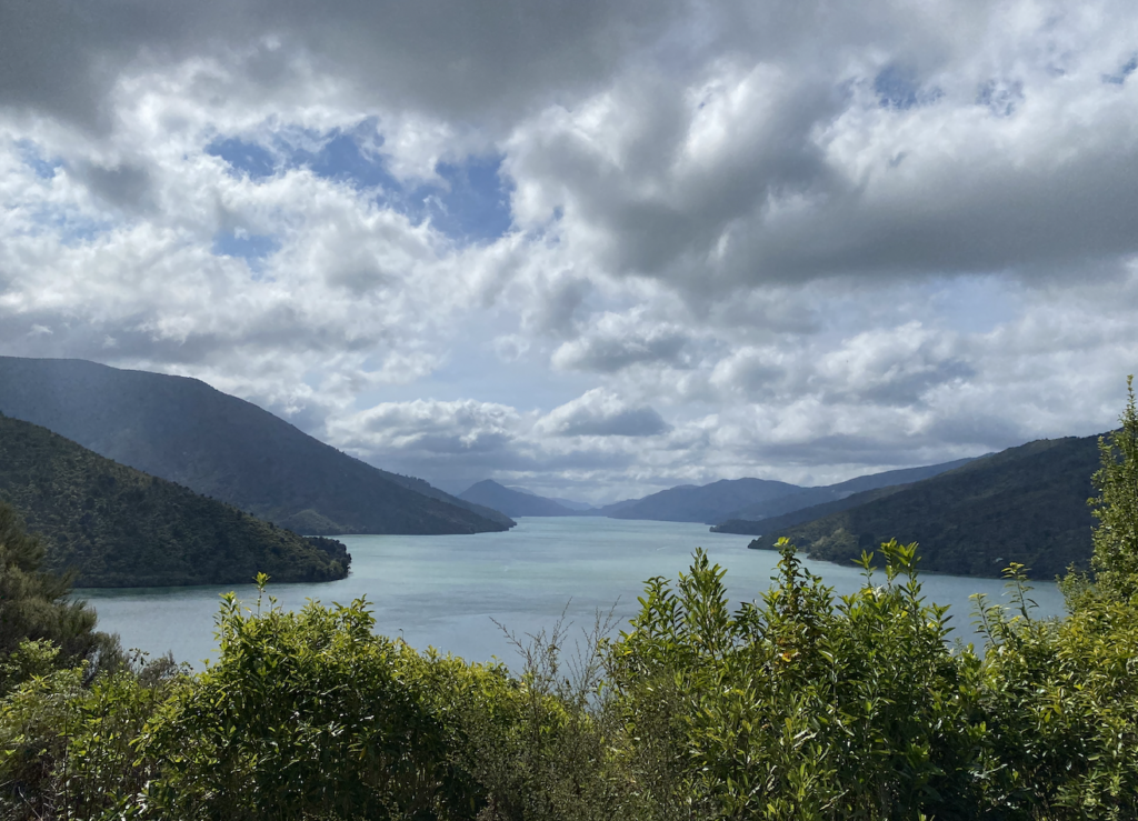
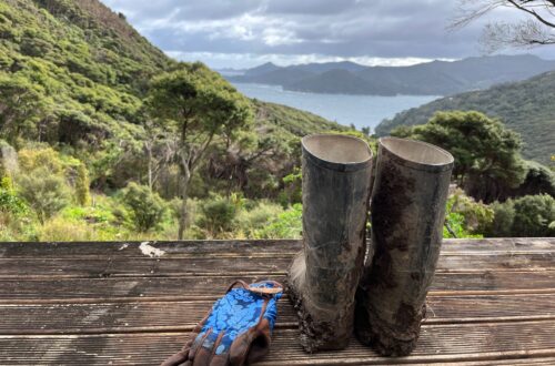
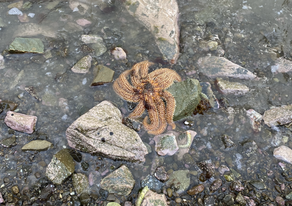
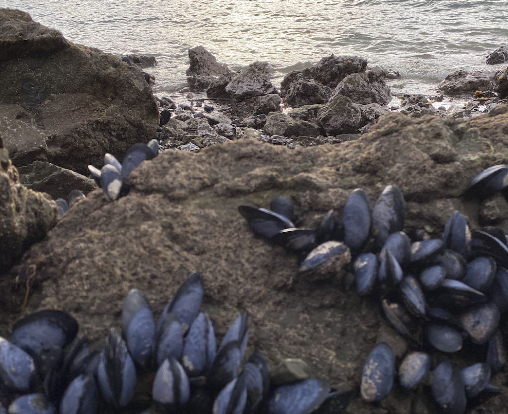
I spent several nights in Picton and I drove the Queen Charlotte Drive and hiked the Snout Track for more views of the Queen Charlotte Sound, and I even picked mussels off the rocks and ate them for dinner!
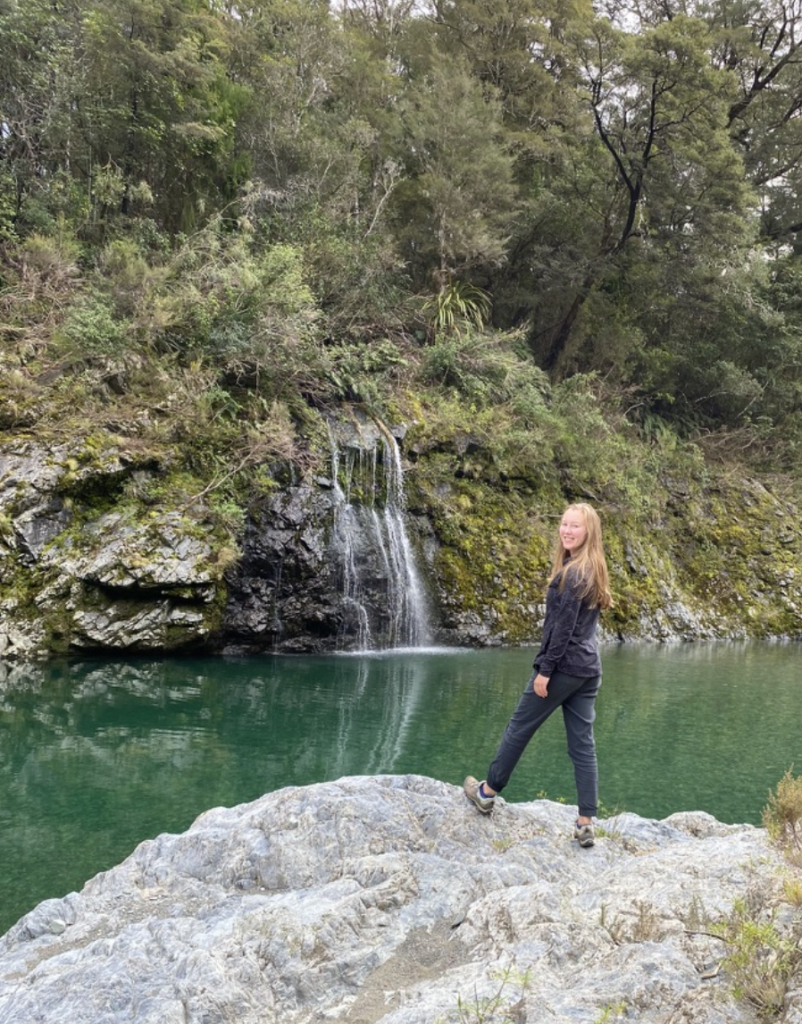
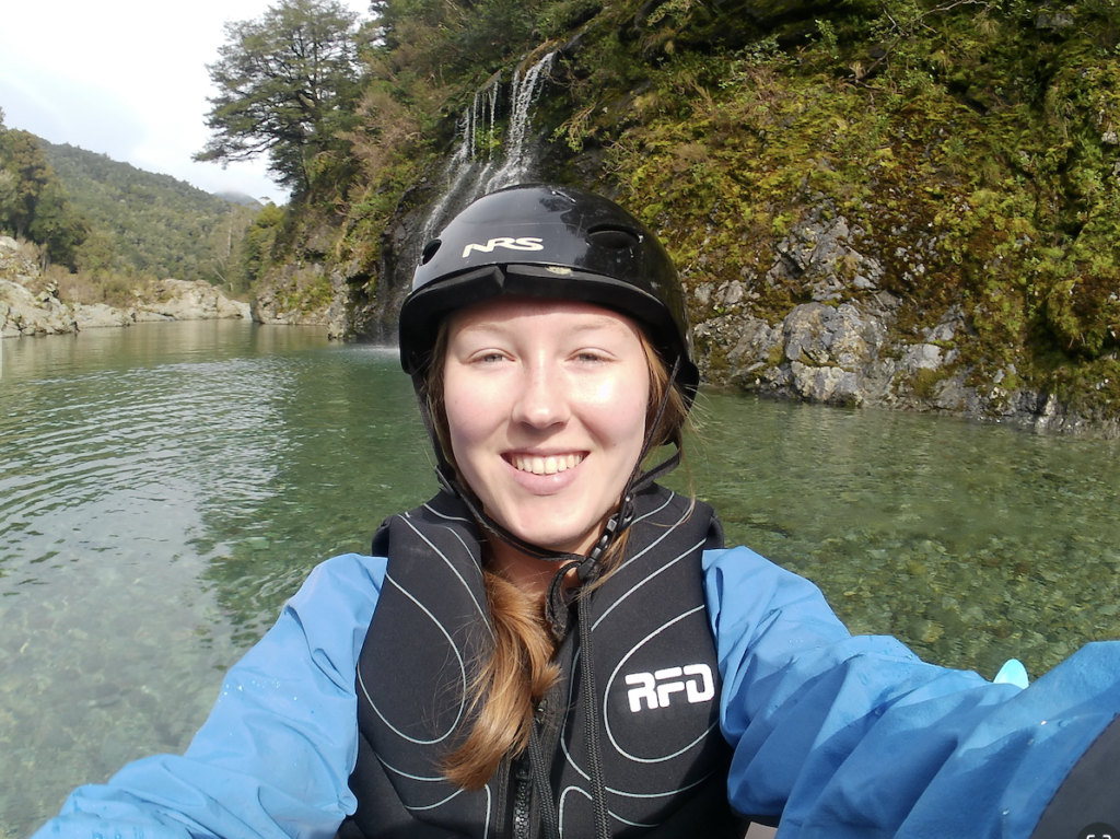
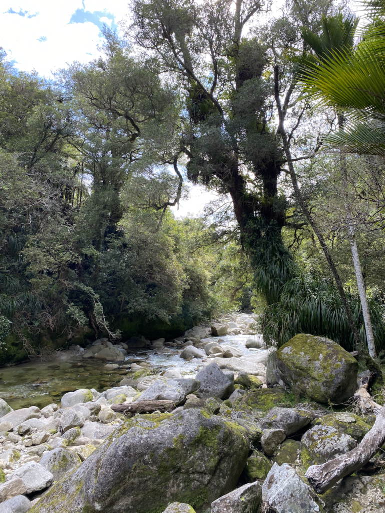
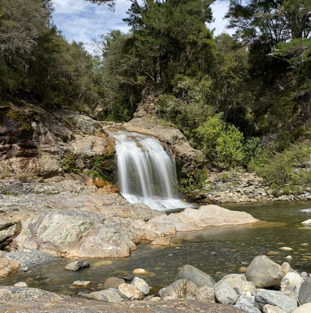
Pelorus River
I picked the Pelorus river as a place to visit because it’s a film location for the Hobbit movies. Specifically, part of the Barrel Scene in the second Hobbit movie was filmed here.
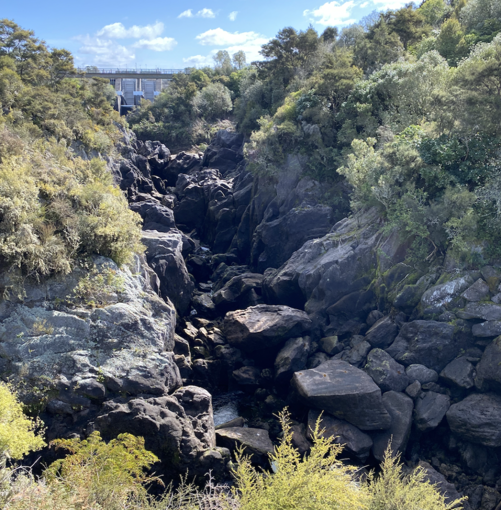
An aside: the Aratiatia Rapids
Back on the North Island, I visited another location where part of Barrel Scene was shot: the Aratiatia Rapids. Generally, the rapids are a small trickle of water threading between giant dark rocks. But every day at scheduled intervals, the dam above the rapids opens for about ten minutes, and pale blue and white water rushes through, filling the river bed to bursting. It’s incredibly dangerous, so no actors were actually involved in the filming here. Rather, barrels were dropped into the water for several days and footage captured, then the dwarves were inserted into the barrels via CGI and post-editing.
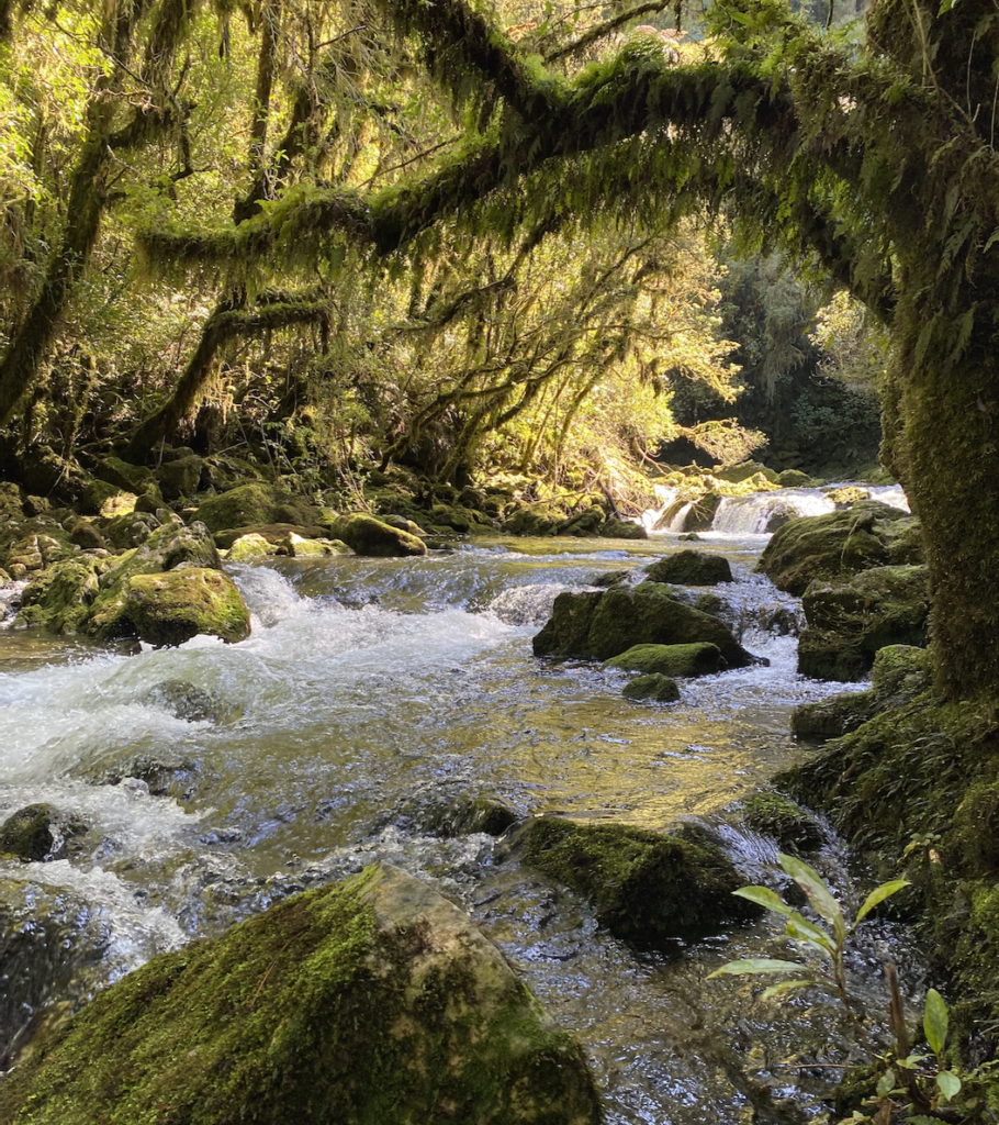
Circling back: Pelorus Bridge Scenic Reserve
The Pelorus River is much calmer, especially by the campground, so the actors actually plopped themselves into the barrels here.
I love the Lord of the Rings movies and enjoyed the Hobbit movies, but my true attraction to visiting the film sites is not to stand where the actors stood, but to see the beautiful scenery for myself. Understandably, Peter Jackson chose stunning New Zealand locations to film in, so they are entirely worth visiting in their own right.
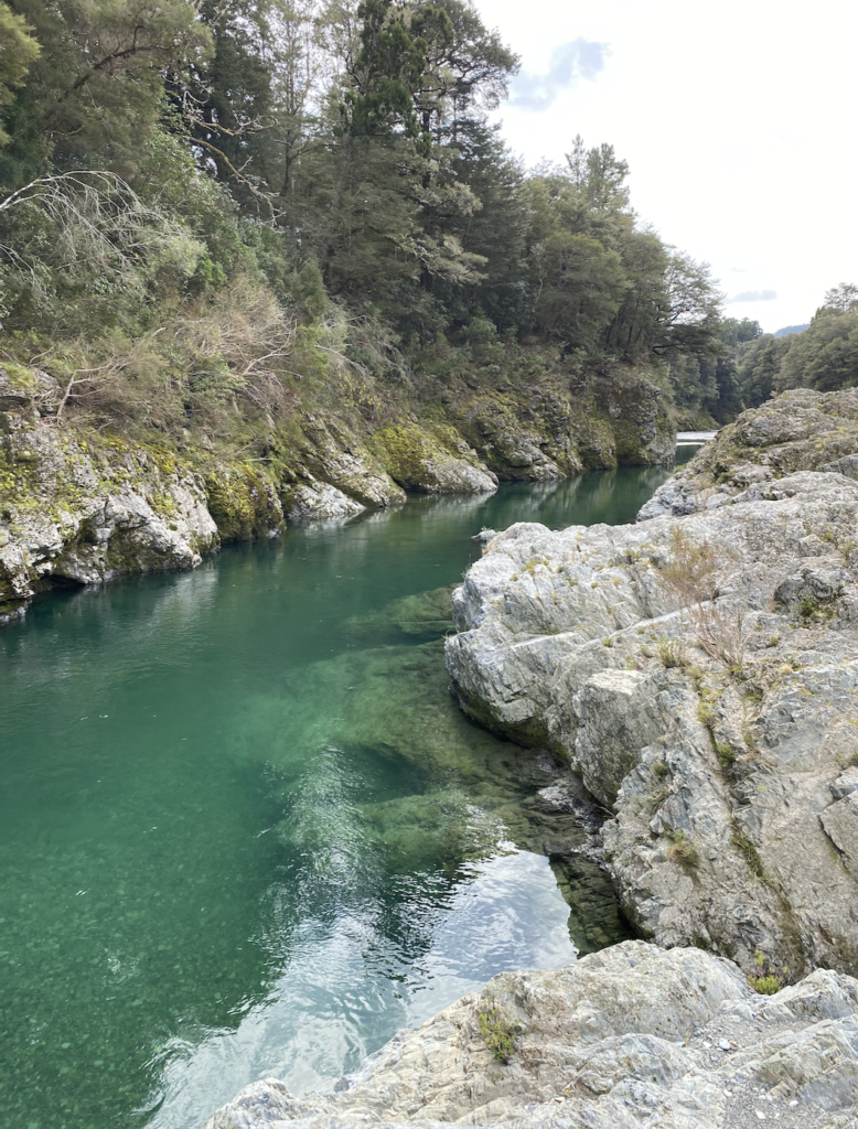

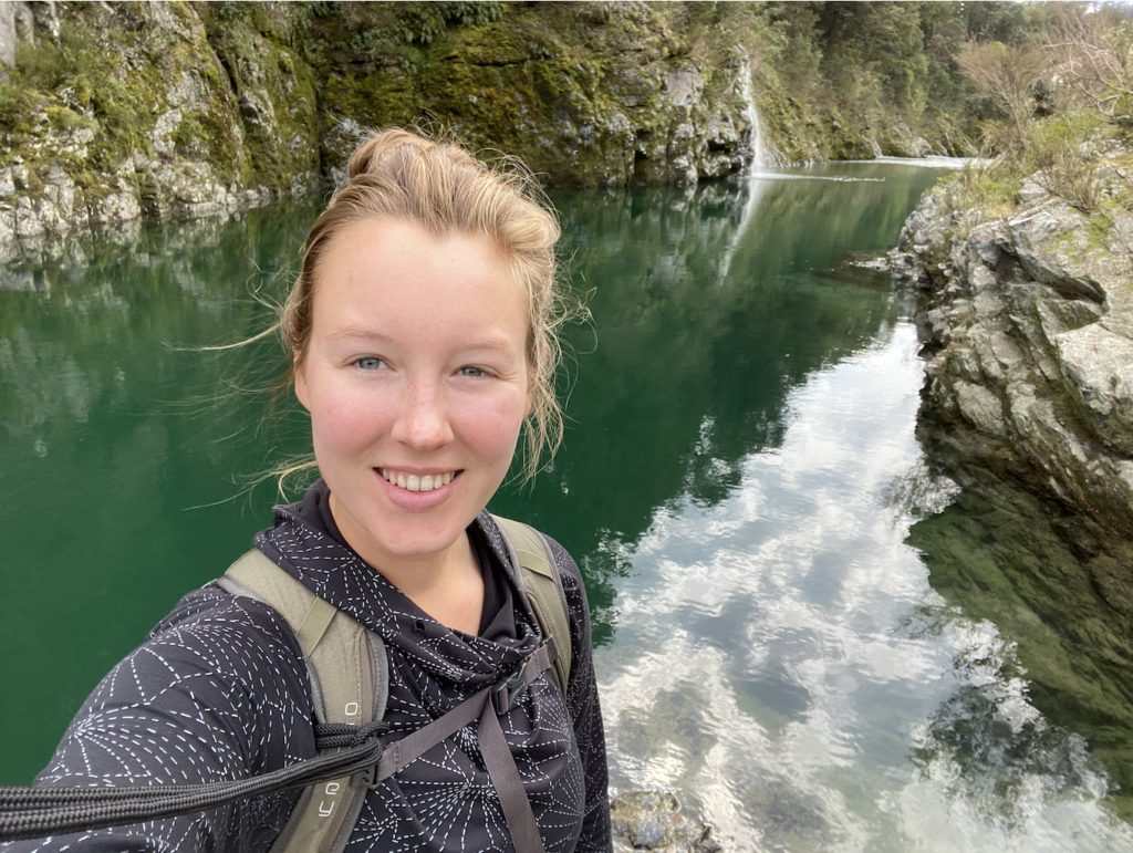
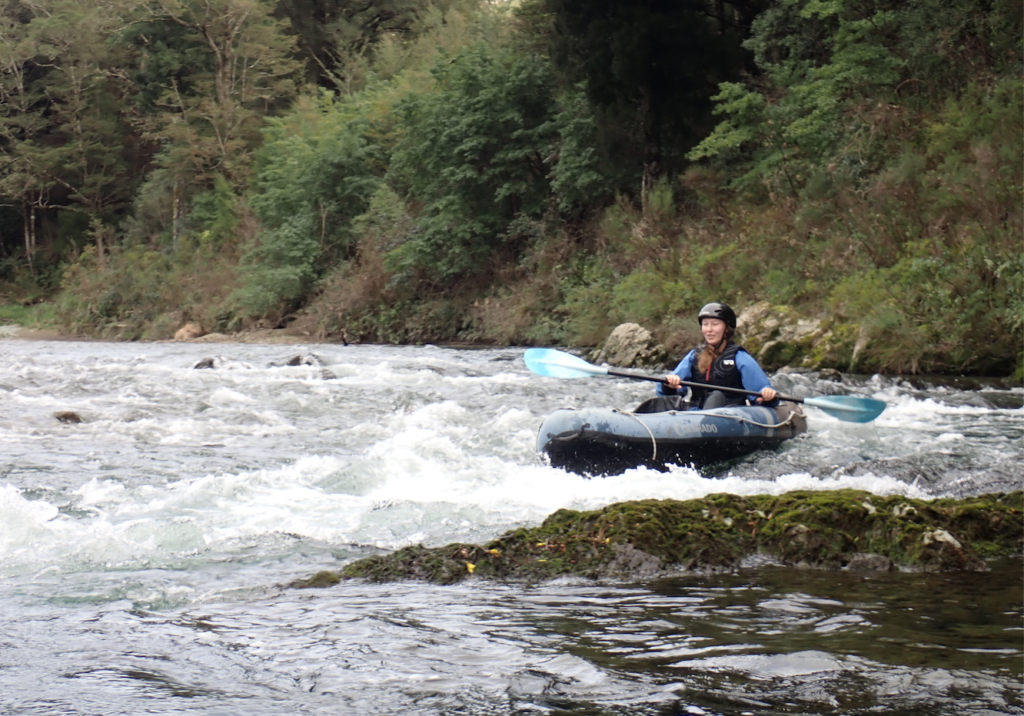
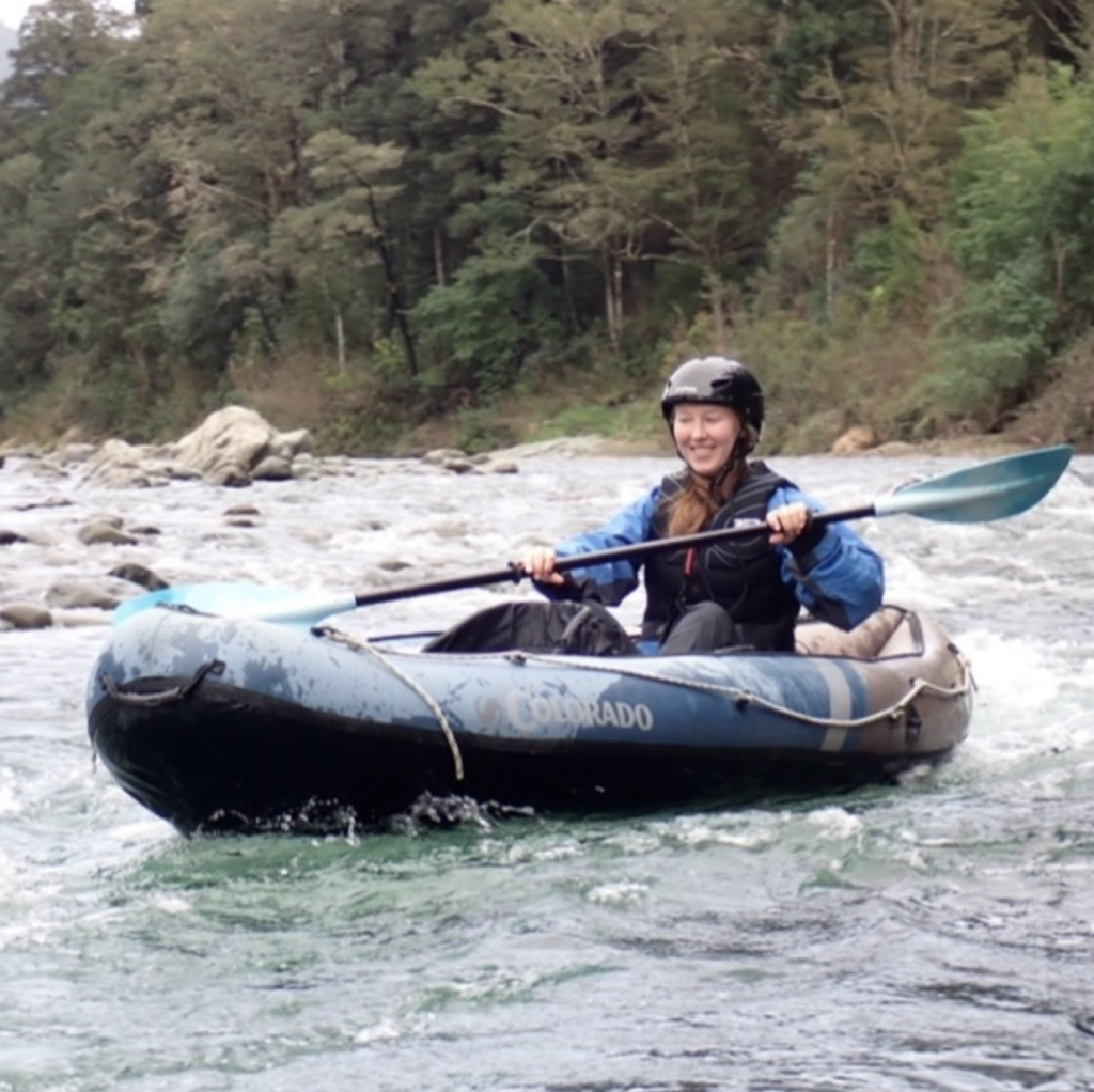
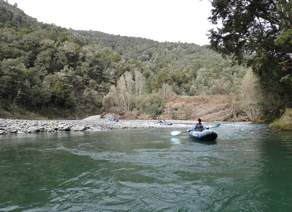
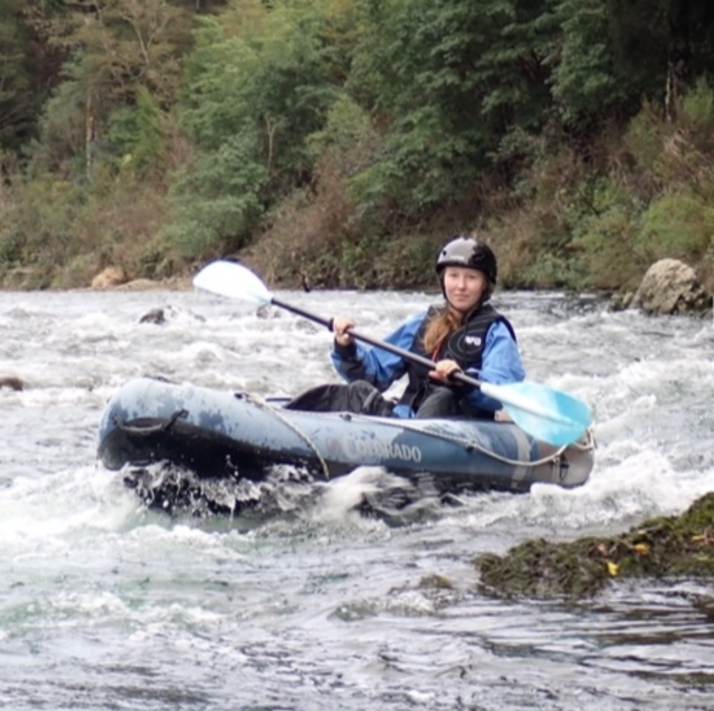
And at the Pelorus River, I didn’t just want to look around (though I enjoyed that too). I wanted to get on the river, which is the most beautiful part of the reserve. Luckily, a tour company offered a river kayaking experience down the Grade 1 and 2 rapids, which including floating through the filming location.
It was a blast going down the river in an inflatable kayak. The rapids added some spice, but were super easy, and the clear blue water of the river and the carpet of stones visible beneath were stunning.
Nelson
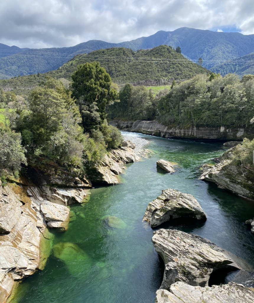
My next stop was Nelson, which was about a two hour drive from Picton through densely forested mountains. The forest is, in many places, dark pines that reminded me a little bit of home, though the mountains here are much shorter and less rocky.
Nelson, perhaps, deserves another look from me, because I did visit in somewhat crappy weather. It was grey and rainy, and the on the one day that the sun came out, the wind whipped and howled. I can’t say I loved Nelson, but then again, cities aren’t usually my highlight. The downtown area was cute, and perhaps when bustling (it was pretty abandoned) and when accompanied by friends or family, I would have enjoyed strolling around and trying some restaurants.
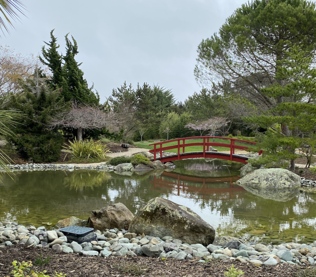
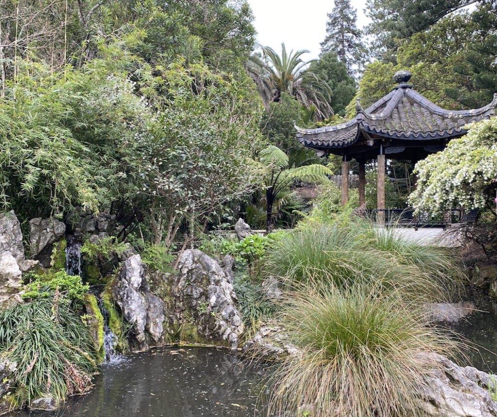
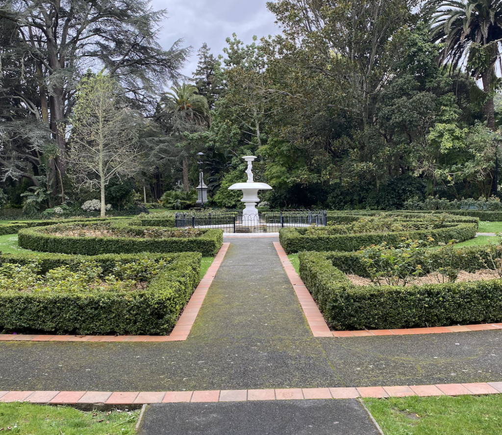
Nelson does have some nice parks, including the Queens Gardens and the Miyazu Japanese Garden.
It also is home to the Geographical Center of New Zealand, except it’s not really the center. It has to do being a central triangulation point for early surveyors…so honestly it’s a bit confusing. But the views are nice!
The Maitai River Walk weaves through the city and follows a nice river, though it was muddy and cloudy during my visit because of all the rain.
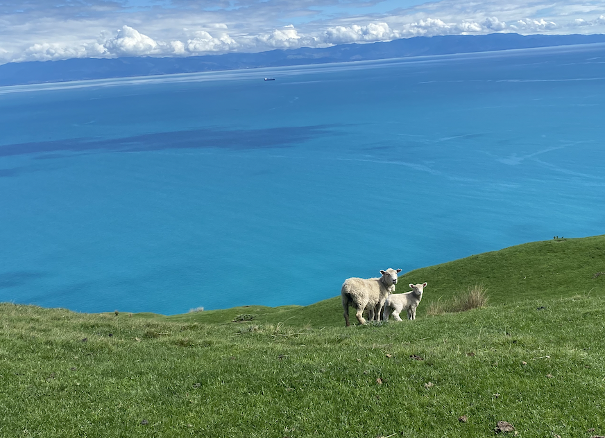
And I did enjoy Cable Bay (despite the howling wind) and got some New Zealand sheep time, as well.
But…leaving Nelson brought me to my favorite part of the North of the South!
Golden Bay
Golden Bay area is on the opposite side of Abel Tasman National Park from Nelson. I skipped most of Abel Tasman, which is a stunning national park and Great Walk, because when my parents come out to visit, we are going to spend five days walking and kayaking through the park. So I didn’t want to spoil the visit with an early one of my own.
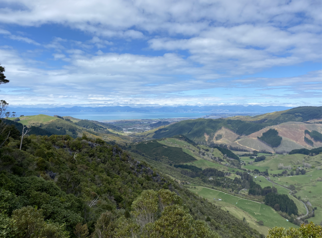
Instead, I stayed inland, driving around the park and up Tākaka Hill. Which is not a hill.
It is definitely a mountain. My car groaned and squealed, but we made it up, and I kept my eyes on the road ahead and refused to look at the steep drops beside me, and it wasn’t so bad.
I broke up the drive with two stops.
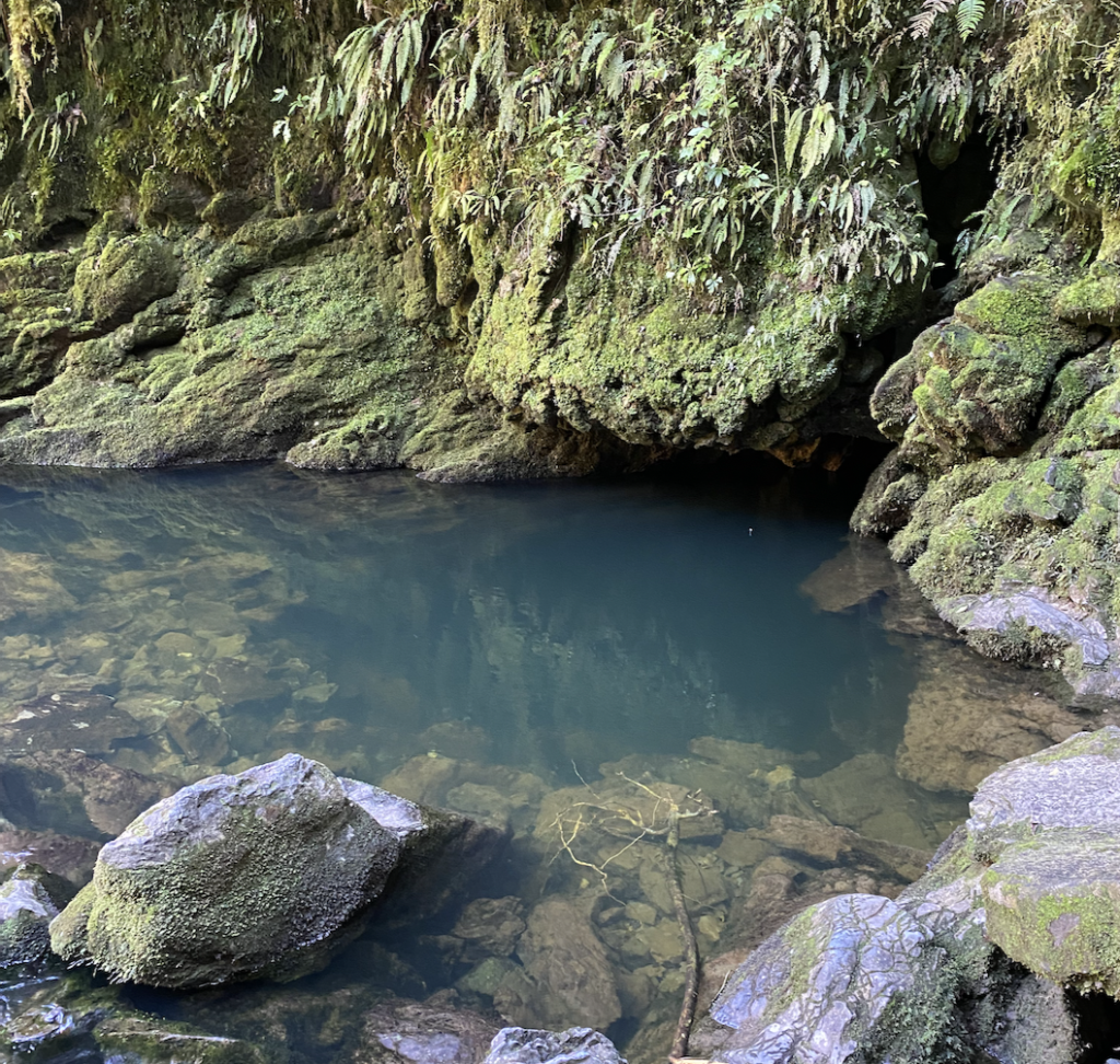
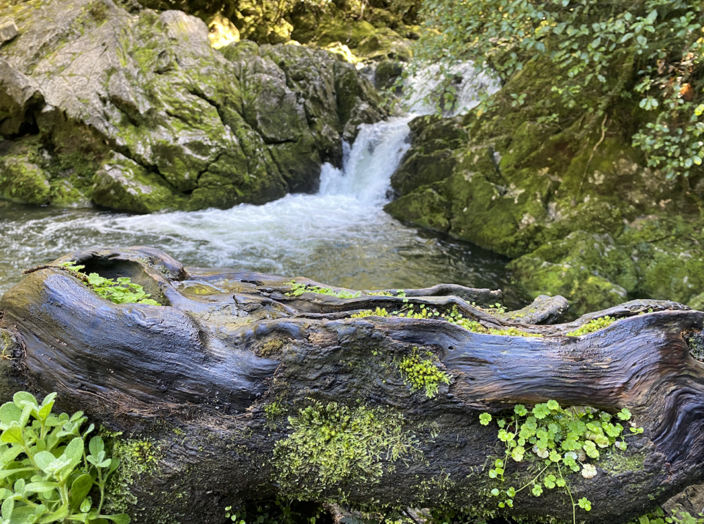
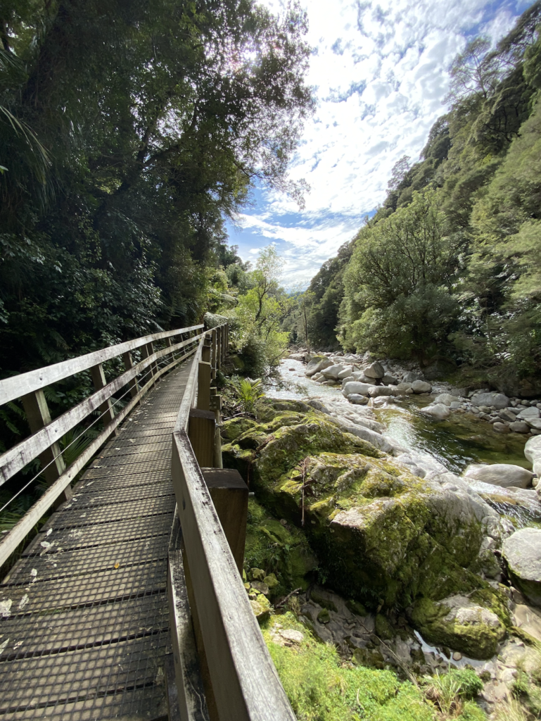
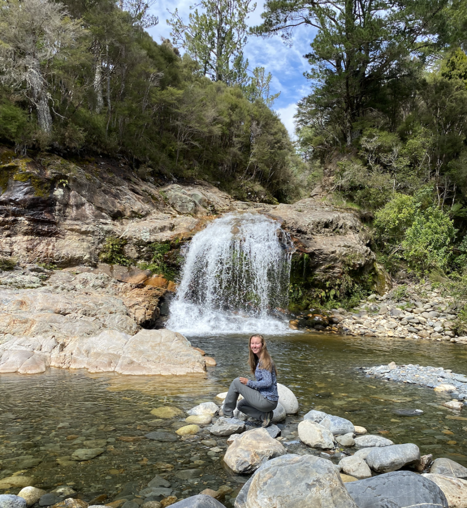
Riuwaka Resurgence
The Riuwaka River emerges out of Tākaka Hill through a cave. The site is sacred to the Māori as it’s fresh, pure water that comes out of the depths.
I enjoyed the short walk back to the cave, but actually found the rest of the river far more beautiful. It felt a little bit Colorado-ish withe the rocks and the sunlight filtering through the trees, but also different because everything was damp and the plants were unique. It was a peaceful place, with gentle water and small waterfalls, tucked away out of sight down a narrow valley road.
Hawkes Lookout
This lookout isn’t far from the Riuwaka Resurgence, and I actually enjoyed the short walk more than the lookout. Tākaka Hill is unique for it’s karst rock formations, and the walk sported some weird, wavy rocks just casually jutting out of the forest.

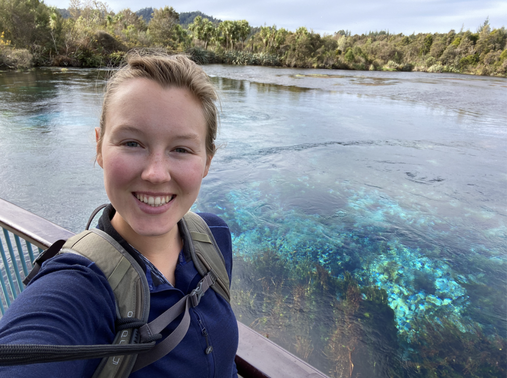
Te Waikoropupu Springs
After a night at Annie’s Nirvana Lodge, which was practically abandoned, I began exploring more of the area, starting with Te Waikoropupu Springs. This is another beautiful fresh water spring sacred to the Māori, and it impressed me far more than Riuwaka Resurgence because the water bubbles up out of the ground in the clearest, most magical blue. It looks fake.
The eddies between the water, forming endless little whirlpools, is utterly enchanting and relaxing. I watched for at least twenty minutes as some of the purest water I will ever see bubbled and moved with a life of it’s own.
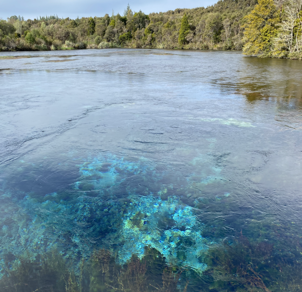
My dad is on a living water kick, searching for ways to enliven the dull, “dead” water that comes out of city pipes. Water carries energy that is incredibly good for our bodies–healing, even–but it loses that energy when forced into stagnant pools and restricting, enclosed pipes. This water, which filters down into the earth and then up through the rocks over a period of ten years, is the very definition of living water. I ached to take a sip–but as it’s incredibly sacred to the Māori, it is illegal to even touch the water, let alone take or drink it.
Definitely worth seeing, as it feels sacred. Just the feel of the air, the cries of the birds, the utterly impossible color of the water…and the endless, swirling eddies as the water dances and lives.
Wainui Falls
I did venture a short ways into Abel Tasman National Park to do this hike. It’s a short walk up a river valley and back to the falls. I was surprised by the number of people in the parking lot and on the hike, though I was told repeatedly that it is the September school holidays for New Zealand kiddos. Still, during the entire two week school holiday, this was the only busy place I experienced! I guess it’s a flash forward to what I can expect in the summer months (which is too bad–I’m enjoying having New Zealand all to myself!)
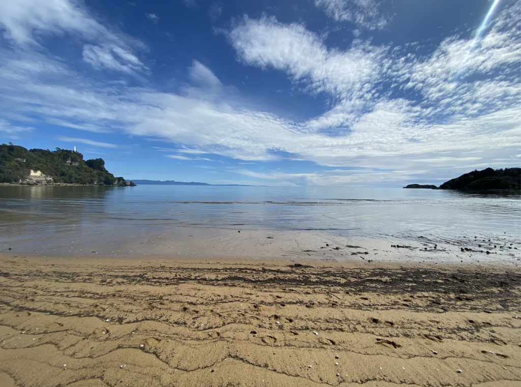
The drive back to this hike passed a beautiful beach full of golden sand, which is a preview to what my parents and I can expect in Abel Tasman National Park. I am very excited for that experience!
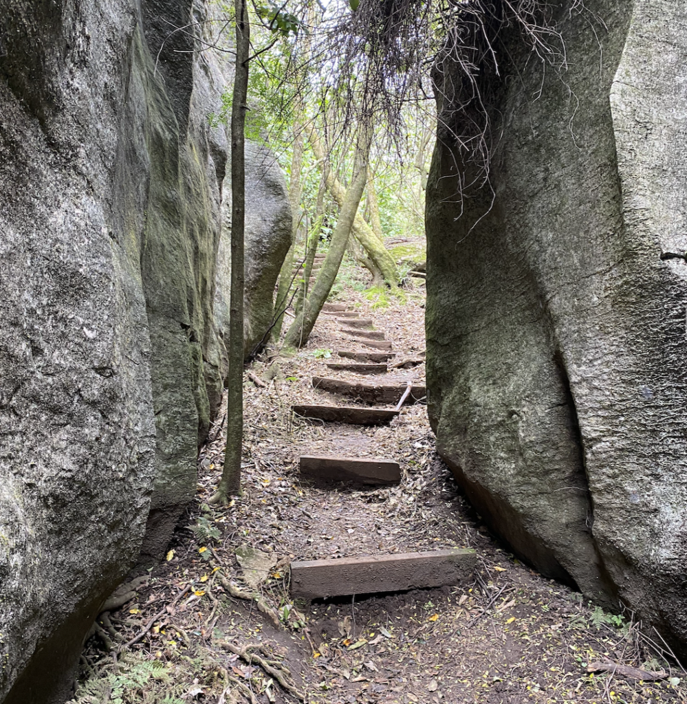
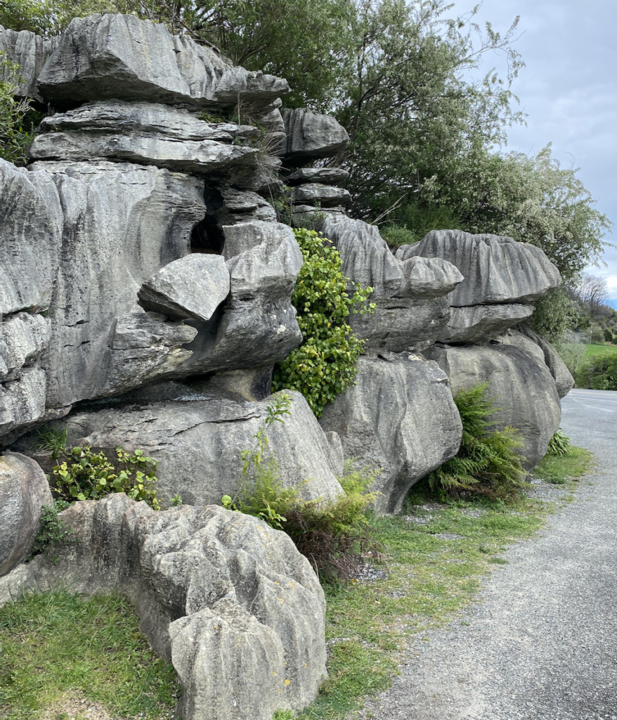
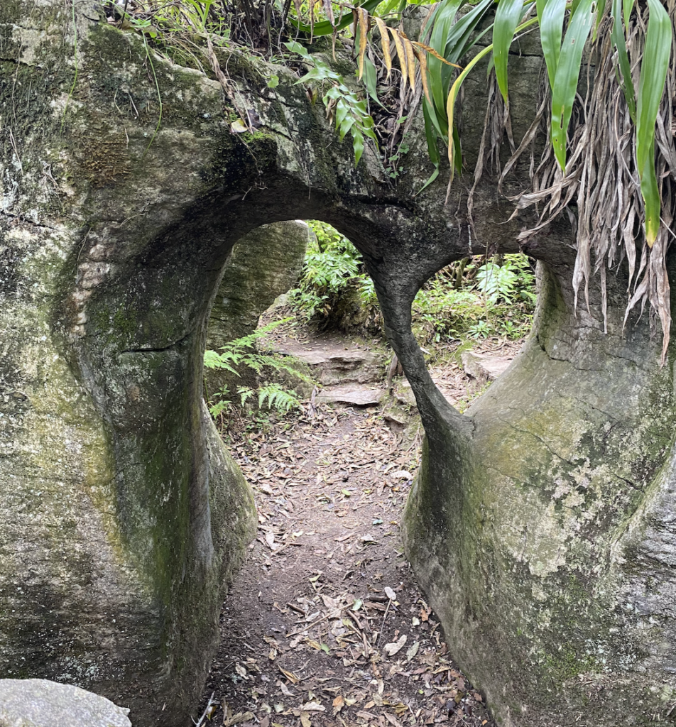
Rocky Paths
It seems that all of New Zealand is a geological marvel, as the karst formations that so fascinated me on Tākaka Hill are not relegated to that single spot. Near the town of Tākaka are two short walks with spectacular rock formations that made me feel like a little kid.
The Grove Scenic Reserve
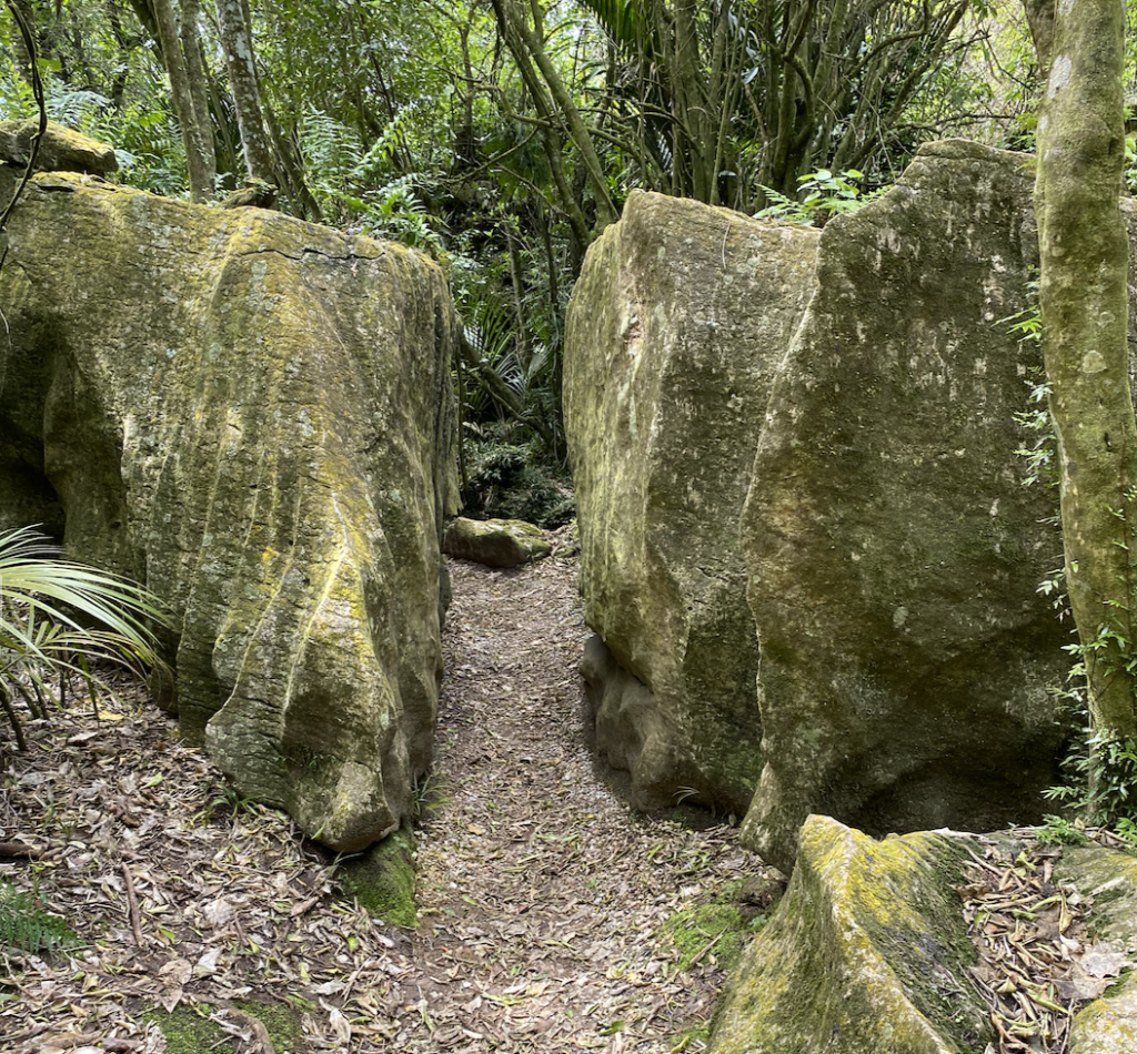
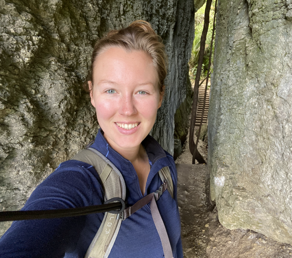
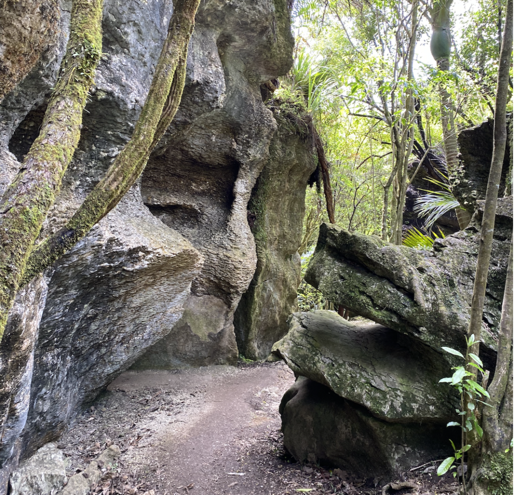
Labyrinth Rocks
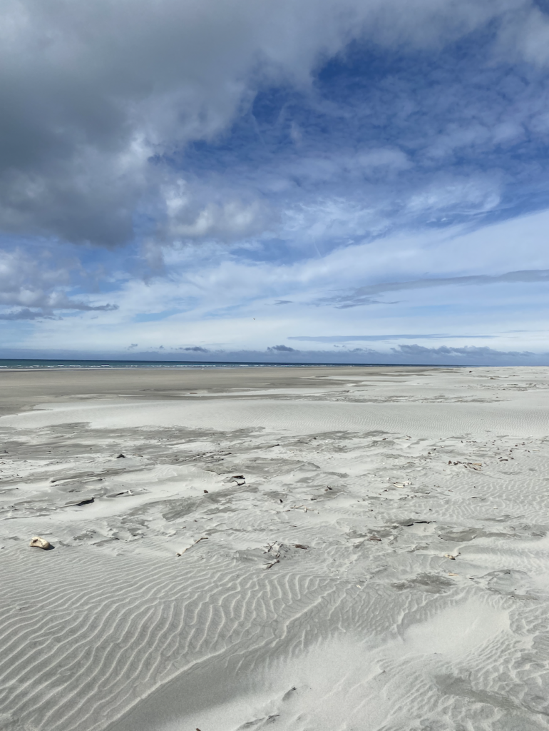
Farewell Spit
So, the most northern part of the southern island of New Zealand is a long sand spit (about 35 kilometers, though it continues underwater for another 10 kilometers). This spit, called Farewell Spit, is a protected area, so the only way to venture beyond the base it is with Farewell Spit Eco Tours. This tour involves a four-wheel drive bus buzzing along on the sand and, occasionally, getting stuck. The tour can only operate around low tide, otherwise the sand isn’t firm enough for driving, which means that if the bus gets stuck for too long…well, it’s a goner when the tide comes in.
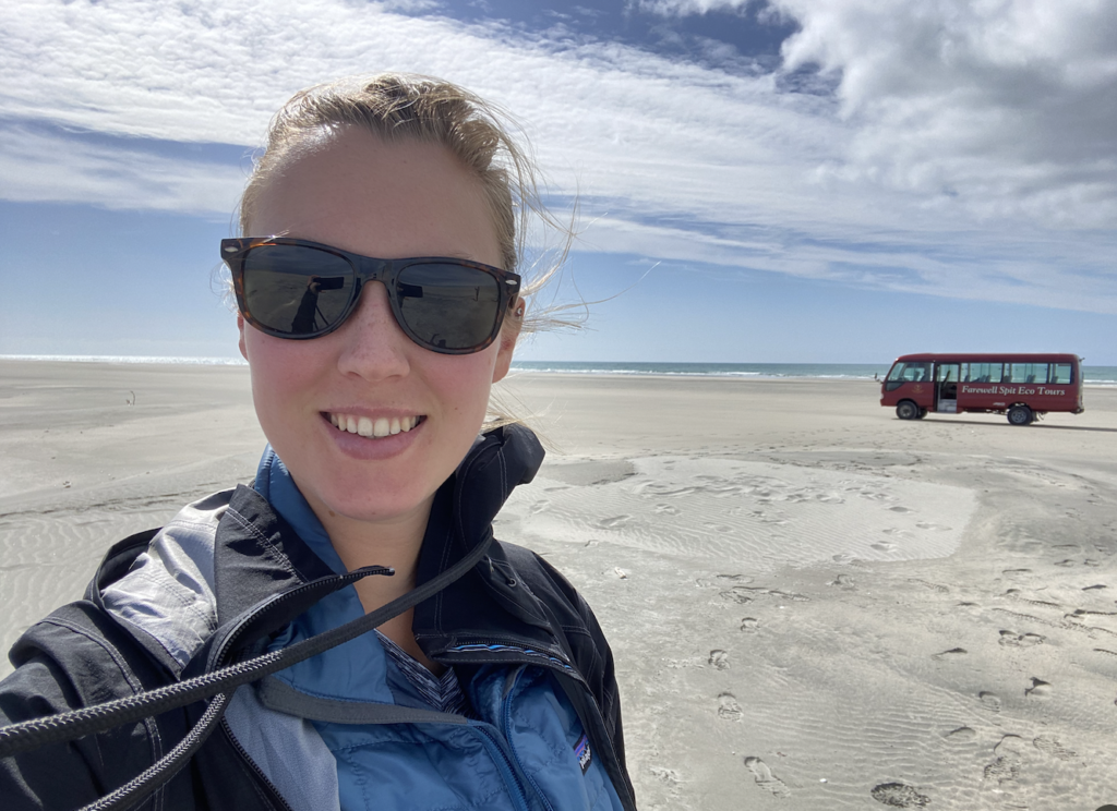
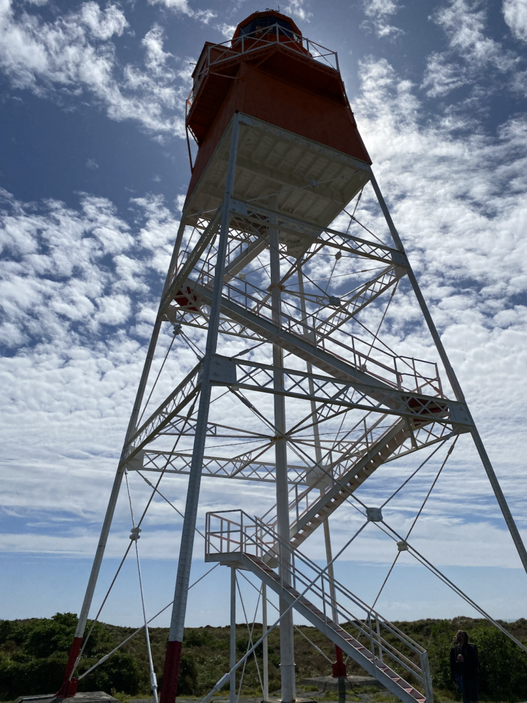
I joined a tour, which took a group of us down and back the long stretch of the spit with a tea stop at the old lighthouse keeper’s house. Long ago, the lighthouse keeper was tired of the wind blowing and constantly getting scurvy because they couldn’t grow a garden, so he began to bring out bags of fertilizer and collect seaweed (Great Barrier Island style) until he could plant a stand of trees and a garden. Now, despite the whistling wind along. the length of the spit, the lighthouse and surroundings are calm and quiet and protected.
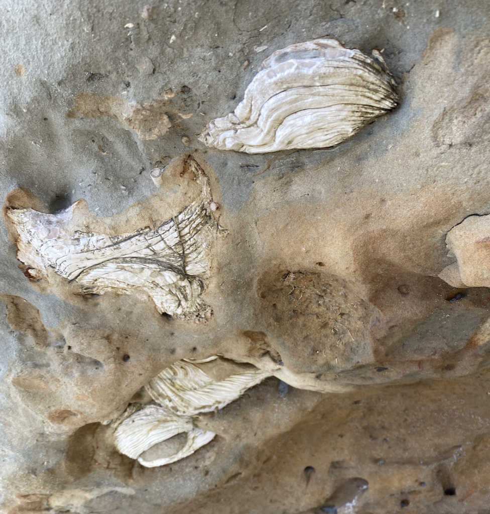
The spit and the tidal flats around it are home to thousands of birds, specifically migratory birds like godwits from Alaska, and Caspian Tern, and Gannets. We also stopped along the way to see the fossilized remains of giant clams.
With the long stretch of sand, no cell service, and the whipping, howling wind, it feels like another world out on the spit. One I was happy to visit, but not one I’d want to stay in long!
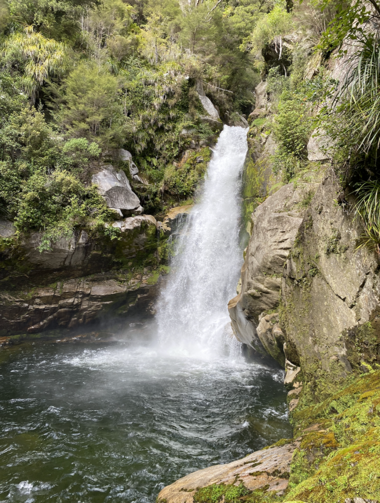
Salisbury Falls
I popped out to Salisbury Falls because I’m obsessed with waterfalls, and New Zealand waterfalls never disappoint. This one didn’t either.
Salisbury Falls is actually another filming location for the Hobbit that comes right after the Barrel Scene. It’s very interesting to me how the director and editors tied together so many New Zealand locations into “one” location in the movie that felt cohesive as a single location.
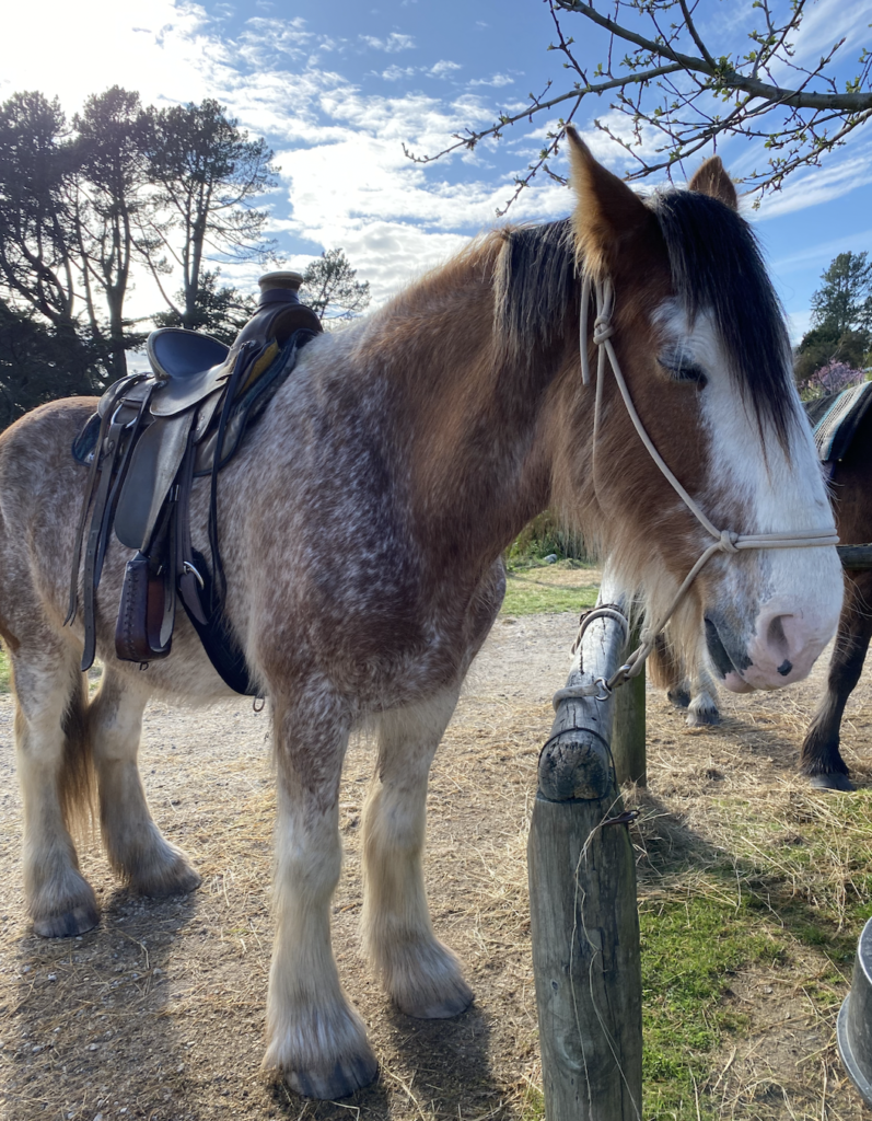
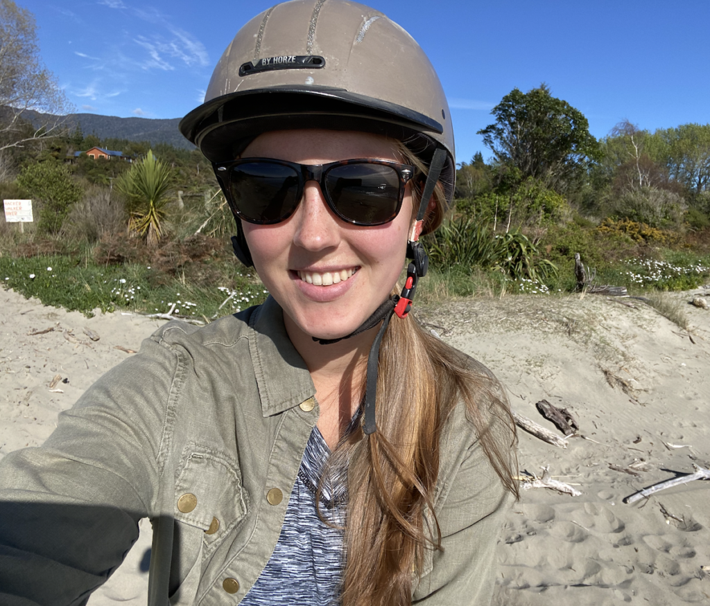
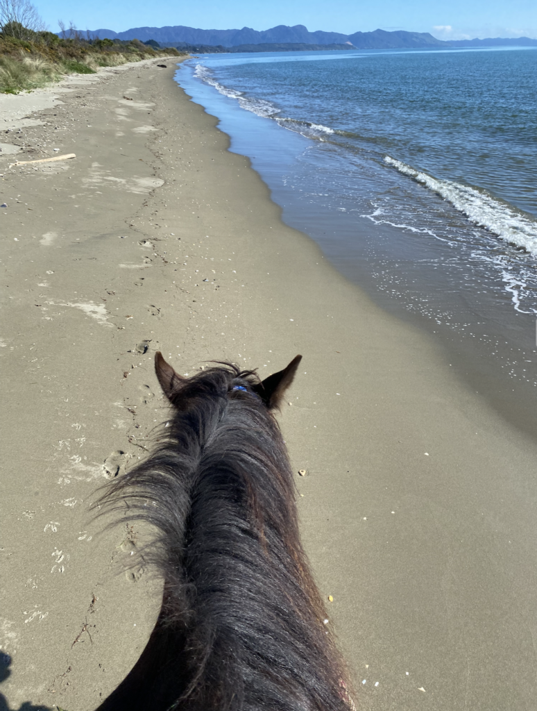
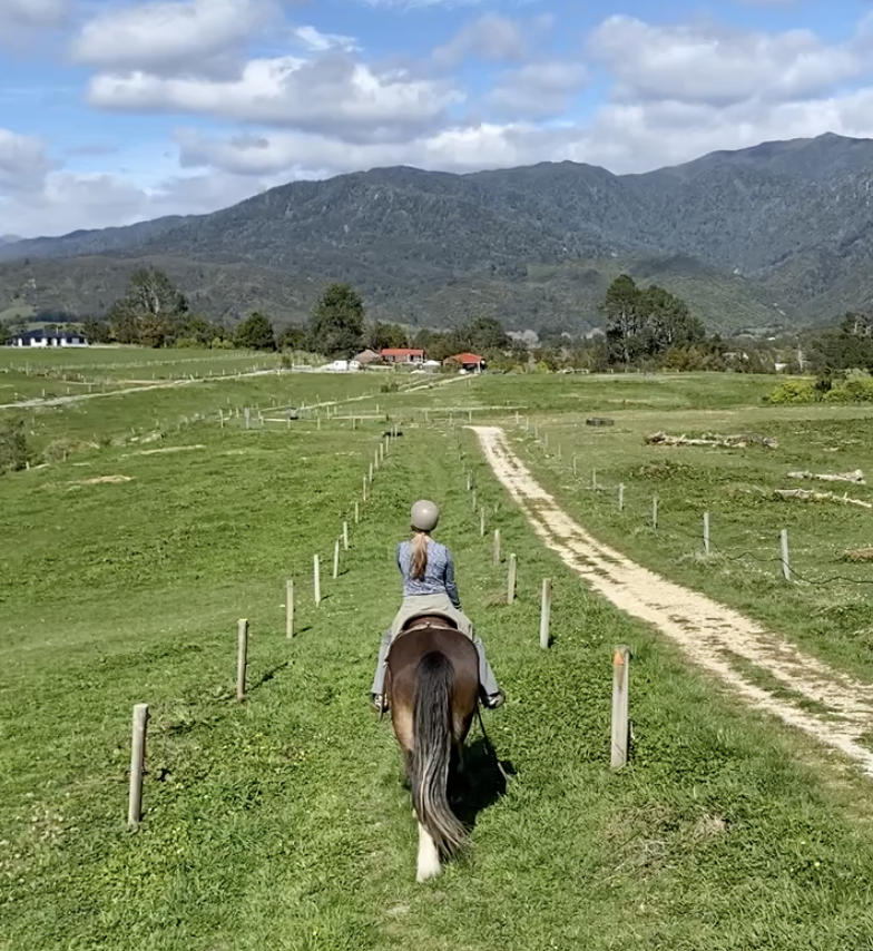
Paton’s Rock Beach
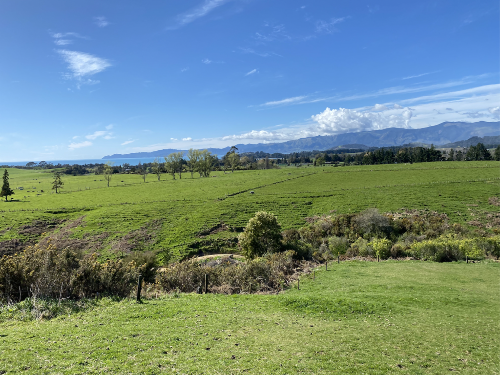
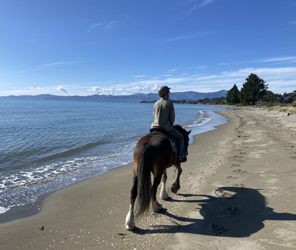
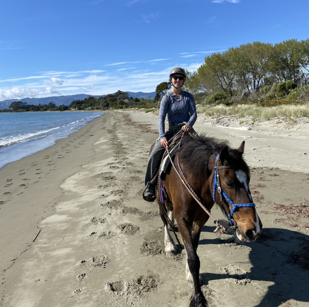
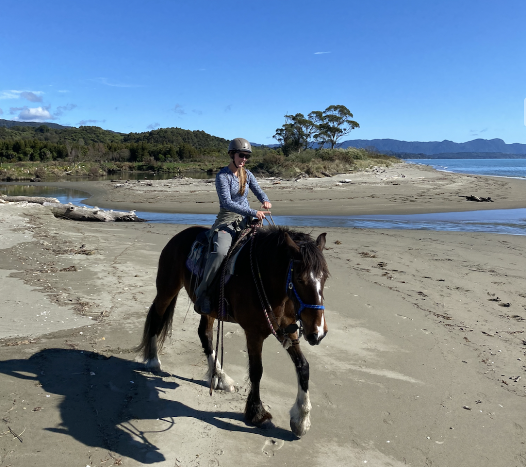
In Golden Bay, I got out for a horse trek on the beach! Lucky me, I was the only one who signed up so it was just me and the guide. We rode down a short path across stunning countryside to reach the beach, where we crossed rivers, trotted alongside the frothy waves, and enjoyed the first truly stunning spring day I’d had on the South Island.
Pakawau
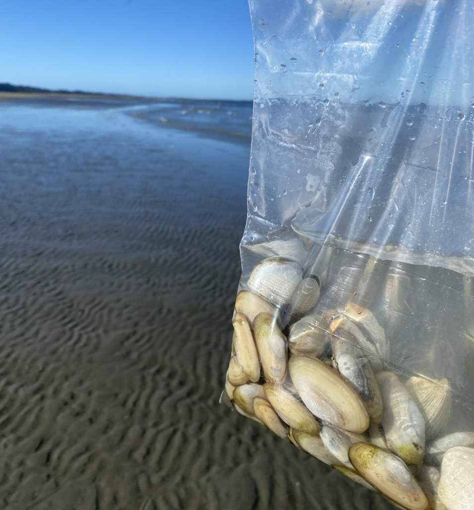
During my tour with Farewell Spit Eco Tours, the guide mentioned that Golden Bay ships a lot of clams to LA, so I figured I might be able to find some myself.
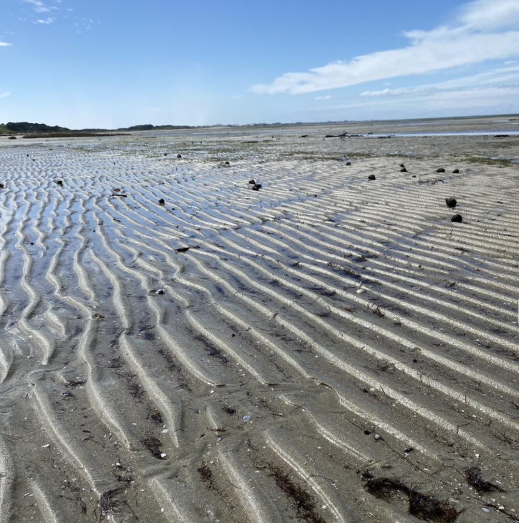
The beaches in Golden Bay are so shallow. At high tide, the beach is maybe ten meters, but at low tide, it retreats so that one hundred meters stretch from the ocean to the shore. So, at low tide, I walked out to the edge of the gently lapping water and began to dig.
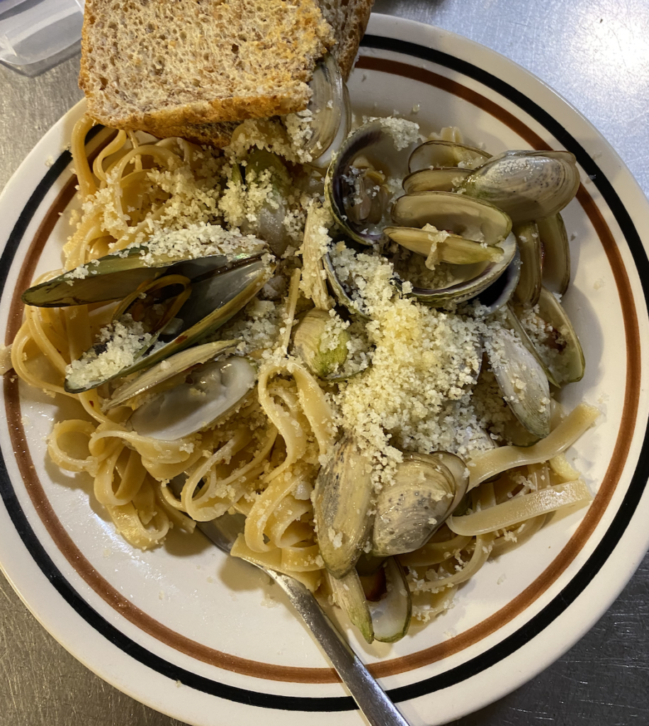
Like magic, I pulled a handful of cockles (the New Zealand term for clams) out of the sand. I collected both Pipi clams and Tuatua clams. After letting them soak in seawater for twelve hours, I steamed them up and enjoyed a bowl of pasta. Yum!
Cape Farewell
Cape Farewell is the northernmost land part of the South Island (i.e. not the sand spit). With it’s photogenic arch and it’s Māori significance as the point where the dead leave the island to sail back to Hawaiki (their ancestral/mythical homeland), it’s a popular place to stop and take a picture. The wind was quite strong, so I didn’t linger.
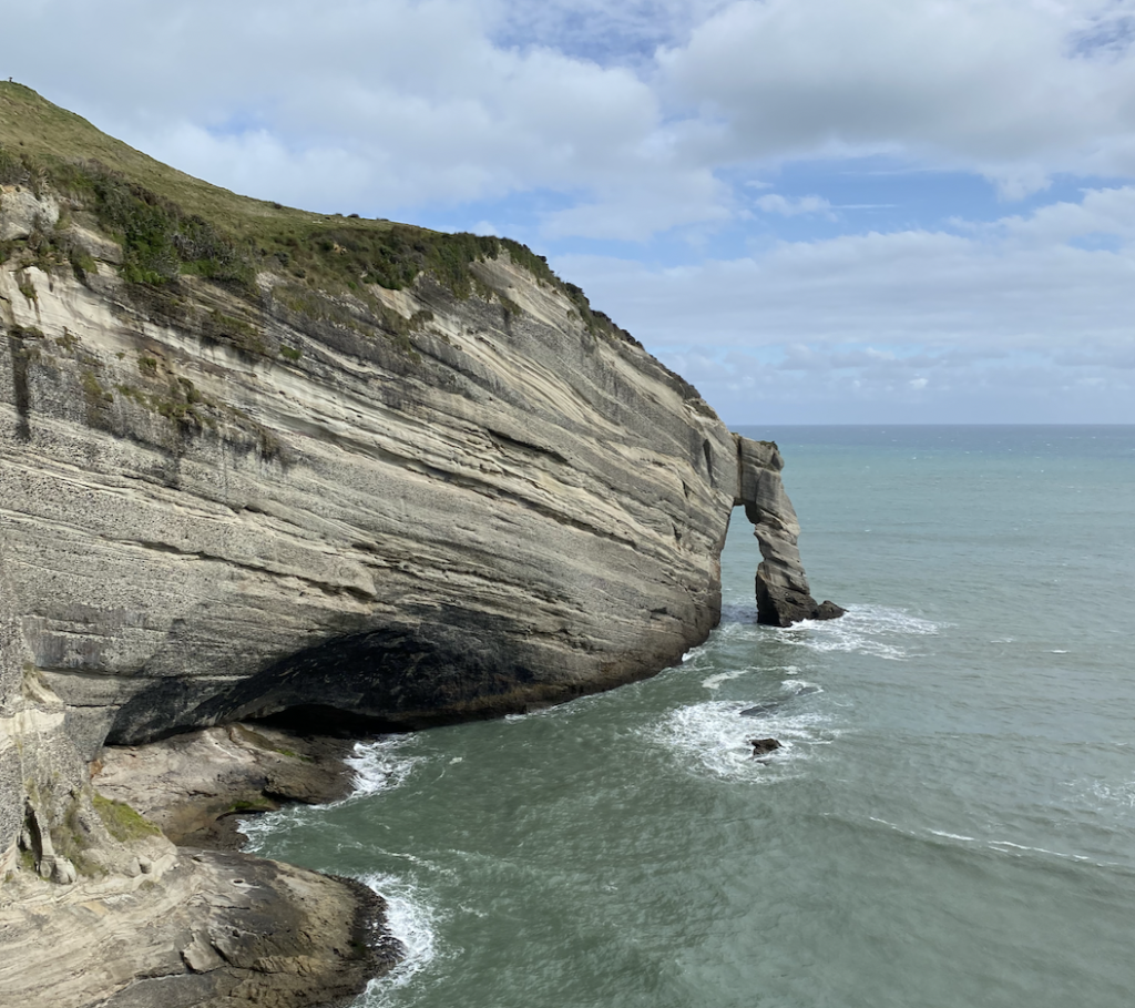
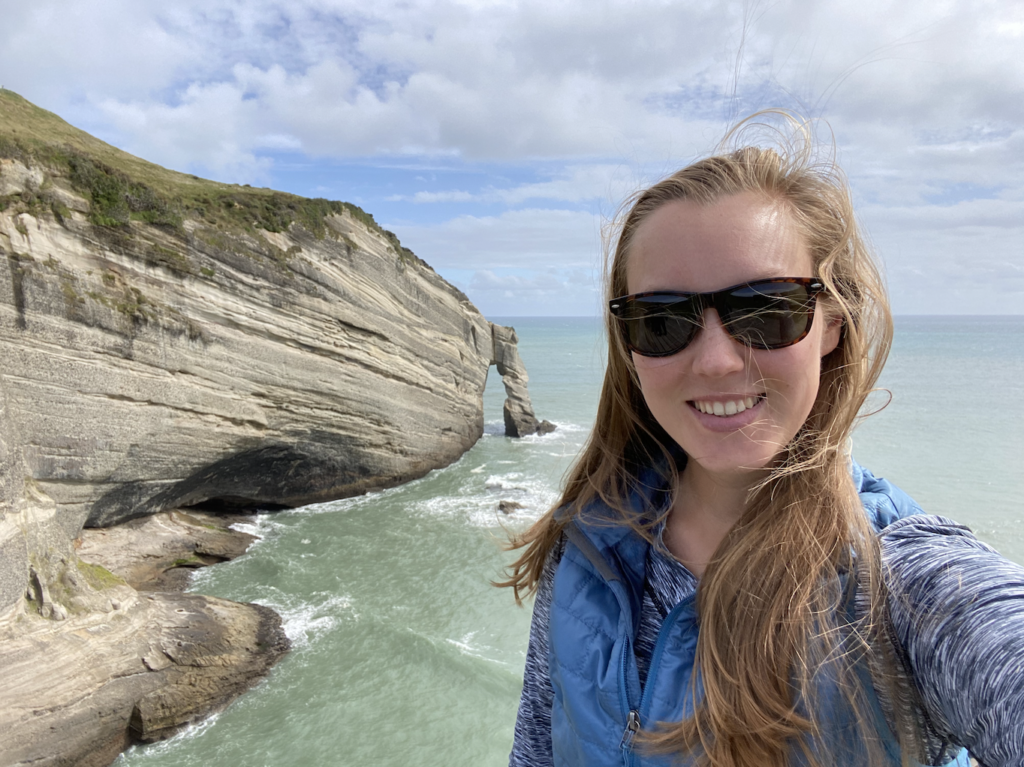
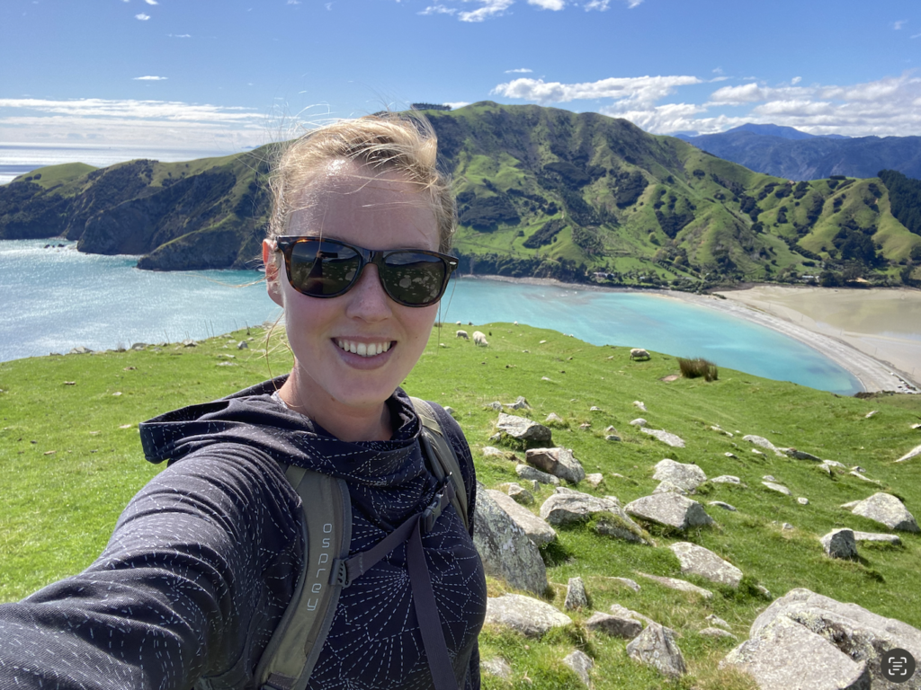
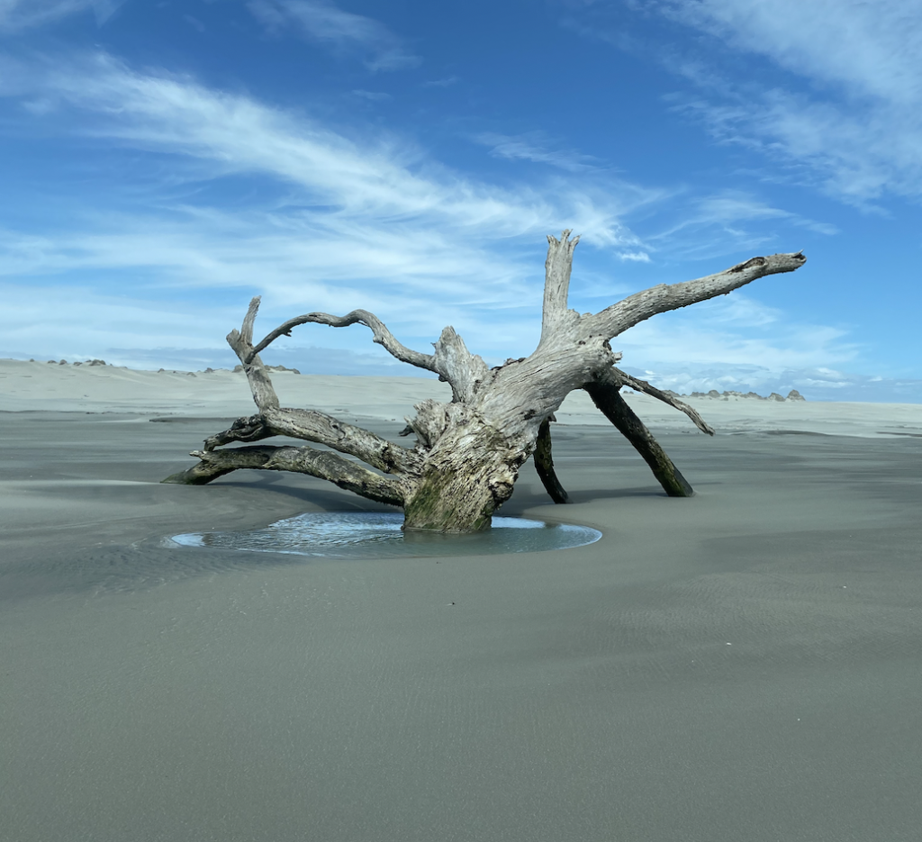
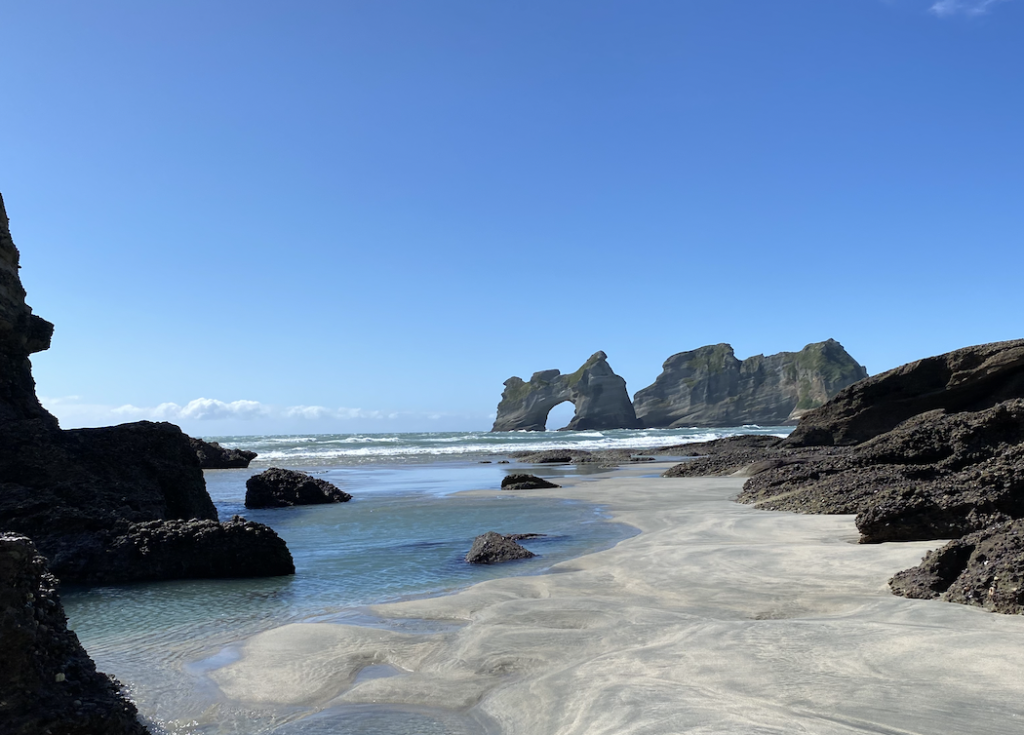
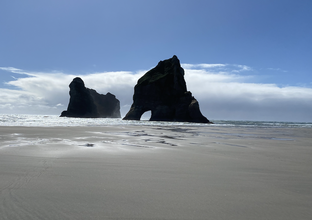
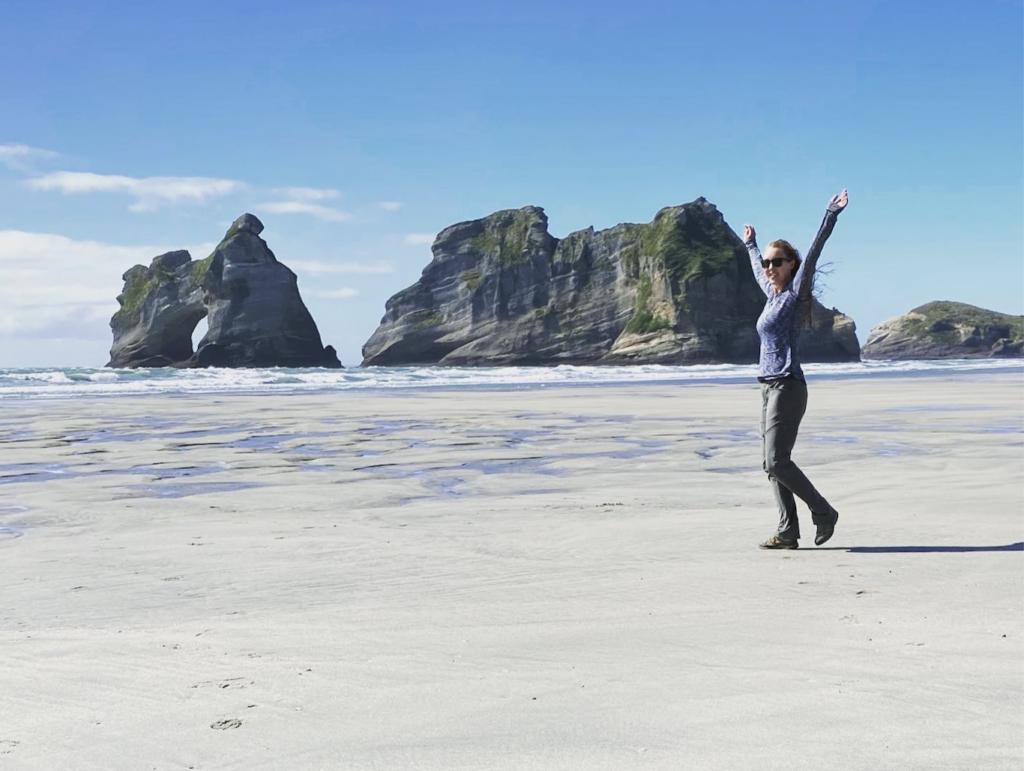
Wharariki Beach
Just a few kilometers from Cape Farewell is Wharaiki Beach, and it is known for it’s view of the Archway Islands, which were made famous because Windows 10 used a shot of the islands as a wallpaper screen.
There’s a short walk down to the beach, but the best views are actually much farther down the beach, so I choose to walk a loop over sheep grazing land and emerge at the south end of the beach and then traverse the wide beach to the common path. I am so glad I did, not just because every other person visiting the beach only did the short walk, so I had most of the beach to myself, but also because the wind was so so terrible.
It was blowing so hard that I was almost sideways bending into the wind. Thankfully, going the way I did, the wind was most often at my back, which made the walking easier rather than harder, and also meant that I only ended up with a hair full of sand rather than eyes and a mouth full of sand!
Still, it was an absolutely stunning beach and the Archway Islands are truly incredible. It. was one of those places that hummed in my chest, that took my breath away, gasped out in a “wow.”
And, to cap off my visit to Wharariki Beach, I saw a fur seal pup playing in a tide pool. It really doesn’t get much cuter than that!
Good Times in Golden Bay
So far, Golden Bay area is my favorite part of New Zealand. It is unfortunate that it is difficult to get too as it’s not on the way to anything. It’s a destination of it’s own, which means it will be hard for me to share it with short-term visitors, but I am so glad I visited. I felt adventurous and awed and comfortable and a little bit like I was the only one there, which wasn’t true, as I encountered many people, but there was still this sense of nature showing off just for me.
In conclusion, not all of the South Island is better, mind-boggling, prettier, or whatever adjective all those many people used to raise my expectations. Of course, that doesn’t mean it’s not beautiful: I’m comparing sunrises and sunsets–all beautiful, but some better than others. Yet, I can say that, so far, The Golden Bay Area on the South Island has surpassed my expectations.
And I hope I can continue to say that in each new place I visit on the South Island!


You May Also Like
Laid-Back Laos Loses My Vote
The Jurassic World of New Zealand’s North