The Magical Milford Track and the Invention of Sandflies
DAY 1
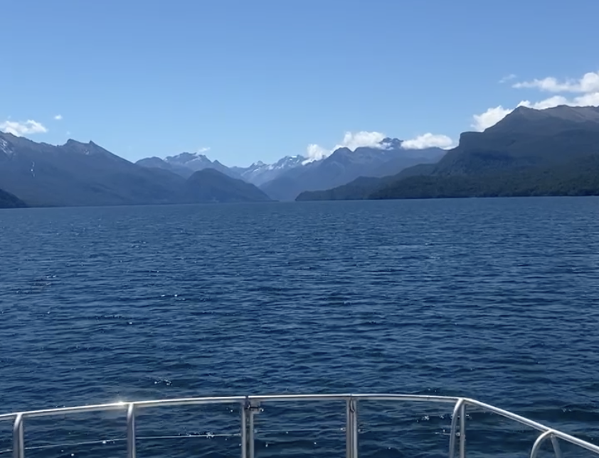
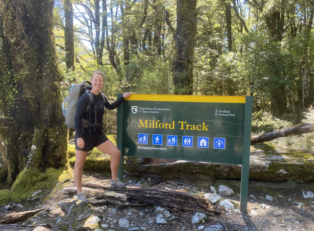
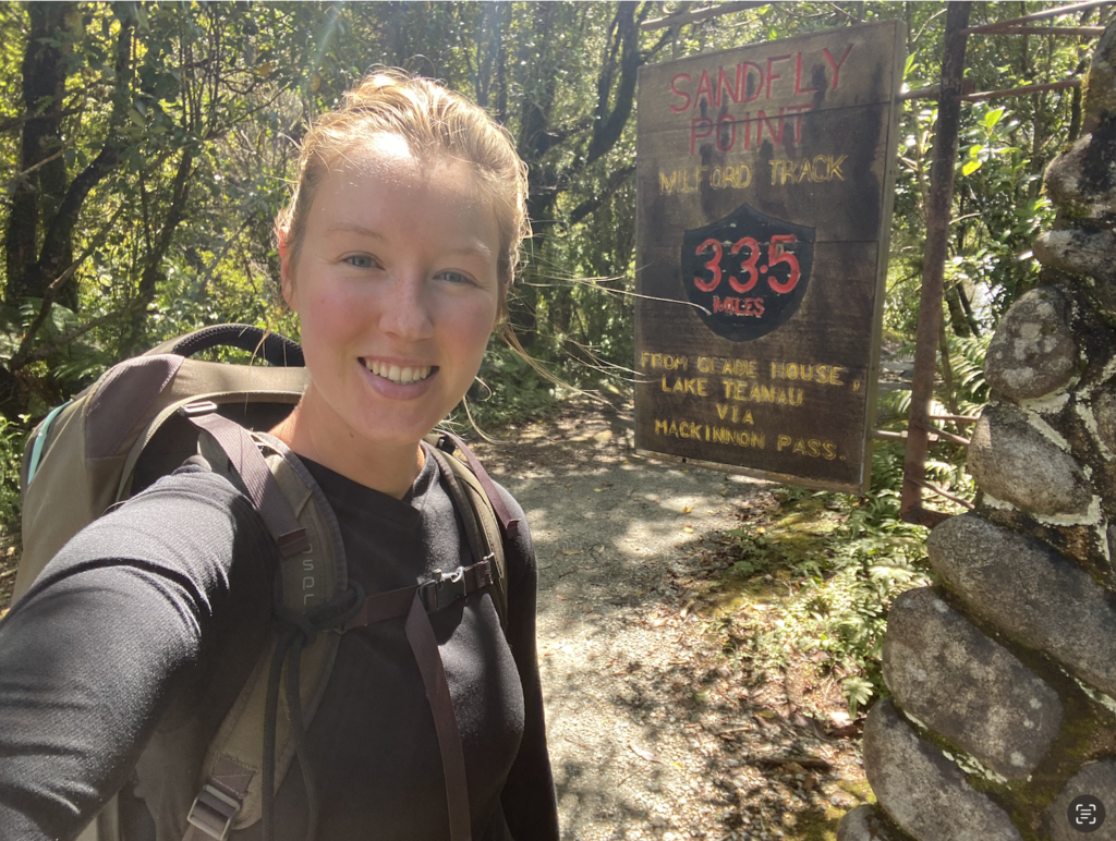
A car. A bus. A boat. Finally, I arrive at the beginning of the Milford Track. One of New Zealand’s 10 Great Walks and often dubbed the Finest Walk in the World.
This is another hut-to-hut multi-day hike. The first one I did was the Routeburn Track back in November. I went into it with great apprehension and concern, but emerged feeling rejuvenated. I went into the Milford Track with what was probably some denial that it was actually happening Only one rest day stood between my 4-day, 3-night epic journey of hiking over Broderick Pass and rafting the Landsborough River and this, the Milford Track, so I really had absolutely no time whatsoever to worry or become apprehensive. Additionally, the weather looked incredibly amazing so no worries about pouring rain or overnight snow.
So here I am. At the beginning of the Milford Track. Ahh, breathe it in. Take in the view. Snap a photo… Then get the hell out of there.
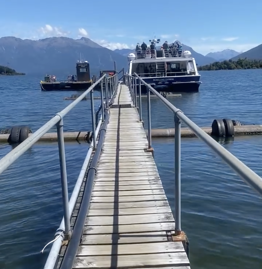
Because the Milford Track begins with an hour-long boat ride on Lake Te Anau, it means that everyone starts the track at the same time. This provides incentive to shove through to be the first off the boat, to take one quick photo at the Milford Track sign, and then to get moving. Leave all the others behind!
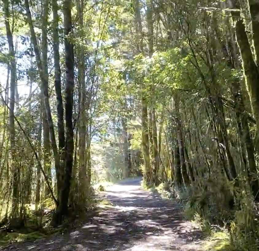
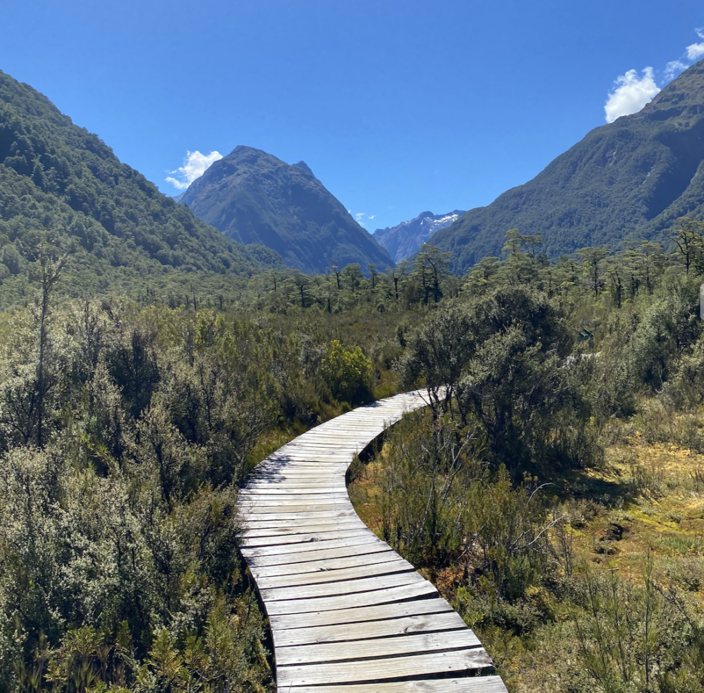
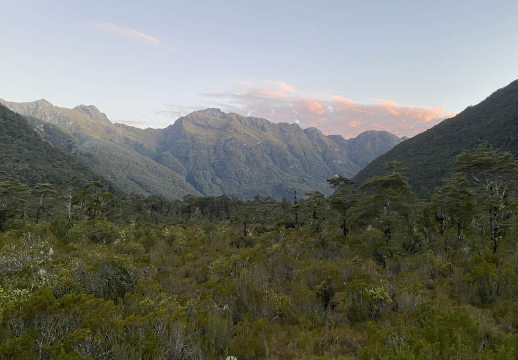
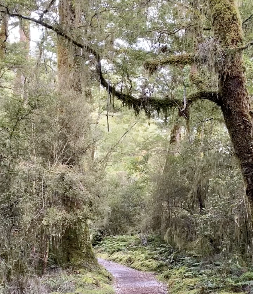
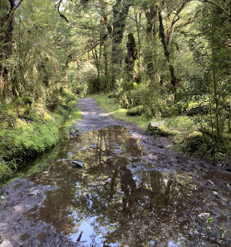
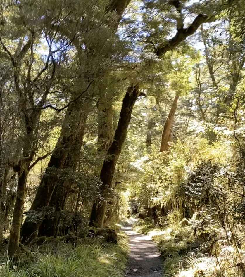
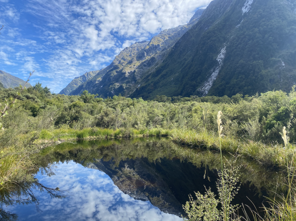
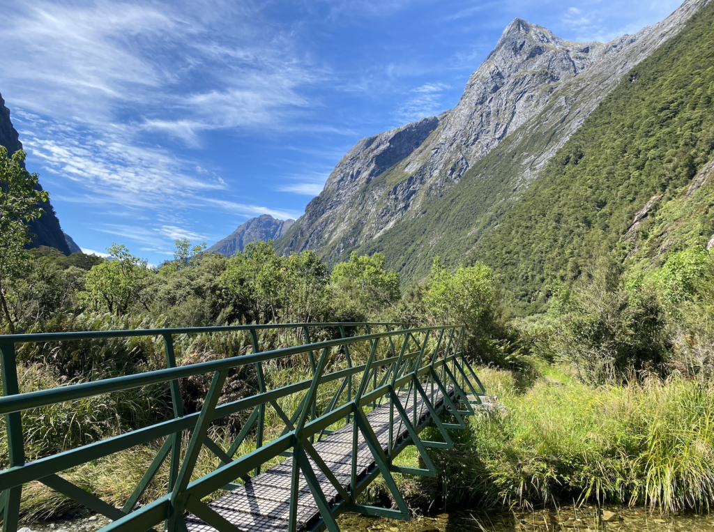
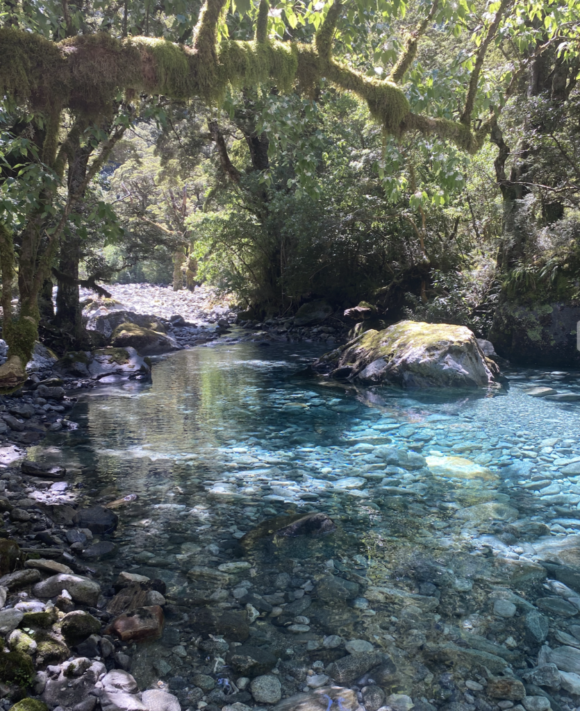
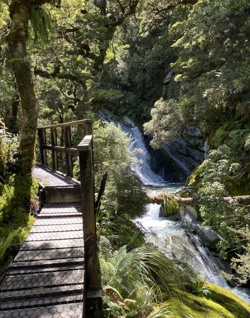
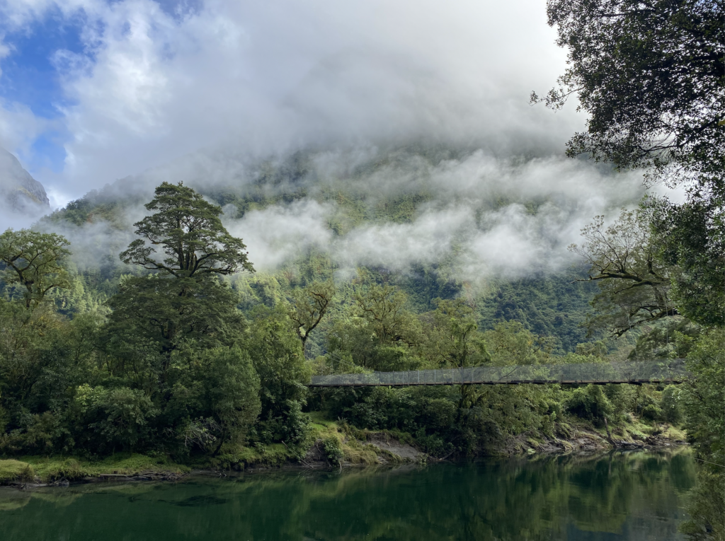
The track starts by winding through thick green forest with trees stretching to great heights and a wide path through the forest. It rained the day before, so puddles dot the path and the trees seem cloaked in in particularly rich shade of green. Fiordland gets between 8 and 12 meters of rain annually (feet), so the forest is particularly good at sponging up the wet and draining the soil. The rivers shivered calmly in their beds, but the high banks indicate the masses of water that often come cascading through.
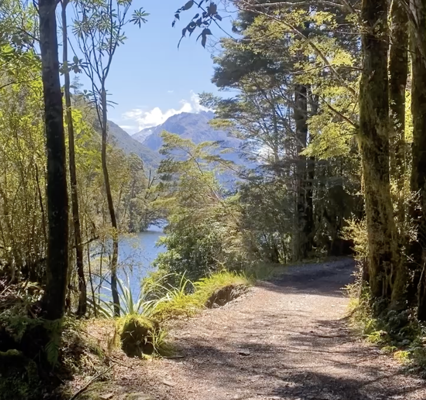
In fact, the track is often closed due to heavy rain bursting over the river banks and flooding the track. Photos at the DOC office and online show weary hikers trudging through chest high water hoisting their packs above their heads. Thankfully, none of that fun is expected during my trek. When I checked in with the DOC office, the ranger said. “Wow, that’s some good weather. I don’t have to give you the doom and gloom talk that I usually give.” He didn’t even ask me if I had a rain coat!
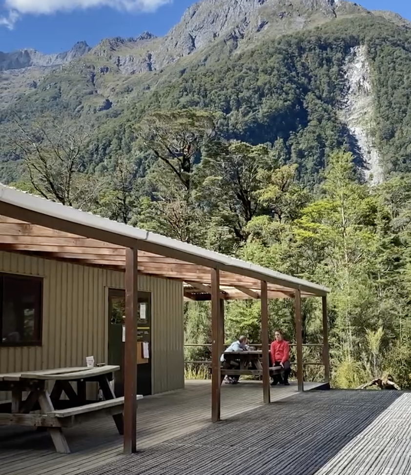
Day one is a short one, hence why I didn’t even board the boat across the lake until 2pm. I arrive at the first hut, Clinton Hut, around 4:15. It’s sunny and hot, and both the bunk room and main room have all the windows open but they are still stifling. I claim my bunk (only top ones left, since the other boat dropped hikers off at 12:30) and plop down at a picnic table with my book.
Ahh, boots off and flip flops on, warm sun heating my skin and a few miles of a pretty track already behind me.
Eek. Ouch! Damn it! The sandflies descend.
Sandflies are tiny creatures. Smaller than mosquitoes, they look like millimeter-long smudges, but their bites hurt and the welts they leave behind itch like nothing else. And there are ten of them on my legs, on my arms, flitting around my head.
So I flee back into the bunkroom and don long pants, long sleeves, and tall socks. I attempt to sit on the deck in the shade, leaning back against the side of the hut. I open my iPad to read, my waterbottle beside me. But the sandflies crawl across my hands, buzz around my ears. I certainly can’t sink into the story when I have to squish sandflies between my fingers ever few minutes.
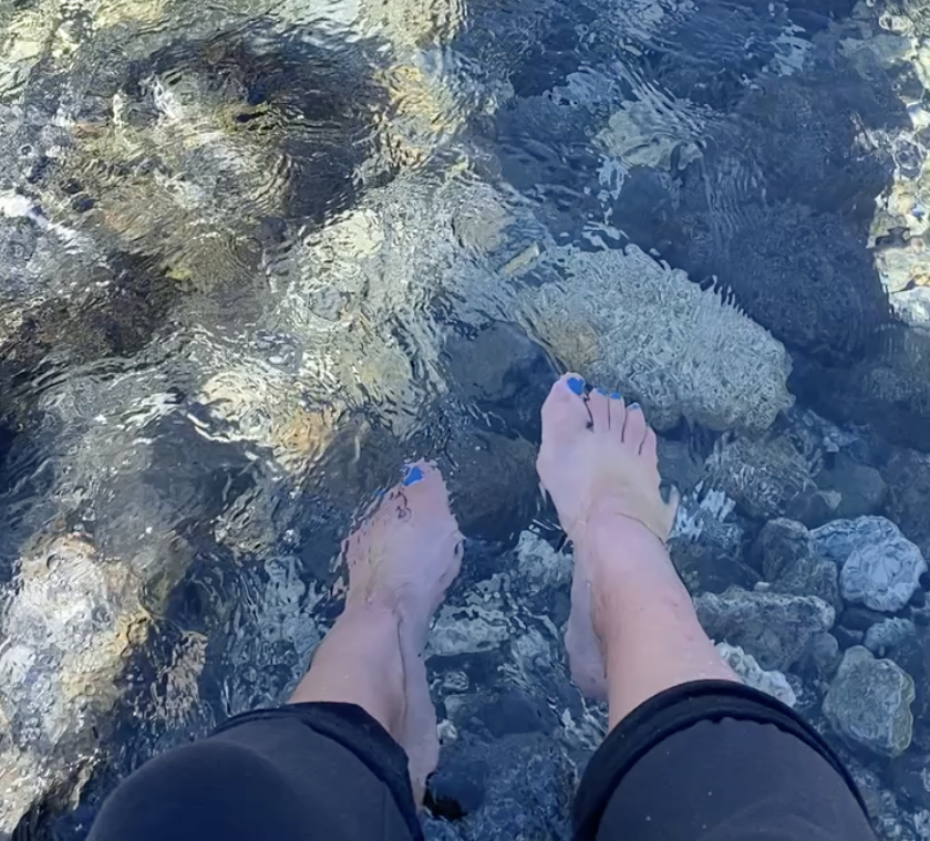
Later, I make my way down to the river to wash my face and my feet, but if the sandflies were unwelcome intruders at the hut, here they are kings. I wrap my towel around my neck like a scarf and pull the ends of my sleeves down over my hands. I could use some bug spray on my face to keep them away, but the whole point of the river was to wash up so I didn’t have any gross stuff on me for the evening and overnight. It’s so peaceful that I endure the sandflies for almost twenty minutes, but then I retreat, effectively overcome.
The sun sinks, low and slow.
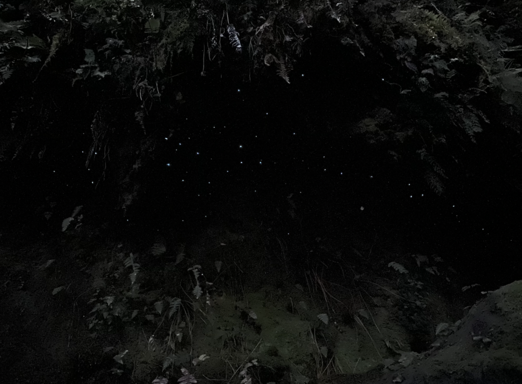
The hut ranger gives a short, curt talk. She gets to go home tomorrow and it’s clear to everyone that she is ready for a break. But she does give some info on the glow worm dell just down the hill. So fifteen minutes after sunset I wander down the track in my socked and sandaled feet. There aren’t many, but tiny constellations of glowworms line the cliff edge just beyond the trees, pulsing softly blue. For the first five minutes I share the space with several others, but they head off to bed and for a while it’s just me. No sandflies—they go to bed with the sun.
Water drips. The forest rustles. It’s still so warm, no chill to chase me to bed. But when everyone is tucked up in sleeping bags by 9:45, it feels very weird to still be wandering around at 10pm.
The moon blazed brightly, nearly full. Only one or two stars winked above. But, in the middle of the night when I scrambled down the bunk bed ladder and ventured out in the night nearly blind from wandering without my contacts, my super blind eyes could make out the Southern Cross blazing brightly in the heavens.
Day 1 – 3.4 miles, 60 ft elevation gain
DAY 2
I wake naturally at 7, but manage to doze with my earplugs in and my headband over my eyes until about 7:45. When I pop in my contacts, 80% of the bunk room is gone already—packs gone, mattresses flipped up. People mill about outside pulling on boots, strapping packs.
Almost everyone is in such a hurry to leave one hut only to hustle over to the next one just to sit.
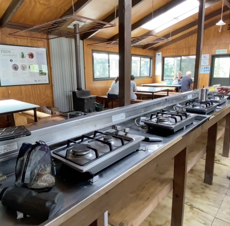
I embark tranquilly on my morning routine. Teeth and hair brushed, face washed and lotioned. I return to the bunk room to stuff my sleeping bag into its sack, change into my hiking clothes, and pack up most of my bag—all but the food. I flip my mattress and bring my pack onto the deck so I’m all ready to make a quick get-away, but then I grab my pots, my book, my food and head to the main building. I heat water and slowly sip while I read my book. There’s only one other group still left at the hut by the time I begin to make my breakfast (oatmeal). They’re a Kiwi-American family of six living in Wellington with four kids between the ages of twenty-one and fifteen. For the next three days, it will be a toss-up on which of us is the last to linger at the huts in the morning. No one else even comes close.
After a leisurely breakfast, I pack my food and hit the trail at 9am. Usually I like to wait until 10, but there are about fifty people daily who hike the Milford Track as a luxurious guided walk. They stay in private lodges with real beds, hot showers, and chef-prepared food (even crème brulée for dessert). And the guided walkers, the hut ranger says, usually pass Clinton Hut at about 9:30 and no one wants to get stuck behind them!
For day two the track starts out with roughly the same scenery as the day before. Tall trees, thick foliage, the occasional glimpse of the river. Also, very flat. I begin to overtake some of the slower hikers. One is an eighty year old man who has hiked the Milford Track seventeen times and is keen to make this one his eighteenth. Accompanying him is a young woman who, I discover, is not his daughter, but an old neighbor. She’s in her thirties or young forties and patiently walks behind the old man as he moves slow and steady down the track. “Save him a bottom bunk at the hut?” she says. I agree.
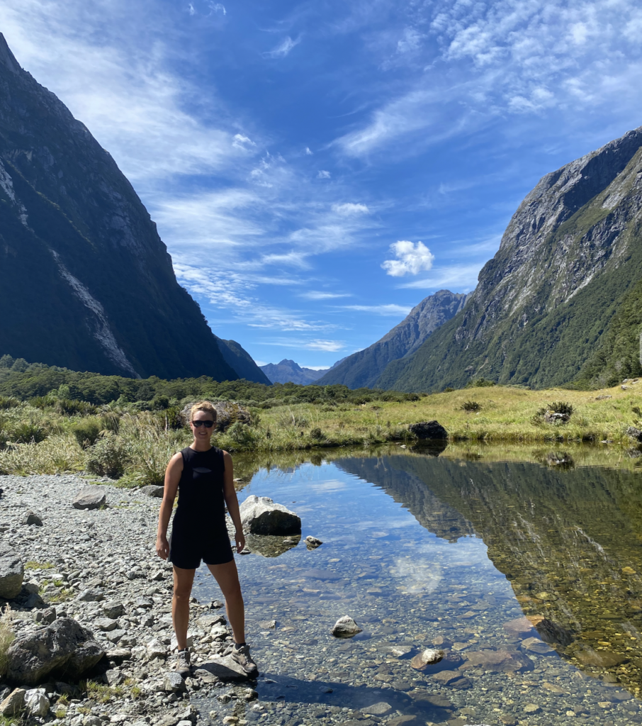
An hour passes and it’s about this time that, though I’m enjoying myself, I’m wondering how this can be the “finest walk in the world.” It’s a flat gravel trail with the occasional puddle or mud-spot, so the track itself is nothing special. As for the views, it’s mostly forest with the occasional mountain peaking through the trees. Lovely–but I’ve seen it on the Routeburn Track, on Lake Marian, on many other tracks in New Zealand. I am ten miles into the track (almost a third of the whole track) and it is nothing particularly special at all.
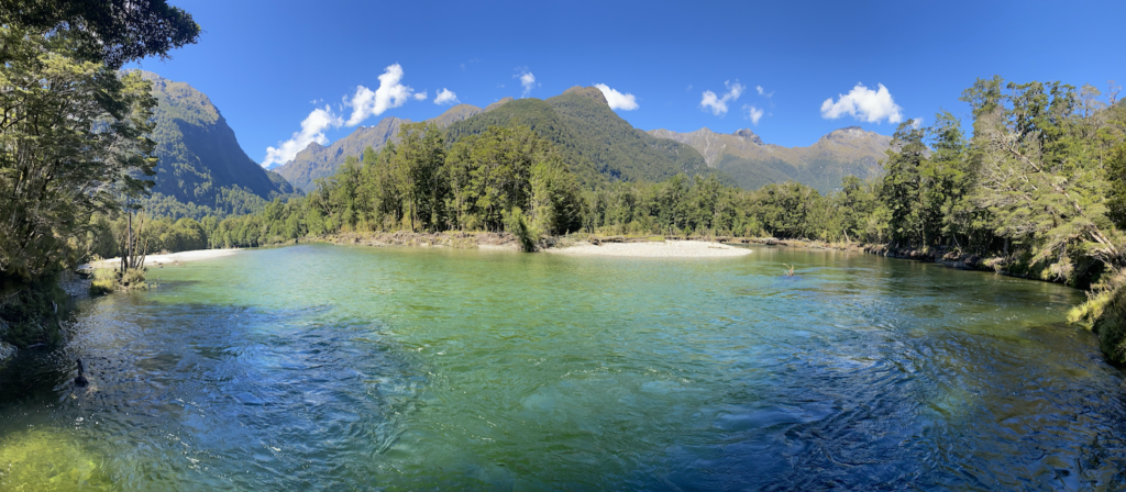
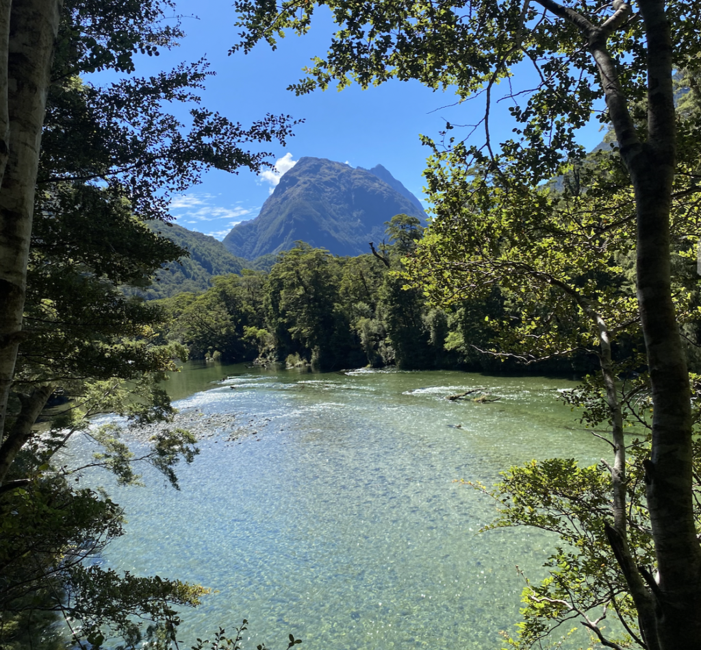
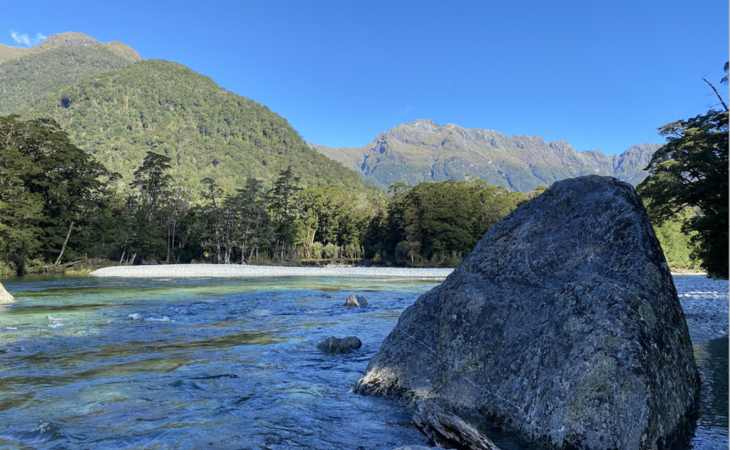
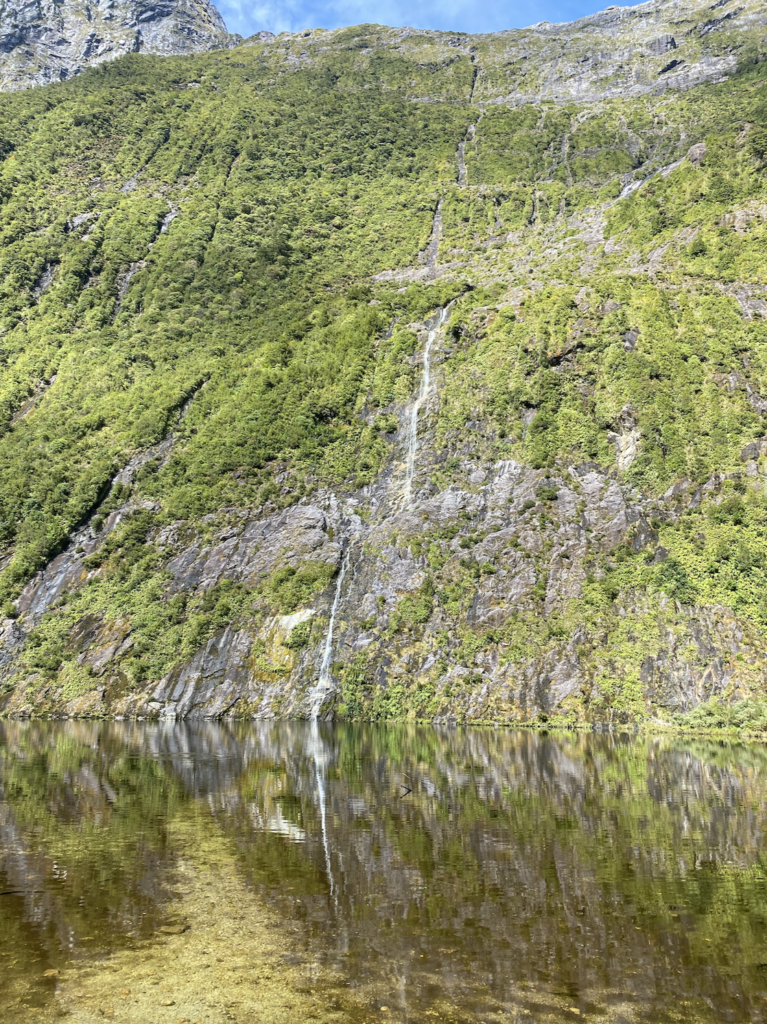
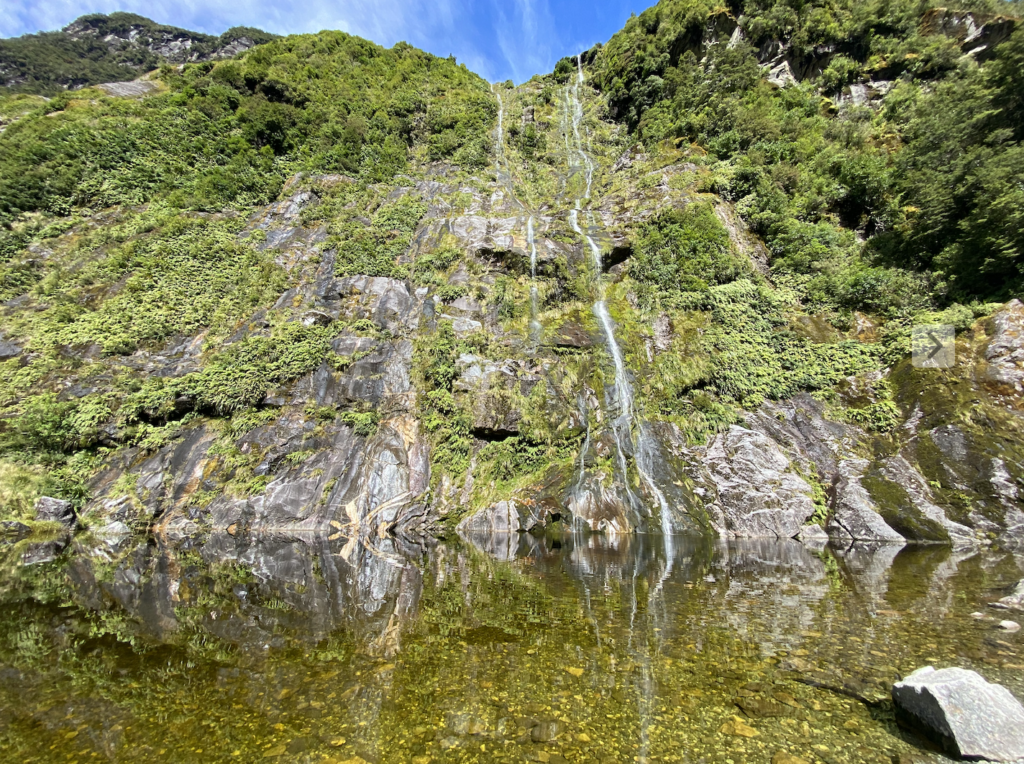
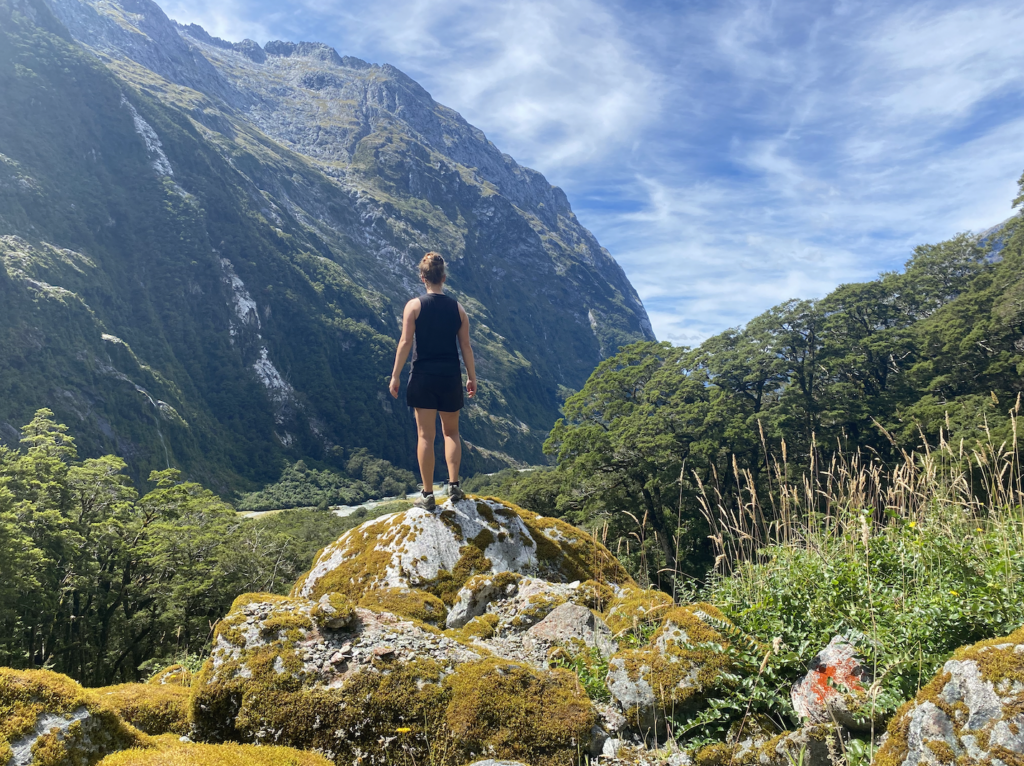
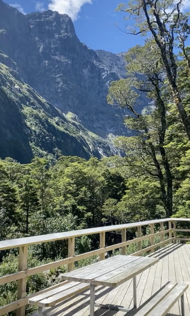
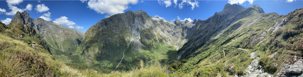
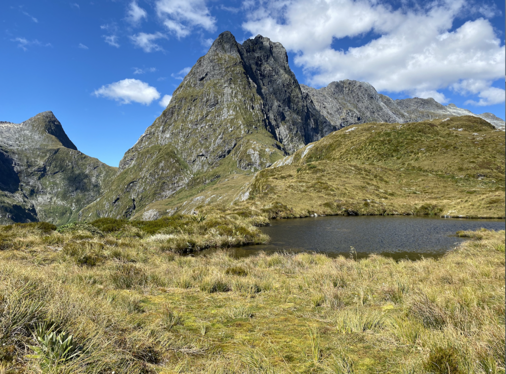
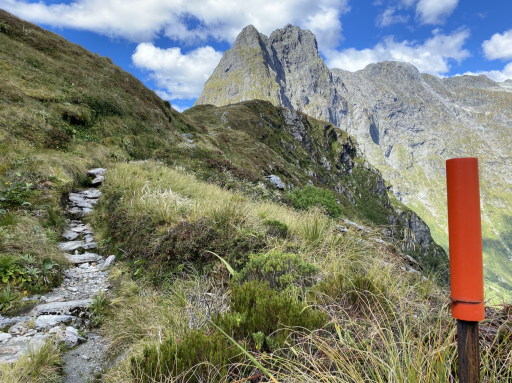
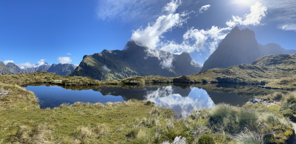
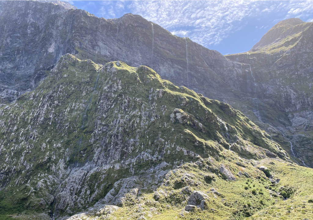
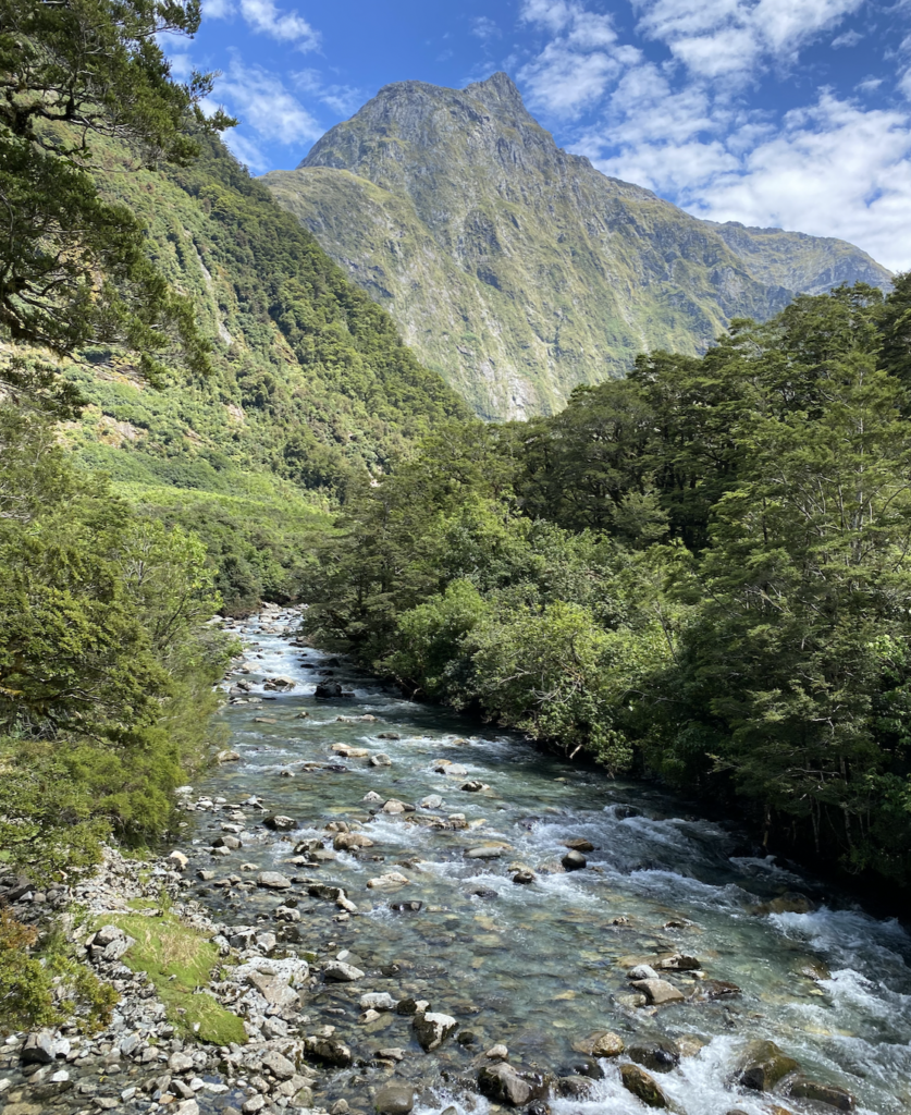
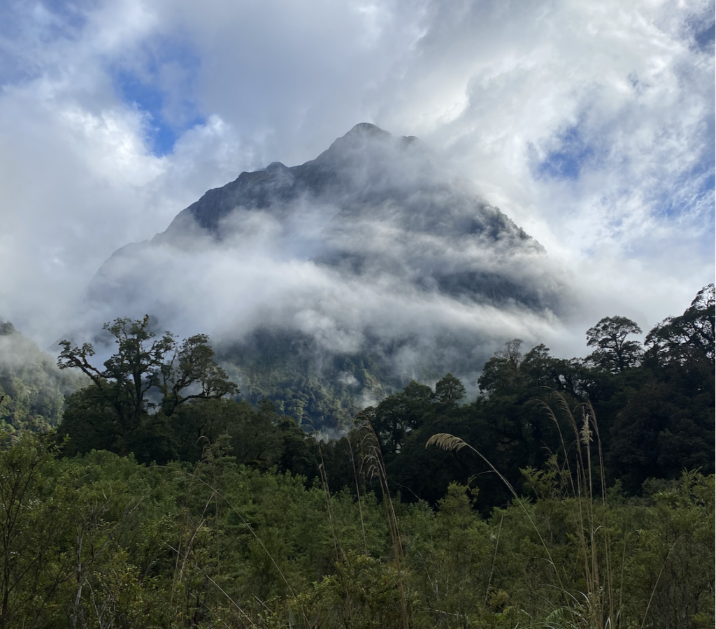
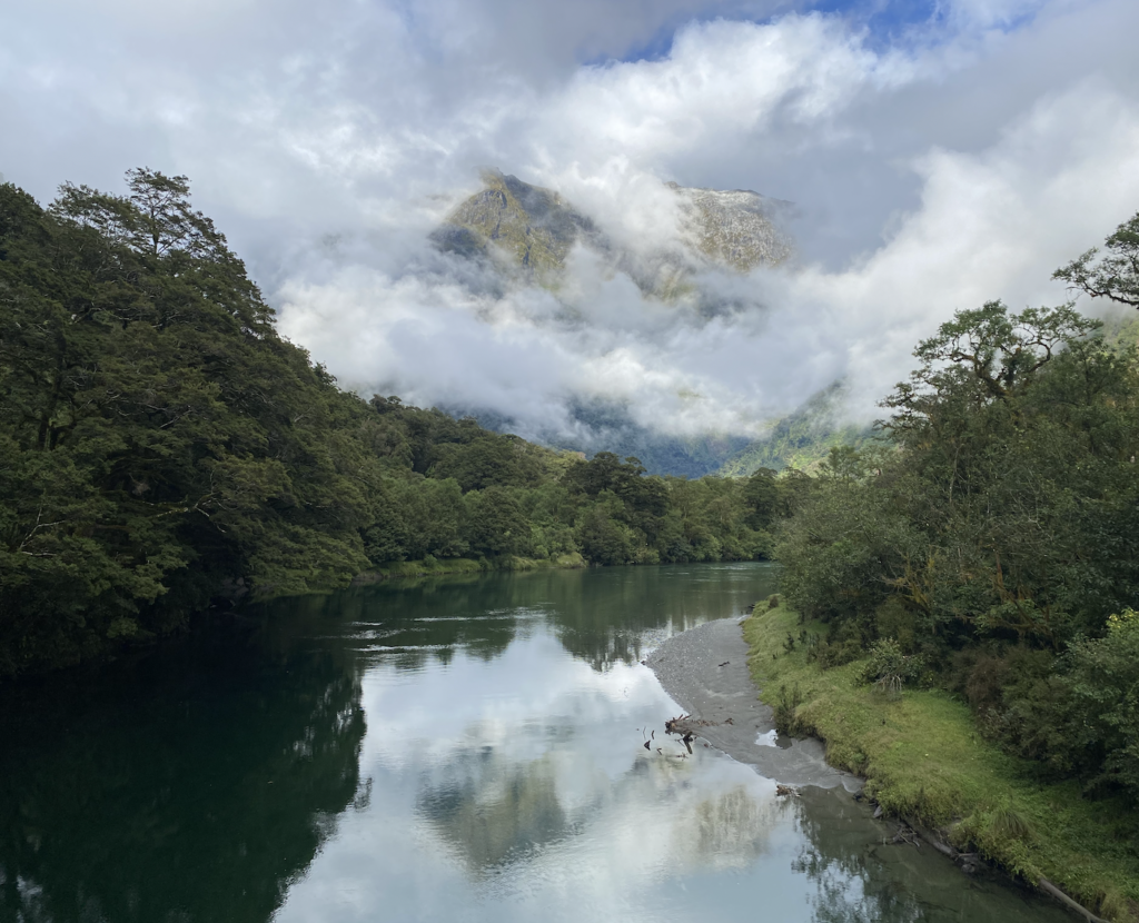
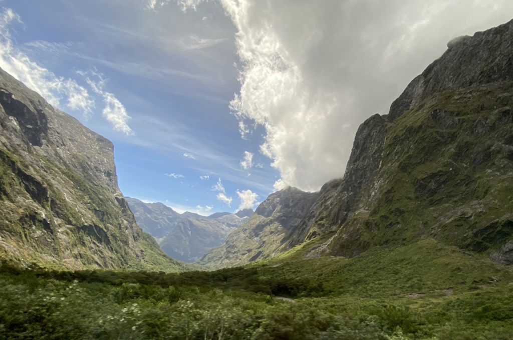
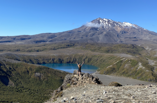
And then it starts. The trees thin and I can finally see. See the sheer edges of the valley. See the masses of diorite and granite peaks and slabs, the vertical mountainsides stretching nearly 2 kilometers straight up into the sky. Though it hasn’t rained recently, a few waterfalls cascade down the cliff-faces, falling and crashing and pure white, like the tails of shooting stars.
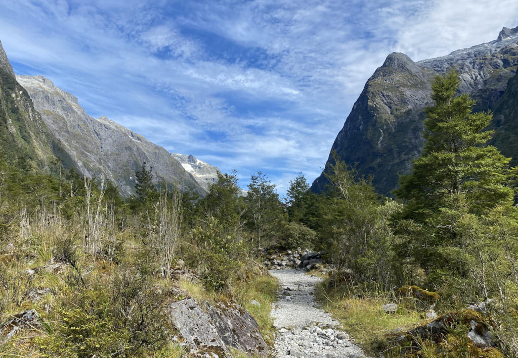
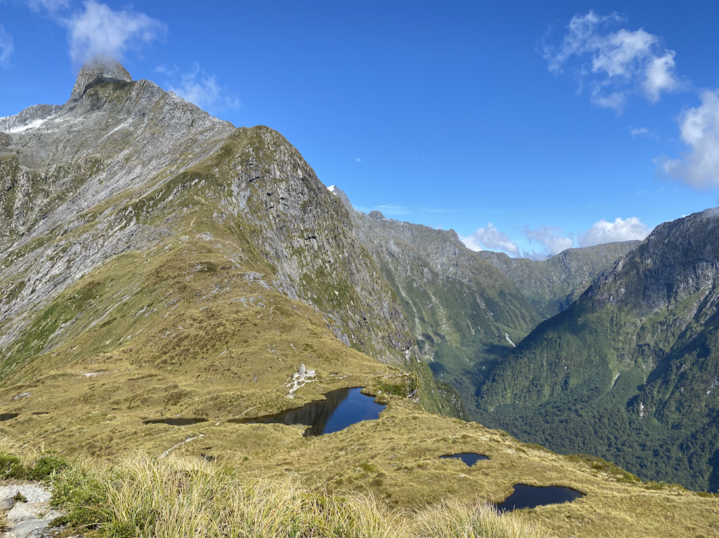
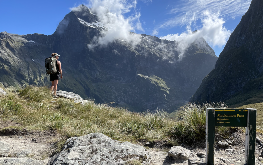
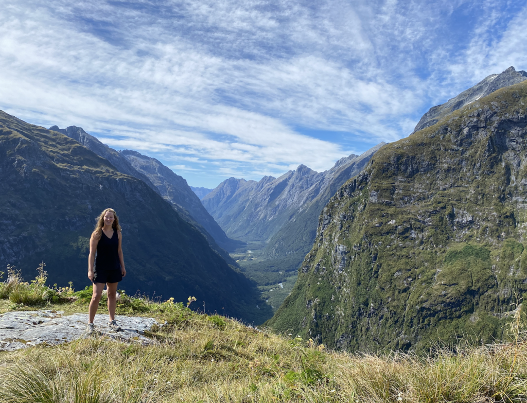
Several lakes have formed beneath the more permanent of these falls, pooling on the flat valley floor and providing the openings needed to see down and up and the valley. I catch my first glimpse of McKinnon Pass, which is my way out of this glacially-carved valley and into the next one. But that’s for day three.
The farther I walk into the valley, the steeper and narrower the sides become. At some point the flatness of the trail begins to disappear and I climb up and down ancient erosion deposits that make the ground feel like it’s heaved and hoed. But it’s not the ground at all—it’s rock and soil that wore away from the edges, falling a kilometer or more to the valley below and, in the last 17,000 years, have become fertile and stable ground.
It’s a long day of walking, the sun blazing down whenever the trees thin or disappear. But, in the back of my mind, I’m wondering if I should make the day longer.
See, the highlight of the Milford Track are the views from the McKinnnon Pass. But, if it’s not a clear day, you’ll see exactly nada from the top. And then…basically you’ve hiked for 4 days to see forest and cliffs, but you’ve missed the jewel in the crown. So, based on my little bit of research about this track, everyone says that if it’s a good, clear day on day two, and you have time, you should drop your pack at the hut and climb McKinnon Pass.
The ranger had given the forecast for the week: day 2 sunny, and day 3 (McKinnon Pass day), partly cloudy in the morning with rain developing in the afternoon. My mind whirs as I walk: what does partly cloudy mean when you’re at the top of a pass? What are the chances the rain develops early? Do I want to rush out of the hut at 7:30am with everyone else and feel pressure to beat the clouds to the top of the pass? And, of course, there’s the final consideration: something like Murphey’s Law (let’s call it Maddie’s Law) probably states that if I climb the pass today, the sky will be perfectly clear tomorrow. If I don’t climb the pass today, the skies will be super cloudy with poor visibility tomorrow.
Finally, I make a deal with myself. If I reach the hut before 3pm, I’ll hike up McKinnon Pass today for the guaranteed clear views.
I reach the hut at 2:15pm.
At the hut, the ranger has the same forecast written on the white board and spells out that it takes 3 hours return trip to reach the McKinnon Memorial at the pass.
I sit for a few minutes, guzzle a bunch of water, dip my sweating and aching feet in the icy-cold river. And, at 3pm, I get back on the track with only my water bottle, my raincoat, my phone, and my tripod. I’m going to climb McKinnon Pass. Just in case.
It’s a horrible climb. My head hurts as I am already dehydrated. My feet hurt, as I’ve already walked eleven miles. My visor is dripping sweat off the end of the cap because the sun is blazing down, and I sweat like a beast. When it gets really bad, I promise myself that I can stop every ten minutes for 10 deep breaths and a few sips of water. I can’t turn around, of course, for three reasons. One, I decided I would do this and I don’t want to disappoint myself. Two, I had met several other solo hikers on the trail and again at the hut. And I’d told them I planned to the hike the pass, so they’d inevitably ask me about it when I stumbled back into the hut, and I didn’t want to have to admit I’d turned around. Third and last reason: the aforementioned Maddie’s Law.
And really, it isn’t that far. I’d done far more elevation gain and a much harder trail for Broderick Pass. So I knew I could do this. I just hoped I didn’t pass out and fall down the cliffside!
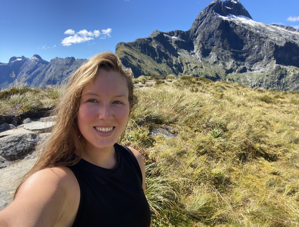
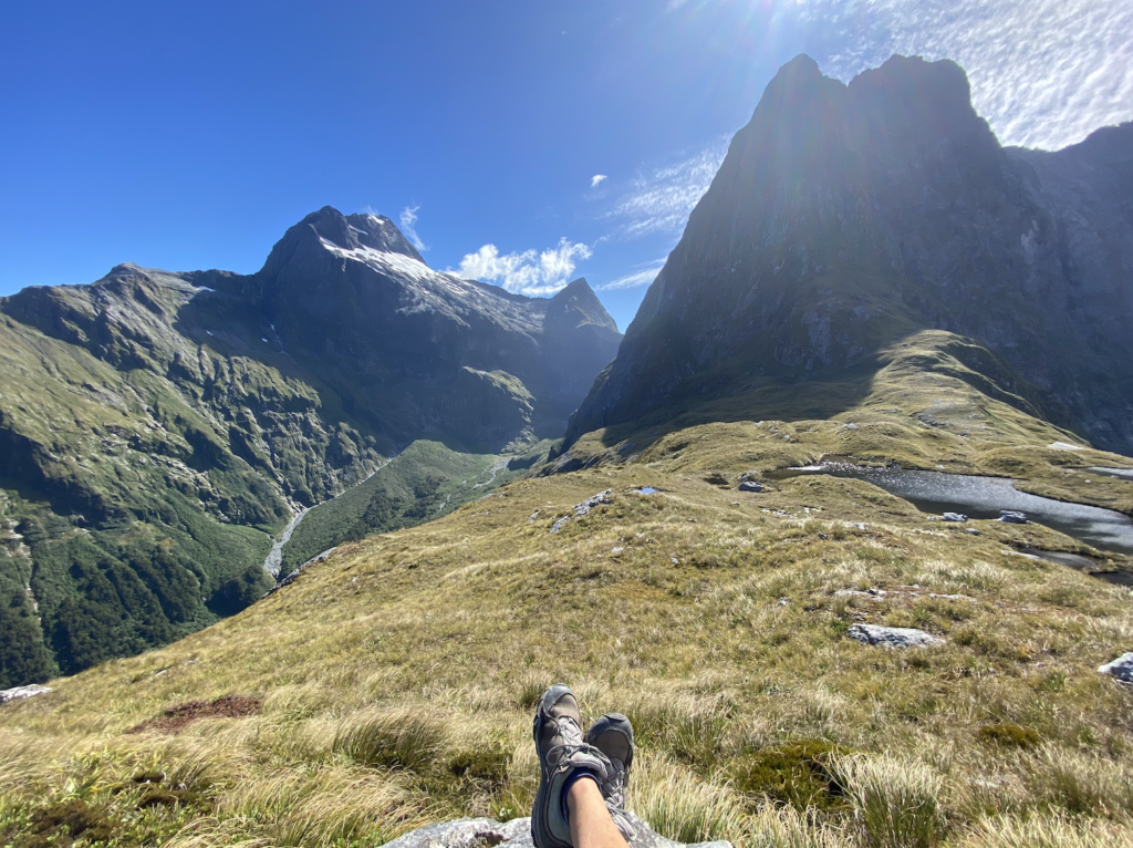
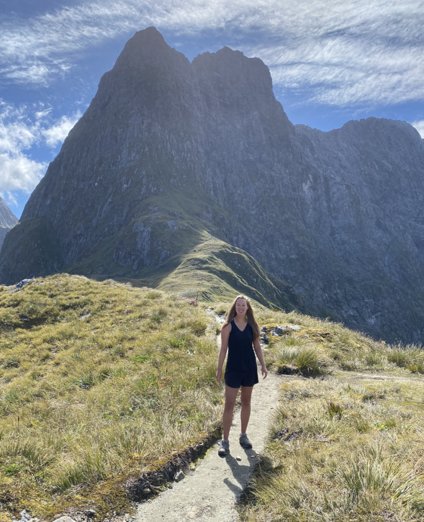
It takes me one hour and fifteen minutes to climb the pass, but I can honestly admit that there was a lot of panting, a lot of trudging, a lot of mental cursing. But when I break through the bush-line I know I only have 200 more meters of elevation to go. Also, the views are already spectacular.
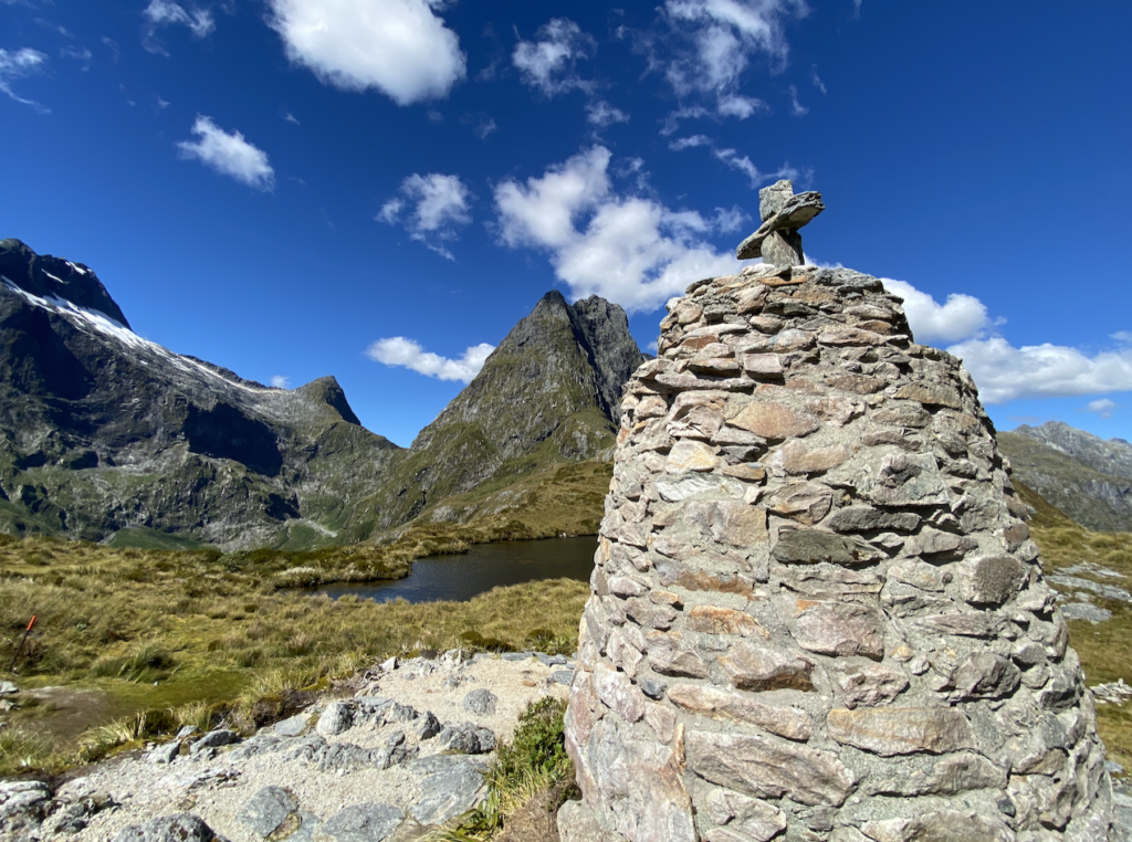
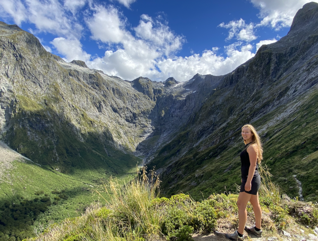
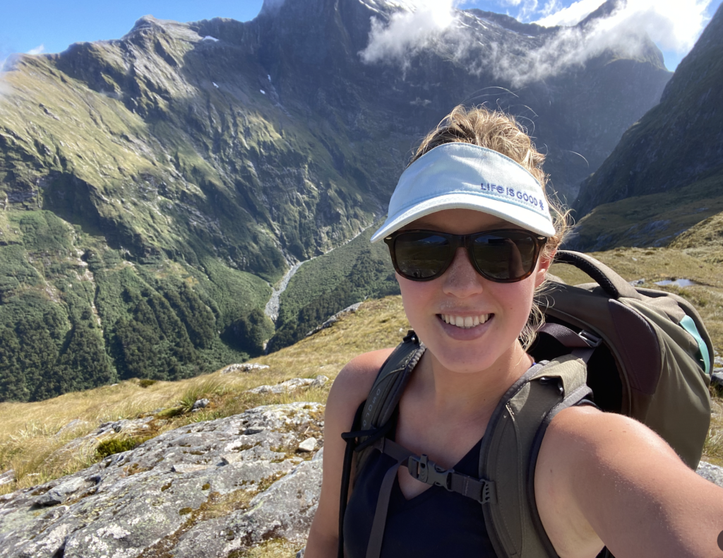
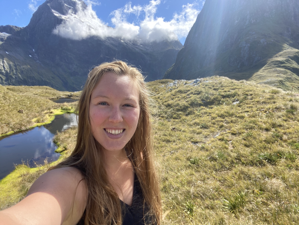
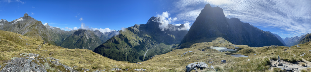
Finally, I see the stone cross of the memorial and am invigorated for the last couple hundred yards. And then, I am here. Top of McKinnon Pass at 4:15pm. And it’s warm and still and I don’t need the coat I brought even as I stand between two massive valleys.
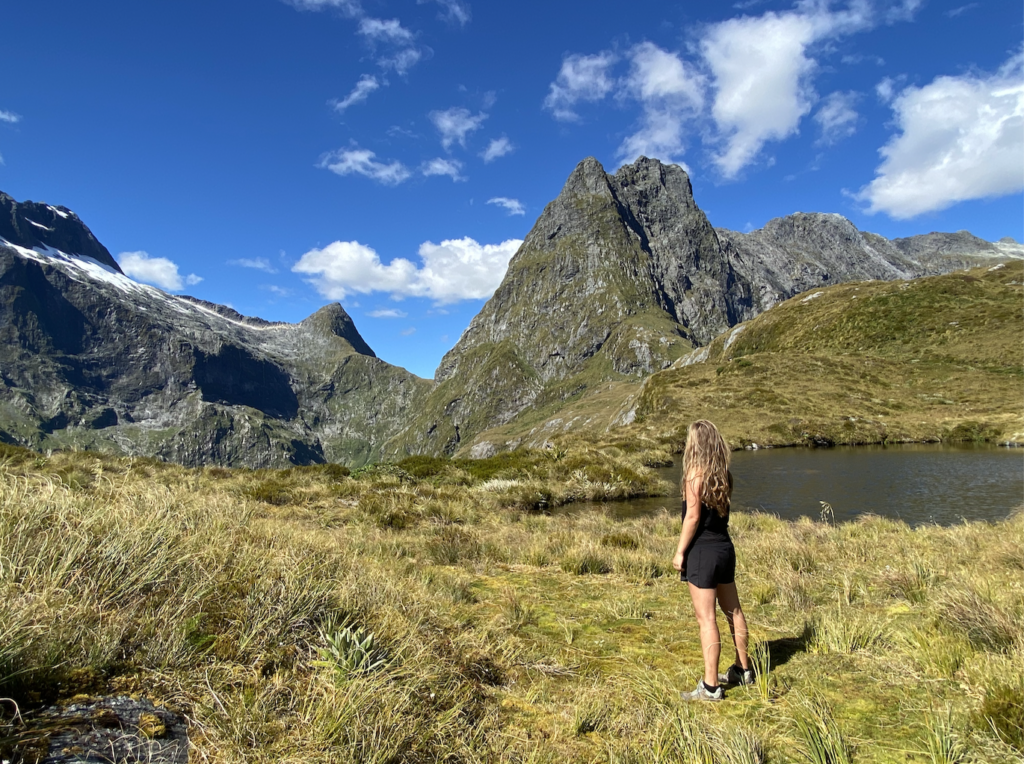
I sit. I suck water like it’s ambrosia. I flop my feet out in front of me. And I stare and stare and stare. It’s hard to know which direction is more beautiful. More striking.
After great amounts of awe, several photos with my tripod, and now mostly dry hair, I head back down the pass the same way I came, dreading the fact that I’m going to have to walk it in sixteen hours with a pack on!
Day 2 – 15.7 miles, 2150 ft elevation gain
DAY 3
Again, I wake to a nearly empty bunk room and enjoy a slow morning. The sky is mostly clear, dotted with a few fluffy clouds. But, of course, it’s beautiful and clear. You’re welcome, fellow hikers!
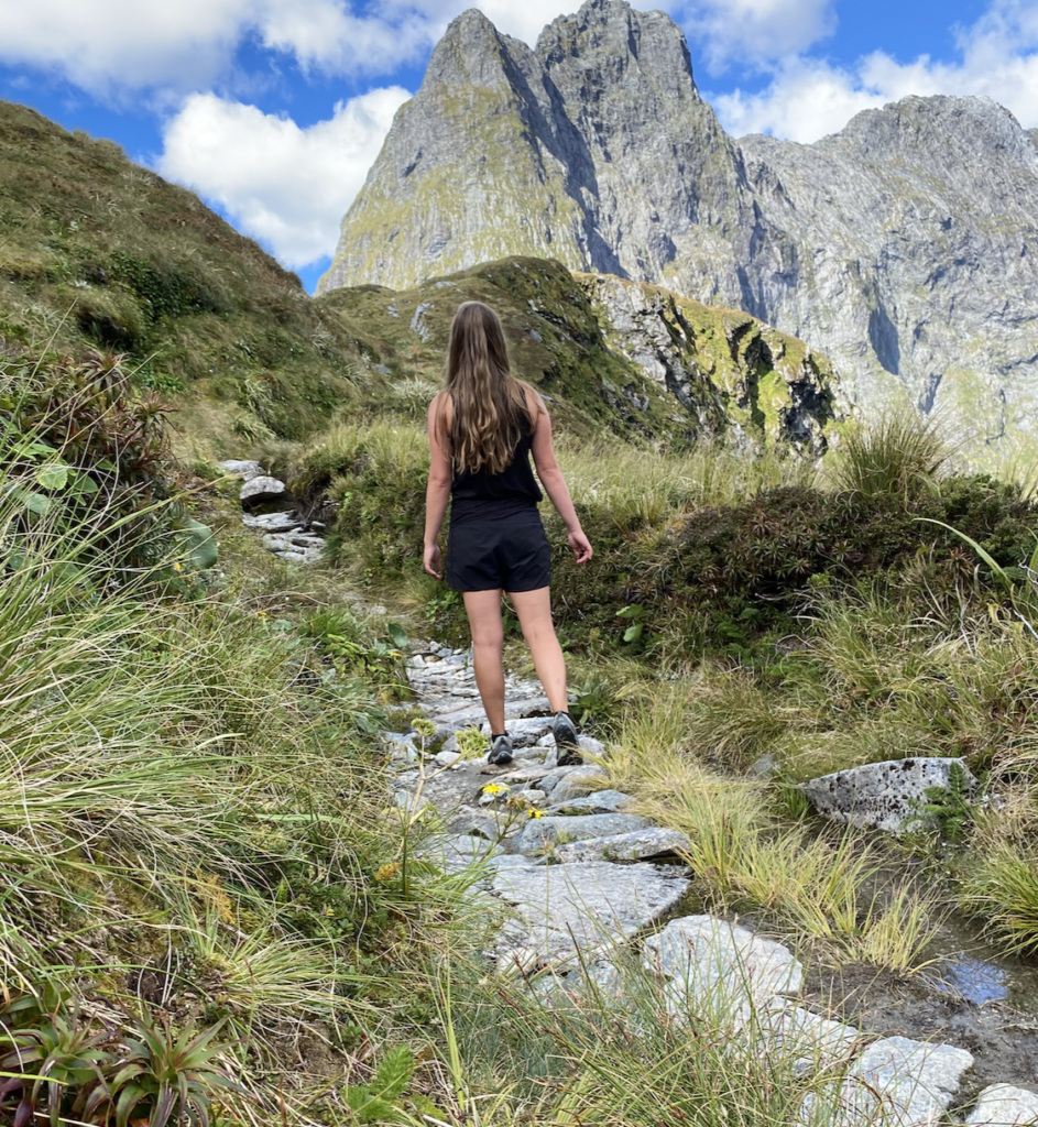
I’m the last to leave the hut, though I quickly begin to pass the others, checking in. Soon I encounter the older gentleman who is striving for his eighteenth completed trek. His young neighbor has her pack on her back and his on her front as he picks his way up the rocky, uneven path with two trekking poles. The young neighbor is jovial as we chat a few minutes and I continue on.
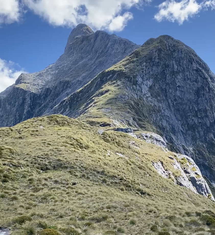
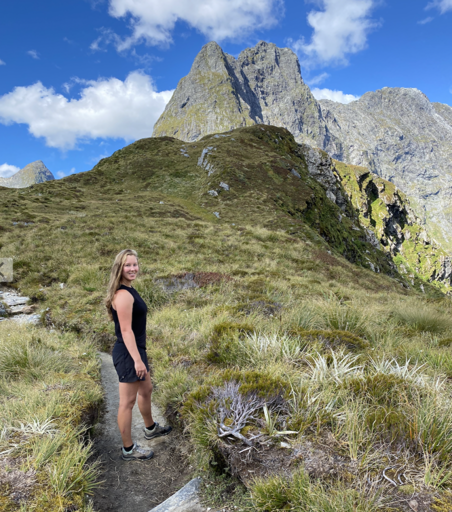
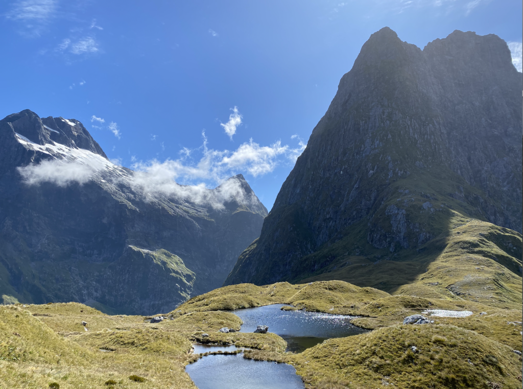
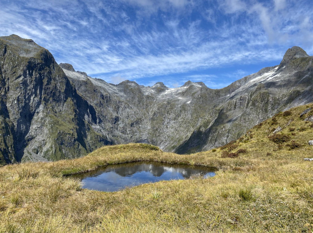
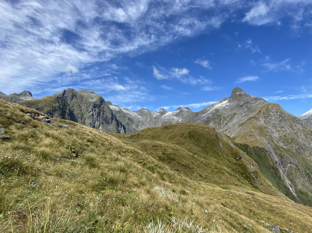
With fresh legs and a night of sleep, I feel so much better than the climb the day before and I’m shocked when I reach the top again. It’s windy, launching clouds up the steep cliff sides and sending them swirling over our heads. After a few more photos, I hoist my pack back up onto my back and continue past the memorial.
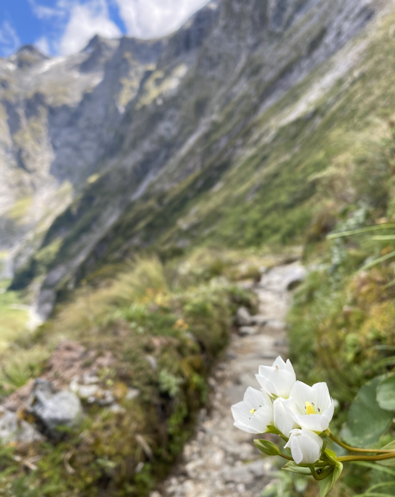
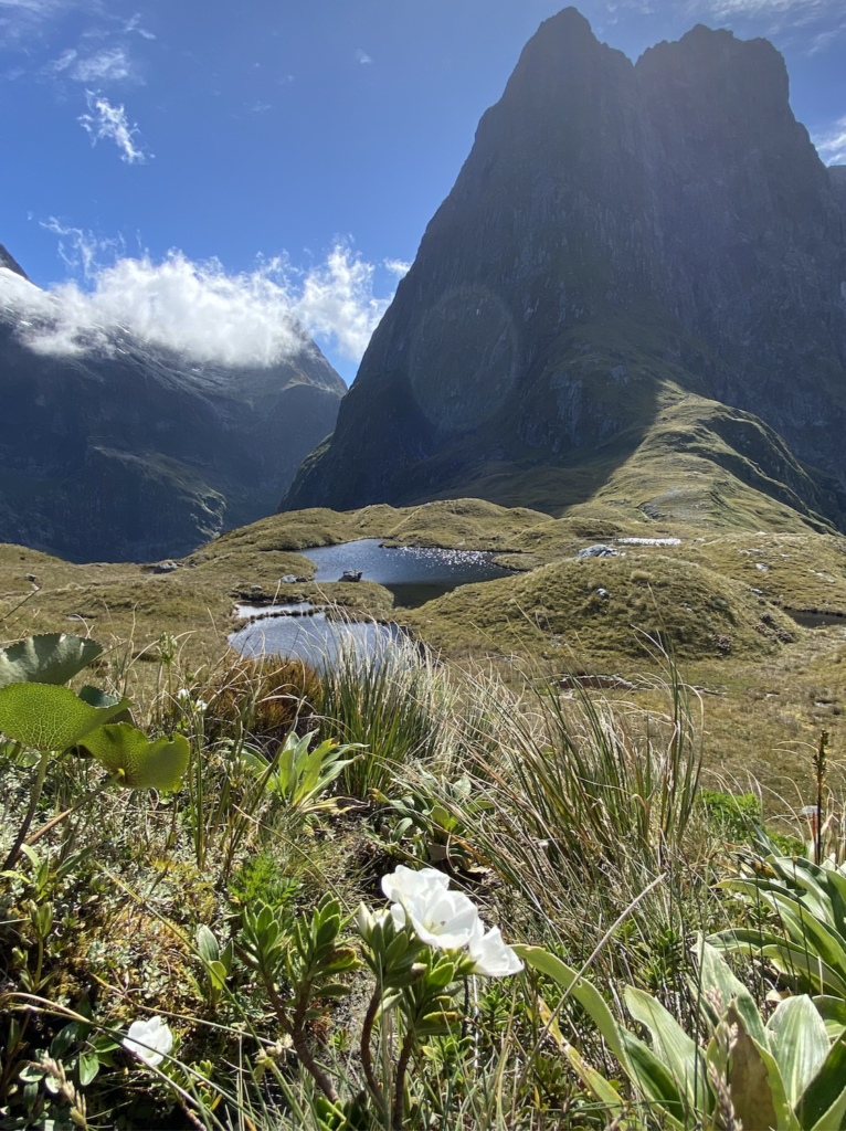
Impossibly, the views only improve. Vast vistas over the two valleys. Towering peaks of impossible heights, impossible steepness. Alpine flowers dot the hillsides, bobbing merrily in the breeze, and the clouds twirl and dip. Every direction I look is incredible, and it feels like a crime that there are still five more hours of hiking ahead of me because I’d like to stay. I’d like to linger. I’d like to lay in the grass and breathe.
It brings to mind a story I’ve heard several times before. Fiordland, as the myth goes, was carved by the Maori god Tu-te-raki-whanoa, and he saved his best work for Milford Sound, creating the steepest, most imposing cliff sides. Fellow goddess Te-hine-nui-to-po saw his last and best creation and decided that it was so perfect that humans would linger here too long. And in their lingering, they would destroy this masterpiece. So she created the sandfly, so we wouldn’t stay too long.
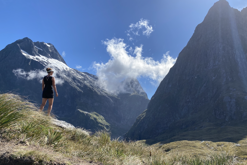
While the slight breeze means my lingering is sandfly free, I feel an understanding of Te-hine-nui-to-po’s reverence and fears. This is majestic country. Stunning land, and while it deserves to be seen, it also deserves to be left alone.
Thankfully, DOC has done that with it’s creation of the Great Walks and it’s regulation and control of the area. I am blessed to be here, nearly alone atop this tiny pass amongst the giant landscape. Able to share this awe with a few people, but mostly to feel it swell in my chest, nearly tear in my eye. It blooms, and it feels absolutely right that I am here right now. This, I believe, is one of the meanings of life: awe at this magnificent world. At what nature has built void of human hands.
So I linger. So I float from side to side, from view to view, from kneeling beside tiny white flowers to tipping my eyes up, tracing the tops of Mount Balloon. But I don’t linger too long. Because sometimes the awe needs to be temporary, so it can pass on to the next person.
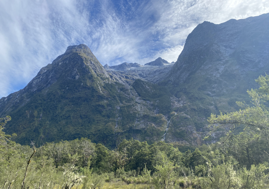
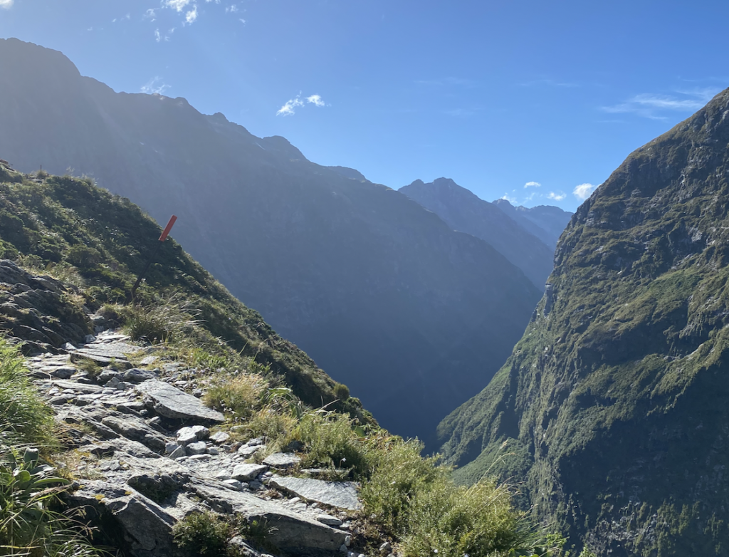
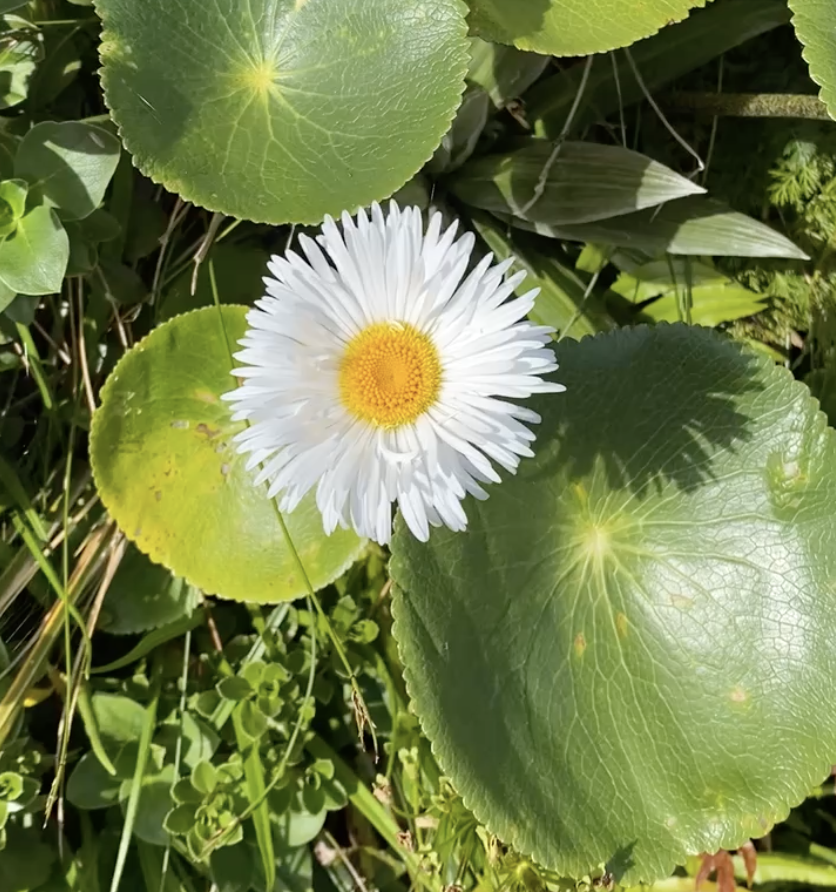
Too soon, but perhaps exactly on schedule, I begin my descent. While the climb was only about 1,500 feet, the descent is over 3,000 feet. The alpine landscape sports constellations of daisies, jabbing flax fronds, funnel-like circular leaves, and waving grasses. The path is jagged rock, tossed like an afterthought on the trail. Occasionally there are signs about rockfall danger and, in winter, avalanche danger. Looking up, I can’t help but think that this whole area ought to be marked as extreme rockfall danger!
Despite the lack of rain, water tumbles great distances down the slopes, melting from snowfields on the high peaks. In rainy weather, the track must be a waterfall of it’s own, tossing and frothing, and the cliff sides more water than rock. While that would be magical to see for a few minutes, I am thanking the universe for the sunny weather.
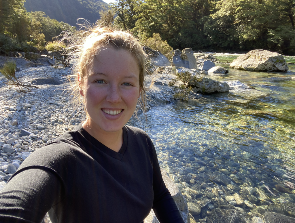
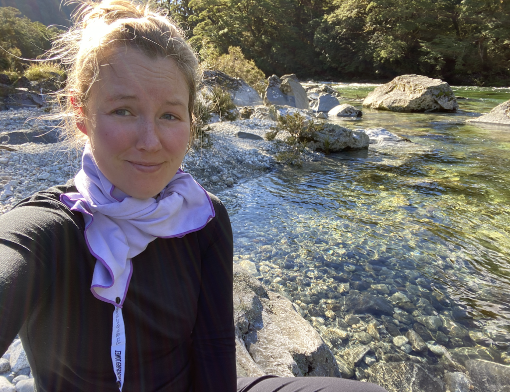
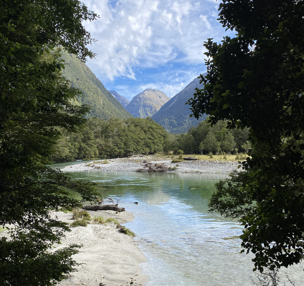
At the valley floor, I reenter the beech forests and the track glides along a boisterious stream bound by water-smoothed rock faces and home to a series of tumbling waterfalls.
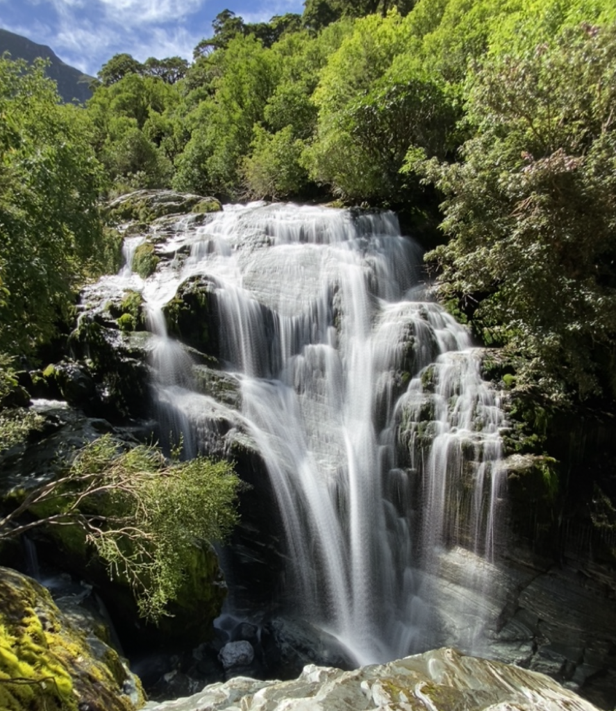
After another hour or so, and after a lunch break, the track evens out. It’s one more hour to the hut or… I can choose to drop my pack and take an hour and a half detour to New Zealand’s highest waterfall.
It’s not even a question.
My legs are tired, and the detour track to the waterfall, while seeming so innocent, has a lot of stairs! But the glimpses through the trees of the waterfall are entirely worth it.
And then I reach the base.
Sutherland Falls plummets in three tiers (or leaps) from Lake Quill. It falls, in total, 1,902 feet. It is the tallest waterfall in New Zealand. (However, some people claim that Browne Falls in Doubtful Sound is actually the tallest. While I was in Doubtful Sound, I saw Browne Falls and learned that it is actually not classified as a waterfall because the water never once free falls. It is always against the rock, even though the rock is nearly vertical. So, I agree with those who say that doesn’t count and that Sutherland Falls is the tallest in New Zealand).
I’m not the kind of person that has to take everything to the extreme (tallest mountain, highest waterfall, etc), but I’ll admit that standing before Sutherland Falls, I am blown away. Literally.
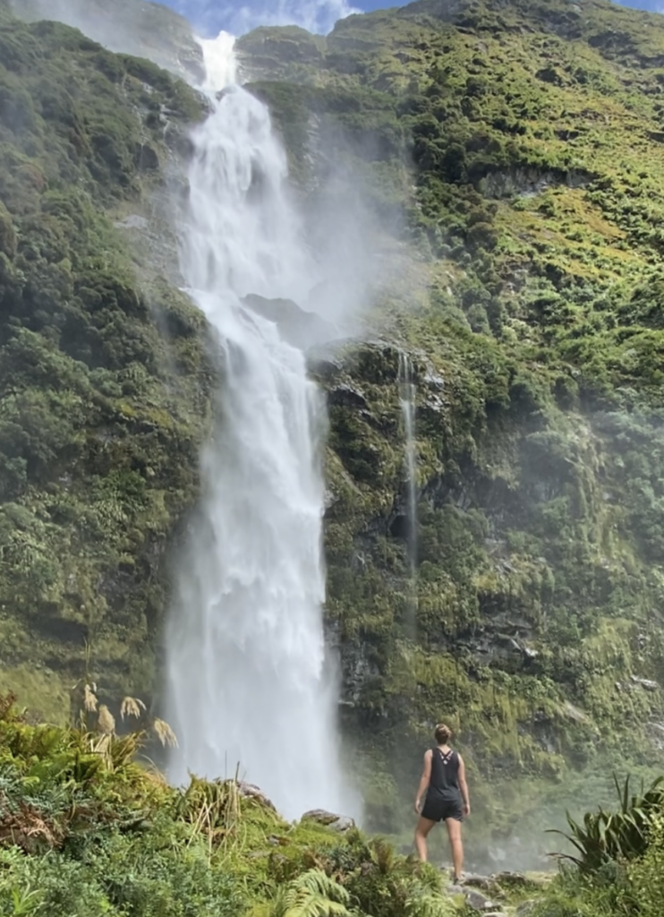
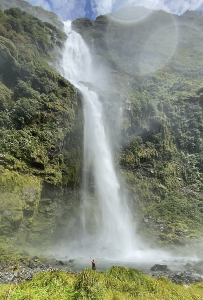
I try to get close. I want to take a dip in the pool beneath the falls, but the force of the water and air blasting off of the waterfall buffet my body, drench my clothes. I almost can’t open my eyes, squinting against the gale. I physically can not walk the last few feet to the edge of the pool because of the force of the wind. It is glorious.
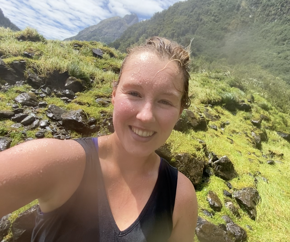
The final walk to Dumpling Hut is a bit painful as my feet throb from hours of stepping on sharp, uneven rocks. When I reach it, I brave another swarm of sandflies to rinse off in the river and enjoy a warm hut and good book for a few hours. Over dinner, I chat with my fellow hikers and we all exclaim over our amazing luck. Just as we’re finishing dinner, the rain begins to fall.
Day 3 – 13.4 miles, 1700 ft elevation gain
DAY 4
There is a boat at 2pm for a 2:30pm bus back to Te Anau. With a 5.5 hour walk ahead of me, even I leave the hut before 9am this time!
The walk out starts nicely because the rain of the night before brought low, misty clouds: a little glimpse of Fiordland as it is over 200 days a year. But the best parts of the track are behind me and now it’s just a quick march to reach the boat on time.
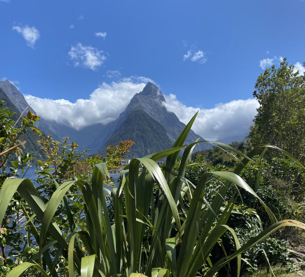
The clouds do clear, burning away within the hour, and the mountains are speckled with temporary waterfalls. Several permanent waterfalls (McKay Falls and Giant’s Gate Falls) cascade down to break up the walk through the rainforest. And then I emerge at Milford Sound to a glorious blue sky and the unofficial eighth wonder of the natural world.


The sun is still shining, just as it was when I left–shedding golden light on which might not be the finest walk in the world, but is definitely the luckiest walk in the world if the sun is bright and hot!


One Comment
Sandee Kunkel
So eloquently said, I feel like I can see it and my feet hurt! Lol