The Jurassic World of New Zealand’s North
I stomp along a muddy track. Bright green moss clings to trees, ferns stretch feathery boughs wide. The air is heavy, humid. The absence of other hikers makes me feel like an explorer. Thankfully, New Zealand has no large predators, so when the canopy above erupts in chaos, I know it’s only a fleeing bird rather than a pterodactyl swooping down to snatch me up. The landscape would say otherwise, however.
Driving through Northland means cruising past farmland and more farmland and still more farmland. Mostly animal farms, since the ground bulges into peaks and creases into valleys much too steep for growing and harvesting crops. Cattle and sheep are dotted along the route, as well as pigs, geese, and the occasional emu mob. But as soon as I step onto a hiking trail, all of that disappears. I can’t hear the gusts of passing cars or the lowing of cattle, only the rustle of leaves, the creak and squeal of big trees shifting in the breeze, and, of course, the ruffles and peeps of many different bird species.
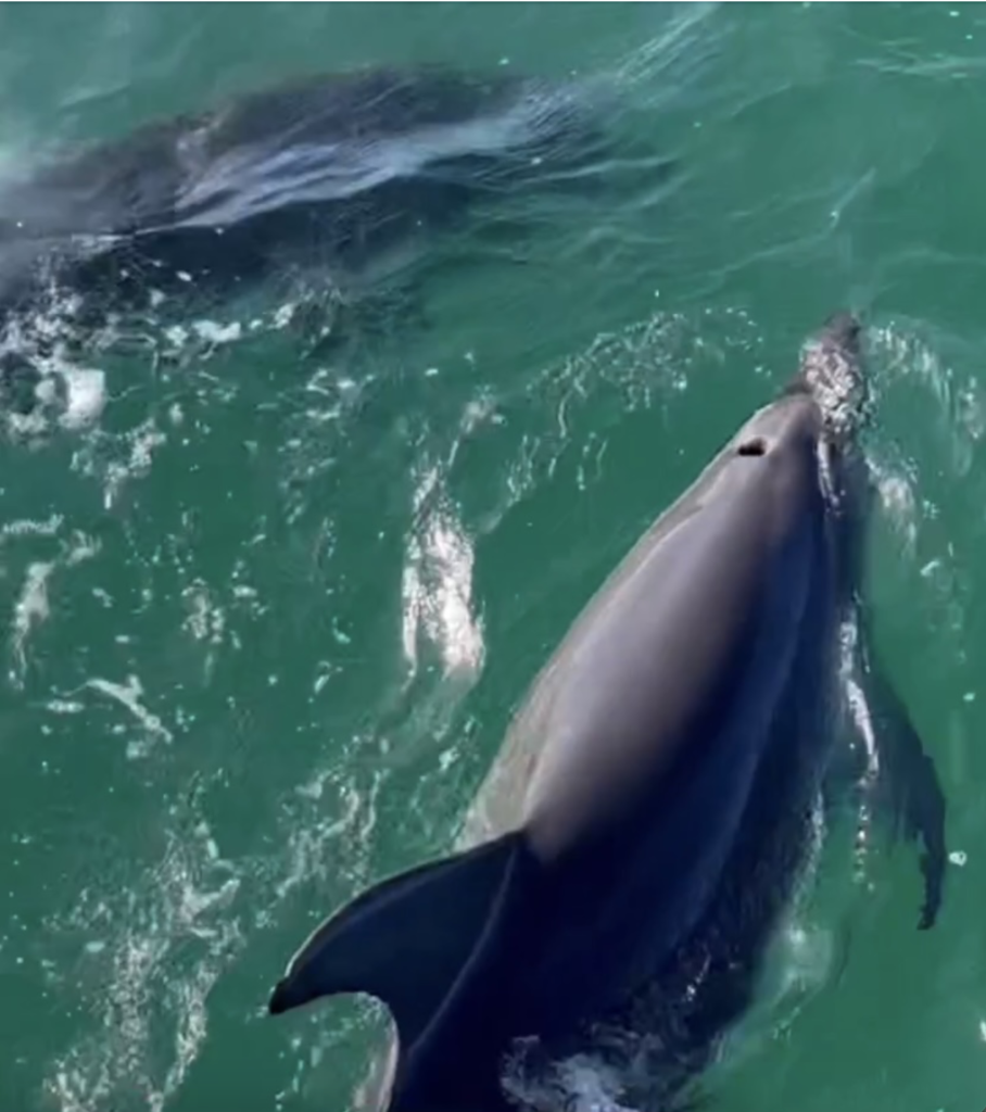
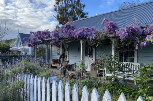
Whangārei, where I spent my first few days (which I wrote about here) was different. It was a decent sized city and the views looked out equally over ocean and rolling farmland. But I left Whangārei, traveling further north to Paihia, on the coast. A classic beach town, Paihia was drowsy and mellow in the middle of winter and the Bay of Islands cruise I embarked upon was less than a quarter full. As we motored away from Paihia and Russell and out into the bay, it, too, felt like drifting into a different world. The Bay of Islands is so named because there are 144 islands in the bay, and most are uninhabited. The bay is also a marine protection zone, so it’s safe to say there were more dolphins than people in the bay that day.
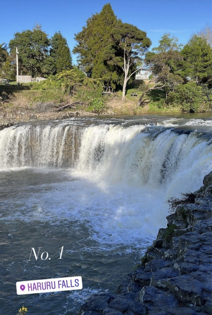
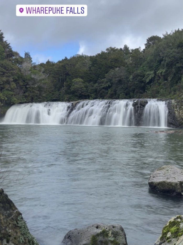
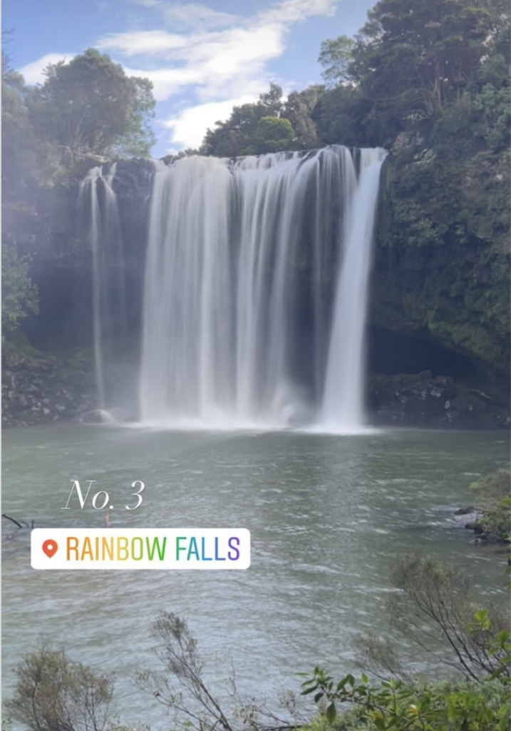
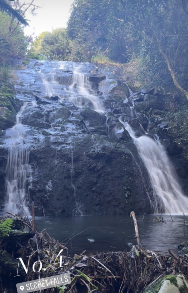
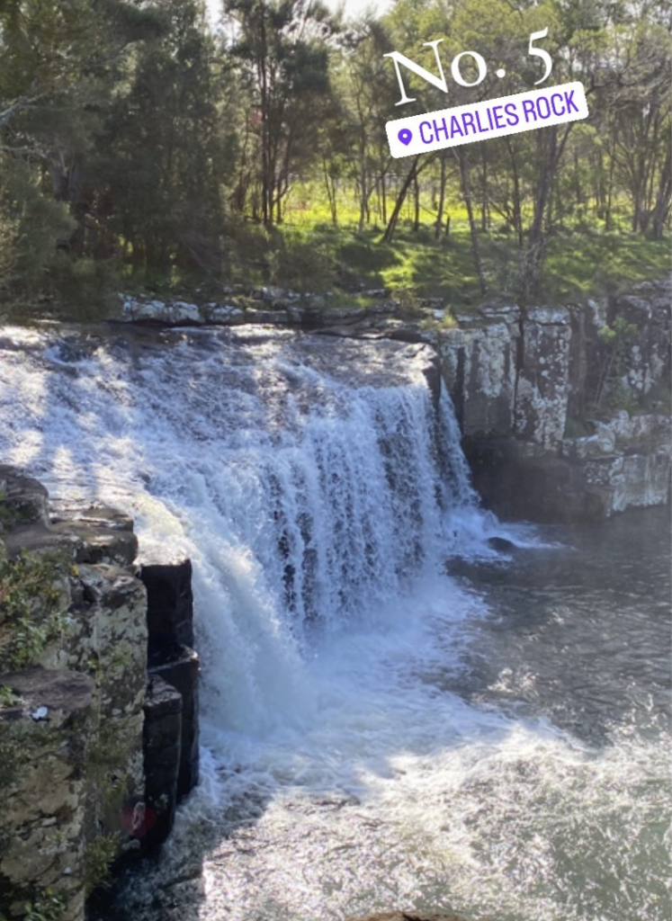
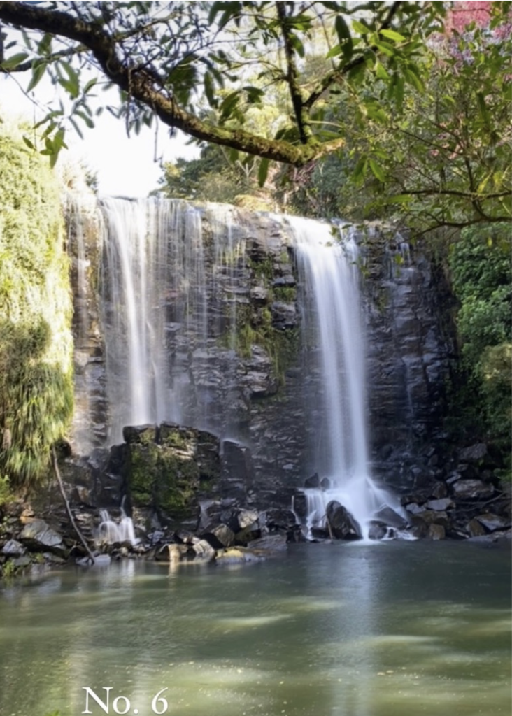
However, it wasn’t until I left Paihia and traveled further north (first stopping in Kerikeri to visit a bunch of waterfalls–and by now we all know how that turned out) that I truly felt a shift back in time.
From the maelstrom of waves at Cape Reinga to the far-seeing heights of the Duke’s Nose to the hidden valley of the Wairere Boulders, it was as though nature had me fully in it’s grasp, anchoring me to an age long past.
Cape Reinga
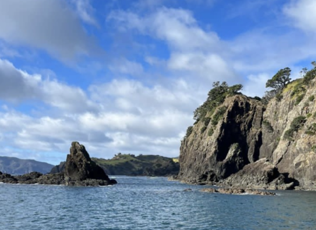
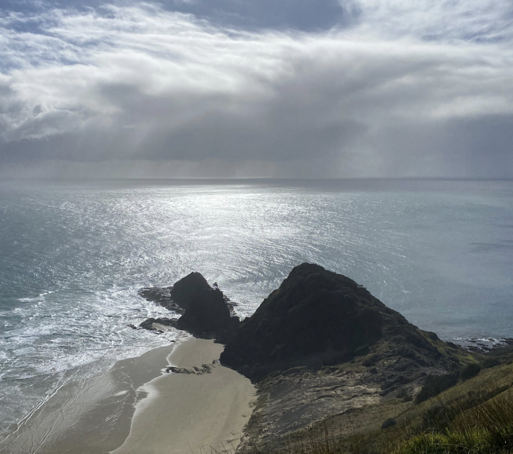
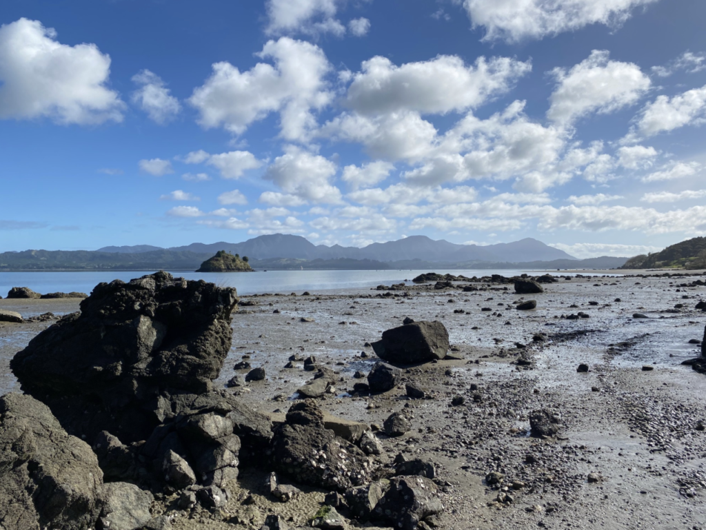
Cape Reinga is the farthest north point on the North Island, and it’s where the Tasman Sea (between New Zealand and Australia) and the Pacific Ocean (if you don’t know where the Pacific Ocean is, I can’t help you) come together. It’s a long drive (through much of that aforementioned farmland). As you near the tip, the farms fall away and mountains rise inexplicably to take their place: untouched and untamed, with a single road winding through. The Cape itself is, of course, adorned with a car park and walking path and the famous Cape Reinga lighthouse. However, looking beyond the path, all is wild land and wild ocean. The plants here grow among volcanic rocks and sandy soil, buffeted by the sea wind day in and day out, and coated in salty spray rising off the waves far below. They are hardy things, eeking out an existence as their ancestors did thousands of years ago.
The main attraction is the point where the two large bodies of water meet. In my mind, I’d pictured water coming together the way water does: i.e. unnoticeably.
Instead, the crescent swoop of the land cradles whirlpools and white water, like rows of underwater washing machines agitating on the seafloor. Waves come together at right angles, sloshing up and over each other as they march inexorably on, like rows of foot soldiers clashing.
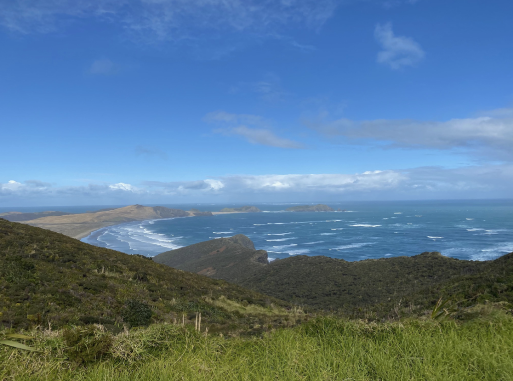
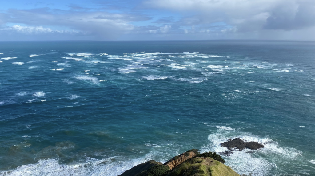
As the wind howls and the surf crashes and the sea and the ocean fight for dominance in an endless, ageless tumult, I am reminded of the power of our planet. And also, the many long years of it’s existence: day in and day out the water clashes, regardless of whether I, or anyone else, stands there to observe it.
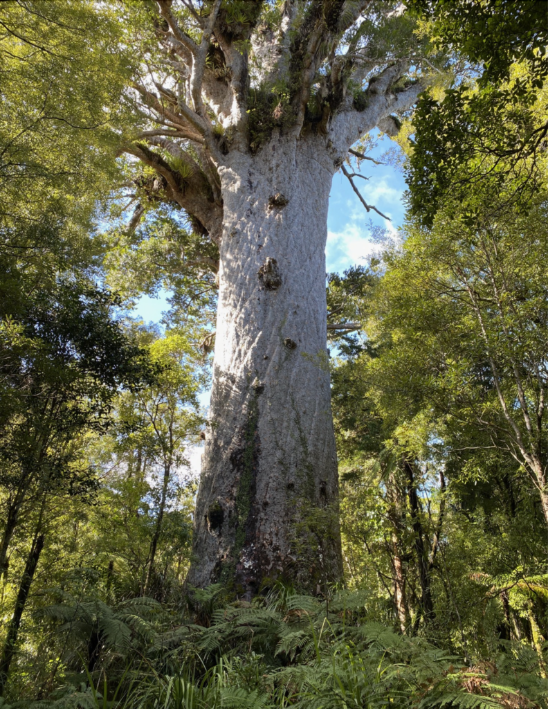
Age-Old Kauri Trees
Kauri trees are the second largest growing and longest living tree on earth, second only to California Redwoods. Growing only in New Zealand in the warm north, felled kauri trees preserved for thousands of years in peat bogs have been found to be as old as 150,000 thousand years. When walking through the parts of these woods that still remain (as much was logged or burned for farmland), it is quite certain the forests looked the same all those many years ago.
The oldest living Kauri tree in New Zealand is estimated to be up to 2,500 years old. The Kauri had special significance to the Māori, especially the long-lived ones like this one. In fact, this ancient tree is named Tane Mahuta after the Māori god of forests who once separated mother earth and father sky to create the land in between. It’s not hard to imagine a tree such as this (at 150 ft tall with a girth of 50 ft) holding up the sky.
Hiking in Whangaroa
During the age of the dinosaurs, New Zealand was part of the southern supercontinent called Gondwana (the step after the singular supercontinent Pangaea). Dinosaurs walked the earth, ferns flourished, pterodactyls screeched. Then, 85 million years ago, New Zealand split off from Australia and moved slowly north. With it’s abundance of ferns and vast swathes of land that feel entirely untouched, it feels like New Zealand is a preserved piece of that ancient world.
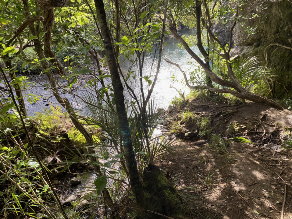
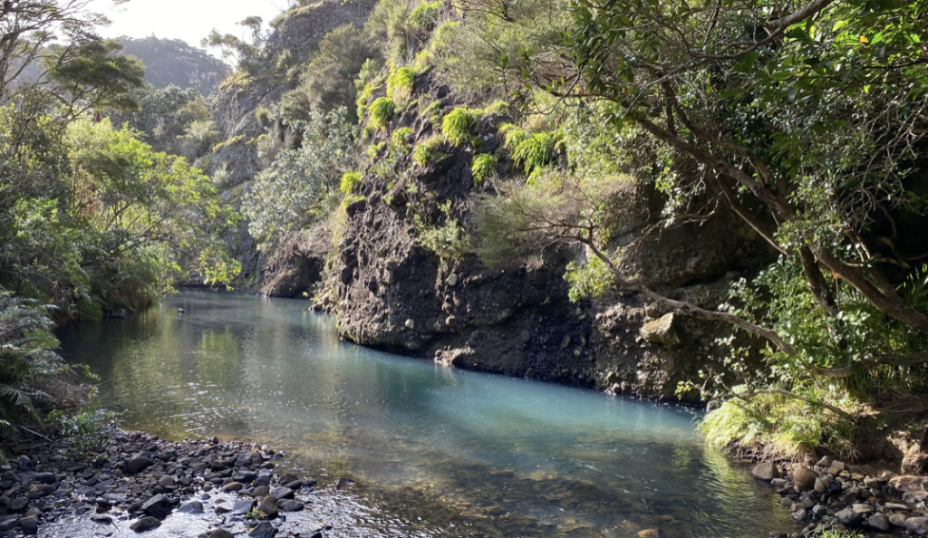
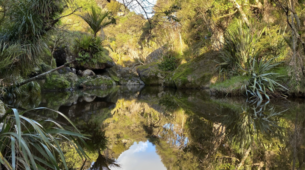
A walk in New Zealand’s Northland means stepping into a forest where the temperature drops, the earth is dark and loamy, often muddy and forgiving beneath your feet. The tree canopy above nearly blots out the sun, but sparks of golden light drift through. Vines like electrical wires hang from sturdy branches and ferns rise chest height, greenery bursting forth. The rivers cutting through the forests are jewel-toned and impossibly clear. Even when climbing near the coast, the views often look out over vivid seawater and rocky basalt cliffs with not a building or boat in sight. It feels like stepping back in time, and not just because ferns pre-date the dinosaurs.

In each breath of greenery-tinged air, in each tease of the passing breeze, in each gurgle of water tucked beneath a roil of boulders or hidden by spiky foliage, I feel like I’m walking on ancient ground. Many of the places I’ve hiked in the Rocky Mountains back home are far more remote, but the feel of the woods is entirely different. In the Rockies, the world feels wild and sharp. The forests are straight lines–tall aspens, pine trees reaching towards the sky in skinny A-frame silhouettes. Even the woodland grasses underfoot stand straighter than their New Zealand brethren, who sprawl out, long blades drooping until they hit the ground again, like a hippy’s long dreads. In Colorado, the air is thin, doling itself out in careful measure, but in Northland it’s thick and abundant.
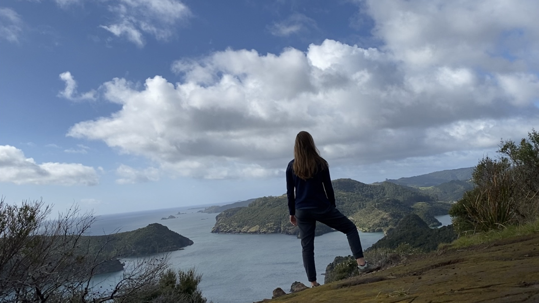
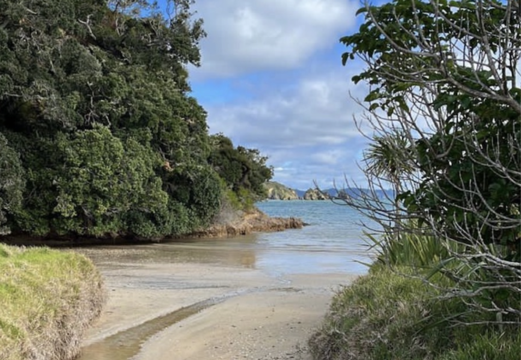
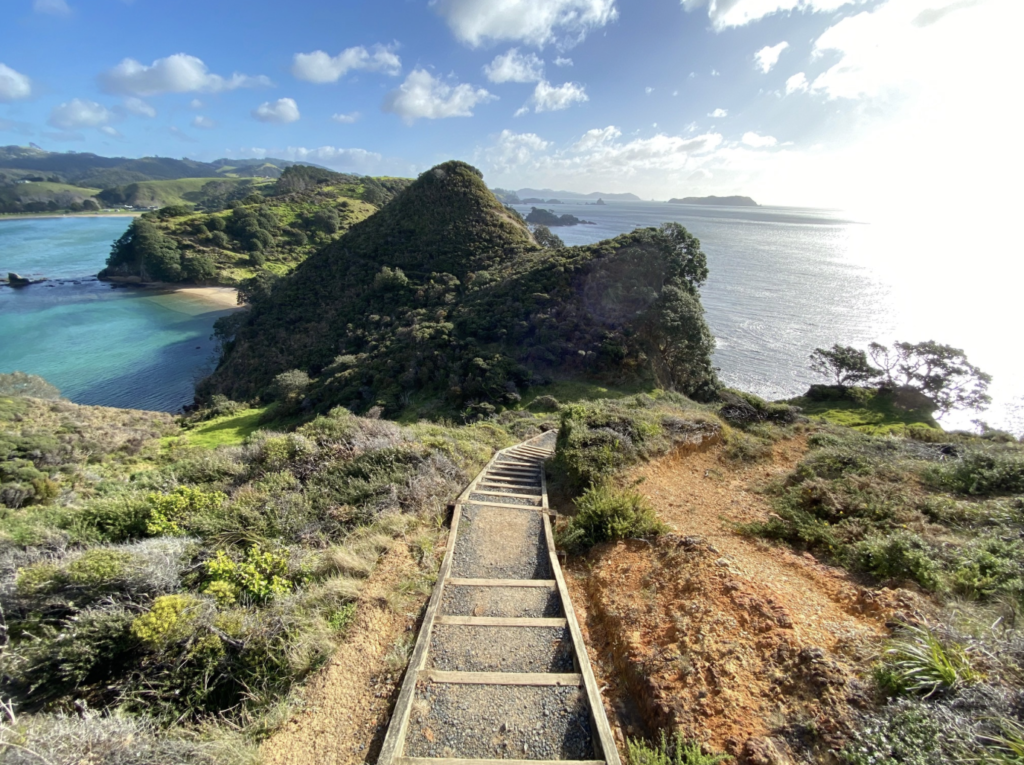
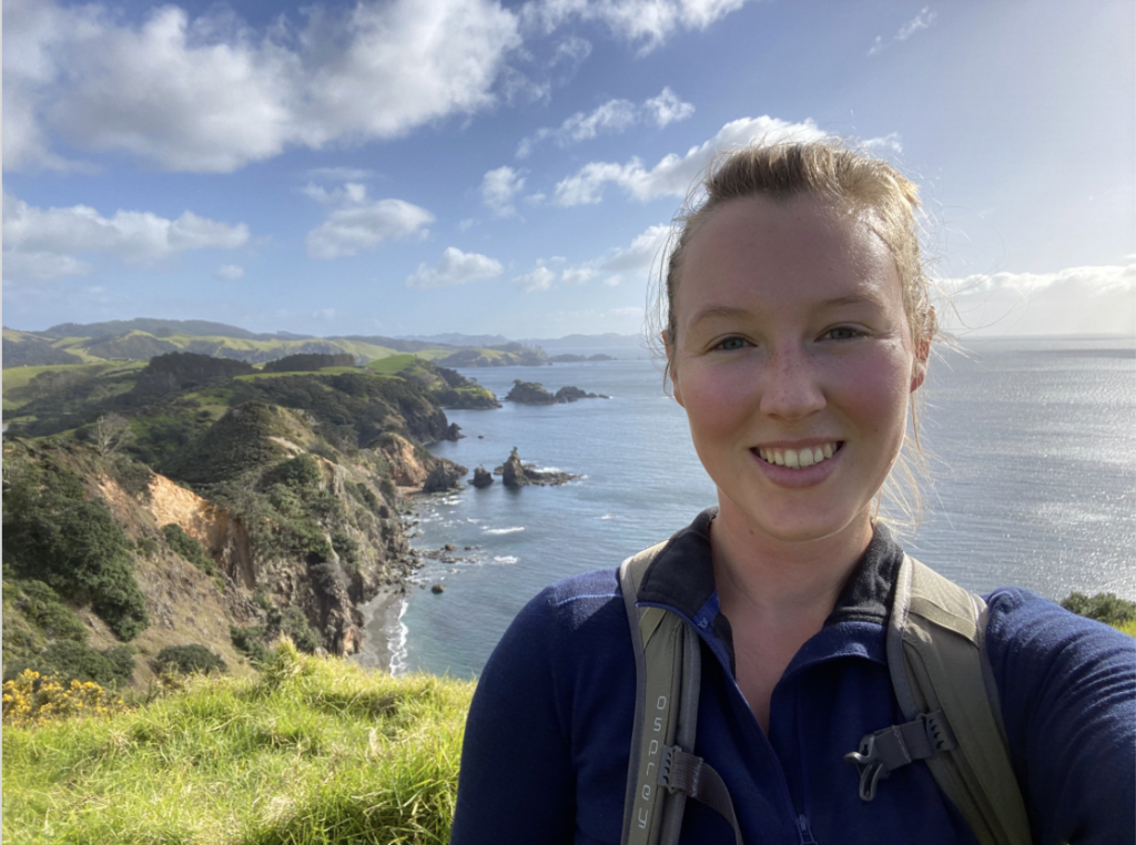
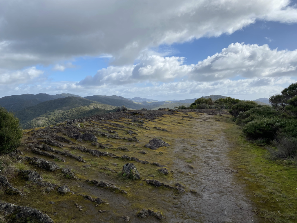
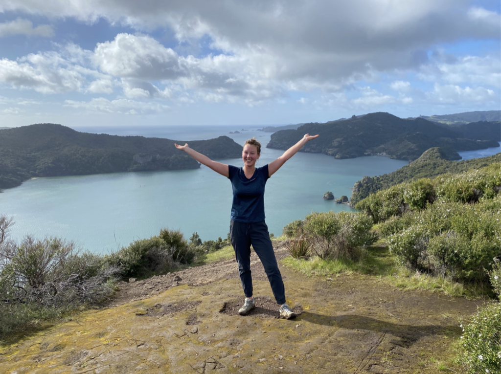
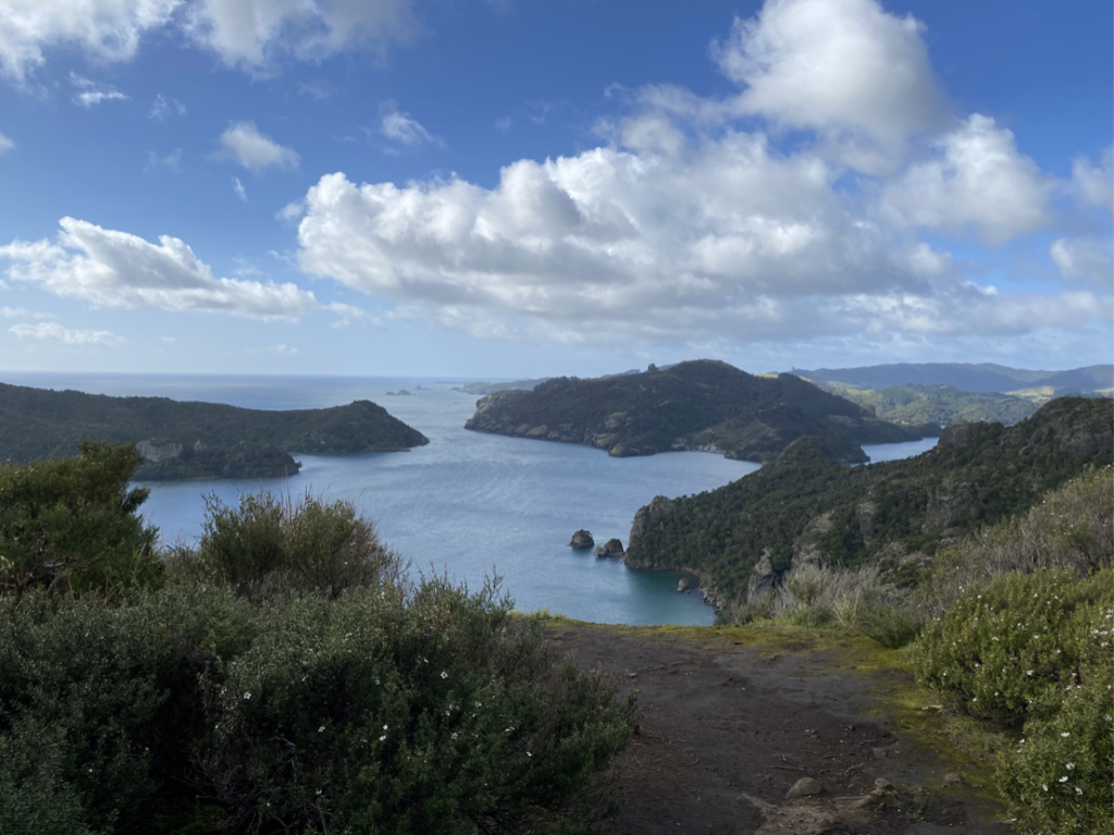
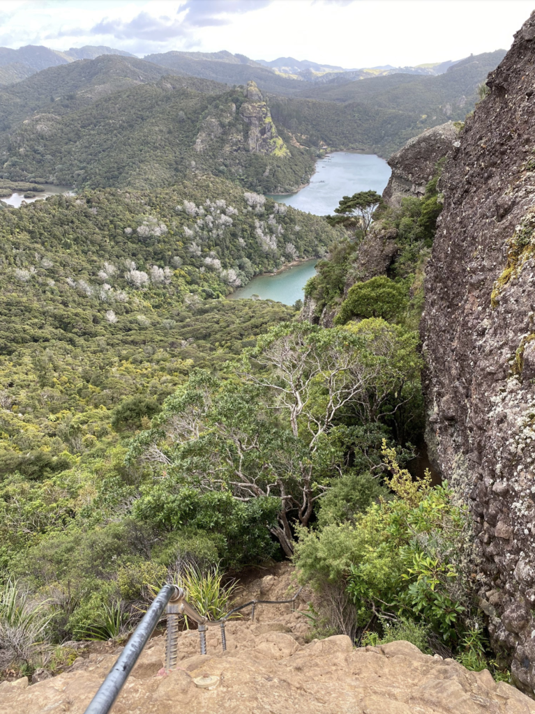
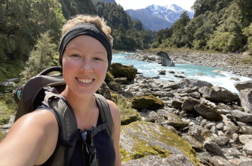
A hike in Mahinepua Bay takes me out on a spit of land surrounded by bright, gleaming ocean, and it’s like I’m perched on the edge of the earth. A hike to the Duke’s Nose in Totara North spits me out on a flat rock balanced above the horizon, staring down at unchanged mountains, spines green and furry with native forest. Fingers of crooked land snake through the blue water and the rivers I ford have no bridge, no marker other than the crumpled grass of previous hikers to lead me on my way.
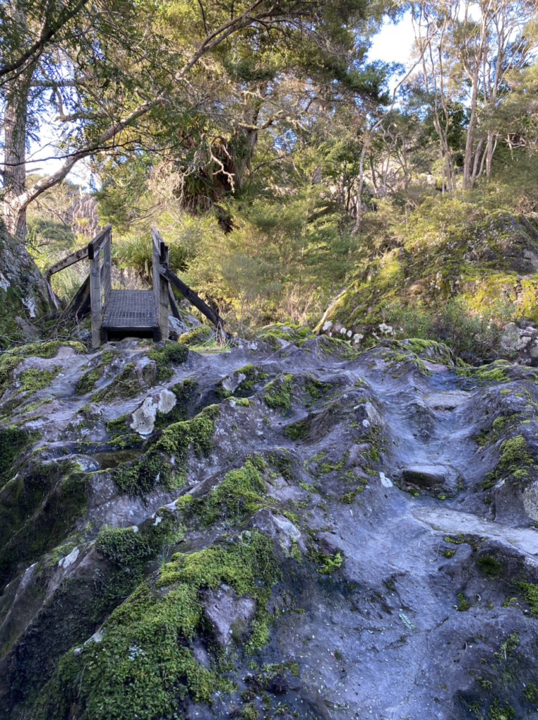
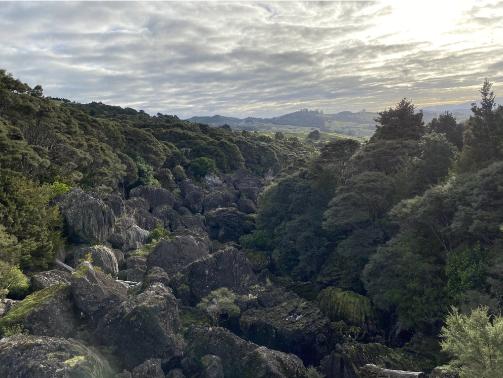
Wairere Boulders
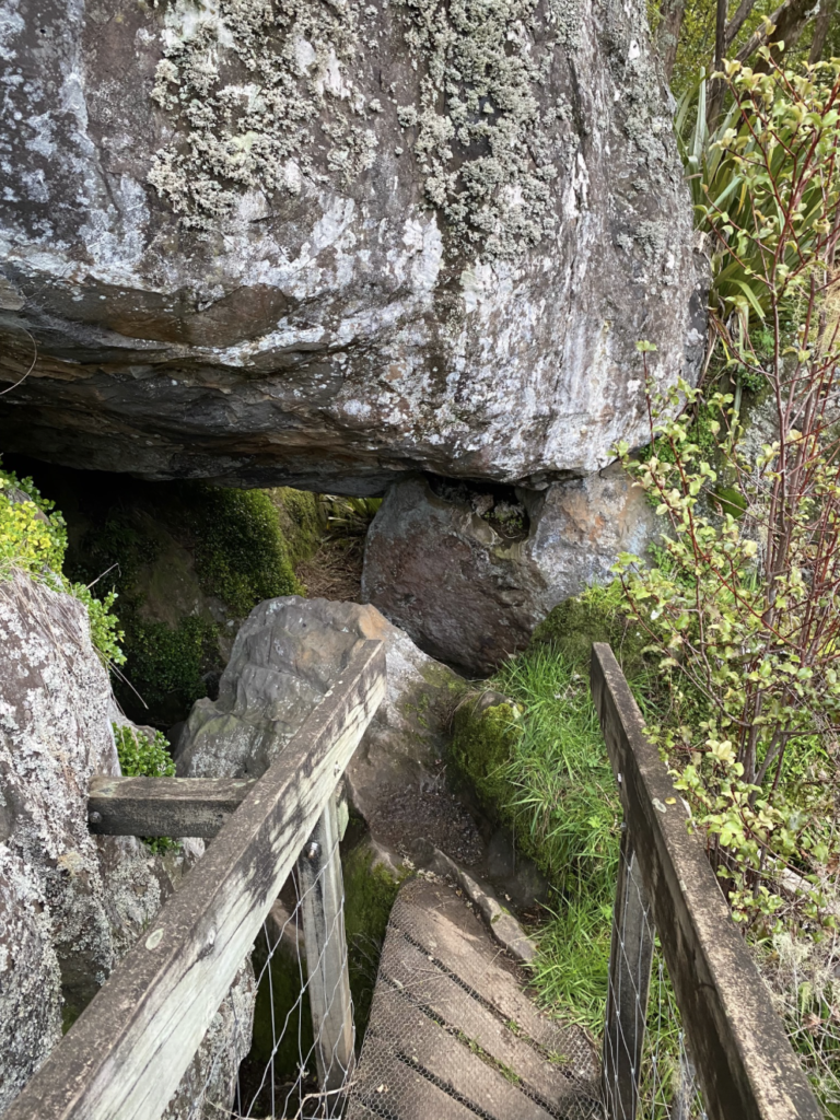
Truer than any other experience in the north, the Wairere Boulders hike picked me up and deposited me in a time before humanity. This area is a Jurassic-era playground with huge boulders stacked and scattered around a gurgling stream. The basalt boulders were formed 2.8 million years ago when a nearby volcano erupted and cooled. As the clay soil beneath eroded away, the basalt cracked into boulders and scattered across the valley, gathering in the lowest place, which is where a stream cut through the ground. Thick kauri forests sprouted up in the area and the acidic leaves, cones, and roots turned rain water and ground water mildly acidic. As it dripped and/or ran over the basalt boulders, it created strange grooves, like the teeth of a giant comb. A sign at the entrance says it takes 1000 years of acidic water drips for the first sign of erosion on the rocks to be visible, so this place has been a very long work in progress.
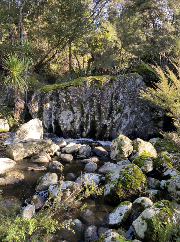
The enormous boulders scattered among the kauri forest as well as the unnatural fluting on the dark, moss-draped boulders and the gurgling water that occasionally sneaks out from under the rocks transported me to a different world. It would not have felt out of place to see a ginormous three-toed T. Rex footprint in the spongy earth. Though, I certainly wouldn’t have felt as free-spirited clambering among the boulders if that had been the case!
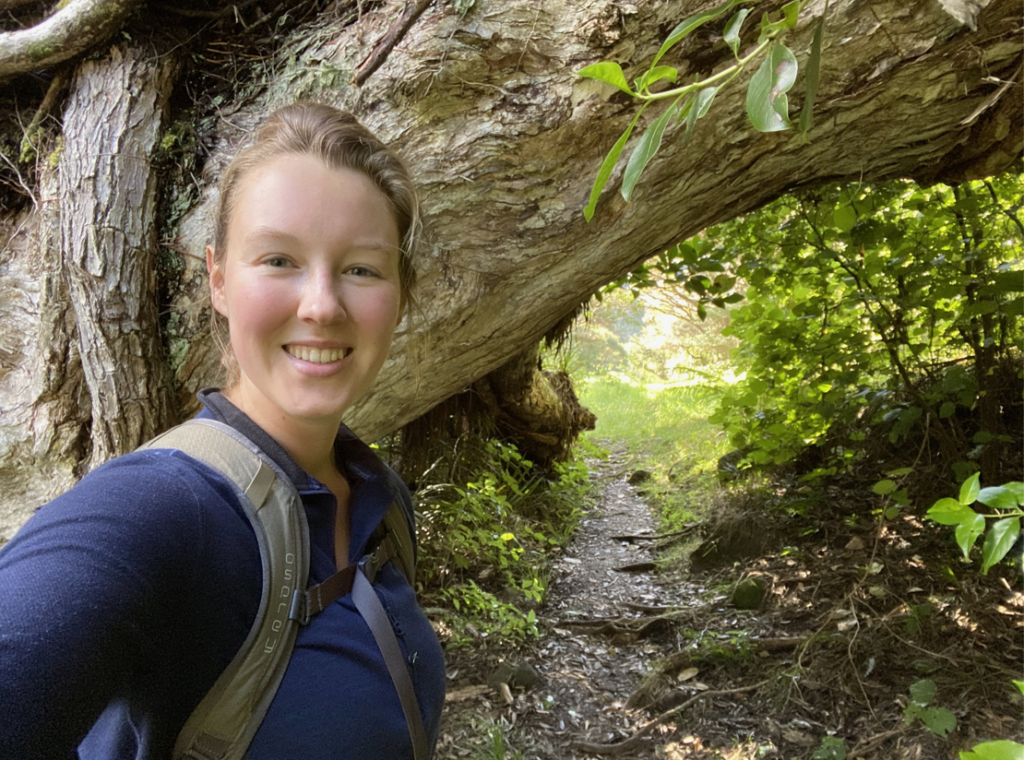
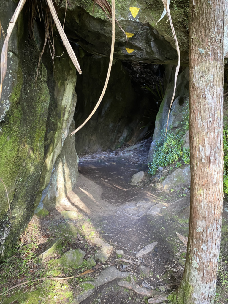
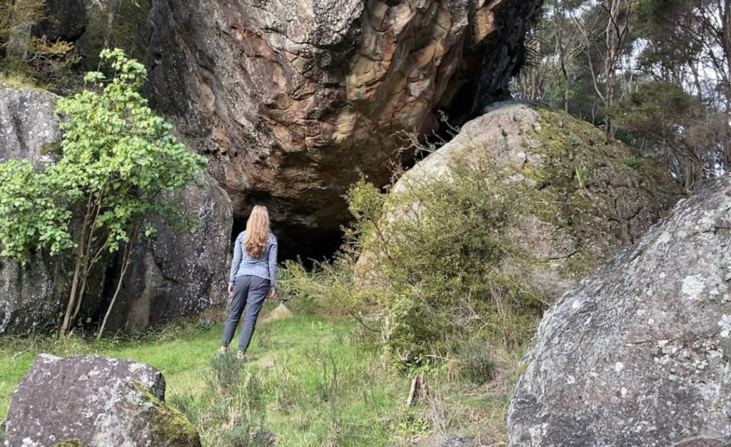
In fact, I think part of the ancient feeling and free-spirited exuberance of my time in Northland is feeling out of place among these brand new surroundings, and yet feeling entirely safe. Hunching over to scramble through rock tunnels and peeking my head into muddy caves holds only intrigue rather than fear of any creatures lurking in the damp darkness. This care-free attitude makes it easier to imagine the land as a slice of ancient times because I need not worry about any modern fears of bears or snakes.
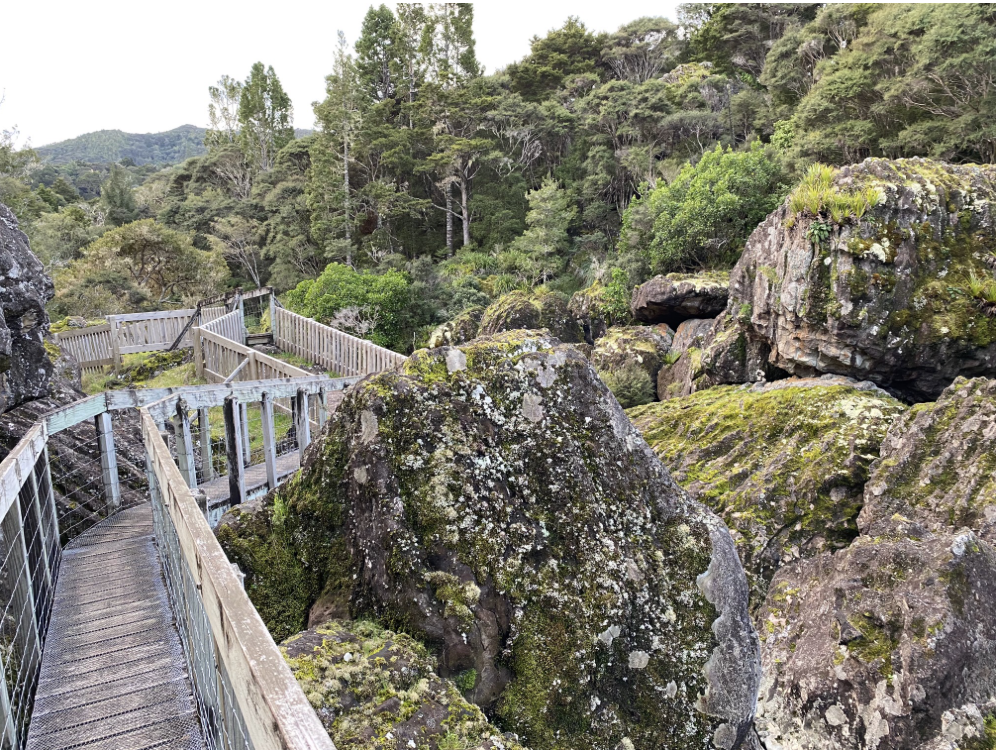
The landowners of the Wairere Boulders track have put great effort into the infrastructure of the track. As many of the boulders are truly giant, it would be easy to fall between and beneath the boulders, sometimes as far as thirty meters into tiny cracks and crevices. So the landowners built extensive bridges and walkways, but they left the wild, vibrant feel of the place alive by bringing the path over boulders and between them, sometimes even beneath them in a twisting, turning playground-vibe all along the stream.
The Novelty of the North
Coming from a background of alpine mountains and flat plains, it was unique to experience tropical vegetation among mountains that sprout from the very edge of the sea. The contrast of farmland to ancient forest is instantly transporting. And so, the green-tinged, fern-adorned, jewel-streamed north of New Zealand has come to dominate my narrative of “New Zealand,” while in reality it is a very small and distinct area of the country. An area that multiple people told me was not that interesting (some of them Kiwis). An area that most international visitors to New Zealand probably ignore (or drive through in a day just to see Cape Reinga).
In fact, if I had only a month or two to explore New Zealand, I am quite sure I would have skipped Northland. And I wouldn’t have known what hidden gems I was missing out on. What strange soul-stirring and thought-churning perspectives I was forgoing. Fortunately, this ability to linger and the opportunity to slow down is exactly why I chose to get a working holiday visa. And I’ve got eleven more months to explore the rest of New Zealand’s 16 geographic regions!


One Comment
Uncle Mike
Well Done Maddie!
Very well weittten. Can’t wait to join you on some of these adventures!