A Weekend at Mount Cook – New Zealand’s Tallest Mountain
It seems to me that humanity in general has an obsession with tall things. Such things come in multiple flavors: man-made, like the Empire State Building, the Eiffel Tower. Or wondrous natural occurrences, such as Mount Everest.
In New Zealand, it’s Mount Cook (Aoraki in te reo Maori).
The obsession seems to extend to getting on top of tall things: eating dinner atop the Eiffel Tower, climbing to the summit of the highest peak.
There is an entire museum in Mount Cook Village about Sir Edmund Hillary, who was the first to summit Mount Cook (and then he went on to summit Everest, so he clearly had a bigger obsession than most). Many have followed in Hillary’s footsteps to summit Mount Cook and/or the surrounding peaks. Thankfully, I don’t have the same burning obsession as Hillary. However, this fascination with tall things persists even in those who don’t wish to climb them. The silhouette of the Eiffel Tower against the Paris skyline, the tip of Mount Cook poking out above the clouds. The height is enchanting, the message intoxicating: that something can reach so high…
Leave such a mark upon the horizon… the world…
In terms of elevation above sea level, Mount Cook would barely even rate in Colorado. It’s height of 12,218 feet would be dwarfed by Colorado’s many fourteeners (peaks above 14,000 feet for all you non-Colorado folk). Here…on an island…with the next highest peak coming in at more than 700 feet shorter… Mount Cook is an icon.
The snow-clad, glacier-bordered monstrosity can be seen from miles away. Even at a distance, there’s something special about it. Something about the point that juts into the sky, the snow that seems thicker and heavier than on the surrounding mountains.
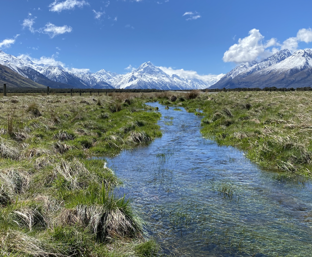
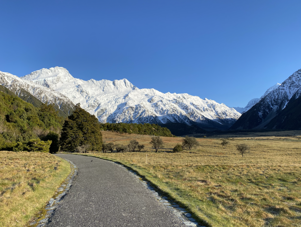
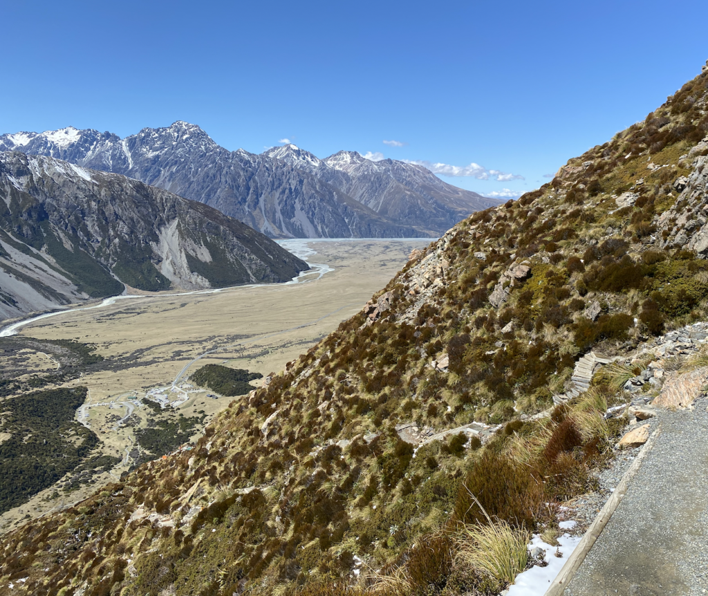
The glacier valley that leads to Mount Cook means that the road takes you straight to Mount Cook, as though an arrow continually pointing to the center-piece of the Southern Alps. Really, there is no other option for the road. It must follow the U-shaped valley forged by the retreating glacier because impassable mountains line the edges.
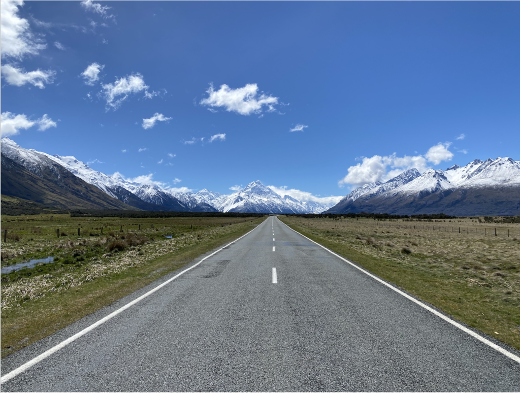
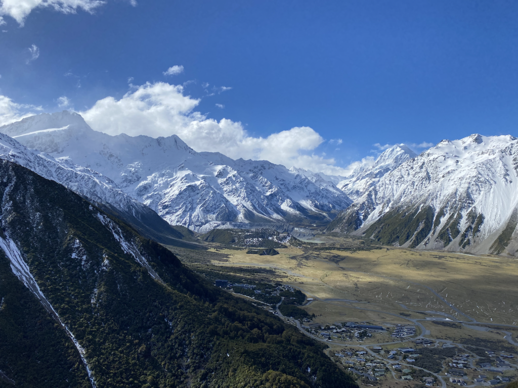
Then, suddenly, the wide valley is no longer and the base of Mount Wakefield rises at a substantial angle from the perfectly flat valley floor. The glacier valley ends and the mountains rise out of nothing. This is breathtaking. This is completely different from the lovely Colorado mountains, and it takes my breath away.
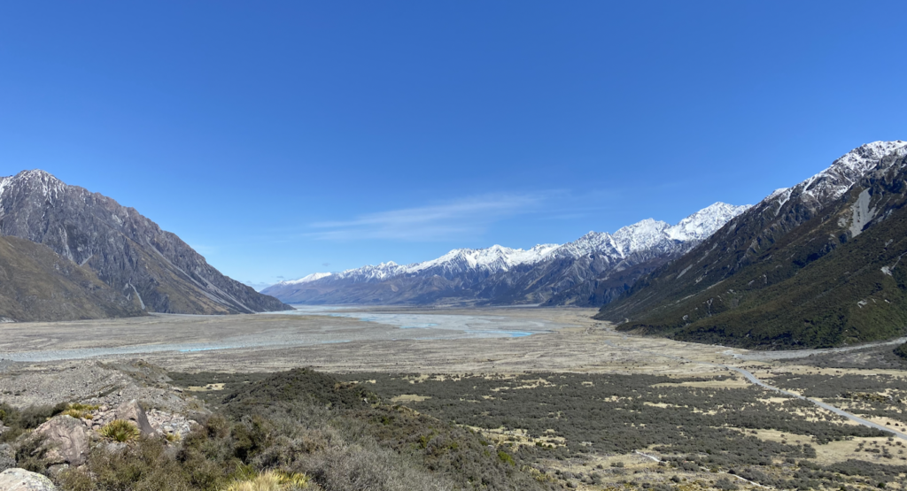
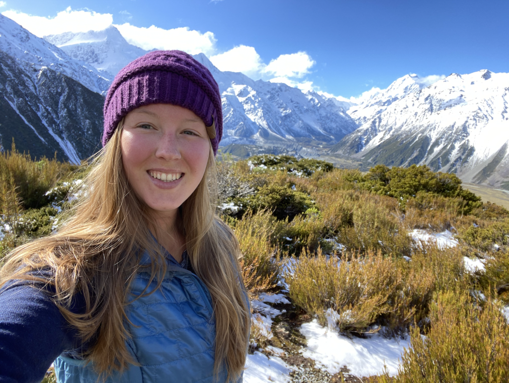
Mount Cook Village is tucked away on the edge of this flat valley just before it narrows and curves, leading to the base of Mount Cook. When I arrive, it’s 34 degrees and snow fell that morning, so the mountains loom larger and the crisp air makes the patches of blue in the sky seem ever brighter. A sense of giddiness has taken over, growing stronger and more effervescent as the road took me closer and closer to Mount Cook and the stunningly beautiful snow-capped mountains that surround it. Even though it’s 4:30pm, I pull on my hiking shoes. I have this urge to take in more of the scenery, more of the presence of this area that towers so high above me on all sides.
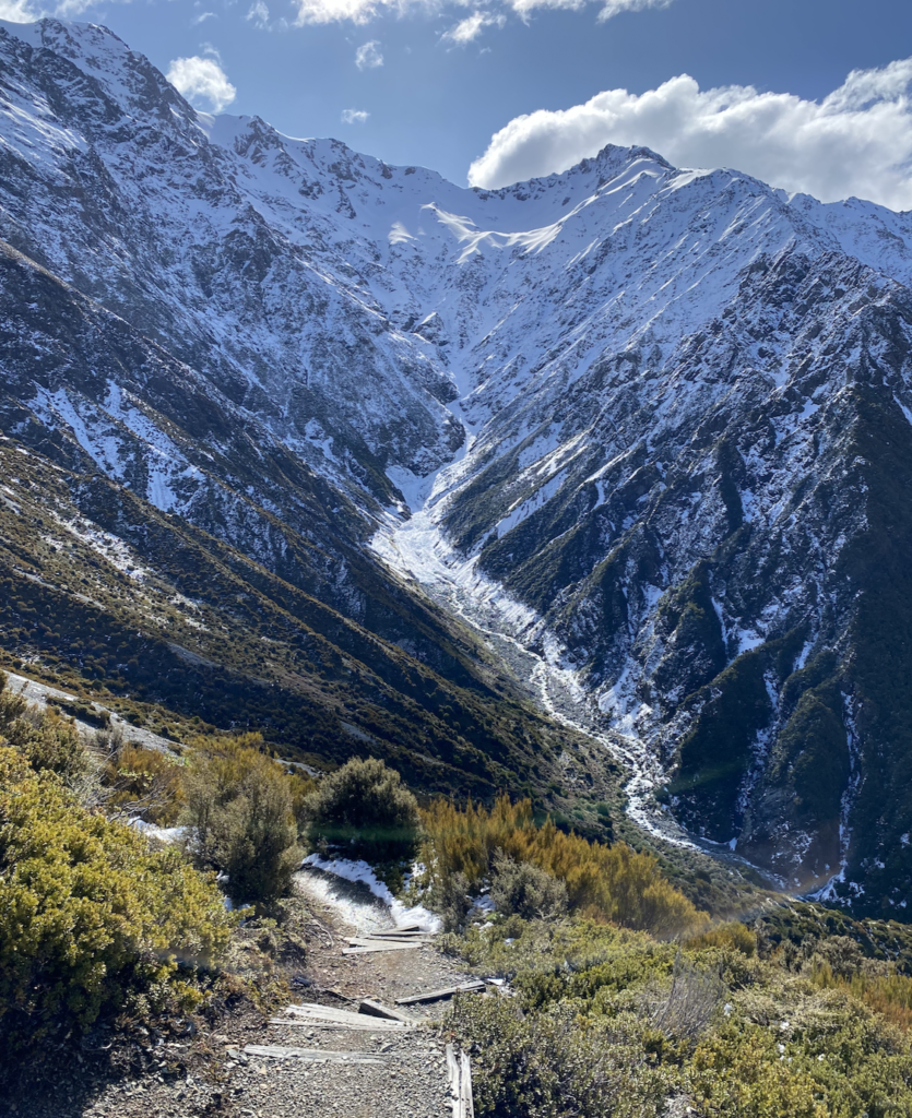
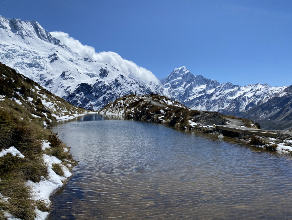
Only a few minutes from my hostel (YHA Mount Cook – which was an amazing hostel!) is the start of the Red Tarns Track. The trail starts by crossing a melt-water river, and then it climbs. And climbs and climbs. (But still a million times easier and shorter than climbing Mount Cook)!
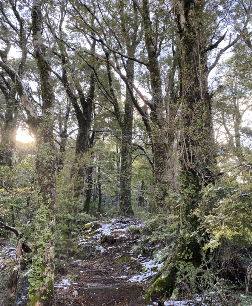
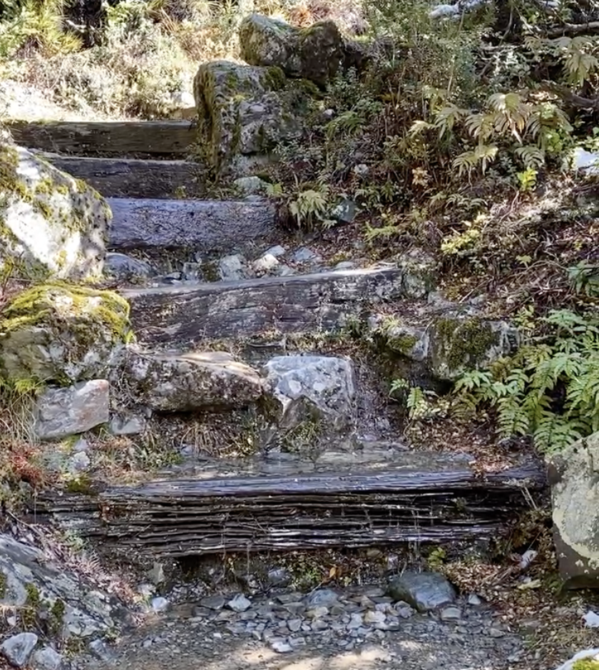
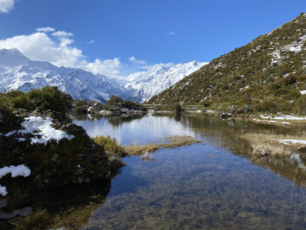
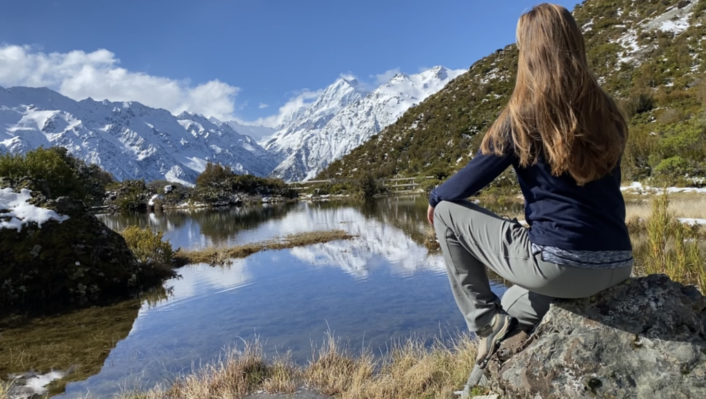
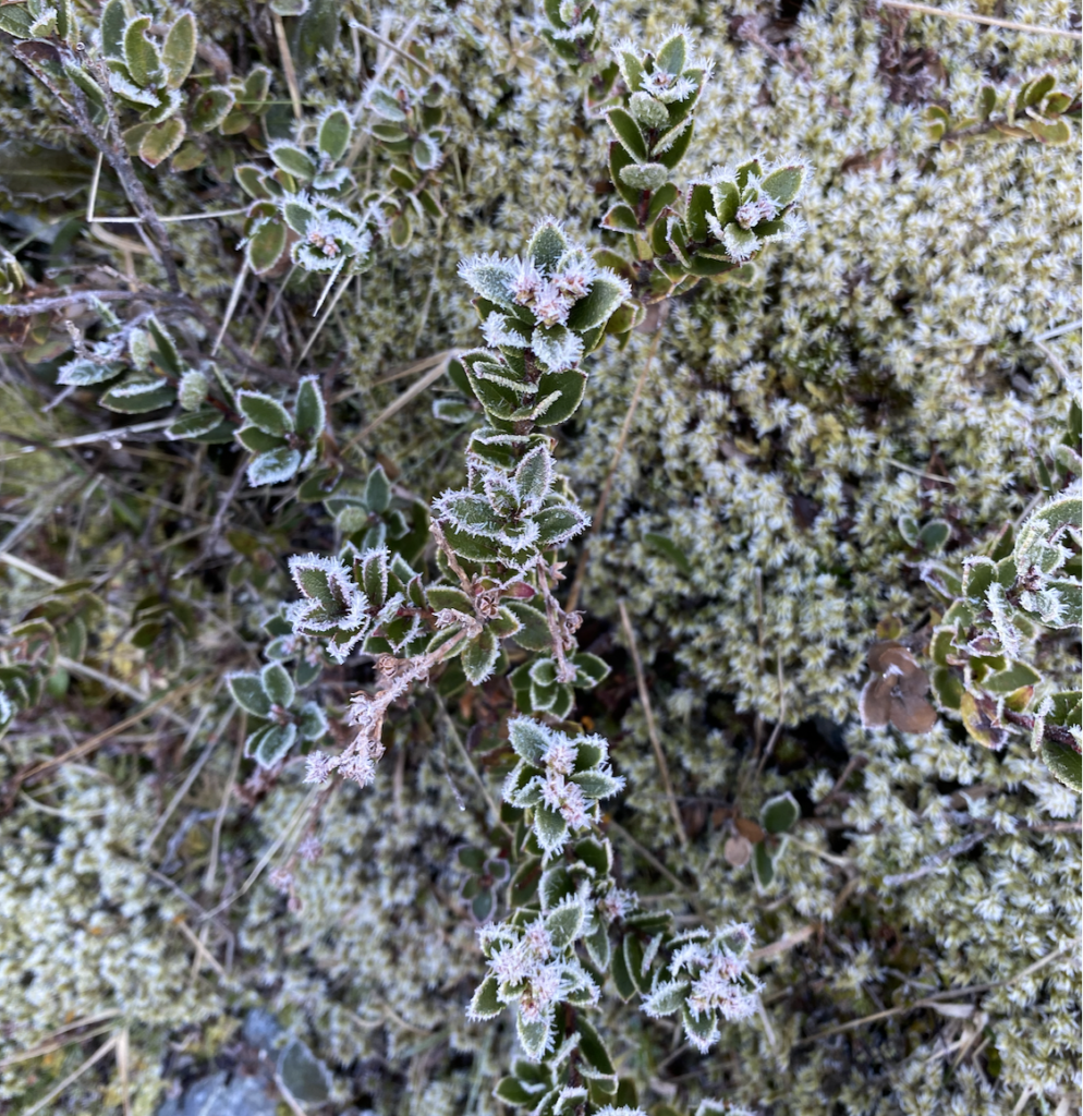
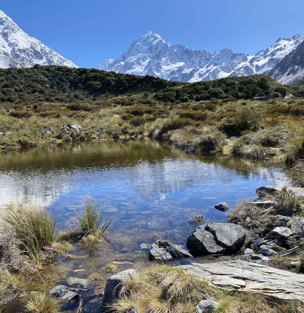
Because it’s spring, and because it snowed just that morning, the path is nearly a creek, water glistening on the steps and dripping down rocks in small streams. After about 45 minutes, I reach the top of a spur and find two tarns with Mount Cook in the distance. With snow dusting the ground like powdered sugar and only a few wisps of clouds drifting around Mount Cook like wayward dandelion tufts, it’s a perfect, brilliant spring-time view.
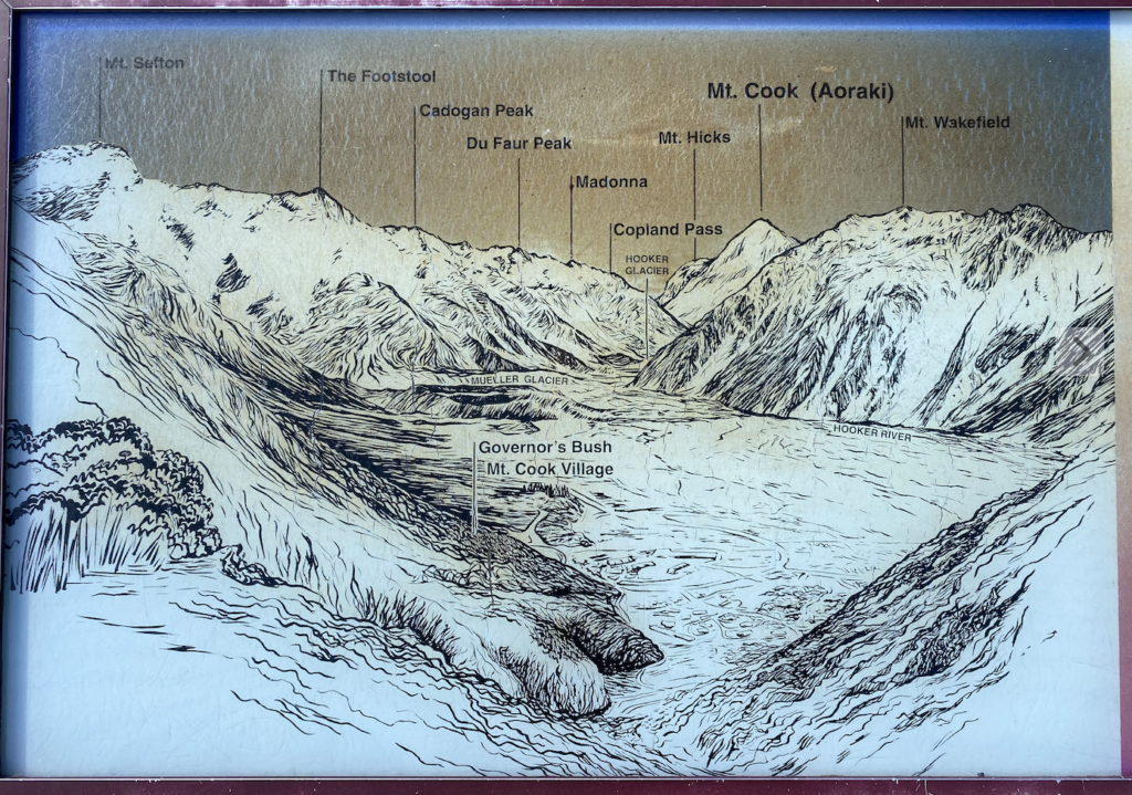
Mount Sefton, the Footstool, and Mount Wakefield frame New Zealand’s highest peak, equally as buried in snow and glacier-fields, equally as rocky and foreboding and impassable. The mountain behind me, Sebastopol (a horrible name), completes the circle of peaks, enclosing Mount Cook Village, the valley, and myself into a ring of mountains. It feels like a place all it’s own, completely disconnected from the rest of New Zealand, as though the single road in and out doesn’t exist when I can’t see it. (Hiking during happy hour and dinner time also means that I have the track to myself, which is a huge contributing factor to the magic of the moment).
The next morning, I head out early to hike the Hooker Valley Track. I’m planning to return to Mount Cook National Park in March with my grandparents and hike this very track, so I consider skipping it this time around. However, with the new snow-fall and the lack of crowds, I figure my experience now and in March will be different enough that it will feel like a brand-new track anyway.
I’m excited and eager as I start on the track, even though it’s not yet above freezing.
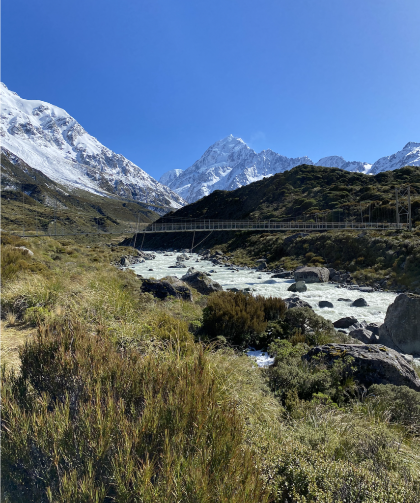
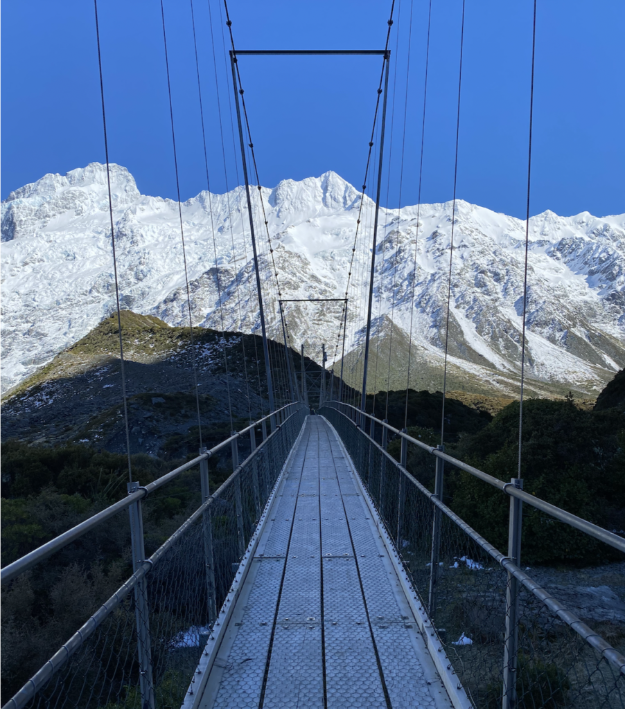
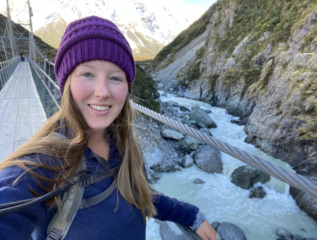
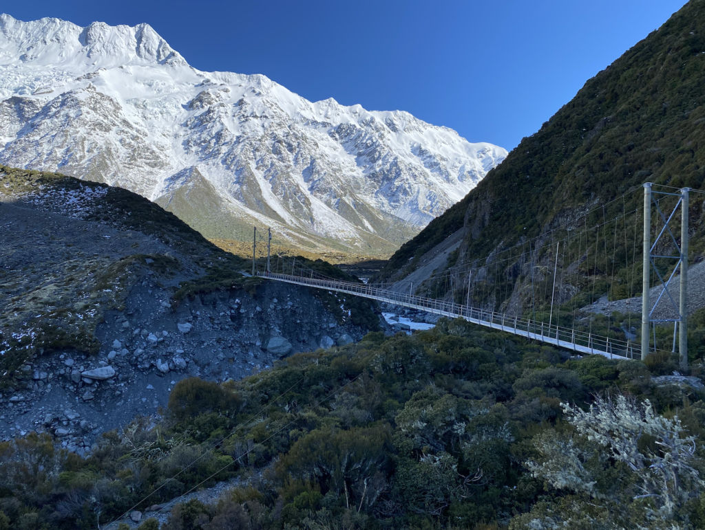
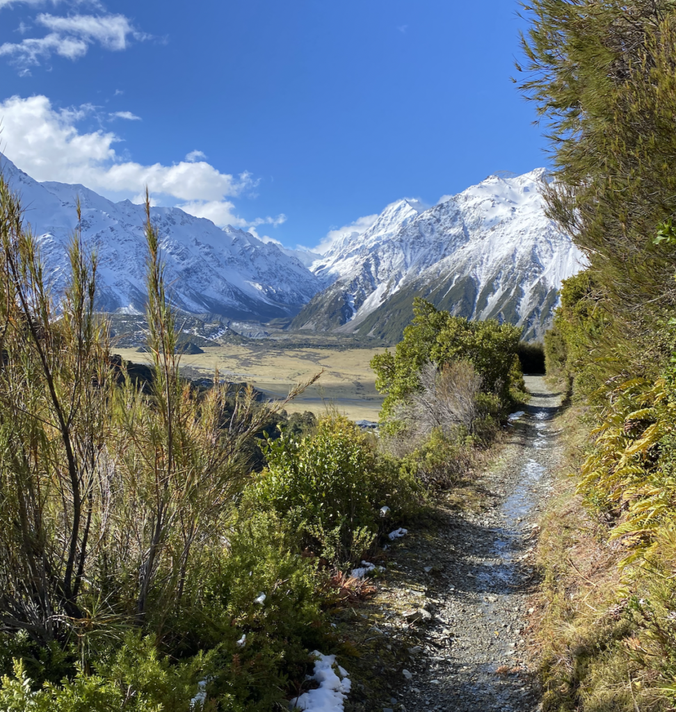
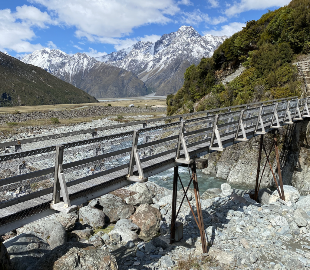
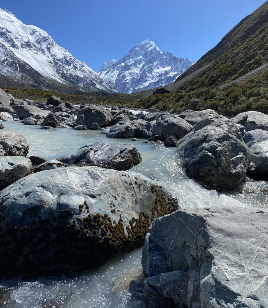
Pretty quickly I begin to understand the hype. The alpine landscape is enchanting, especially frosted and iced-over from the freezing temperatures. The marks of a retreating glacier are everywhere: mounded moraines, giant boulders, and the cloudy grey water of the Hooker River, which I cross three times on massive swing bridges.
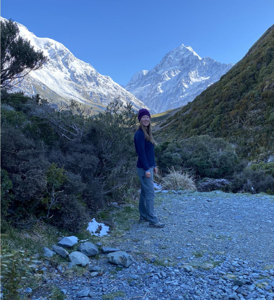
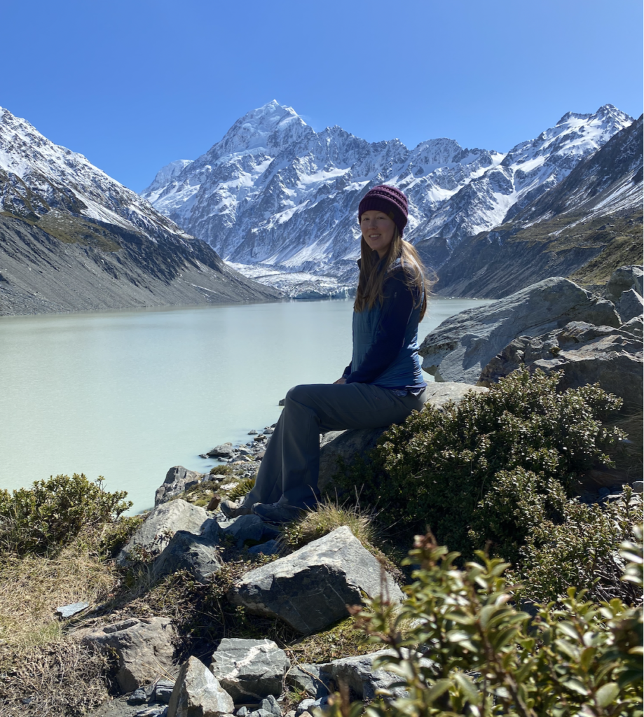
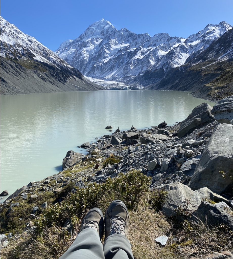
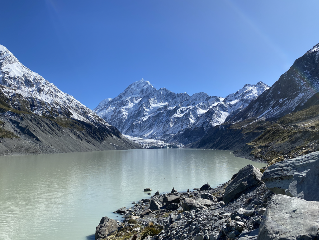
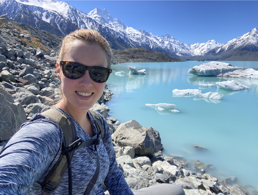
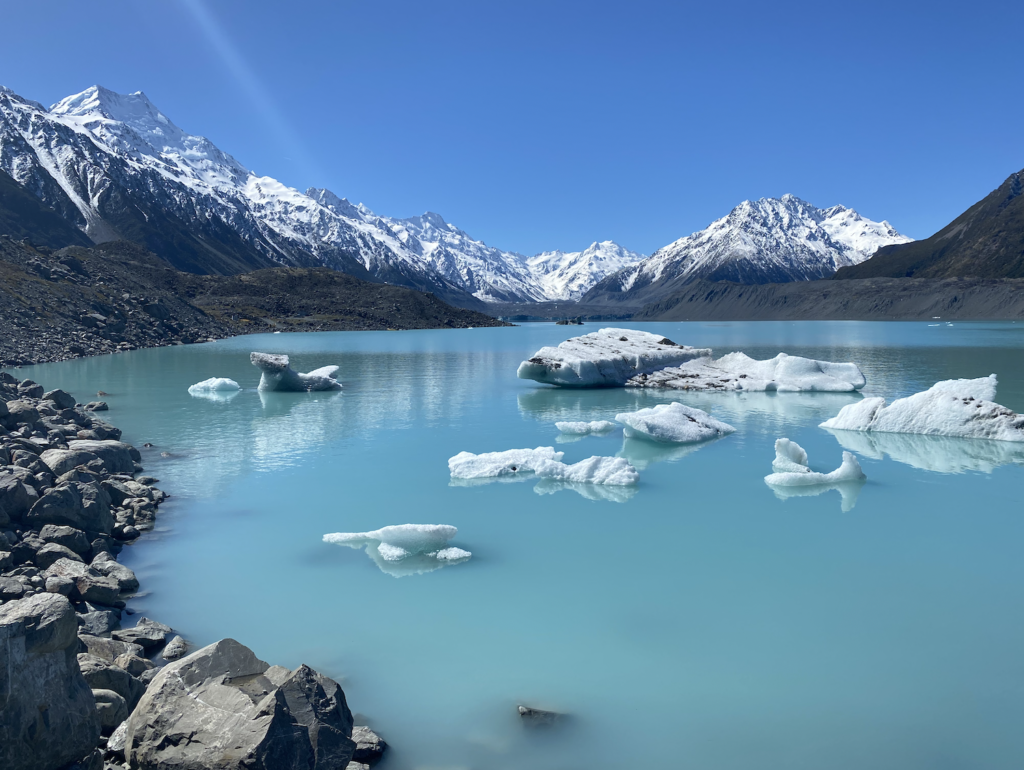
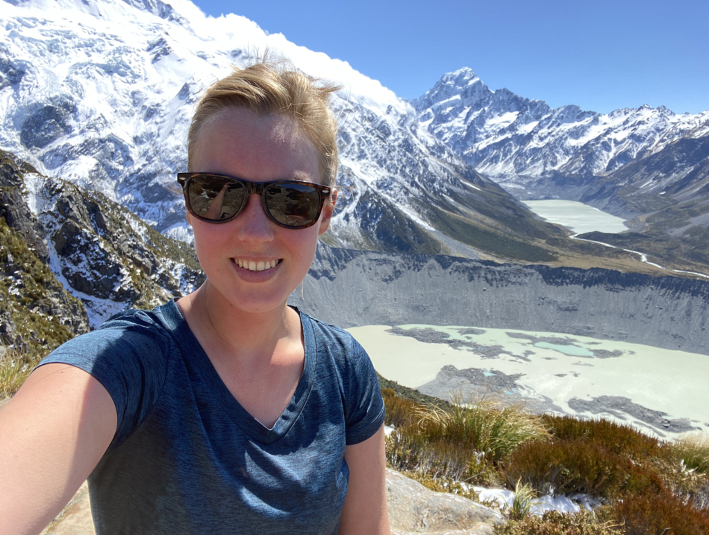
The best view, naturally, is at the very end. The cloudy glacier-fed Hooker Lake is spread out at the foot of Mount Cook. Not a single cloud mars the view, and though I’m hardly alone at the lake (and more and more people arrive every fifteen minutes), something about the view lulls everyone into silence. There’s the usual photo-taking and scrambling down to the lake shore and mid-hike snacking, but it’s respectful. No one can tear their eyes from the mountain longer than it takes to capture a photo. The magnet of the mountain attracts all.

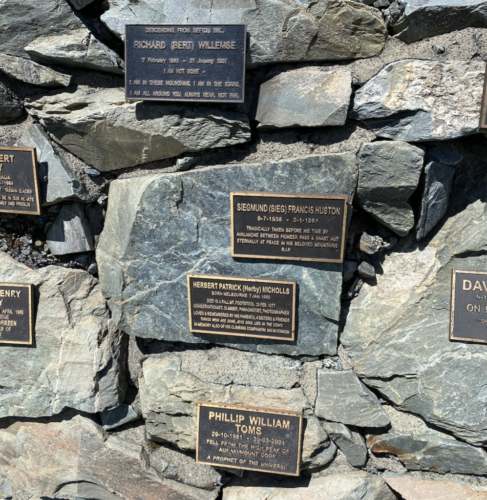
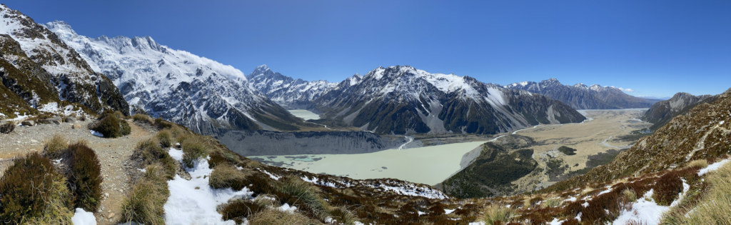
For the afternoon, it’s warmed up a bit: 38 degrees! The sun is all-powerful, like in Colorado, so it actually does feel warm. I venture a bit further afield, driving to the other side of Mount Wakefield to the Tasman Valley. A short hike leads to Tasman Lake with views of Tasman Glacier and another angle to Mount Cook. A whole new range of mountains, tucked behind the bulk of Mount Wakefield, reveal themselves: Mount Haidinger, Novara Peak, The Armchair, Nun’s Veil. These names mean something to me because I stopped earlier at a memorial for lost mountaineers–those who passed away attempting to traverse or summit these peaks and Mount Cook. Most were lost due to avalanches, even in January and February, or due to falling from rock walls or disappearing into crevasses. They came from all over the world. Most were in their 20s.
I feel sorrow for the families and friends of these mountaineers, but I can’t help but feel a touch of serenity standing at the memorial with those very peaks shooting to staggering heights around me. These men and women pitted themselves against nature, strove for nearly unreachable heights…came so close… And then were claimed by the very mountain that they sought so fiercely to understand, to connect with. Perhaps they wanted to conquer the mountain, perhaps they wanted to delight in the mountain. Either way, they are now part of it. I have a deep well of respect for those brave people. Standing beneath the weight of those peaks, I experience a tiny piece of that desire to be atop them, to stand among the clouds on top of the world. But I would never be brave enough or dedicated enough or brash enough to pit myself against the mountain, so I can’t help but admire those whose desire and bravery burns so brightly that they do.
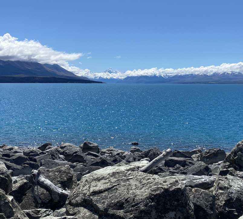
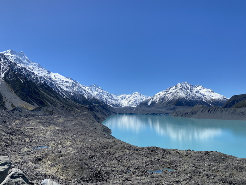
Hooker Lake and Tasman Lake are night and day different. Both are glacial lakes pooling between moraines left behind from the receding glacier. (Moraines are piles of rock debris left behind by a receding glacier. A defining feature is that there is no indication of natural layers–they look like they’ve been randomly dumped, because they have). Both lakes have dirty glaciers visible at the end, which are shrinking, calving icebergs into the lakes. But, for some reason, Hooker Lake has more glacier flour than Tasman Lake.
Glacier flour is tiny sediment created as the glacier grinds up the rocks and mountains around it. It is so fine that it is easily suspended in water. The color of the water depends on how much glacier flour is present. Muddy grey water means more glacier flour, while less glacier flour creates the brilliant Gatorade blue common in so many of the lakes and rivers in the area, such as Lake Tekapo, Lake Pukaki, the Rakaia River, and the Copland River. Hooker Lake is grey, but Tasman Lake is a brilliant pale blue that makes the icebergs floating on it’s surface really pop.
While the lake is really beautiful, an article I read says that the formation of the lake means Tasman Glacier has reached a tipping point. The lake didn’t exist forty years ago, but now, because the glacier ends in a lake that cuts off it’s base from below, no matter what the climate does, the glacier will continue to melt. In a matter of decades, Tasman Lake will be longer than Lake Pukaki.
My last full day in Mount Cook is an early one as I make my way to the Hermitage Hotel to watch the Rugby World Cup Final at 8am. With the TV on one wall, and a floor-to-ceiling view of Mount Cook out the window behind me, I feel pretty spoiled.
After the game, I tackle the hardest hike in Mount Cook National Park. Let me clarify: the hardest hike for normal people. Obviously there are plenty of summits and traverses in the area that are much harder.
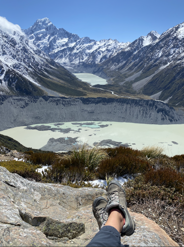
The hike I’m doing is Sealy Tarns. The DOC website says it’s 2,200 steps up the side of a mountain to get stunning views. For even more of a challenge, people can continue on after the tarns for another two hours scrambling over loose rocks and scree to reach the Mueller Hut. But this time of year it requires crampons and an ice axe, of which I have neither. So I’m sticking to the Sealy Tarns route.
And I thought Red Tarns had a lot of steps…
However, I did count the steps on the way up (and again on the way down to be sure) and I found the DOC number to be high. Imagine my shock when I reached the tarns 400 steps early. It was a fabulous surprise!!
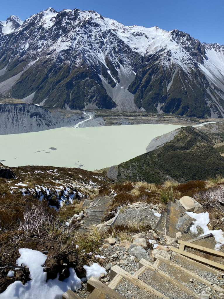
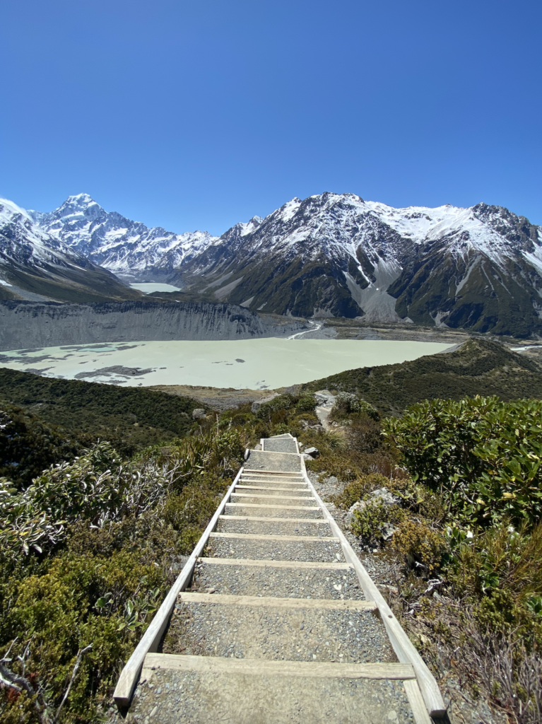
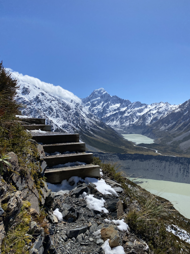
The climb, whether 2,200 or loosely 1,800 steps, is more than worth it. The views up Hooker Valley and over the snow-encrusted Mount Sefton, as well as backward toward the mouth of the valley, are stunning.
My one critique (there being fewer than expected steps was not a critique, it was a blessing) is that there is only one tarn. It can’t be called Sealy Tarns if there is only one tarn.
But that’s pretty minor when faced with this view.


You May Also Like
Embracing Surrealism: Snorkeling the Great Barrier Reef
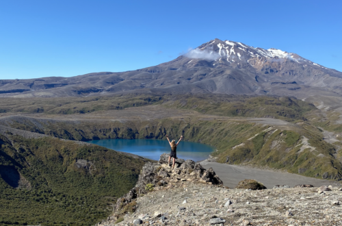
Dueling Volcanoes and Fire Power in Tongariro National Park
