-
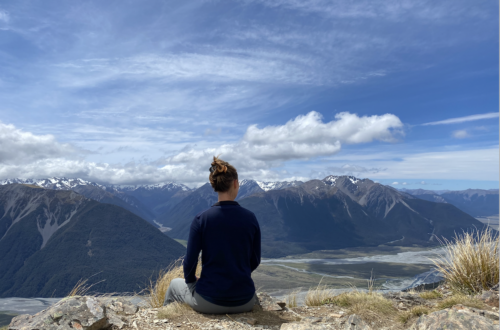
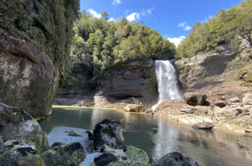
Arthur’s Pass: My Favorite Alpine Region of New Zealand
You know a valley is glacially carved because it is U shaped: a wide, flat bottom and steep sides. The narrow Arthur's Pass Valley is a glacially carved valley, though not as wide and flat as many other glacial valleys in NZ. But the second feature--the steep sides--is very much present.
-
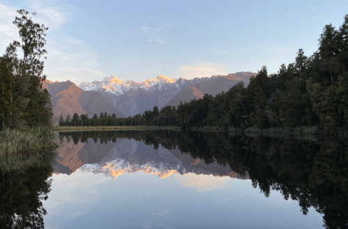
Goodness Glaciers, Great Balls of Ice
In New Zealand, Kiwi's pronounce glacier differently. I say "Glay-sure," with an sh sound in the middle. But Kiwi's say "Glass-ee-er". I like it. It makes what is essentially a several-kilometer-long hunk of ice capable of re-shaping entire landmasses sound very delicate. Fragile.
-
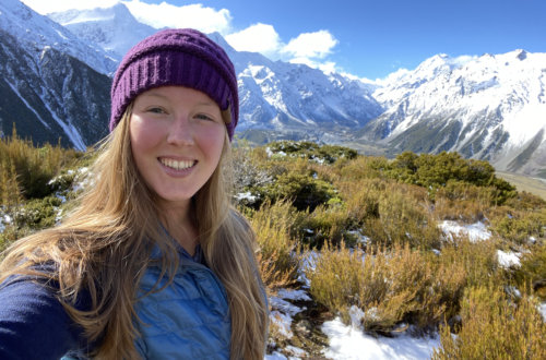
1 Year of New Zealand Selfies: November & December
New Zealand gets busier and I get crazier! You could be forgiven for thinking that "planning" now means "throwing a dart at a board and seeing what sticks." I promise: there is a method to the madness of these next couple months (and I'll let you know what it is once I've figured it out!).
-
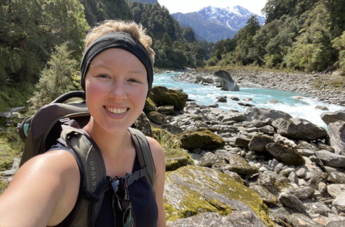
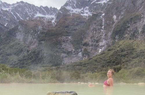
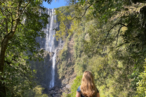
Solo Hiking and Lessons about Life: The Copland Track
The Copland Track starts with bluster. Less than 50 yards from the carpark is the biggest river crossing: Rough Creek. According to river crossing safety, it's not recommended to take off your shoes to cross a river, but the hostel owner in Fox told me I should take off my shoes so I didn't have to hike the next eleven…
-
A Weekend at Mount Cook – New Zealand’s Tallest Mountain
It seems to me that humanity in general has an obsession with tall things. Such things come in multiple flavors: man-made, like the Empire State Building, the Eiffel Tower. Or wondrous natural occurrences, such as Mount Everest. In New Zealand, it’s Mount Cook (Aoraki in te reo Maori). The obsession seems to extend to getting on top of tall things:…
-
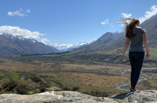
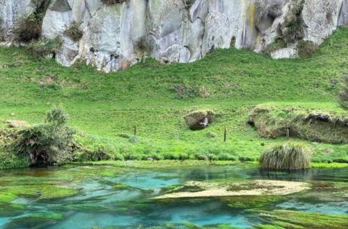
Highlights of the Road South: Methven to Omarama
In traveling from Christchurch to Lindis Pass (gateway to Wanaka, Queenstown, and many of the activities most tourists come to experience), I discovered some lovely places on, and off, the beaten path. Mount Sunday got it's name because boundary riders would meet at the tiny mount on Sundays.
-
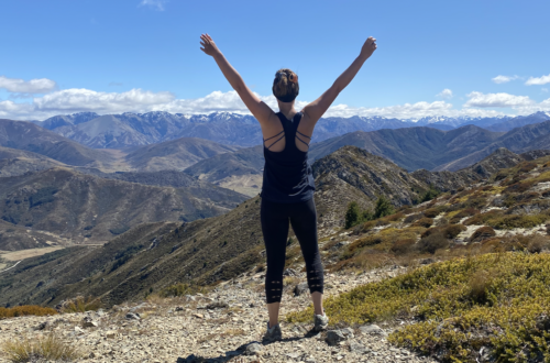
Home on the (Mountain) Range
This post picks up where I left off: traveling from Westport back to the East Coast of the South Island. Though I’d made the same drive only six days previous, I didn’t take the time then to stop and appreciate the beauty (partly because I didn’t even know I’d reached Lewis Pass until I’d passed it!). My return drive, I…
-
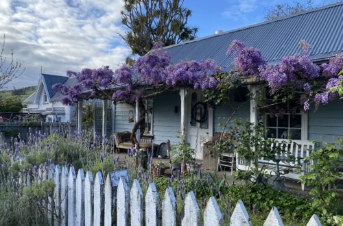
Akaroa in the Spring, New Zealand
A glimpse of Akaroa, New Zealand in the spring time. Akaroa is New Zealand's little French town. However, other than some French street names, it doesn't feel particularly French. It does, however, feel quiet and peaceful. Almost forgotten.
-
I Would Drive 500 Miles…Just to Hike 20 More
I compile my items and hop in the car to drive from Kaikōura to Karamea. From East Coast to West Coast in one day. New Zealand is such a small country. But...also not that small. It's 263 miles, but will take seven hours. Distance-wise it's like driving from Longmont to North Platte, Nebraska. But it will take almost twice as…
-
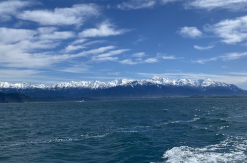
Dizzy and Delighted in Kaikoura
Kaikoura is one of those places that I didn't imagine could exist before I arrived. What I mean by that specifically: I had never before imagined a place where snowy mountains met the sea in such a combination of wild coast and snow-capped crowns. Nor could I have possibly imagined swimming in that ocean the morning after a frosty night…
-
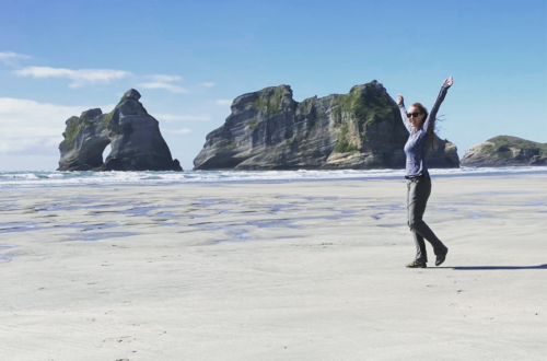
The North of the South: Picton to Golden Bay
Crossing the Cook Strait between the North Island and the South Island felt like embarking on a completely new adventure. Perhaps it was the high expectations. Afterall, nearly every person I've spoken to, kiwi and traveler alike, told me the South Island was the best island, that it would blow my mind, that it was far more beautiful. All of…
-
1 Year of New Zealand Selfies: September & October
The adventure continues! In September and October, I explored the middle of the North Island, and then took the plunge and went to the South Island!
-
Photos from the Kaimai Range
I visited the Kaimai Range several times while I was staying in Whiritoa, so they were disjointed visits. Hour long drives out and back through small towns and straight roads (shocking, but the Waikato region nearby actually has straight roads!). However, since I visited about three times in the span of three weeks, there is no backbone to the whole…
-
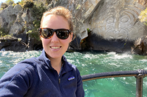
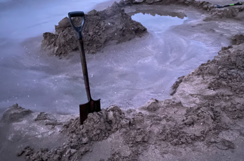
A Kaleidoscope of Rotorua and Taupo – Central North Island of New Zealand
Rotorua is a geothermal town. Think of Yellowstone National Park, but with a town built on top. Steam comes out of grates in the ground or wafts over roads and walking paths in the park--and not the kind of park where ducks swim in the water and toddlers splash around in the summer.
-
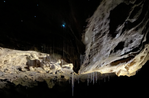
Waitomo, NZ: Finding Little Lights in the Dark
Last Monday, I drove away from Whiritoa, and I felt set adrift. Uncertain. Lost, even. Suddenly I'm wondering why I have chosen to be half a world away from all the people who know and love me. Experiencing the glow worm region of New Zealand reminded me that I am an explorer. It doesn't make it easier being away from…
-
Circling the Coromandel Peninsula in Winter
The Coromandel Peninsula is deceptively small on a map of New Zealand's North Island. It juts from the land mass on the east side, across from Auckland. On summer Fridays, the roads are jam-packed with cars streaming out of Auckland and headed to the Coromandel's beaches. With only a few roads running through the peninsula (one of them closed due…
-
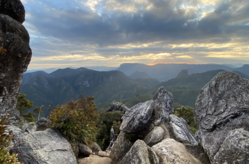
My Pinnacles Experience: Hiking to Great Heights
First, I bought a sleeping bag. And that meant I had to do it. Hike the Pinnacles. Stay overnight in the DOC (Department of Conservation) hut. And (hopefully) love it--because one measly overnight stay wasn't going to justify the sleeping bag purchase. The Pinnacles Hut is the most popular hut in New Zealand.
-
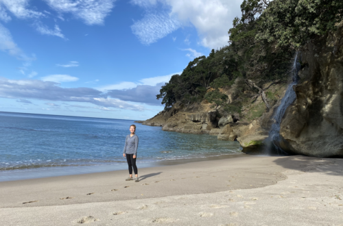
A Hidden Paradise in Whiritoa, New Zealand
On Google Maps, Whiritoa looks like a beach town at the very bottom of the Coromandel Peninsula on the east coast. As I drove in through 16 kilometers of windy S-curves and 180-degree switchbacks, and then entered the town, I realized that I had been wrong. This was no town. Rather, it was a collection of a few hundred houses…
Find adventure. Write it down.