
I Would Drive 500 Miles…Just to Hike 20 More
From Planner to Pantser
My New Zealand adventure started out well-planned. Sure, I left some time slots open for figuring things out and spontaneous choices, but before I even got on the plane, I knew what my first three weeks were going to look like. I knew I had three more weeks left open to buy a car and travel Northland. And I knew that afterward I was going to Auckland for a soccer game, Piha for waterfalls, and then Whiritoa for a month. I knew what was on the horizon.
Even once I left Whiritoa, I planned out my next four weeks before I got in the car: central North Island, cross the Cook Strait, and then explore Picton, Nelson, and Golden Bay.
And that’s where the planning dissolved. Completely gone. I was sitting in my hostel bed in Takaka in Golden Bay looking at the weather and it was horrible everywhere except for a brief, shining day in Kaikōura.
I guess I’m going to Kaikōura, I thought. So I booked the hostel and the next day I went. (And it was spectacular and amazing and incredible and if you missed it, you can read all about it here.)
So it’s a hailing, horrible day in Kaikōura, and I’m thinking I should figure out what happens after Kaikōura. I’m checking the weather in a host of places when suddenly I remember the Heaphy Track.
The Heaphy Track is one of New Zealand’s ten Great Walks. In other words, multi-day tramping/hiking tracks spotted with huts. Because these tracks have Great Walk status, they are in high demand and also expensive. For example, one night in a hut on the Milford Track would be the equivalent of a three-night stay in a nice hostel. But I couldn’t even book the Milford Track if I wanted to because it books up for the entire season within hours of opening.
But the Heaphy Track has been closed for a while because there is a vital bridge out along the route. You can still hike parts of it, but unless you’re willing to risk fording a wide west coast river, you’ll have to hike back out the way you came. Which is perfect for me because I just want to hike to Heaphy Hut (16kms), stay one night, and hike back out the same way, father than doing the full five-day walk.
Finally, the track officially reopens and regains it’s Great Walk status on October 19. That means that before October 19, there are plenty of spaces available in the hut (and it’s cheaper). After October 19, I’d have to monitor the website daily to see if anyone canceled their Heaphy Hut booking and try to slip in. A bit difficult to do when the track is literally at the end of the road. It’s not easy to get to on a whim.
Alas, the stars align and the notoriously wet and rainy west coast is scheduled to have four straight days of sun: Tuesday to Friday.
I guess this is happening. (Here I am, going to Heaphy Hut on a whim. I guess I set myself up for this one.)
The Drive
So, after a long, adventurous weekend in Kaikōura, I compile my items and hop in the car to drive from Kaikōura to Karamea. From East Coast to West Coast in one day. New Zealand is such a small country. But…also not that small. It’s 263 miles, but will take seven hours. Distance-wise it’s like driving from Longmont to North Platte, Nebraska. But it will take almost twice as long because so many of New Zealand’s roads are narrow and twisty.
Additionally, I’ll be driving over Lewis Pass and it’s early spring. I obsessively check the weather the night before for each and every town along my route. I don’t have chains, I don’t have 4wd. I’m not hugely prepared for a early-spring drive along an alpine pass. But sunny skies and low winds are predicated. Perfect.
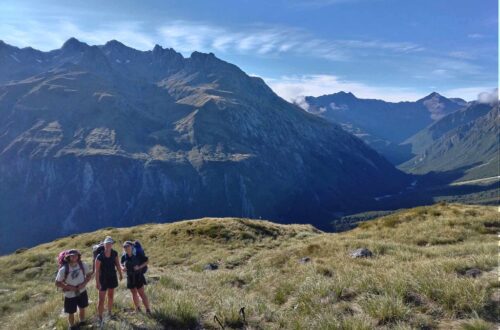
The best part about driving in New Zealand is that 99% of the time the scenery is breathtaking. Only minutes from Kaikōura, I’m already threading through narrow valleys full of pasture fields and mountains rise around me, occasionally revealing a glimpse of snow-capped cones in the distance.
As I near Lewis Pass, my shoulders tense up. I’m waiting for the dramatic climb, the steep drop-offs beside the road, the snow-edged asphalt.
…Then suddenly the road is going down.
Down?
I frown to myself. Was that the pass? The high-alpine pass? That I worried about driving over?
I guess it was. There wasn’t even a sign saying I’d reached the top, much less a dramatic climb or snowy roads. The mountains closest to the route didn’t even have any snow on the tops.
But I am not complaining at how easy that was.
I pull over, scarf down some lunch (while doing a series of stretches and yoga moves to ease my stiff muscles), and continue on.
Karamea
I almost named this post I Would Drive 500 Miles to Visit a Town Named for Stinky Europeans, but my diagnostic tools told me that wasn’t a “clickable title.” What do you think?
According to a local guide, karamea is a Maori word. On the North Island, karamea means caramel- or ochre-colored. On the South Island, karamea means the stink of the Spaniards.
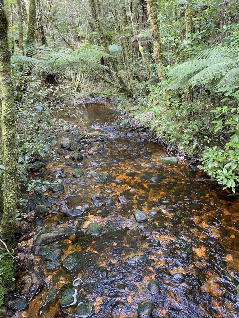
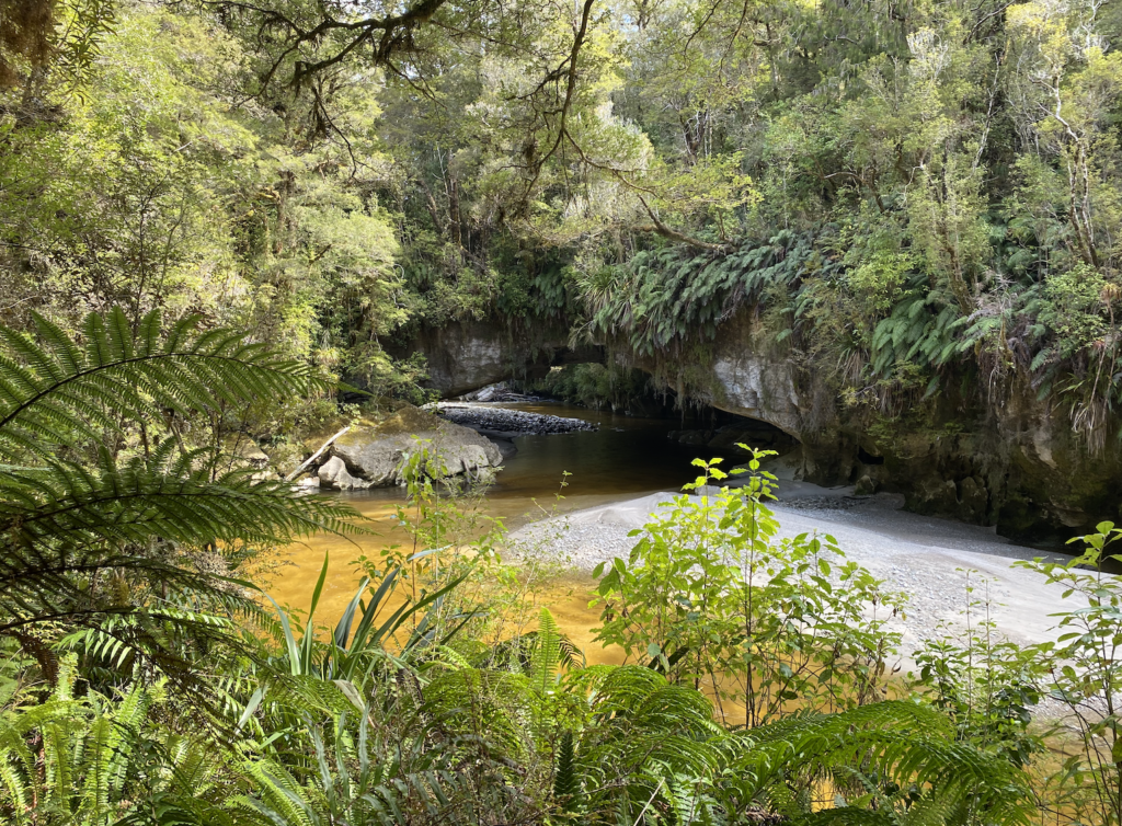
Now, one would think that the town of Karamea was named for the North Island meaning, since it’s rivers are a beautiful whiskey color due to the tannins from decomposing forest flora getting washed into the rivers. But, when I asked, the guide told me quite sincerely, that for decades people have been arguing both meanings, and it’s inconclusive. Finally, to complicate matters, when I Google it, I find an article that tells me karamea is actually a contraction of a Maori phrase meaning sweet-scented gum, because they use to chew a gum made from local speargrass. So, who knows.
Karamea is a tiny town at the end of the road coming from Westport. Actually, the road ends a few kilometers past town, exactly where the Heaphy Track begins.
On Wednesday morning, I’m at the trailhead by 10am, my pack packed, my shoes tied, my sunscreen and bug repellant applied.
Let’s go.
Hiking the Heaphy Track
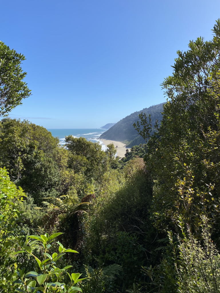
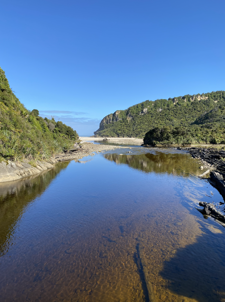
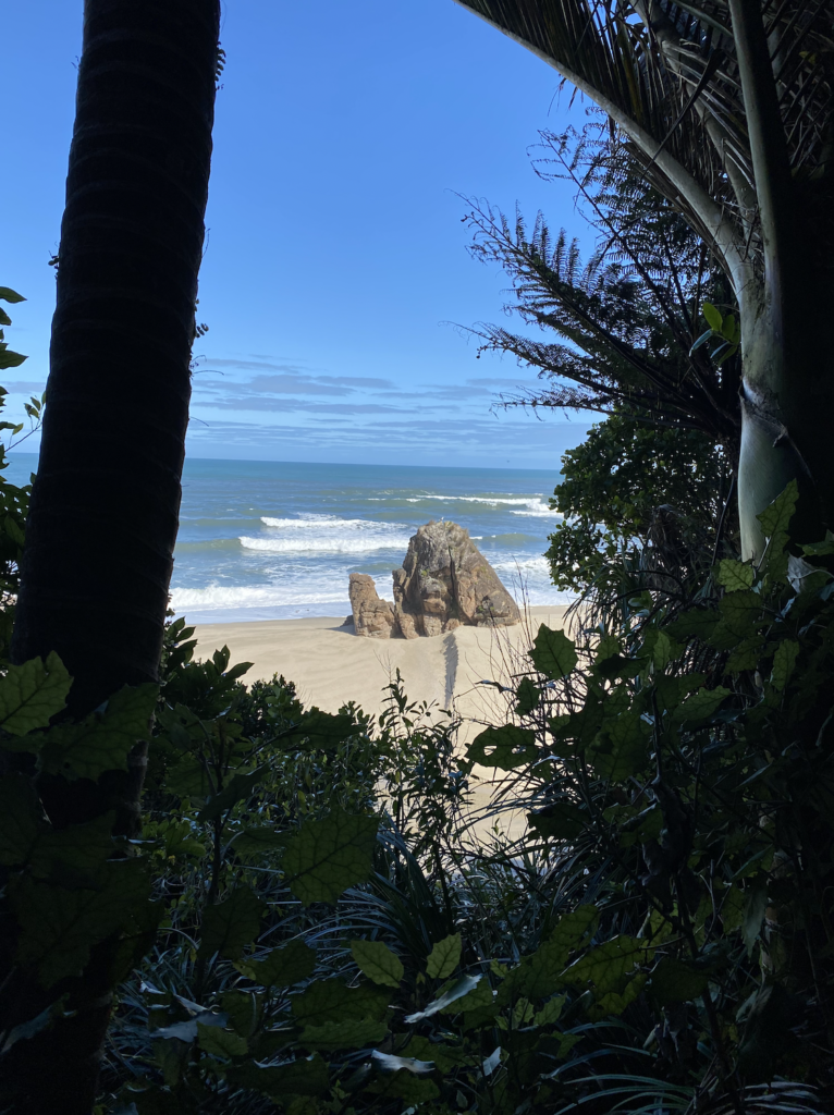
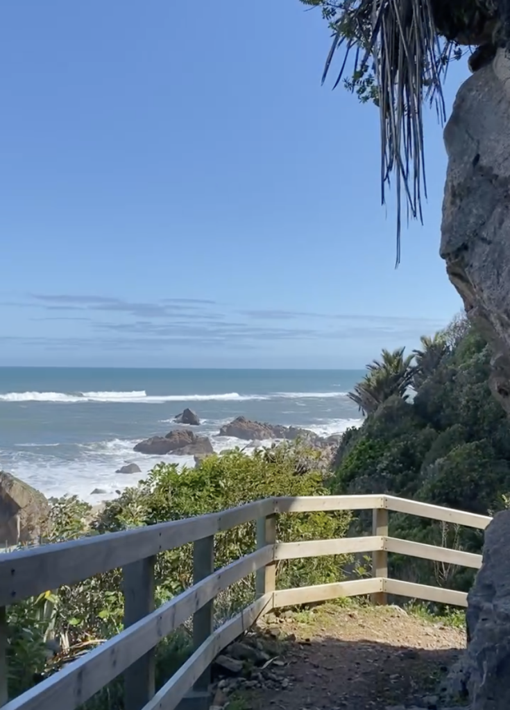
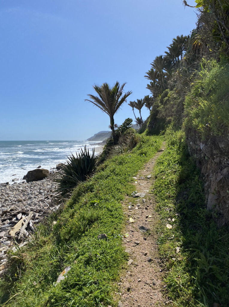
This section of the Heaphy Track, I’m told, is unlike the rest. And it’s easy to see why. From the car park at the Kohaihai River all the way to Heaphy Hut (where I’ll be stopping), the track follows the beach. Sometimes it weaves in and out. Sometimes it’s tucked just within the tree line. Sometimes it climbs to get over a rise, but the whole time I can hear the crash of violent west coast waves against sand and rock.
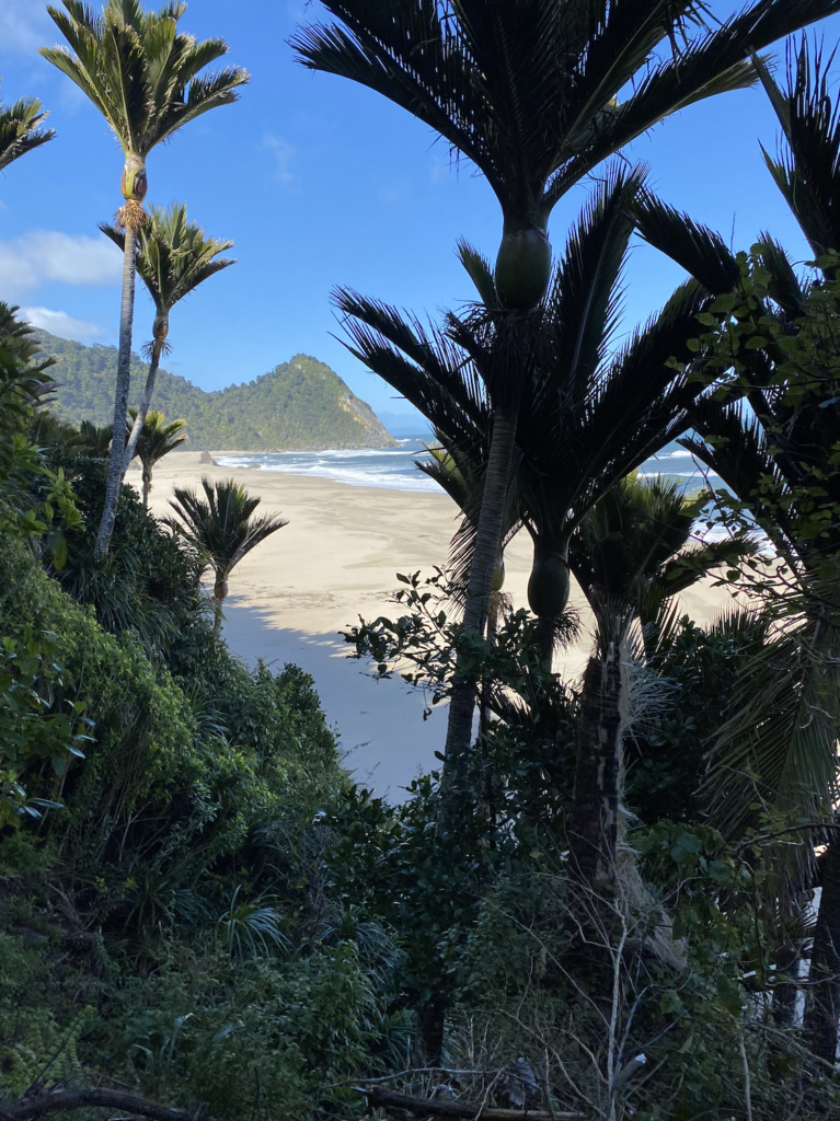
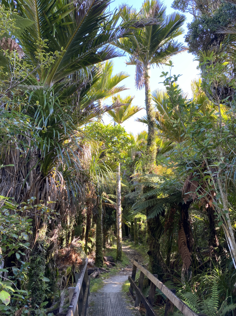
First, I walk through a forest of palm trees straight out of a tropical island. In New Zealand, the palm species is called Nikau. When the Maori arrived (from tropical Polynesian Islands), they recognized the tree as part of the palm family and looked for coconuts. But, New Zealand isn’t tropical enough for coconuts, so they called the trees nikau which means no nuts.
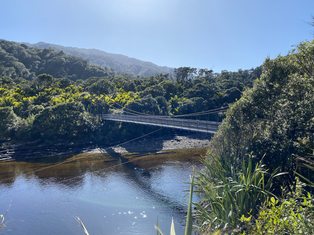
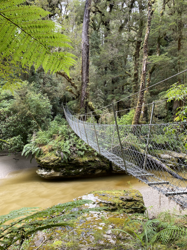
The rest of the track weaves down to the beaches, crosses swing bridges over wide west coast rivers, follows cliff edges where rock fall danger instructs hikers not to stop on the path. Other areas have signs with a big wave looming over a stick figure with a pack. In the right sea and weather conditions, waves can wash over the track. I’m very thankful for the bright sun and only slightly breezy weather.
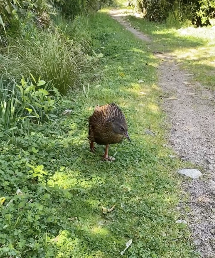
Wekas pop out of the bush with no fear, turning little eyes toward me. I’m guessing people feed them. I’ve been warned that they can be aggressive, even jumping up to land on your arm to make you drop your food, so I keep a healthy distance while I eat my lunch.
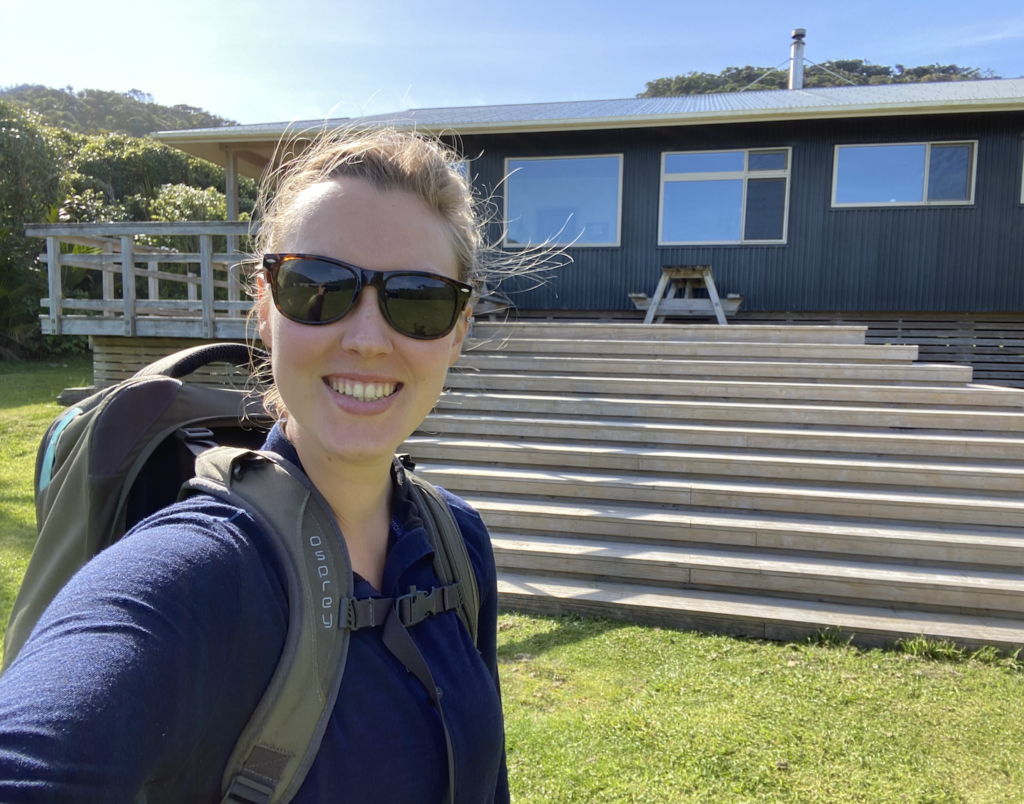
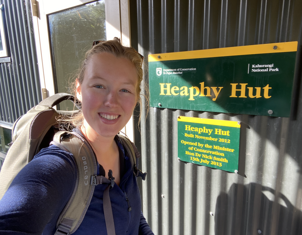
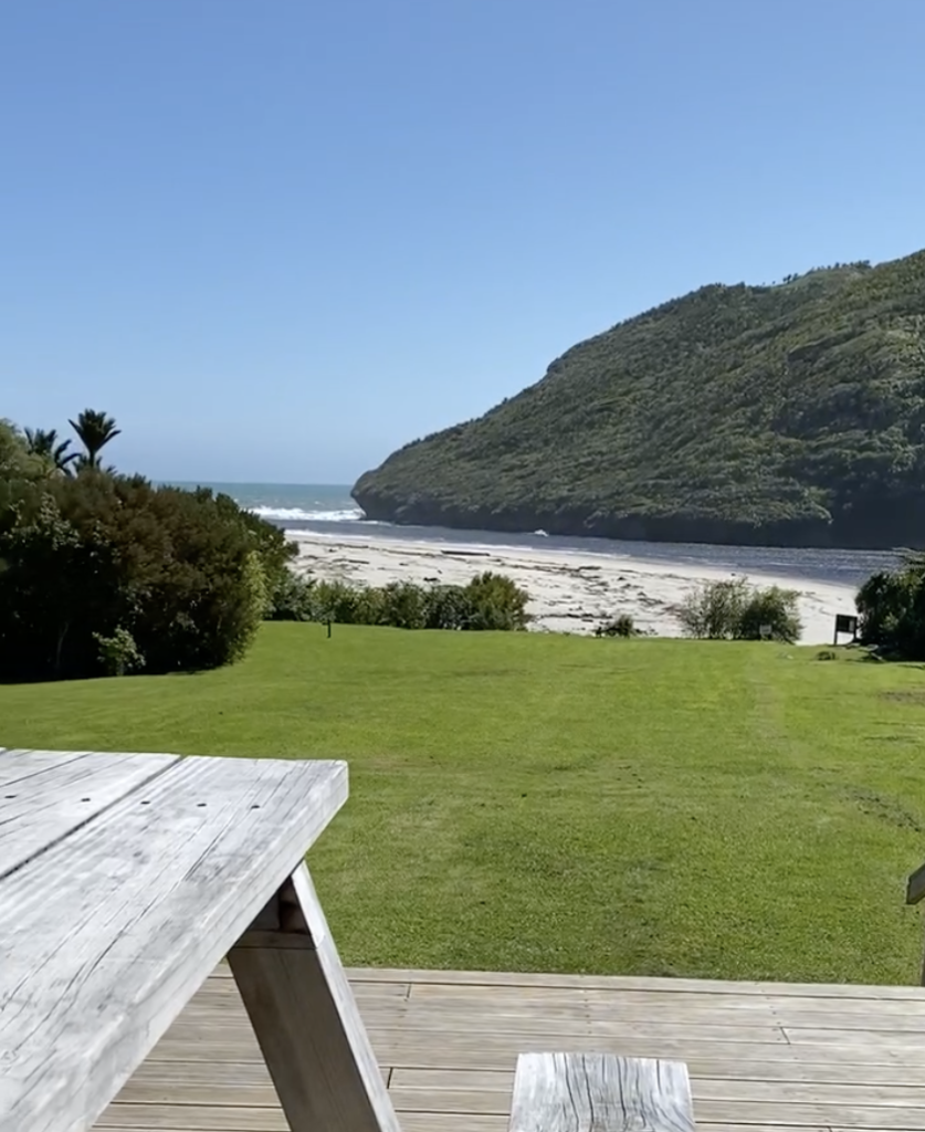
Far sooner than I expect, I stumble across the Heaphy Hut. It’s built up on a bank where the Heaphy River meets the Tasman Sea, and it’s got a mowed lawn. That strikes me as strange, but it sure looks nice.
I’m the first one to arrive and the day is far too nice for anything else, so I take my book outside and read in the sun. The only way I can do this is by renewing my layer of insect repellent as the sand flies swarm. Thankfully, the spray does it’s job.
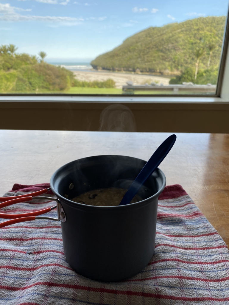
The hut fills with children and parents and several teens from Karamea who hiked out. Workers who are repairing the bridge between Heaphy Hut and the next hut also have a bunk room to themselves and supplies flown in by helicopter, including a generator, so they feast on spaghetti and meatballs, with ice cream and cold beer for dessert. It’s a little unfair as the rest of us heat up water for dehydrated back country meals or, in my case, couscous with veggies and canned tuna.
Unlike my Pinnacles Hut experience, no one snores, and I get a fantastic night’s sleep with the waves pounding down on the beach.
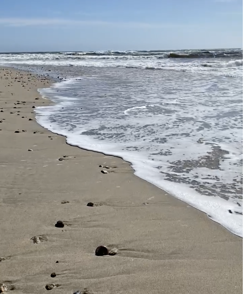
My hike in the day before was much faster than expected, so I dawdle at the hut in the morning, reading my book, wondering down to the beach. Then I head back, following the same route, and returning to Karamea.
Ōpārara Basin
I’ve mentioned that Karamea is the end of the road. It’s a 90 minute drive from Westport, which is the closest hub of connecting highways. So, I may have driven all those miles to do the hike to Heaphy Hut, but that didn’t mean I had to drive back all those miles only having visited the Heaphy Hut.
Besides being the start or end-point of the Heaphy Track, Karamea is also known for being near the Ōpārara Basin, which sports ancient limestone caves and arches.
Because of the high value of the Honeycomb Hill Cave, the only way to visit it is with a tour, so I signed up for one. Additionally, the Karamea mechanics have to rescue people every year from the road to the Basin, so I was very happy to let the guide drive the steep and narrow route.
Honeycomb Hill Cave
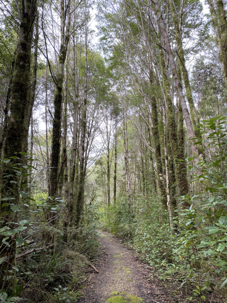
From the carpark, we entered a regrowth forest. This area (and indeed the original purpose of the steep, narrow road) was devoted to logging for many years, but most of that stopped in the 80s.
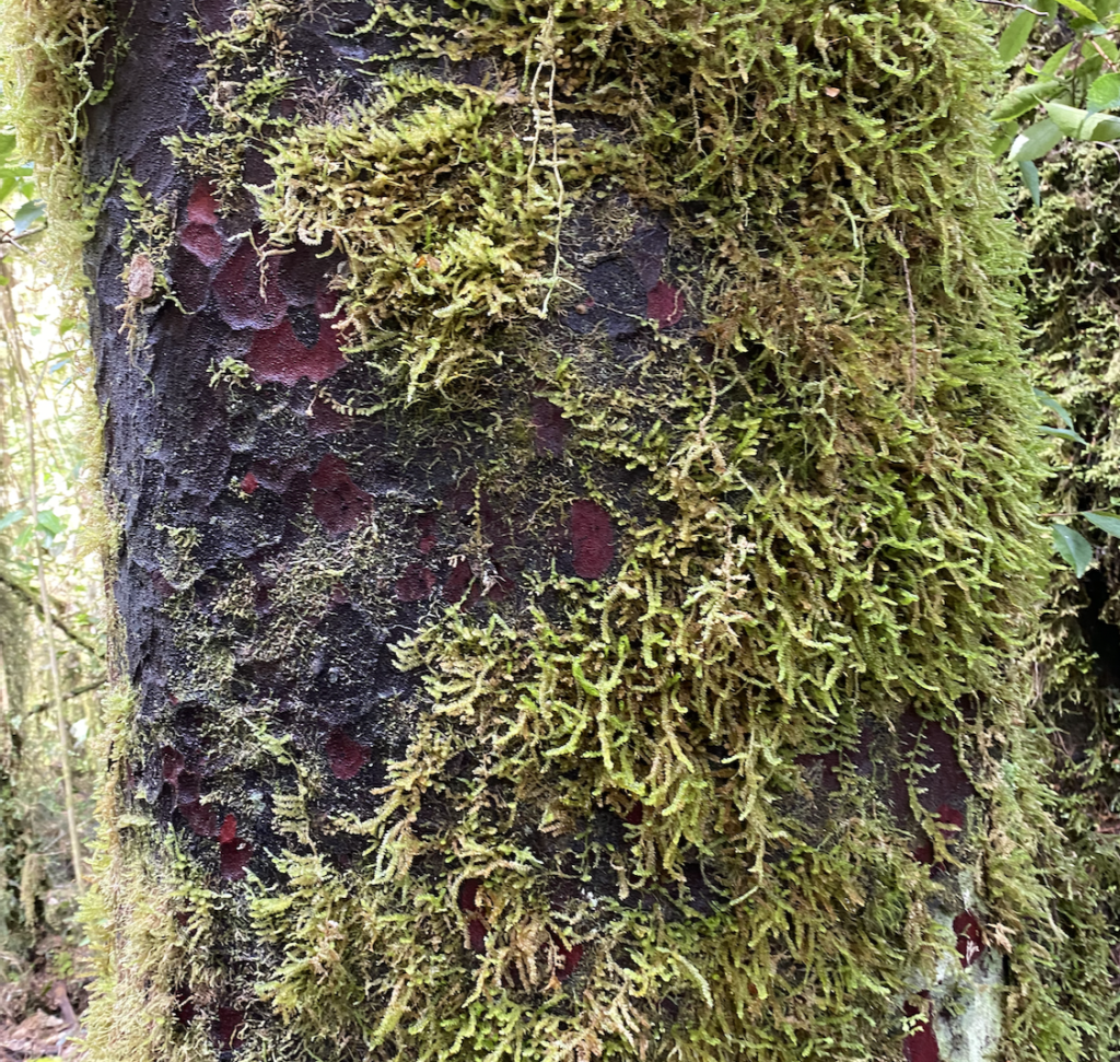
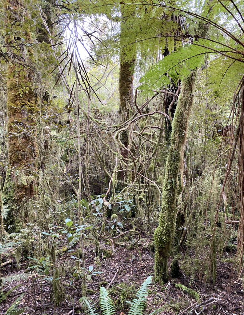
After half an hour, we enter the old forest. This is the best representation of what New Zealand looked like 12,000 years ago. Of course, the ecosystem is different as many of the animals living back then are now extinct and the usual New Zealand pests like possums, rats, deer, and wild pigs inhabit this forest. But it’s the closest we can get.
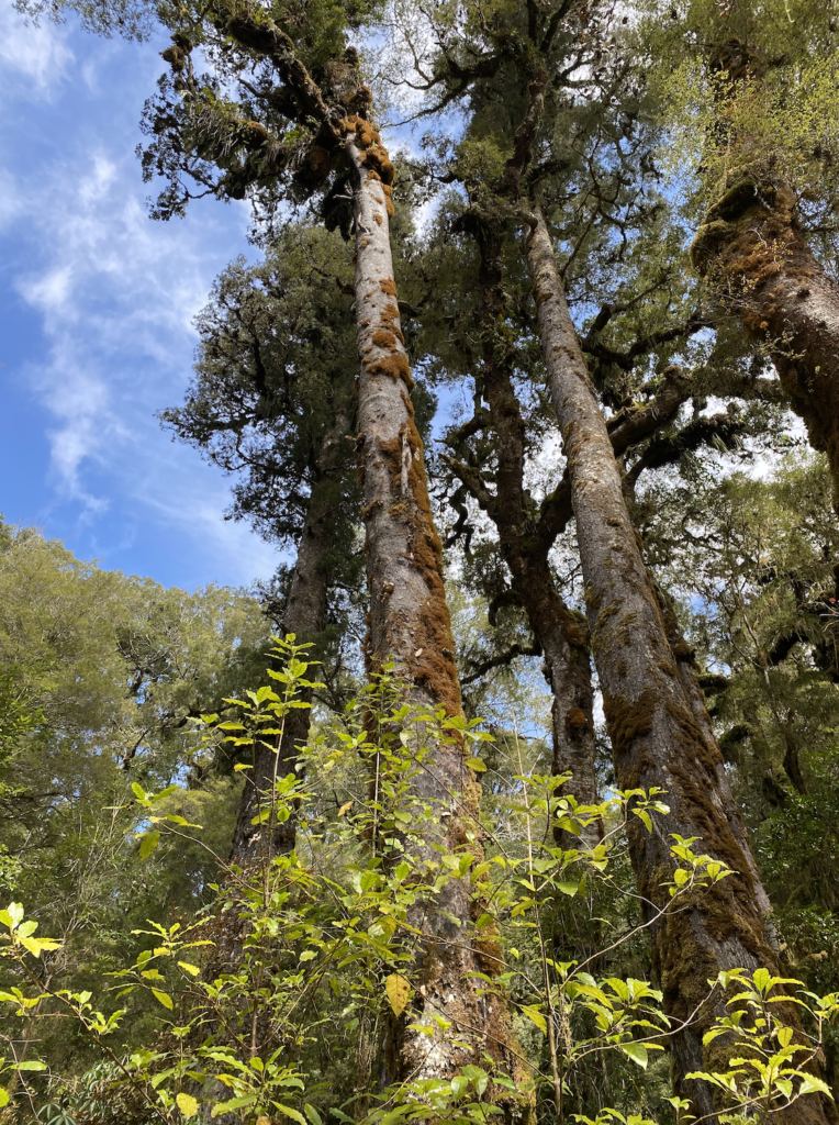
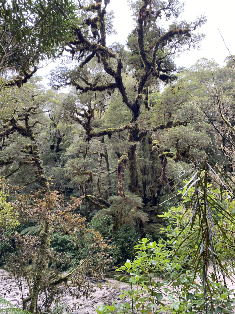
And it feels like it. The giant beach trees, the rata rising high among top-heavy kahikatea trees. Bush lawyer vines slashing through gapes, and scores of bristly ferns. The damp banks sport a variety of swollen liverworts, lichens, and mosses. Whistling bell birds (sounding surprisingly like the mockingjays of the Hunger Games films) call back and forth among the leafy canopy. We walk past a straight, narrow trunk and the guide pushes on it. The whole thing sways, detached from the ground. It’s actually the aerial root of a rata tree growing downward from a rock overhang!
The air is cool and damp, and, when the guide warns us not to step off trail because of possible sinkholes, is begins to feel as though the forest has a separate consciousness, as though it’s tracking our every movement through it’s space. Not in an evil way, but as though we’re trespassing where humans were never meant to step.
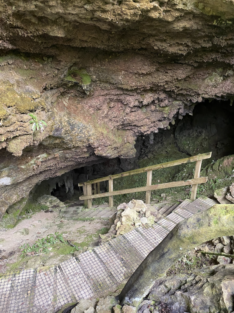
The cave appears out of nowhere. Just another mound of rock in a richly-treed mountainous region.
This cave tour is like a mix of the two I did in Waitomo. It’s not as commercial and accessible as the Spellbound Cave Tour, but it’s not quite as adventurous as the Down To Earth Caving Tour. This is because the river that carved out Honeycomb Hill Cave over millenia no longer runs through it. At some point, whether suddenly in an earthquake, or gradually over time, the cave and it’s surrounding rock was raised about 30 meters and the river rerouted.
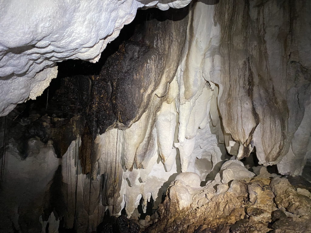
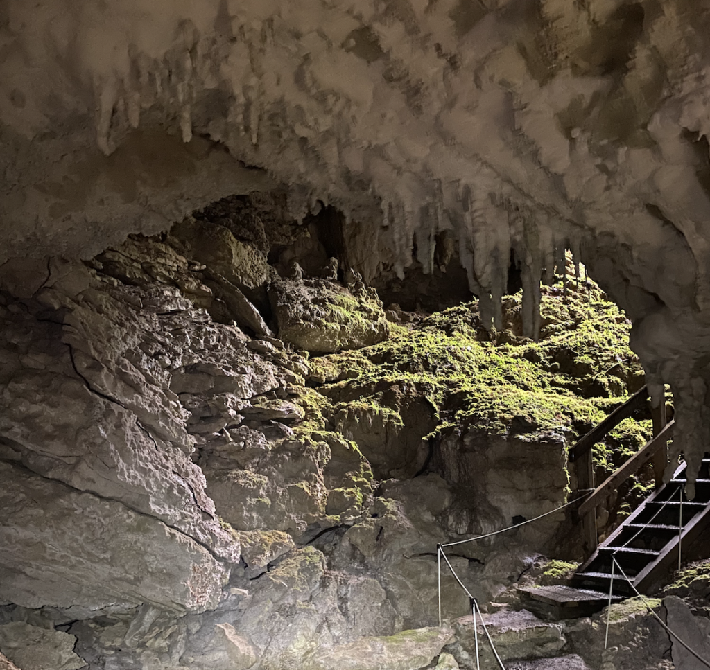
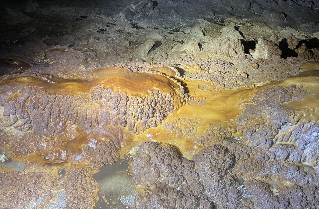
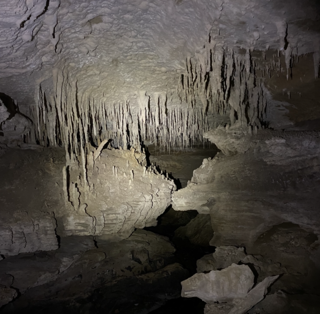
The cave itself is a mix of limestone, granite, and mudstone, as well as home to stalactites, stalagmites, moonmilk bacterial colonies, and many more incredibly cool features that I have already forgotten the name and significance of! In one place, the guide told us to press on one of the visible rock layers. When I did, it gave. It was a layersof clay between the larger, thicker granite layers.
It was a bit worrisome… Not the best feeling to be standing in a cave and discover that the walls are partially made of clay pieces soft enough to indent with the brief press of a finger.
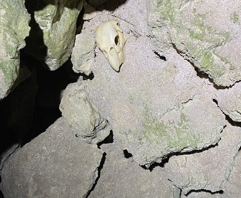
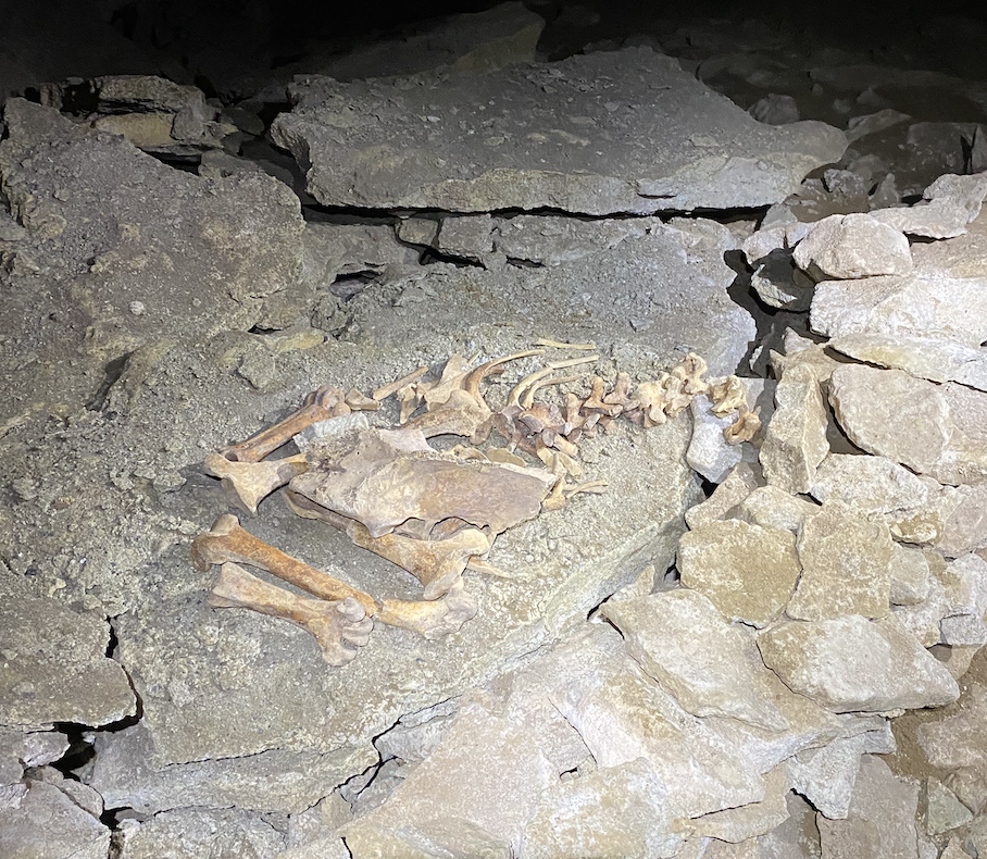
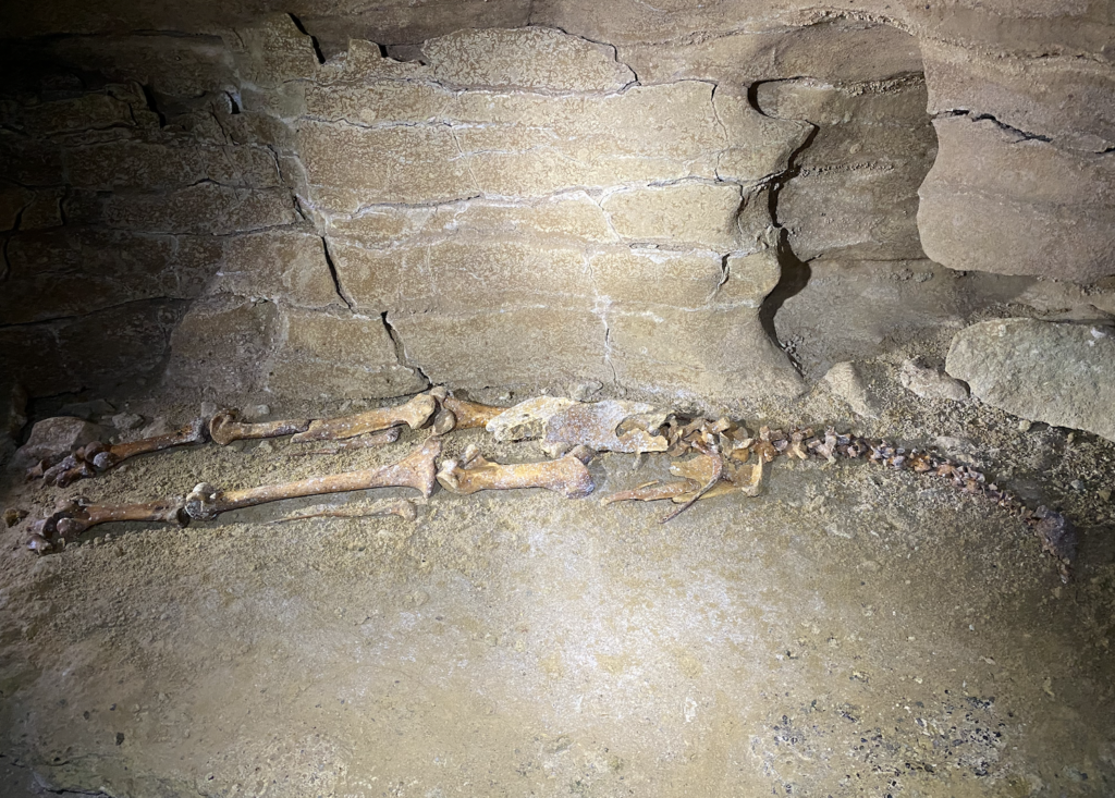
After our intro to the cave, the guide began to show us what I’d really come for. Bones!
Honeycomb Hill Cave is part of a 14km cave system, and all along the route scientists have found fossils of now extinct animals that existed during the last ice age and after.
Many animals were washed into the cave by the rushing glacier-melt rivers after the last ice-age, while others fell through the aforementioned sinkholes and died in the dark depths. This still happens today, and the guide pointed out deer bones and a still-decomposing weka that fell in only two weeks prior.
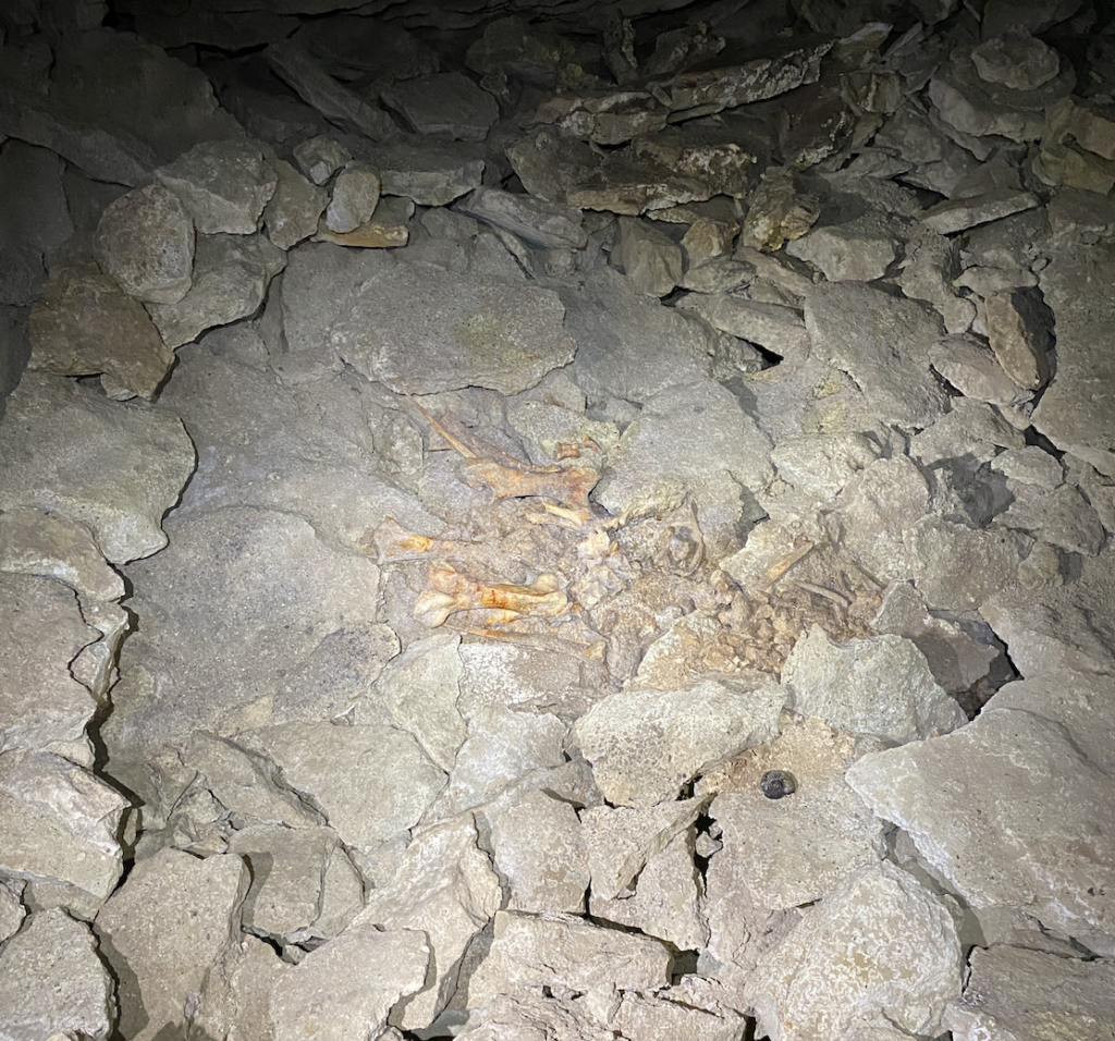
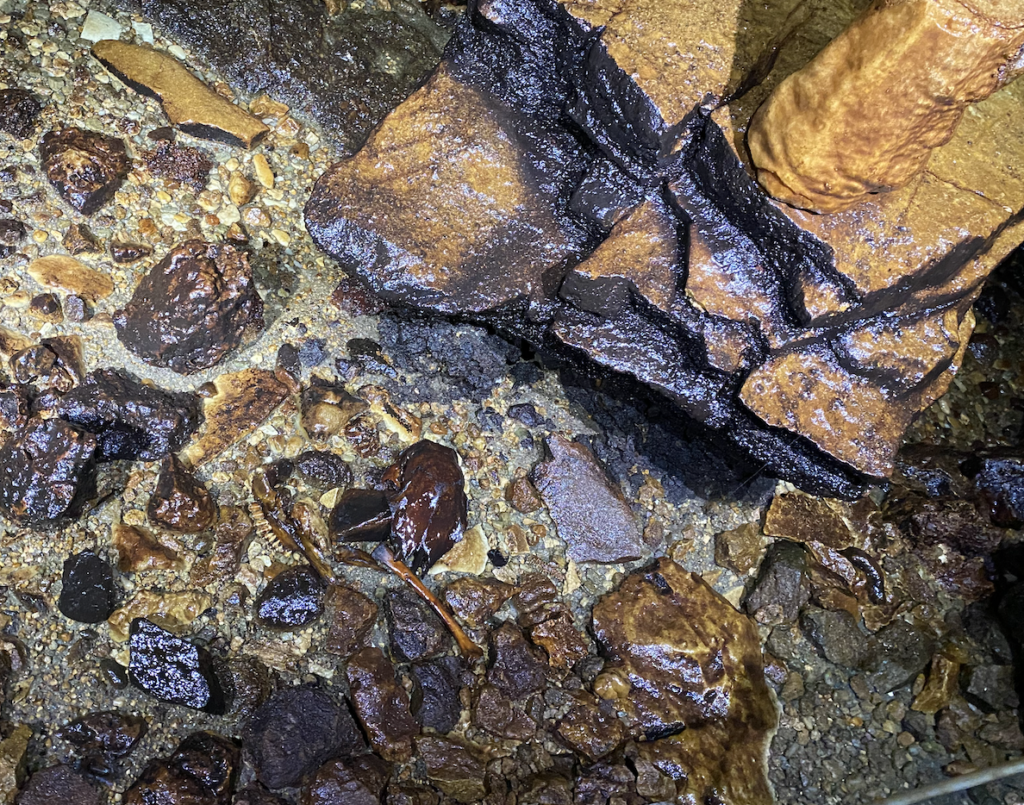
This is why you don’t leave the path in the Ōpārara Basin!
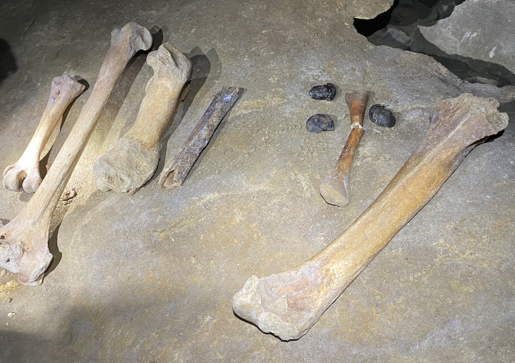
The public can only access a very small part of the cave system (and only with a guide), but many other parts of the cave have been sectioned off and are being studied by teams of scientists. The coolest (but also worst thing) the guide said, was that only a few meters from where we walked were complete skeletons of giant moa (standing at ten feet tall and 550 lbs), but he couldn’t take us to see them. Additionally, in another part of the cave they had found bones from Haast Eagles, which were the main predator of the Moa (and had a wingspan of 10 feet). Instead, we got to see the still impressive (but less so) 20,000 year-old-bones of the bush moa (the smallest species of moa).
However, the fossil records in these caves cannot be overemphasized. The millions of fossils have allowed scientists to deepen their knowledge of New Zealand native species, both those still walking the islands and those which are now extinct. For example, they now know that the kiwi and the moa arrived in New Zealand at vastly different times. And, confusingly, the kiwi’s most closely related relative is the now-extinct giant elephant bird that once resided in Madagascar. The kiwi bird’s next closest relative is the Australian emu. The moa and the kiwi, despite once living on the same landmass, are only connected way down the line in the very distant past.
Moria Gate Arch
Despite it’s name, this has nothing to do with the Lord of the Rings. Well, nothing to do with the filming. Rather, back in the 80s when they needed to name the arch, a fan of the Lord of the Rings books suggested this name. And it stuck.
And, the guide explained, it was extremely fortuitous because people take his tour all the time just because they are LOTR fans and the arch sports a familiar name.
Despite it’s false hype, the arch is incredible and definitely deserves to be visited, LOTR-themed name or otherwise. The short walk is through more ancient-feeling podocarp forest and towering trees, and it takes us twice as long to do the walk as advertised because the guide stops to point out different plants and tell us all about them. I wish I could remember even a quarter of all the amazing information he provided!
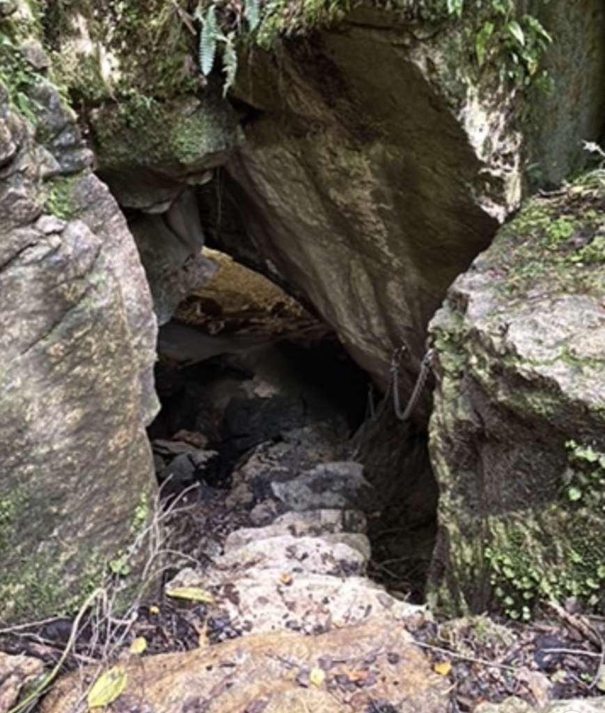
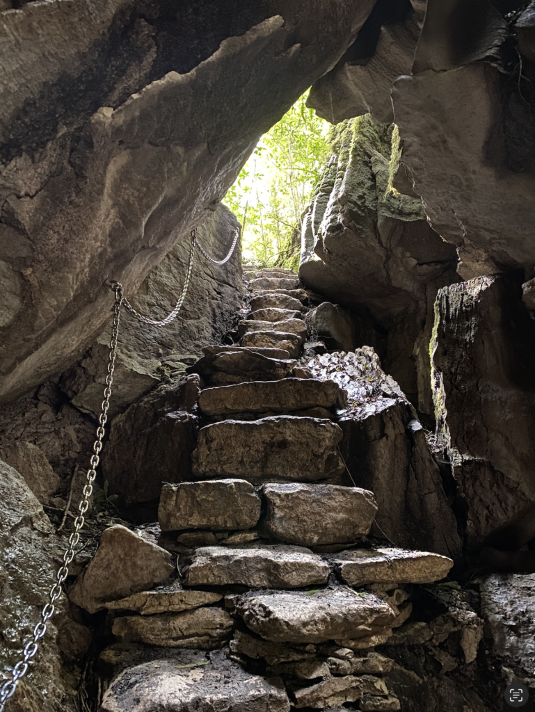
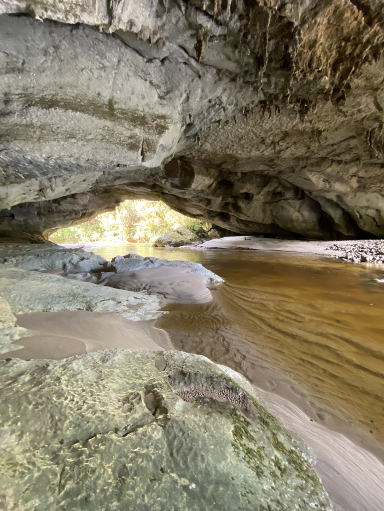
Then, just as you begin to wonder if you’ll be walking forever, the trail dead-ends at a hole in the ground. A hole with a chain. Daylight shines through below, so it’s not quite as eery as it sounds. We descend the stone steps and emerge beneath the arch. The river that formed the arch still runs through it and sand deposits from the last flood cover the ground where we walk. It’s beautiful, this natural arch over the river, and it’s only enhanced by the unorthodox way of accessing it.
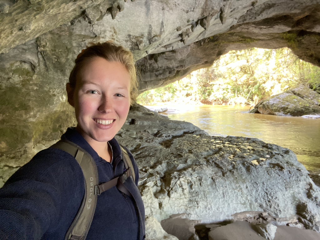
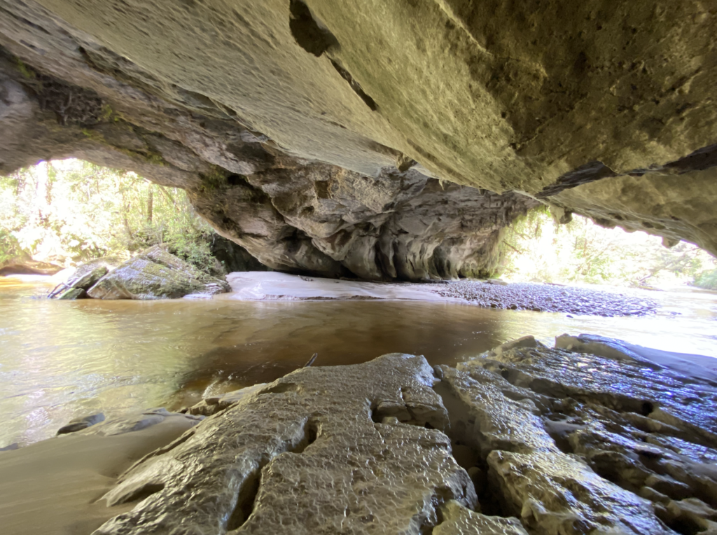
Next, we scramble back up the stairs and walk over the arch(!) to reach a viewpoint. I guess that the giant trees growing out of the arch are heavy enough that a few humans tramping across it are hardly worth notice. Still, if I was DOC, I would have created the trail to go around. But I guess that would mean building a bridge. Why do that when nature has provided one for you?
Westport
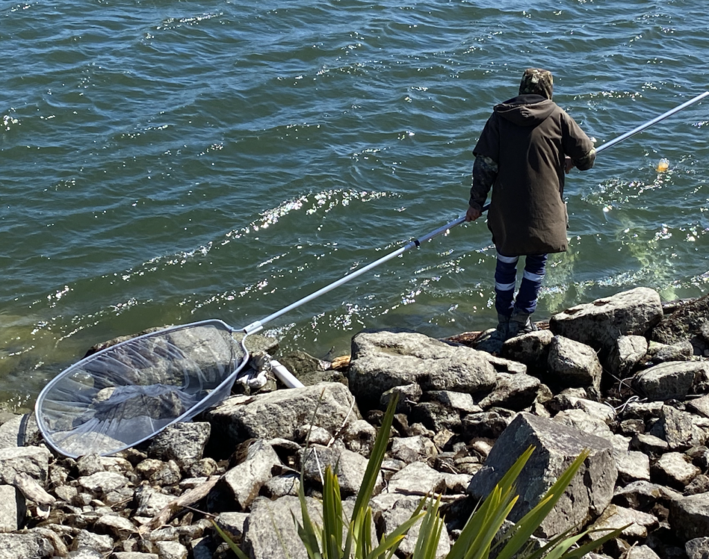
Westport is the closest town to Karamea, but it is by no means large. In fact, it reminded me of a tiny Gunnison, perhaps what Gunnison would be like without the spillover of wealthy Crested Butte half an hour away. Westport is small, laid out in a grid formation, and everyone in town is either a hunter, fisherman, or both. This time of year is whitebait season.
“Whitebait” is the name for the juvenile stage of several types of fish which lay their eggs in rivers. When the rivers flood, the eggs are carried out to sea. When the eggs hatch, the teeny, tiny fish swim out of the ocean and back up those rivers. Kiwis stand at the mouths of the rivers and scoop up the whitebait in nets. Not great for conservation (fish species whose juveniles count as “whitebait” are approaching dangerously low levels), but good for Kiwi pockets (apparently 1 quart-size ziplock bag of whitebait is $40 market price). I was excited to try whitebait fritters (the way they’re usually served), but when I tried some in Kaikōura, I can honestly say they tasted like nothing.
Maybe it was just bad luck or maybe I picked the one place in all of New Zealand that serves up a terrible whitebait fritter (though I doubt it, since I had to wait in a long line to place my order).
My opinion seems to be the unpopular one, because everywhere I drove, walked, and looked, fishermen stood perched at the mouths of rivers like herons, their long nets in hand.
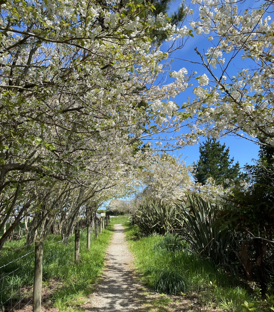
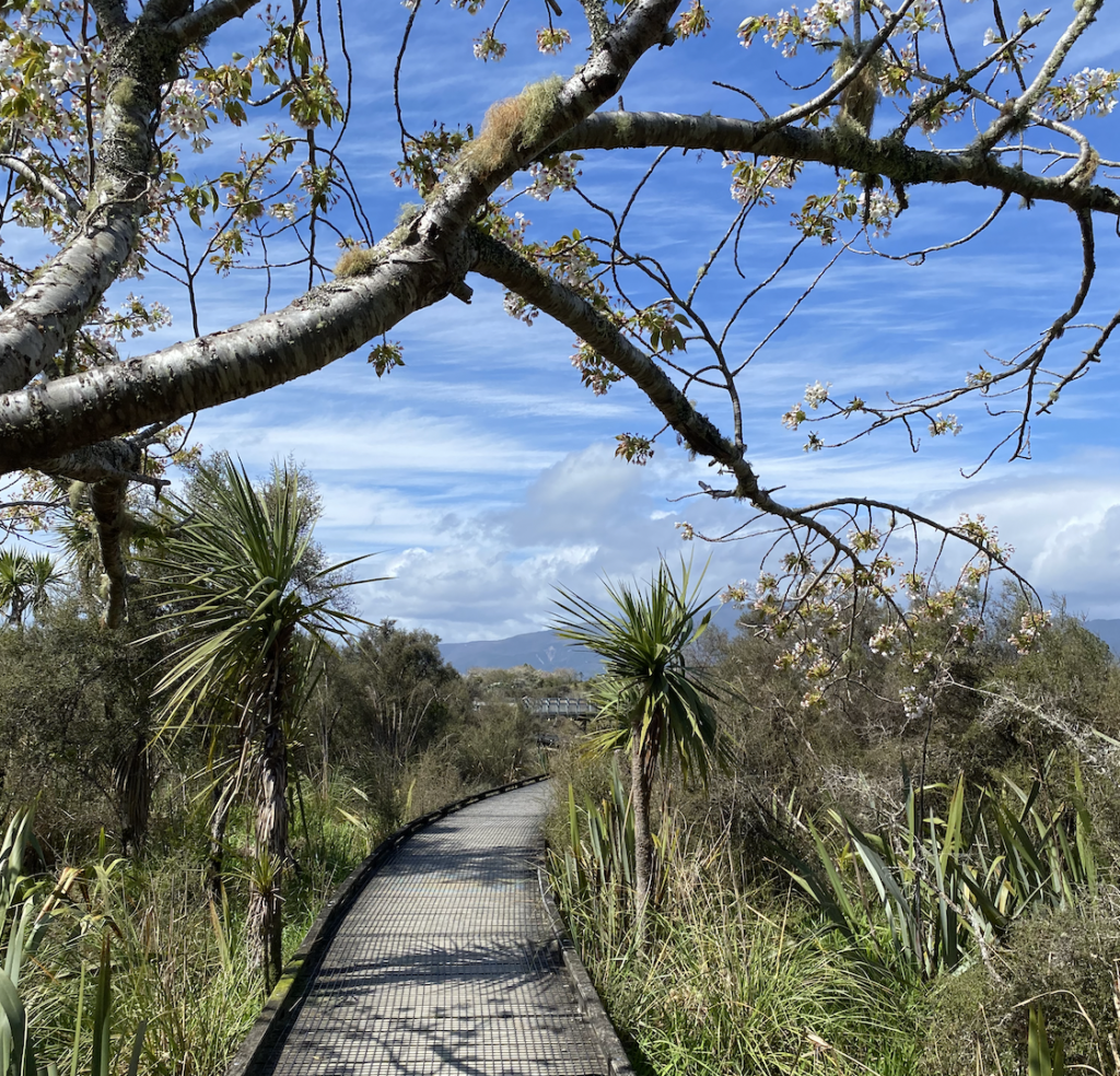
Since I wasn’t planning on fishing, I found several hikes near Westport that drew my attention instead. The first was more of a stroll through town and into the lagoon, finally ending up at the beach. The bright spring leaves and plucky flowers were the highlight of my explorations.
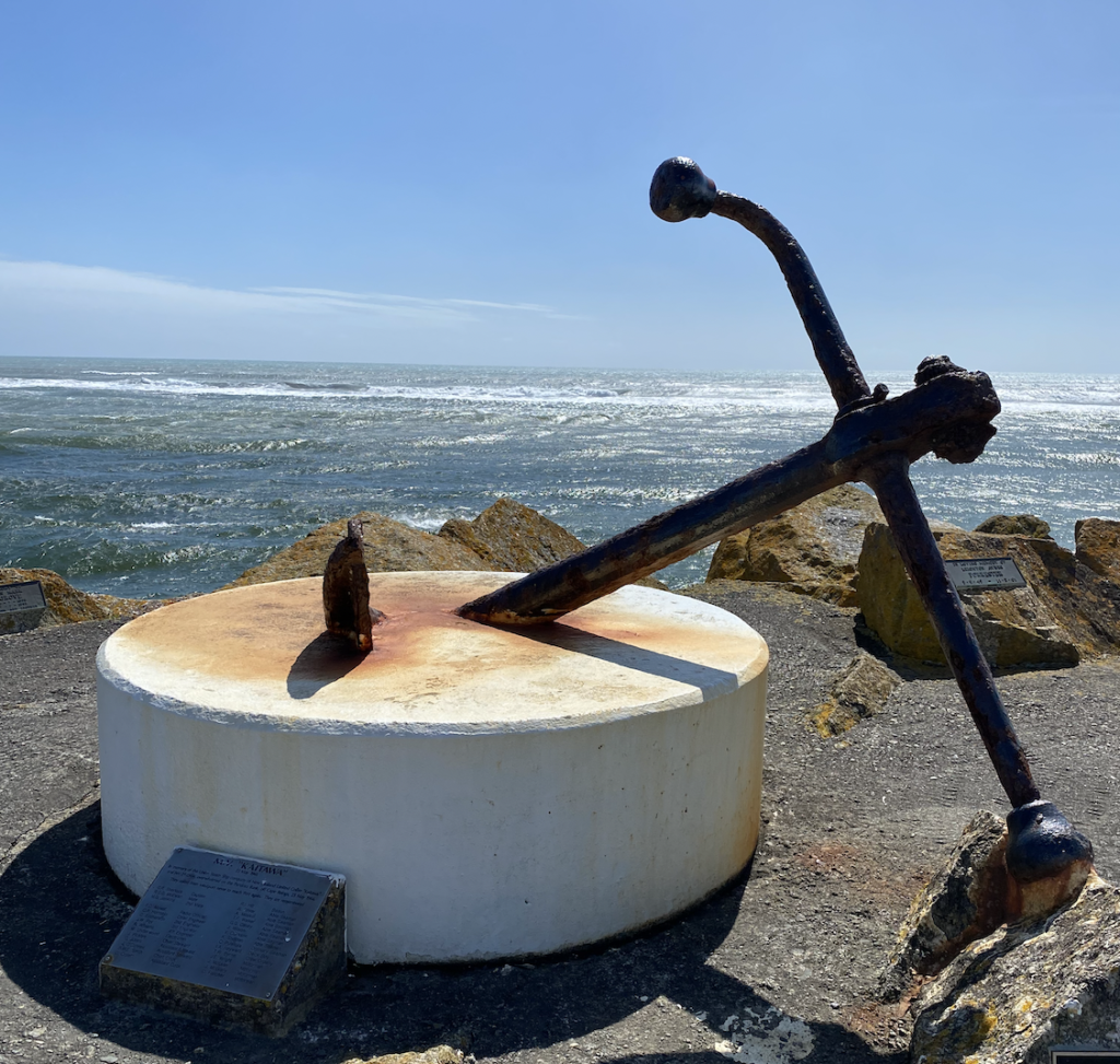
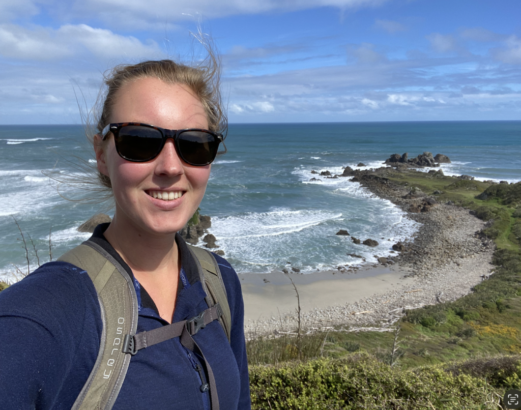
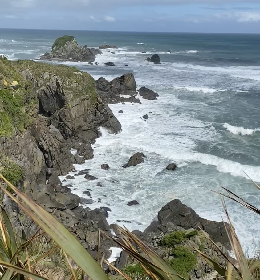
Cape Foulwind
This short walk lived up to it’s name as the wind hooted and howled around me, but the rocky coast, cliffs bracketing driftwood strewn beaches, and the crashing, hammering waves were worth the wind.
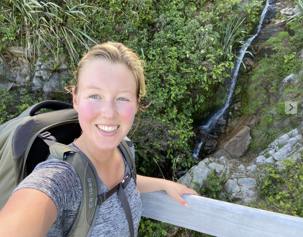
Charming Creek Walkway
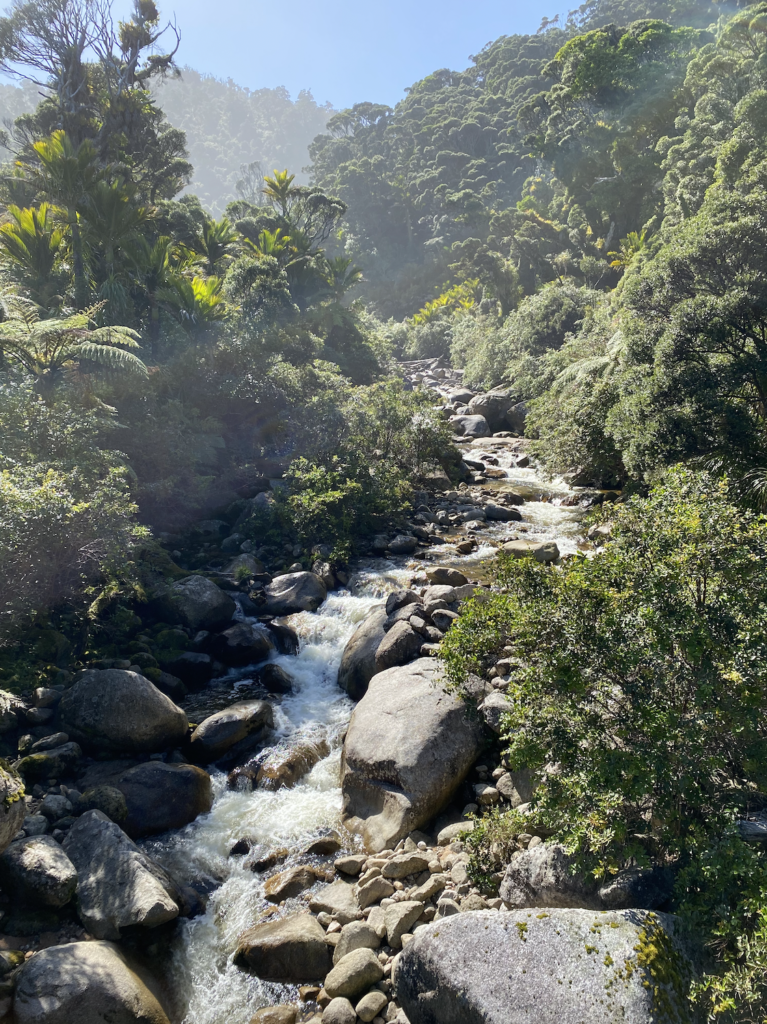
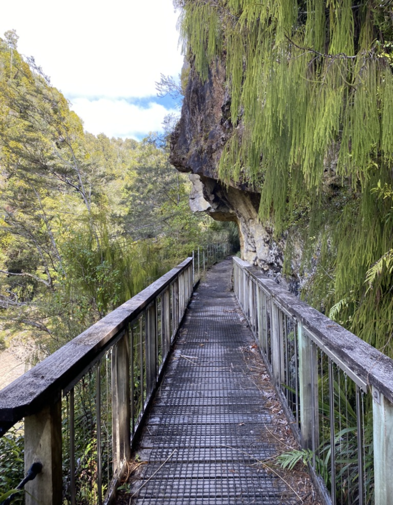
About halfway between Karamea and Westport lies Charming Creek Walkway. It’s mostly flat, weaving through old, rusted coal mining relics. The trees bend over the path and I crossed so many babbling brooks I lost count.
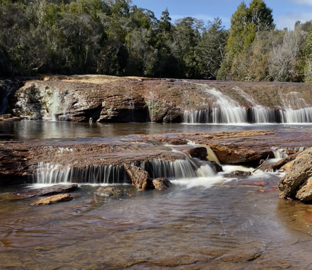
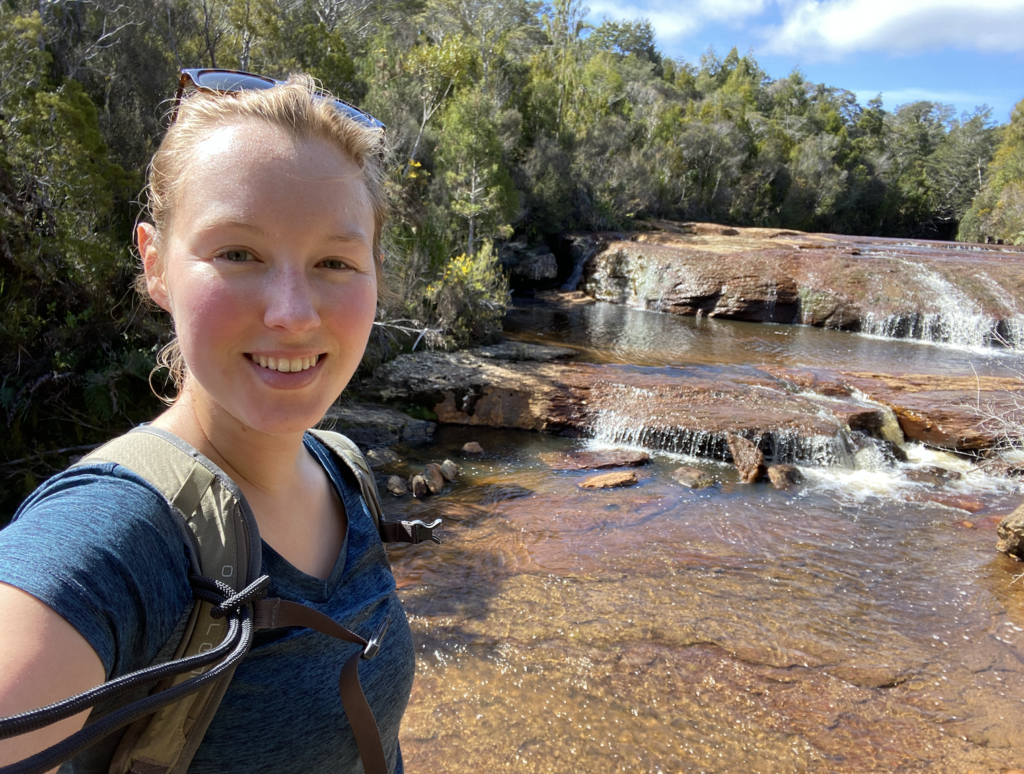
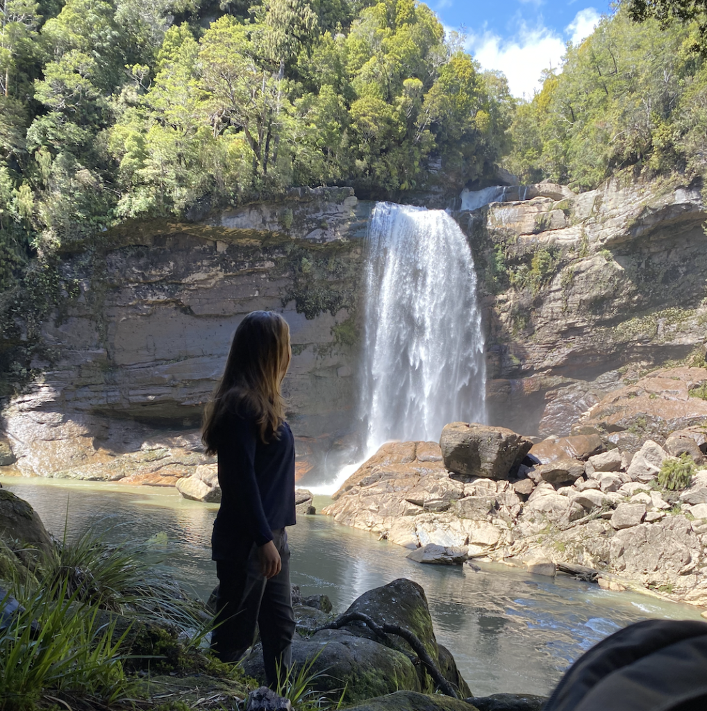
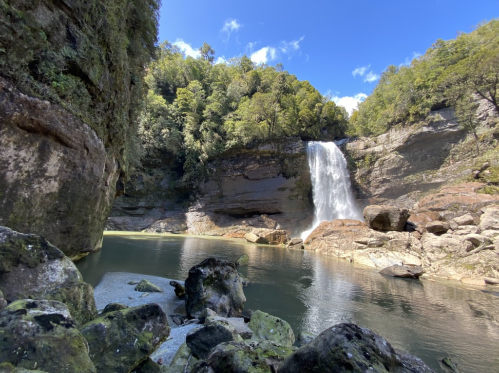
The rusty-colored rocks at the very beginning of the track hosted the best section of river, but the true highlight of the walk is a short tunnel that emerges at a thundering waterfall.
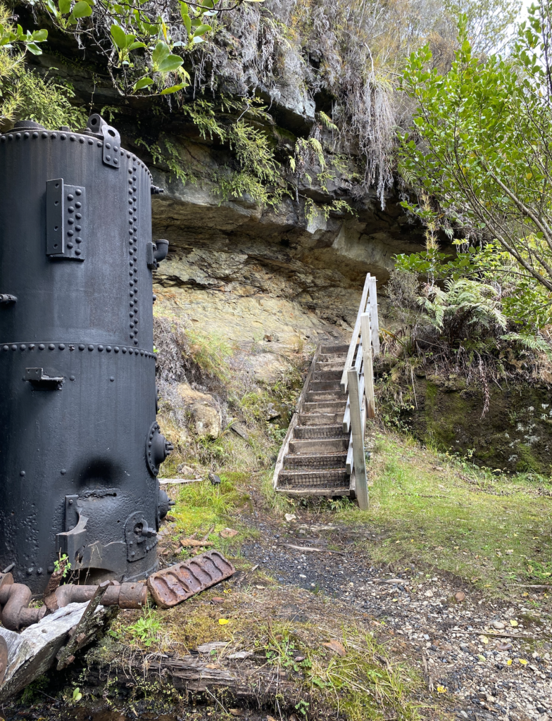
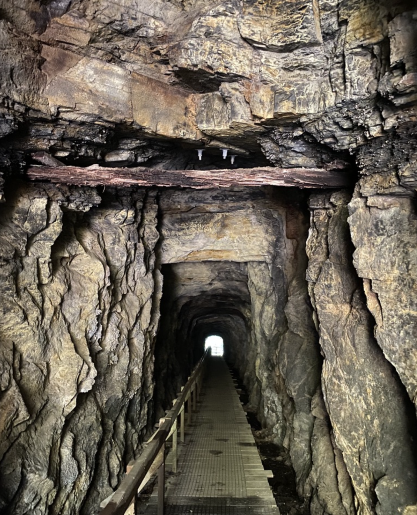
I’ve said it before and I’ll say it again. I am constantly caught by surprise by New Zealand waterfalls. Put yourself in my shoes: I’m walking a flat track. I’ve never heard of this waterfall before I looked it up the night before. The description of this track mentions the mining relics and the tunnel and the swing bridges and adds the waterfall as an afterthought. Then BAM!
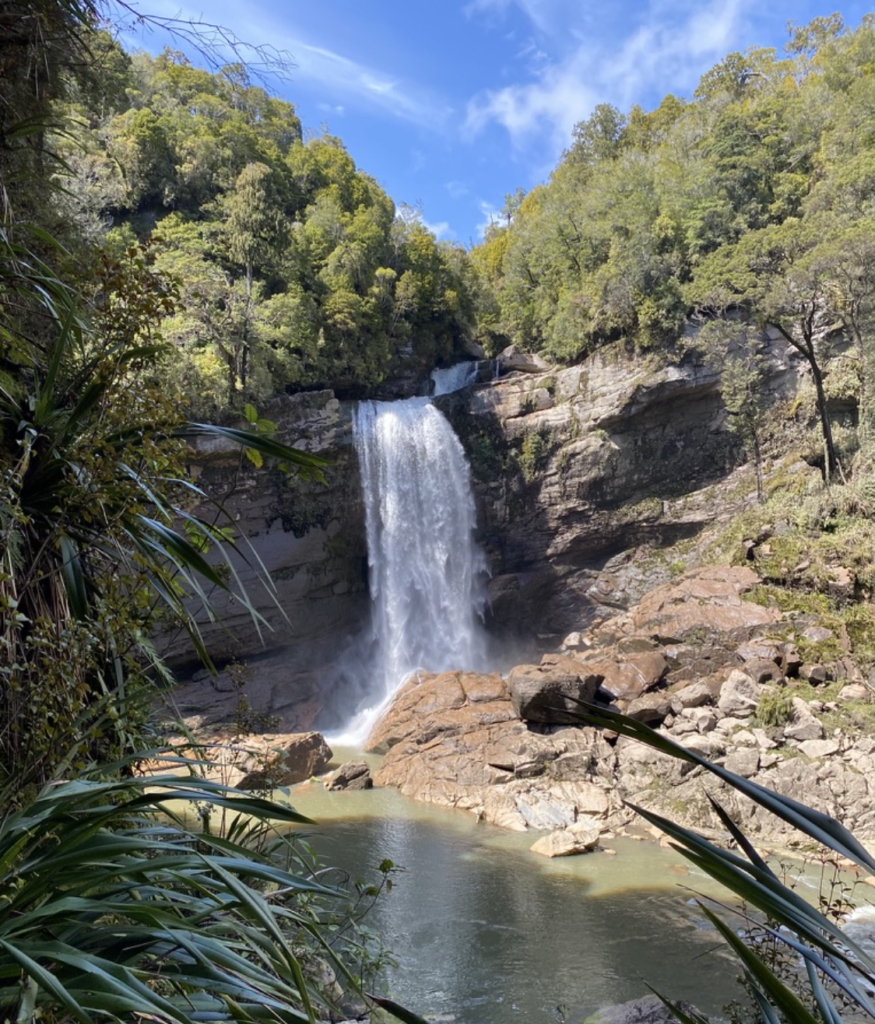
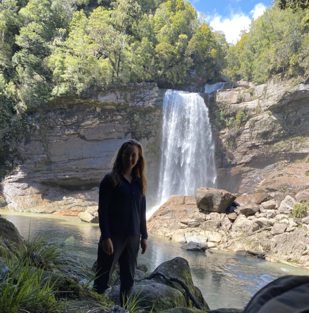
I emerge from the tunnel to see an 80-foot waterfall plummeting over the side of a cliff in great, powerful curtains. Stunning.
Wet and Windy West Coast
I left the West Coast when I saw the forecast called for 10 days of wind and rain, so I drove back through Lewis Pass, retracing my steps from only six days before. But I think it was worth it–a long drive, but a few beautiful sunny days on the West Coast and an overnight hike I probably wouldn’t have gotten to do otherwise.
Turns out I would drive 500 miles just to hike 20 more. And I’d do it again!


One Comment
Uncle Mike
Another good write up Maddie. Loved it!
Please remind me to call your Dad “Nikau” when we come visit. We’ll see if he was paying attention…!!!