I love ME…I mean Maine!
Maine Trip: Part 1 of 3
After a busy month of work, hunting, and visitors, my parents and I jetted off to enjoy the easternmost state in the Union.
We choose Maine because none of us had been before, and the idea of rugged coastlines, mountainous forests, and stunning fall foliage sounded like an excellent way to spend a week.
Even as the plane circled the coast above Portland, I could see hints of reds and yellows in the trees. Islands popped out of the ocean like the backs of porcupines. The sky was clear and bright–none of that gloomy winter east coast weather I was used to from a year in Maryland. Something about that 10,000 foot view already had me falling in love.
Seriously–I don’t know what exactly it was, but I told my parents in the airport “I might move here one day.”
Driving down the highway (which didn’t feel like a highway), we researched the numbers. Portland is the biggest city in Maine at 60,000 people. Augusta, the capital, has only 18,000. We stopped in Augusta for snacks and drinks and it felt like a small mountain town spanning the hilly banks of the river.
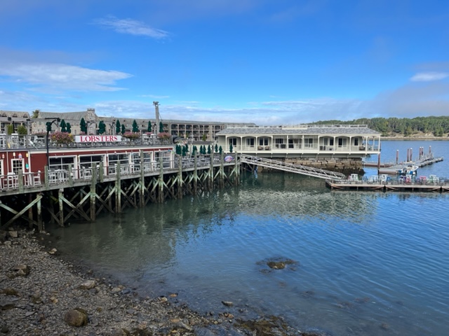
We reached our official first destination of Bar Harbor, Maine after night fell. At 8:30 pm, Bar Harbor was a quaint, quiet town. We thought it would be crawling with tourists, but we had the streets to ourselves and the bar was quiet. We had oysters and seafood at The Loft and enjoyed the slight buzz you get from traveling all day and finally arriving.


Bar Harbor
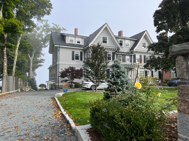
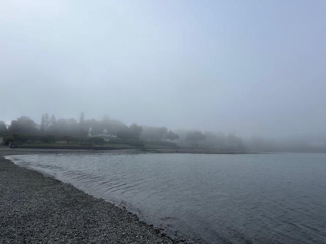
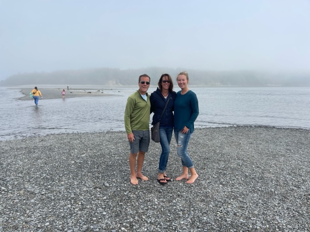
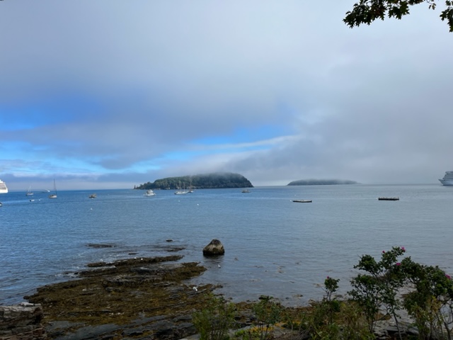
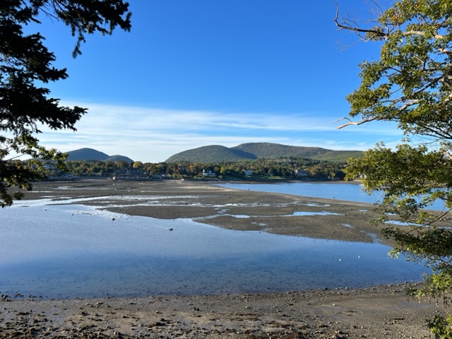
Bar Harbor is a small town on the northeast side of Mount Desert Island (pronounced like dessert). When we woke late and finally ventured out, it was into a foggy Maine morning. Our hotel, The Little Fig Inn, was blocks from downtown, but bordered a small neighborhood. We walked through the fog, peering at the large homes with cute carriage houses and colorful shutters and long front porches perfect for drinking a morning cup of tea. It was too foggy to see the ocean behind the houses, so we cut down to the shore as soon as we could. We happened to stumble across the Bar Island path, which is a sandbar between Mount Desert Island and the small Bar Island that only appears during low tide.
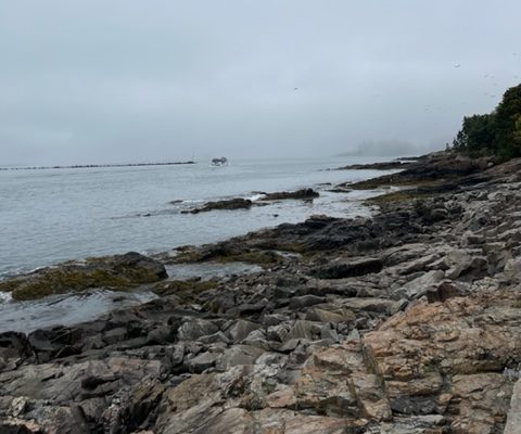
We passed some runners and tourists climbing up the hill and we could see that part of the sandbar was already covered in water, but we walked out to it all the same, wondering how far away Bar Island was. All we could see was fog.
Eventually the island appeared out of the mist with rocky shores and jutting trees, like something out of King Arther.
I casually glanced behind me, back toward Bar Harbor–and the tide was coming in! There was another low point already filling with water. We ran back over the rocks, shucked our shoes, and waded through the cold water as it streamed around our ankles. Already–we were having an adventure!
Acadia National Park
In the afternoon, we drove into Acadia National Park. This beautiful park was what drew us, like most people, to Bar Harbor in the first place. I’ve visited several National Parks, such as Rocky Mountain National Park, Yellowstone, and at least one in Utah (did you know there are five national parks in Utah?), but visiting them had never been high on priority list. Perhaps it’s because they’re often full of people and I always felt like I was fighting crowds. I’d much rather be in the mountains behind Vale, in 201, or hiking in the national forest by our cabin. Despite the crowds, every national park I’ve been to is gorgeous, and I read that Acadia is a great place to experience Maine’s incredible fall foliage.
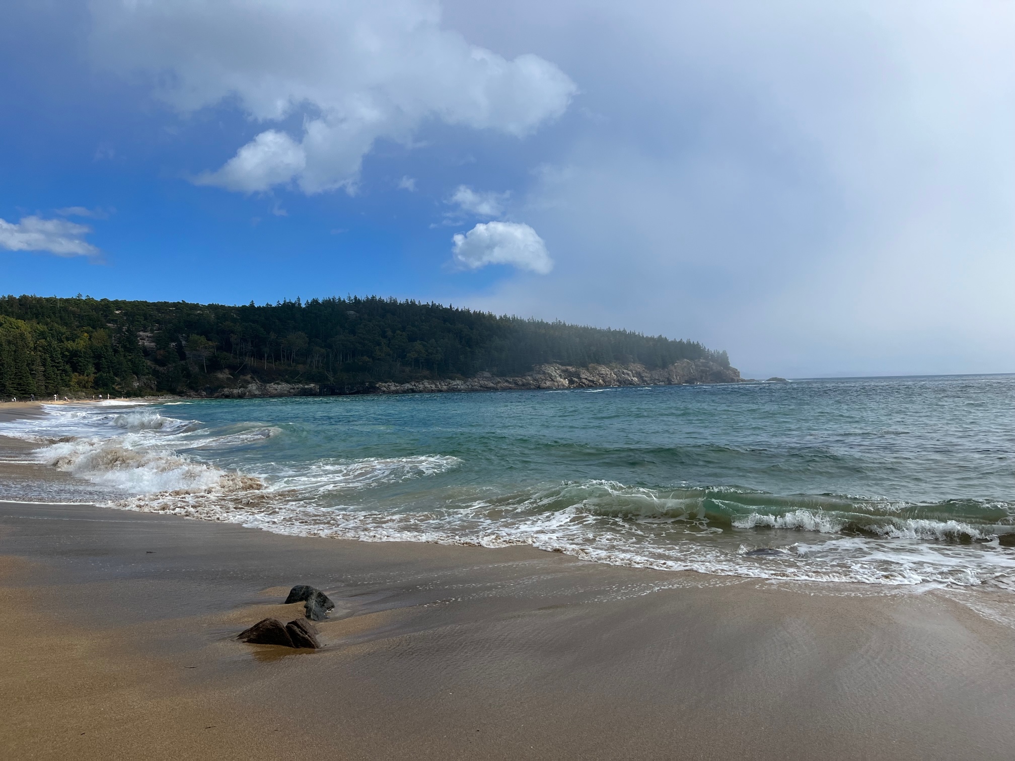
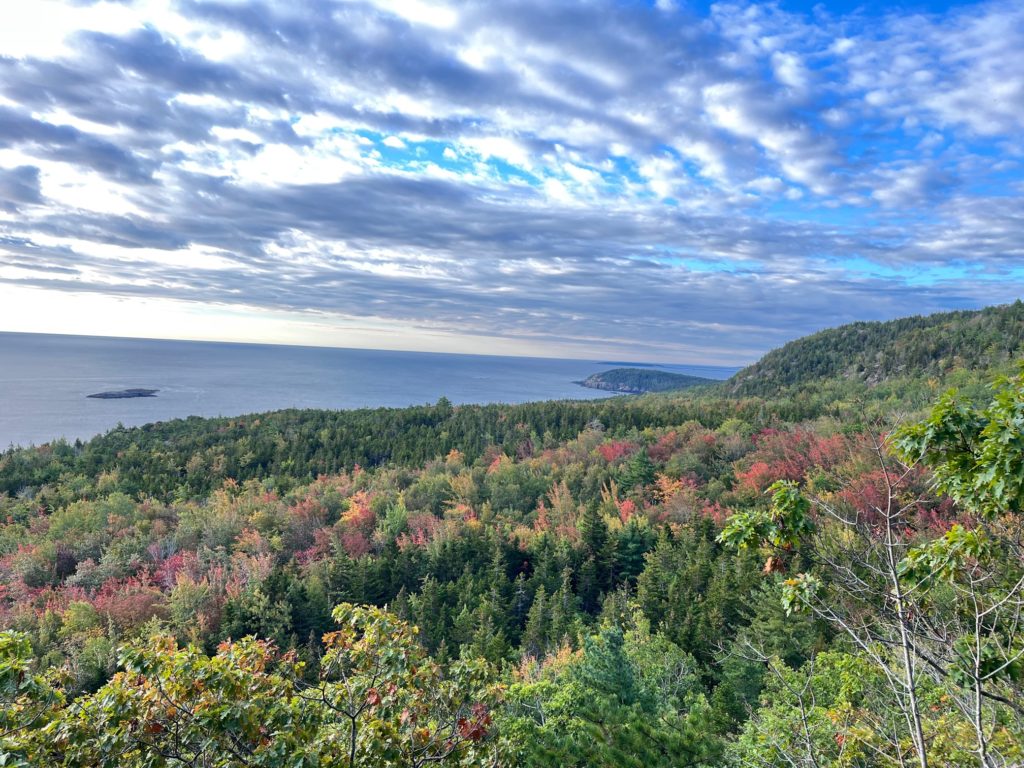
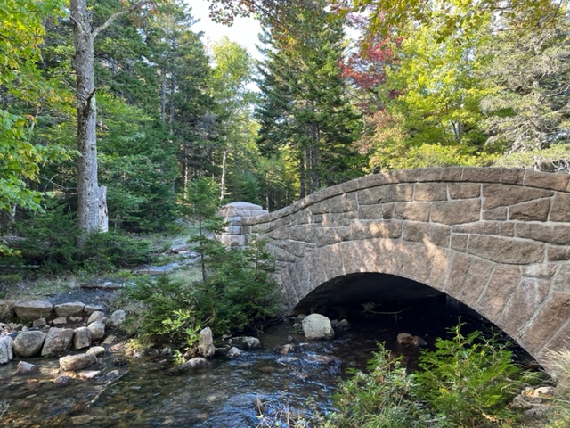
We decided to start with the Park Loop Road in Acadia to hit all the high points and get the lay of the land. It’s a beautiful drive with plenty of lookouts and beautiful stops. If you go, our high points were (in order from the Gulls Cove Visitor center entrance) the first lookout over Bar Harbor, a random pond off to the right, Sand Beach, the rocks by the Thunder Hole (but not Thunder Hole itself–too many people and rocks/shoreline that’s just as cool only fifty feet away), and Jordan Pond.
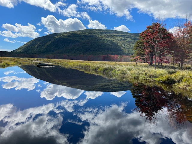
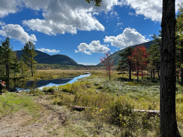
Already we got glimpses of fall foliage, walked through the crashing waves, and stared as though in a trance at the turquoise waves crashing against the rocky coastline. There were a lot of people and it definitely takes away from some of the awe that nature usually inspires, but the end of September is a good time to visit national parks because at least kids are in school.
Still, the next day we had plans enjoy the nature without the crowds.
The Beehive Trail
We headed back into the park at seven the next morning. (Well, 7:05 since Mom needs her morning chai and the coffee shop didn’t open until 7.)
We drove directly (with a slight turnaround because I forgot I was supposed to be navigating and not just staring at the beautiful scenery) to our first activity: The Beehive Trail.
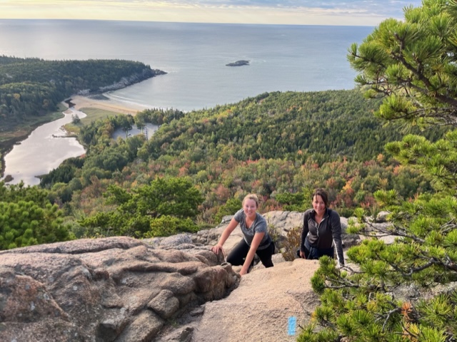
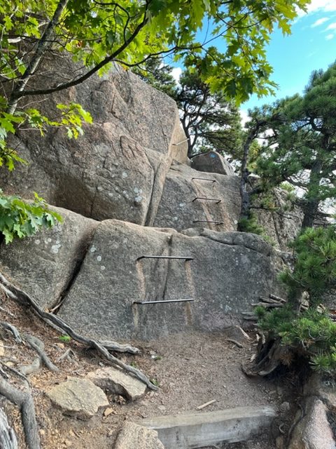
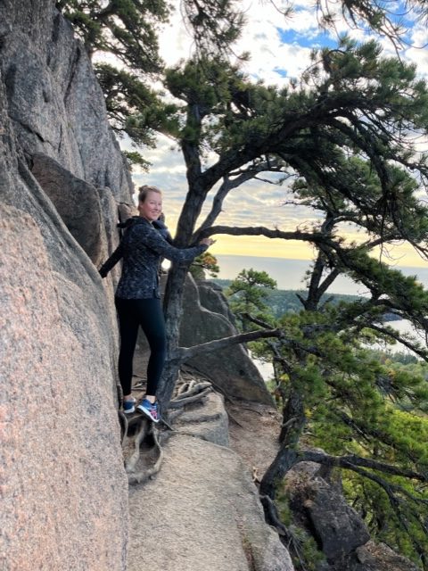
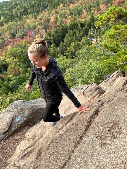
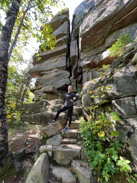
The Beehive Trail is one of Acadia’s Iron Ladder trails. You basically climb up the side of a rocky cliff assisted by iron rungs secured into the rock face. There are several hikes like this in Acadia and all are popular, but as we set out, we encountered only two other groups. While there were more people at the top, enjoying the view, we were glad for our early start because, the afternoon before, there had been a continuous line of people on the cliff face.
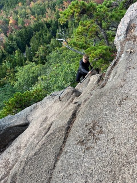
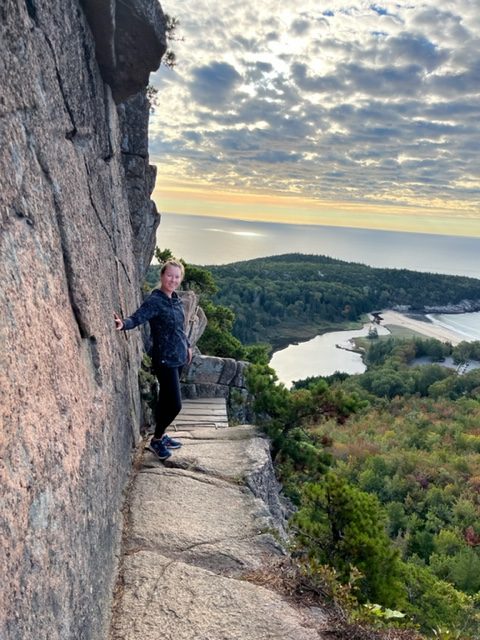
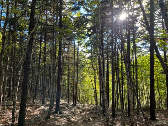
Imagine: leading from the road, the trail first takes you through the forest. With trees all around and thick roots jutting from the ground, you scramble over boulders and step from stone to stone like crossing a calm river. When you reach the cliff face, the scramble begins. There are narrow rock ledges only two feet across and iron bars secured to the rock serving as ladders. You follow the blue rectangles painted on the rock, and sometimes you see one and almost can’t believe that that’s the route. The view only gets more beautiful the higher you climb. Pine trees carpet the mountains around you with the occasional belt of oak and maple and birch that’s already changing color, like a little bit of flame peeking out of the green.
The only bad part of the Beehive Trail was that it ended too soon!
Gorham Mountain to Cadillac Cliffs Trail
Atop the Beehive Trail (with a laughable summit height of 520 feet), we sat for nearly a half hour. It was slightly breezy, but the sun was shining and the view was breathtaking. The sea stretched out as far as we could see and we peeked at our maps, trying to figure out if any of the pine tree covered islands and land masses in the distance were part of Canada (probably none–I think we were too far away).
From the top of the Beehive, we took The Bowl trail down (it’s considered very rude to try to go down the cliff face of the Beehive because it disrupts all of the people trying to come up). Just because we weren’t scaling a cliff face didn’t mean the rocks disappeared. We jumped and leaped and scrambled and slide down on our butts. We were having too much fun and enjoying nature just too much, so instead of follow the trail all the way back tothe parking lot, we took a left turn and headed up the Gorham Mountain Trail. We reached the top in twenty minutes, which was so bizarre coming from Colorado where it can take all day to summit a peak. Here, we’d summited two in one hour!
Question: What is the best thing about being from Colorado and going hiking in the east?
NO ALTITUDE!
All of the hikes, even the Beehive, which is straight up a cliff, were so easy.
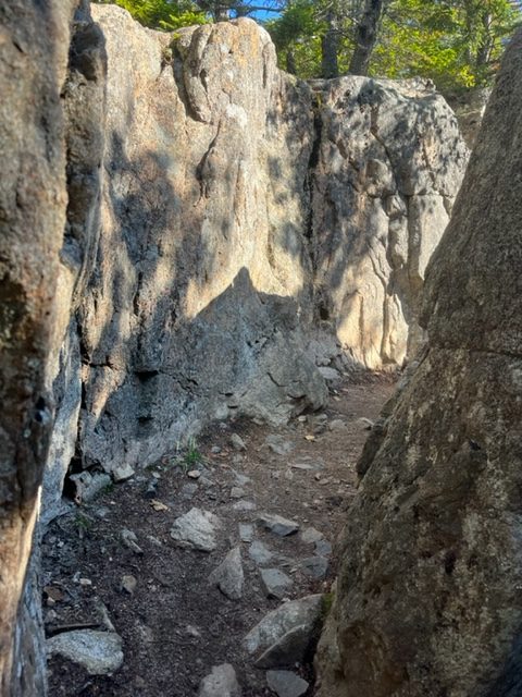
After the Gorham Mountain trail, we still weren’t ready to be done (it was only 9:45 after all). Instead, we took the Cadillac Cliffs trail back to the road. The entirety of Acadia is so rocky–giant cliffs, boulders to scramble over, trees growing out of the rocks, even round and light colored glacial erratics (which are boulders that were pushed into Acadia when the last glacier in the area was expanding). The Cadillac Cliffs hike, while not an Iron Ladder trail, did not disappoint. We walked between walls of stone and scrambled over rough granite.
When we finally reached the road, we were faced with a two mile walk up the Ocean Path to reach our car. While the Ocean path is a lovely idea, in reality it follows the Park Loop Road so you’re constantly walking by cars wizzing past. And it was busy!
We walked twenty feet on the Ocean Path and then ditched that idea–and it was the best idea we had the whole trip.
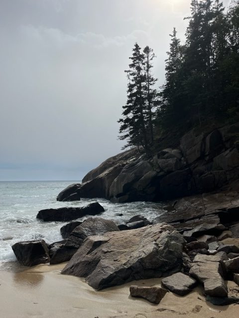
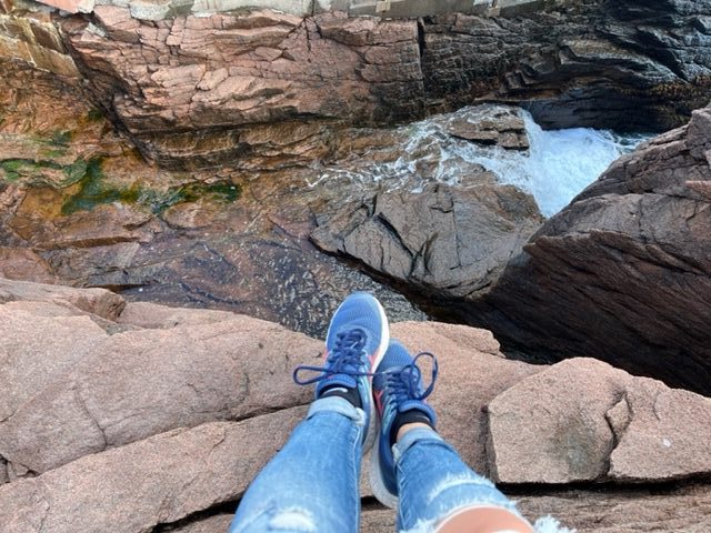
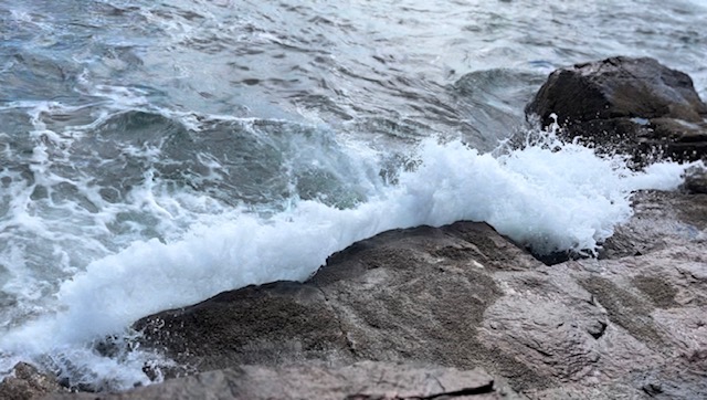
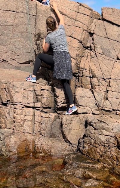
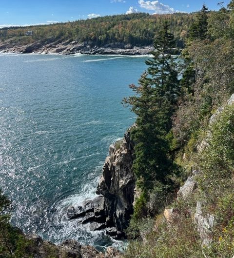
Instead of walking the busy Shore Path and getting an eyeful of the cars, vans, and campers that drive through Acadia National Park, we choose to scramble down the cliffs and rocks to where the waves break white on the red rocks, and we climbed and clambered and jumped from rock to cliff to tide pool all the way up the shore.
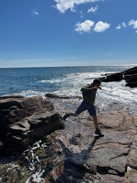
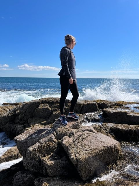
There weren’t many people and we had the time of our lives watching the waves, scrambling up the cliffs, finding mussels and snails, timing our steps so as not to get splashed, and picking a difficult path through the absolute most beautiful and breathtaking part of Acadia.

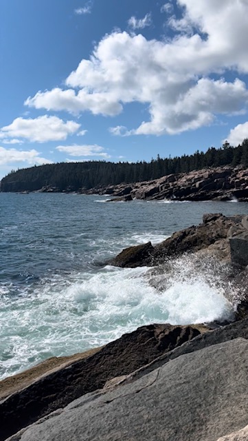
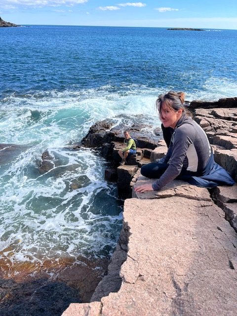
By the time we reached the car, we were very hungry! We’d spent nearly six hours climbing and hiking and exploring, dashing back and forth like children, lying on the cliffs to lean over the side and watch the frothy waves, picking our way across wet, slippery rock to reach a dry spot before the next wave rolled through and soaked us.
We ate our packed lunch at Sand Beach and took a quick nap in the sunlight while listening to the crashing waves and the screams of delight from the children brace enough to run through the cold water.
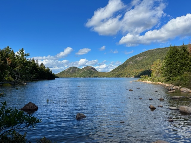
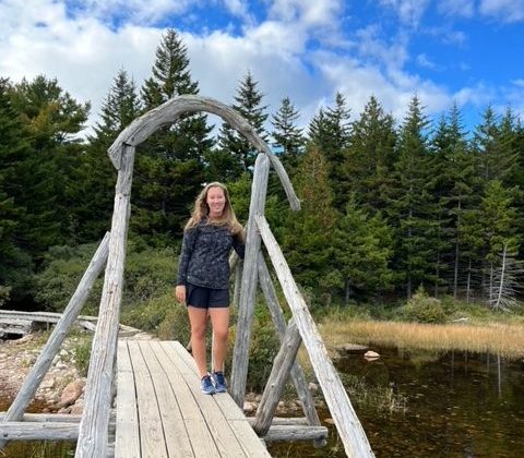
In the afternoon, we headed around the Park Loop Road again toward Jordan Pond. We did another hike from the Bubbles Parking lot and then down to walk part of the Jordan Pond Trail. We had it mostly to ourselves until we neared the Jordan Pond House, but it was late enough in the evening that the trail still wasn’t too busy. It was incredibly peaceful and an easy hike compared the morning. The pond (whose status as ‘pond’ felt very misleading) was perfectly still and the trail ran only a foot from the curvy shore. Above our heads, the tree canopies made a tunnel and branches hung low over the water.
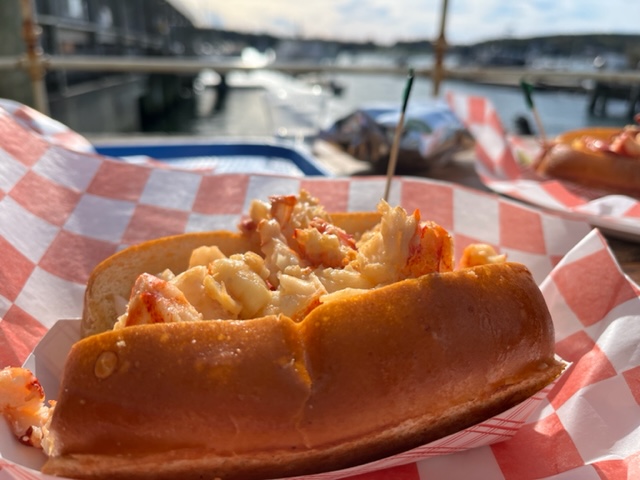
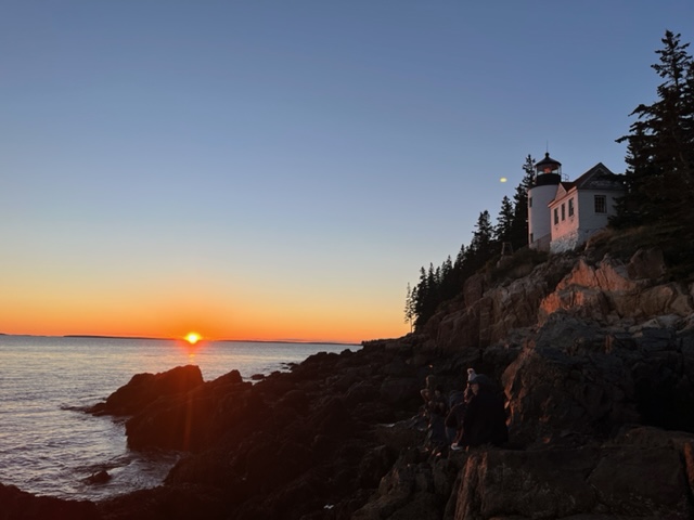
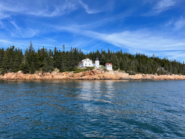
We ended the night at the Bass Harbor Head Lighthouse, where a local recommended we go to watch the sunset. Unfortunately, it was not a well-kept local secret and it was crowded with tourists. Next time, I would skip this despite the pretty picture. But dinner at Thurston’s Lobster Pound was well worth the drive! (Though, for those interested in such things, Beal’s was the best lobster of the whole trip).
Bar Island Path
The next morning, Dad and I got up early to walk the Bar Island Path (remember the Sand Bar where we almost took a swim on the first day). The sand bar is accessible from 1.5 hours before low tide to 1.5 hours after. We headed over at 7 am, with low tide falling at 8:11.
It was a lot chillier than the day before, reminding us that despite the sunny days, we are still headed toward winter.
There is very little sand in Maine (which is why Sand Beach in Acadia is especially wonderful), so the so called ‘sand bar’ is actually made of broken shells and small rocks pounded smooth by the waves. The path is wide with small inlets of water encroaching and tide pools scattered like moon craters. Giant strands of seaweed, brownish green and edged with ruffles, lay scattered like abandoned party streamers, and when we followed the strand, often we could find the skinny end attached to a rock no bigger than a baseball.
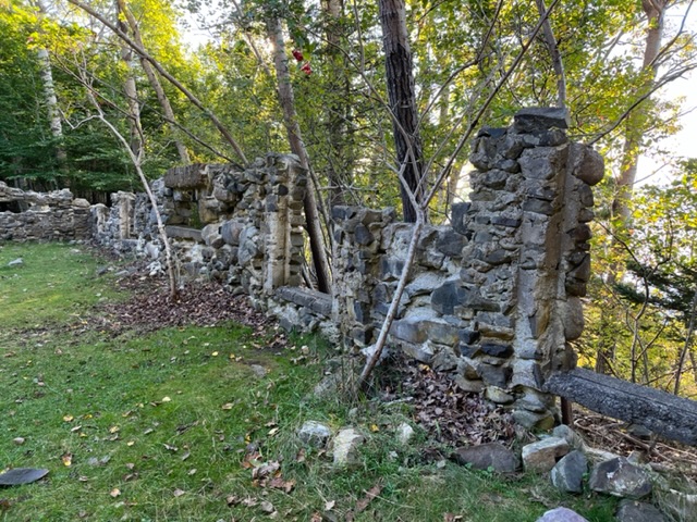
Once we reached the Island, we discovered a large path that leads to the highest point on the humpbacked island, but we cut off on an (unofficial) side trail long before reaching that point because we didn’t want to walk with everyone else. We circumnavigated the island on our small path, got good views of Bar Harbor through the trees, stumbled across the remains of an old stone house where we sat and speculated about who might have lived here and why they had a three-sided fireplace, and got back to Bar Harbor with plenty of time to spare. No getting trapped on the island!
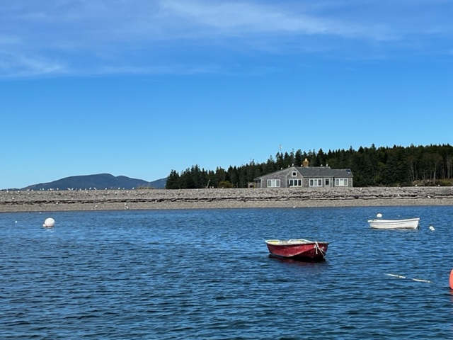
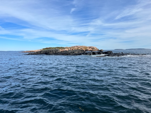
Bass Harbor Boat Tour
After lunch, we drove across Mount Dessert Island, heading back to Bass Harbor, where we’d been the evening before. We were dying to get on the water, so we’d signed up for a touristy boat tour of the area. The bout tour was given by a couple from Bass Harbor and they told us stories about growing up in a small lobstering community while also sharing the history of the area (granite quarries, cod fishing, logging, and finally lobstering), showing us native wildlife (such as seals, harbor porpoises, and bald eagles), and explaining the ins and outs of the lobstering industry in Maine today.
It was windy as the boat cut through the waves and water occasionally sprinkled my face when a gust hit just right. My lips were salty and my scarf pulled tight around my neck, but the cold was worth it to get a different view of Mount Desert Island and to see the animals in the harbor. We didn’t get too close because we didn’t want to disturb the animals, but we floated by several bobs of Harbor Seals (fun fact, groups of seals can be called a colony, a rookery, a herd, a harem, or a bob), we watched a pup flop himself onto a rock, then continue to bounce and flop and jiggle farther onto the rock. It was the cutest thing, even though we were so far away, to watch his little body try to bounce up the slick rock.
One of the coolest things our guides told us about the Lobster Industry is that, unlike most fisheries, it is not in crisis. More and more lobsters come out of the Maine waters, yet the population continues to grow. According to our guide, there are several reasons for this.
First, by-catch (lobsters that are caught but cannot be kept) are not injured in any way, and in fact, go back into the water better than they were before they crawled into the trap. Imagine: a too-small lobster crawls into a trap where he eats a bunch of bait and hangs out safe from predators for a few days before he’s hauled out of the water, measured, and tossed back. And then…down comes the trap in almost the exact same spot with more food. So he does it all again. Lucky little thing!
Second, back in the 40s, the lobster fishermen and fisherwomen in Maine realized that they wanted their children and grandchildren to have the same way of life as them (catching bountiful amounts of lobsters), so they decided, as a lobstering community, not as state law, that any female lobsters who had eggs on their tail (female lobsters carry fertilized eggs on the swimmers under their tail for 9 to 12 months) would not only be thrown back, but would be marked so that any future fishermen who caught them (regardless of whether the female was actively carrying eggs or not) would NEVER keep that lobster. Here’s why this is so important.
A 1-pound female lobster might carry 8,000 eggs. When she finally releases them, on average, only 1 will survive. But a 9-pound female can carry 100,000 eggs. And the bigger she gets, the more eggs she’ll carry and the more eggs will survive. Therefore, it was important to the fishermen that a lot of females are able to grow really big and keep producing more and more lobsters.
And keep feeding more and more tourists as they travel to see the wonders of Acadia National Park and enjoy the delicious seafood!
The Story Continues…
Part 2: To the Main! — Heading Inland like the Fishermen of Old
Part 3: Colorful Camden: Sea Winds, Mountain Views, and Lobstah!


You May Also Like
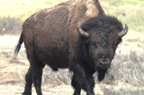
Where the Buffalo Roam–Some Thoughts on Yellowstone NP
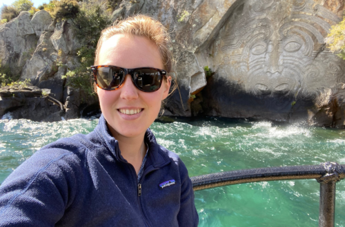
1 Year of New Zealand Selfies: September & October