Ducking Ropes and Slippery Slopes in Piha
I’ve heard it said that the west coast of New Zealand on the North and South Islands alike is the “wild west.” The waves are bigger, the coasts are rockier, the people are fewer.
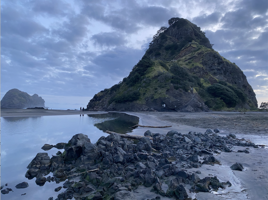
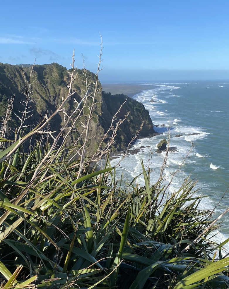
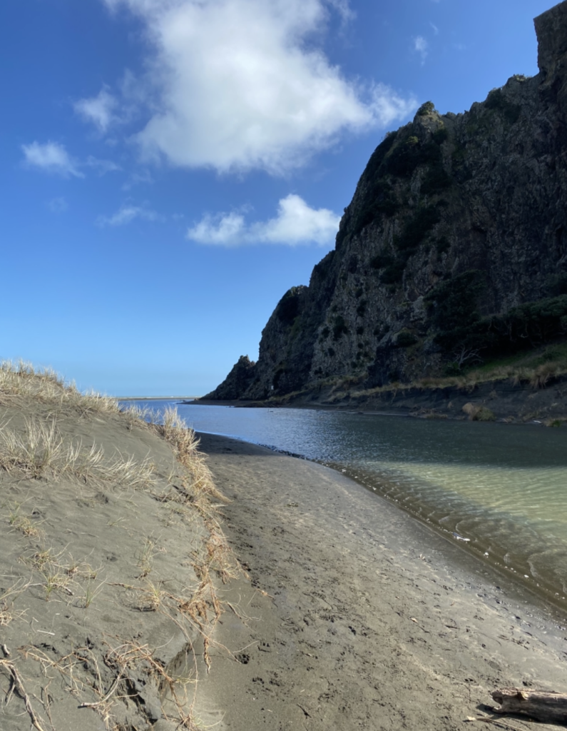
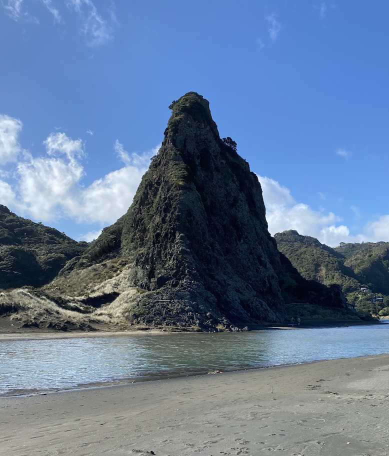
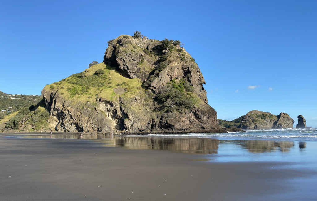
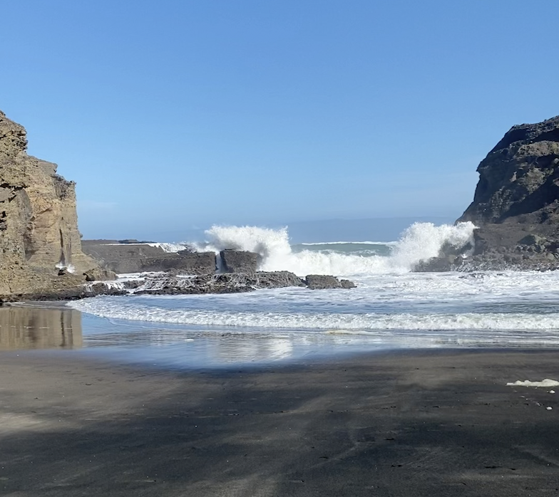
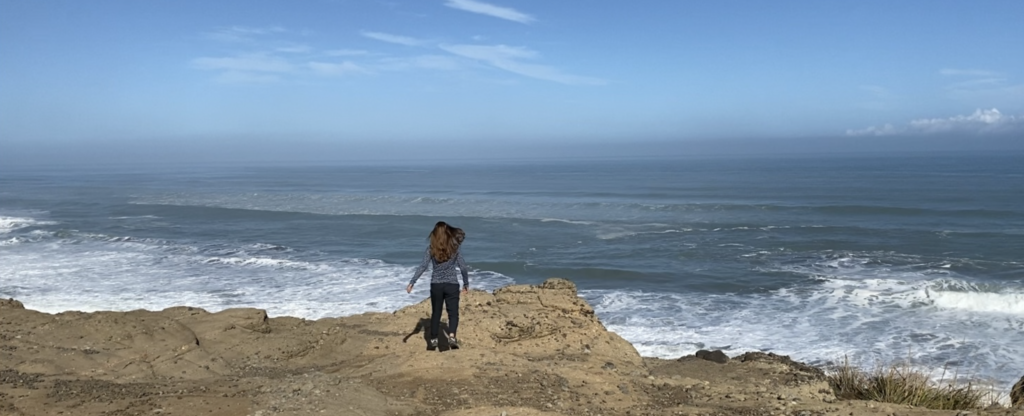
Piha, about a 45 minute drive from Auckland through the Waitakere Ranges, proved much of this to be true. The black sand beach’s most prominent feature is Lion Rock, which rises out of a sea of sand and a sea of waves to tower above the beach and the town. The waves beyond crashed and smashed and thundered, tossing and frothing like a herd of wildebeests. On each end, the beach was framed by rising mountains and stark, steep cliffs that rebounded the waves back into the surf and sent jets of water shooting into the sky.
On a sunny Saturday afternoon, the beach was the busiest place I’ve seen during my time in New Zealand, but being such a short distance from Auckland, I’m sure that’s inevitable. So, the third part of the above statement still remains to be seen. However, the first two: bigger, rougher waves and a more dramatic coastline certainly proved true in Piha.
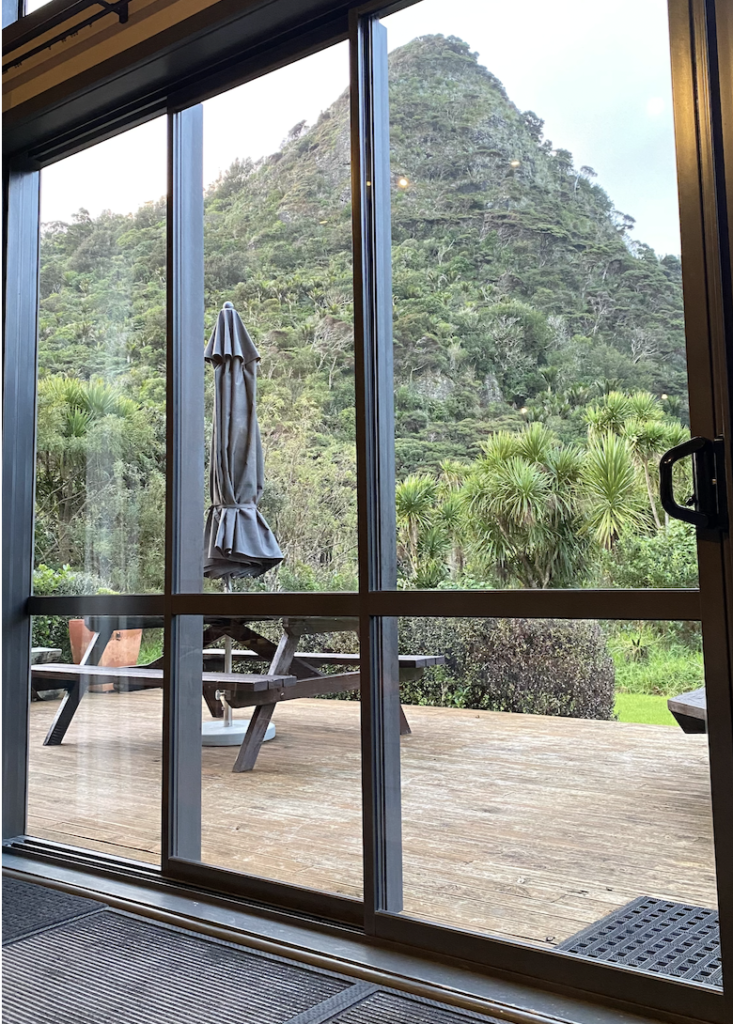
In addition, Piha still boasts scars from the hurricane last February. In fact, many of the hiking trails I was looking forward to experiencing were closed due to storm damage. When I arrived at my hostel (Piha Beachstay), the local host had a flyer with the nine most popular hikes in Piha hanging on a cork board. I asked him which ones were actually open and he grimaced. “Only one.”
One out of nine.
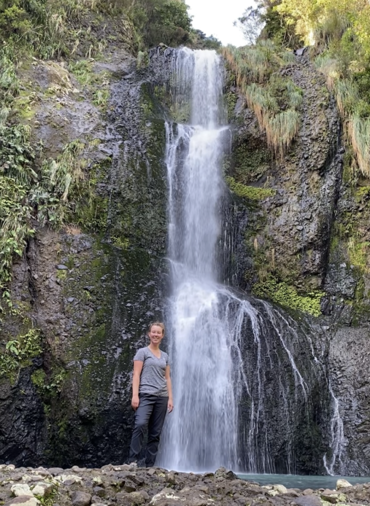
A German girl working at the hostel walked up and the owner asked her what hikes she’d done while here. She named a few more–one in particular that perked my ears up: Kitekite Falls. I’d marked those falls on my map of things to do long before I’d gotten here, but all my Googling had shown that one was unequivocally closed.
“That’s right,” the host said. “You can just climb over the closed sign. That’s what the locals do.”
That brought my head up for a moment, and the seed was sown.
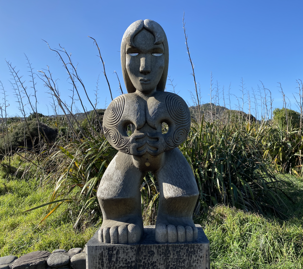
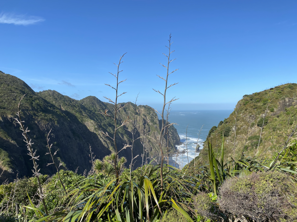
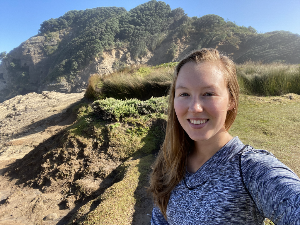
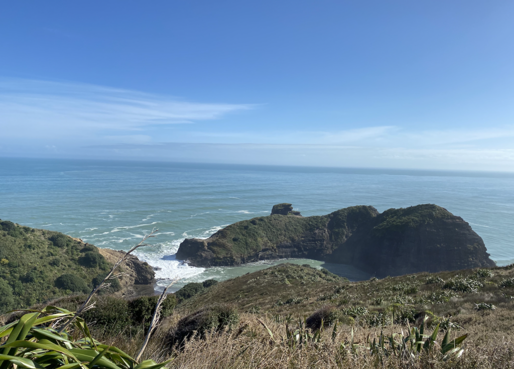
I started out responsibly, I will say. I did a hike that was open called Mercer Bay Loop and it was a short, beautiful loop with lookouts over Piha and the Tasman Sea. It snaked down to a Maori Pa site, one perched upon a mountain that fell in a sheer cliff down to the sea. Dramatic gorges and gullies edged right up to the water in a clash of land versus sea power.

The Loop had several trails leading off of it and I was dying to see more, but each one was closed due to storm damage. The frustration was starting to build, and with it, the same reckless spirit of the “wild west” that sprayed up from the churning waves.
So I hoped in my car and turned onto a closed road. Closed to all but residents, so it wasn’t like the road was going to collapse beneath me. It was hardly a rebellion. I cruised down the mountainside and down to Karekare Beach (pronounced like the name Carrie said twice). Another black sand beach, this one has nothing so disruptive as Lions Rock rising out of the middle of it, but a dramatic slice of mountain does lead down to the waves. I’m not sure who gave Lions Rock it’s name, but if they’d ever seen a bison, they might have named this one Bison Rock.
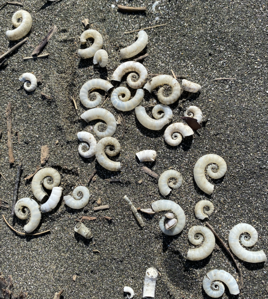
With the road “closed,” the beach was abandoned, and I strolled along the seething waves and contemplated the delicate white shells cracking beneath my feet.
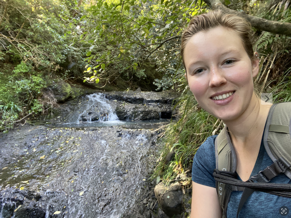
A short climb up the road led to a forest path to a towering waterfall: Karekare Falls. The waterfall was needle-narrow and fell from a great height, but it was the glistening pools and tiny falls along the way that I found most enjoyable.
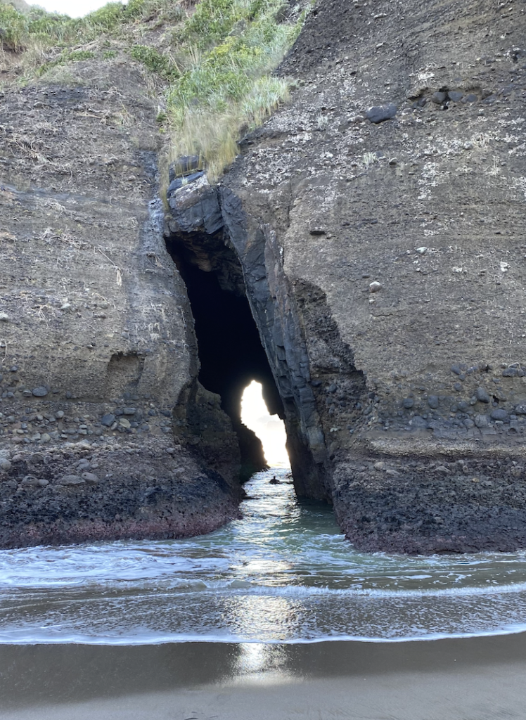
The next morning I headed toward Piha Beach. I’d walked the entire length of it the day before, but today I wanted to check out the south end. In a mash-up of mountain and beach, there are several places on the south end of Piha Beach where the black cliffs have broken away and the waves surge through. Some are just cracks in the rock, like the Keyhole and the Blowhole, while others have been chiseled away for far longer.
I climbed up to another lookout and sat sheltered among the mountains and looking out over the waves for quite some time. With the sun behind me, each crashing wave, right at the moment it broke, threw mist into the air that glistened like a rainbow cape as the curl of the wave plummeted to meet the ocean beneath it.
Alas, like a foolish inlander, I relied on someone else to tell me that they were pretty sure the tide was going out. It was, in fact, coming in. So the hour I sat upon the cliff lookout meant that I descended to find that what was once a beach of sand was now a thrashing eddy of water.
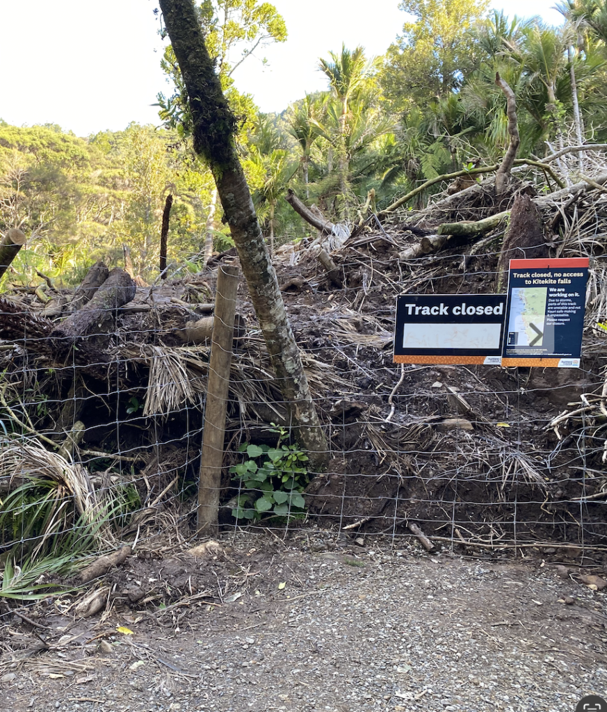
And the high tide track back to Piha town? Well, that was also closed due to storm damage. But it was one of the hikes the German girl had said she’d simply climbed the temporary fence to access.
It was venture upward on the closed track or wait four hours for the tide to recede.
I took the track.
It was a beautiful walk about one hundred feet up on the mountainside. The track sported no obvious damage aside from a downed tree or two and I continued on, feeling quite free. Soon, I could see the parking lot and the road and, presumably, where the track ended.
And then there was a cliff.
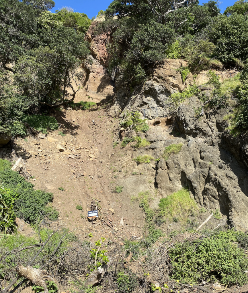
The major problem with the hurricane that passed through was all the rain, which caused extensive and massive mudslides. And here, where I was perched thirty feet up on hillside, was one such massive slide. It had taken out the trail and left only hardened dirt and rock in it’s place that fell to meet the beach at a sheer angle.
I could go back. By the time I reached the cove, I’d only have to wait three more hours for the tide fall. I vacillated back and forth, even climbing a little ways back up the trail to see if there was a better place to scramble down, but it was all steep.
So I sat down on the edge of the trail, shimmied my butt over to the edge, and found a foot hold. Gripping thick roots and the few bigger rocks, I crawled and shimmied and slid the thirty feet to the bottom.
Wild west indeed!
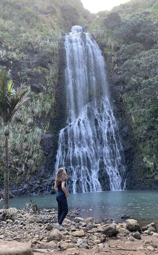
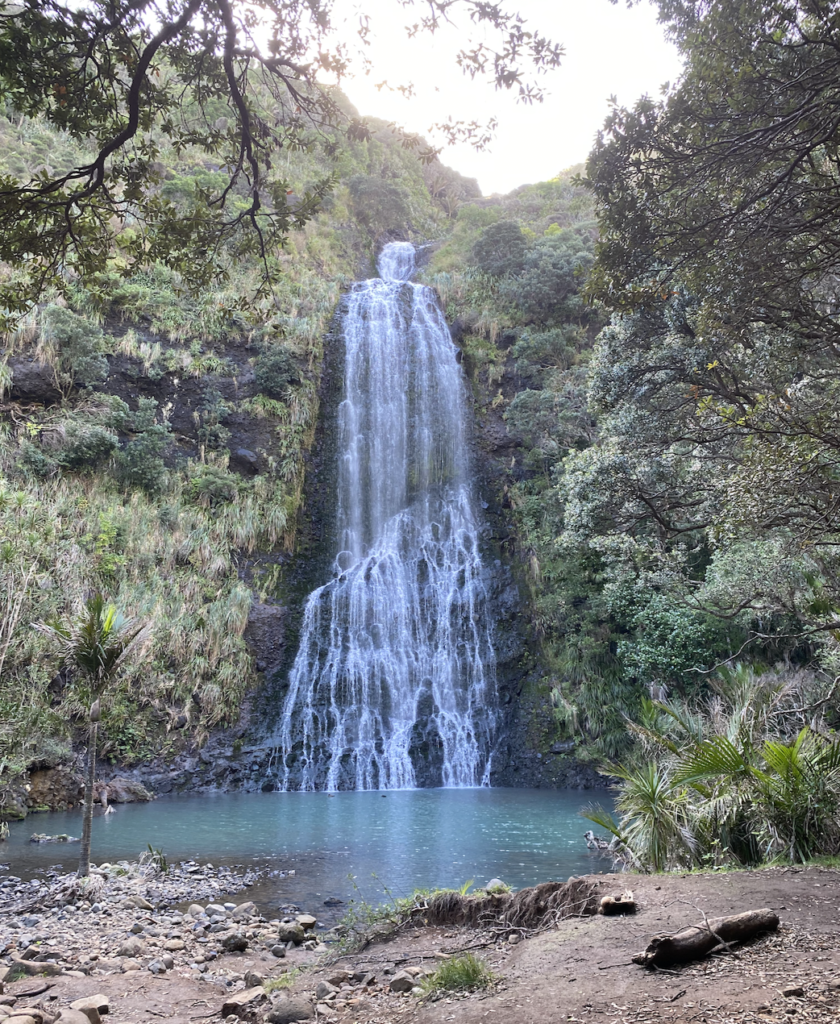
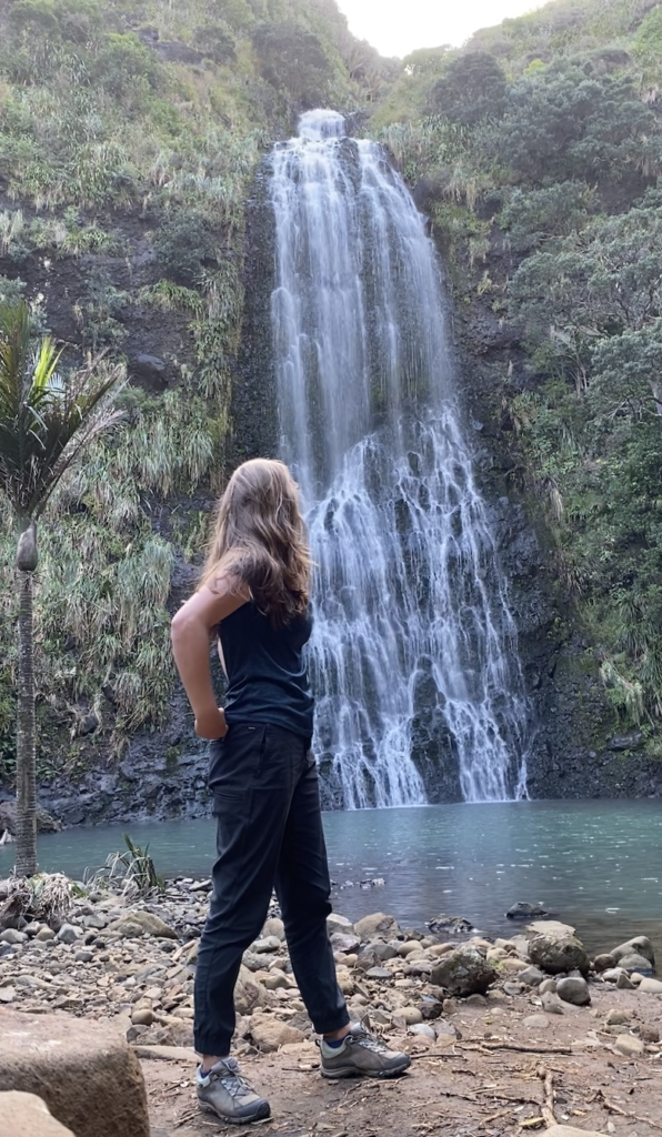
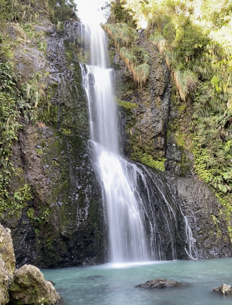
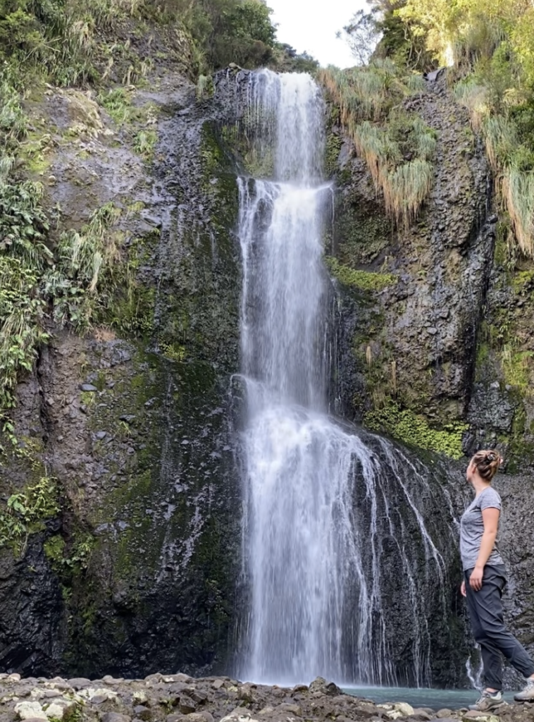
Feeling exuberant from my success, though also covered in dirt and quite cognizant of the fact that the hardened dirt could have given way at any moment and my mostly controlled slide would have become an uncontrolled tumble, I decided to give Kitekite Falls Track a try (pronounced like “kitty-kitty”).
The beginning of the track was open and it followed Kitekite stream through the woods. I passed several groups of people and my curiosity grew. Were all these people only walking the stream path, or had they gone all the way to the falls too?
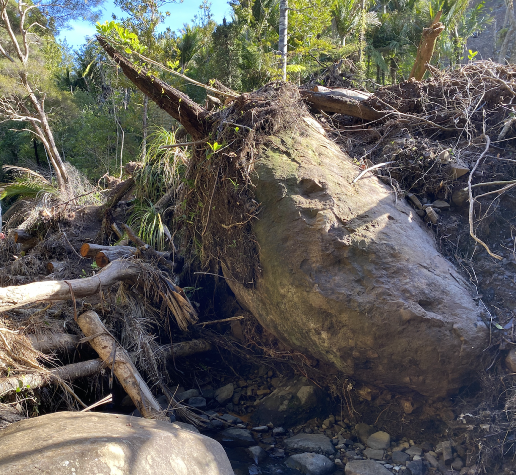
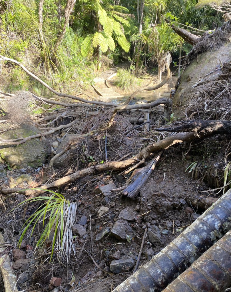
Halfway down the trail, another major mudslide had taken out the trail and spread wide over a good portion of the river bank. Unlike on the high tide trail, the debris of the mudslide hadn’t been cleared yet, so enormous rocks, snapped tree trunks, and piles of mud and dirt taller than my head were smeared across the valley like a giant might spread a hunk of chunky peanut butter.
First climbing around the closed sign and temporary fence, I stuck close to the stream’s edge, I clambered over tree trunks and hopped from rock to rock among the slow-moving water. And then I was past. Easy peasy compared to the morning scramble.
As New Zealander’s do love their steps, it was entirely uphill from there. This felt like true rain forest with everything damp and glistening even though it hadn’t rained in several days. The track eventually split, one trail leading down to the base of the falls and the other going up to the top. I will always choose to do the uphill climb first, so I headed to the top.
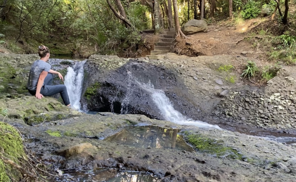
There, I found what I suspected to be true–I was not the only rebel. But I waited only a few minutes and the other group cleared out, leaving me to enjoy the brink of the falls on my own.
I encountered another group at the bottom of the falls (and many more walking out, so climbing over the fence is not a well-kept Piha secret). I suppose they all decided to embrace the wild west spirit.
Though I didn’t see any of them sliding/falling down the cliff by the high tide track!


You May Also Like
A Gem in the German Alps: Garmisch-Partenkirchen in Springtime
My Love for Laos Restored by Looms and Rice