Arthur’s Pass: My Favorite Alpine Region of New Zealand
Don’t Drive Past Arthur’s Pass!
Arthur’s Pass, in the middle of the South Island, is one of the few roads that crosses from east to west. Todays road follows a route the Māori used for centuries, traveling to the west coast for pounamu, or jade, which they used to make tools, weapons, and adornments. Then it was “discovered” by a European after some Māori told him about it, and the pass is named him. The first road was built in less than a year because of the rush to link the West Coast gold fields Christchurch. Gold is king. A paved road was constructed later on, but it was stille quite dangerous and prone to slips, rocks slides, and avalanches.
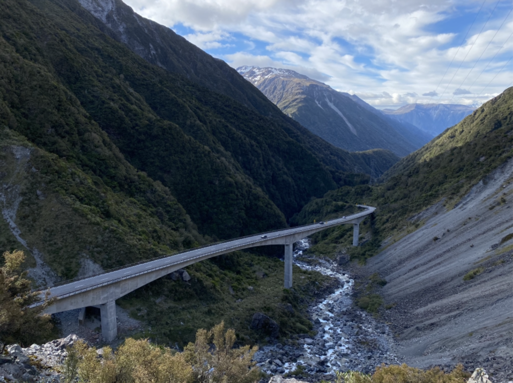
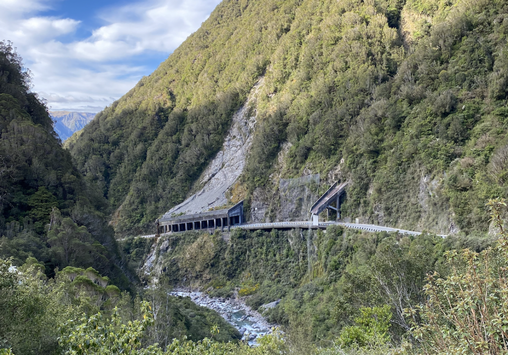
Arthur’s Pass road is a true feat of engineering. In 1999, the Otira Viaduct was built as a solution to the many deaths and burned-out brakes as a result of the steep, narrow, and winding road. Now, there is a narrow and steep (but less steep) viaduct (essentially a bridge) that is super cool to look at.
Arthur’s Pass Village is a tiny village (about 25 permanent residents), and the train from Christchurch to Greymouth stops there. There’s a pretty tall waterfall that all the tourists driving east to west or west to east tend to stop at, but the true magic isn’t for the faint of heart. You have to climb.
Temple Basin
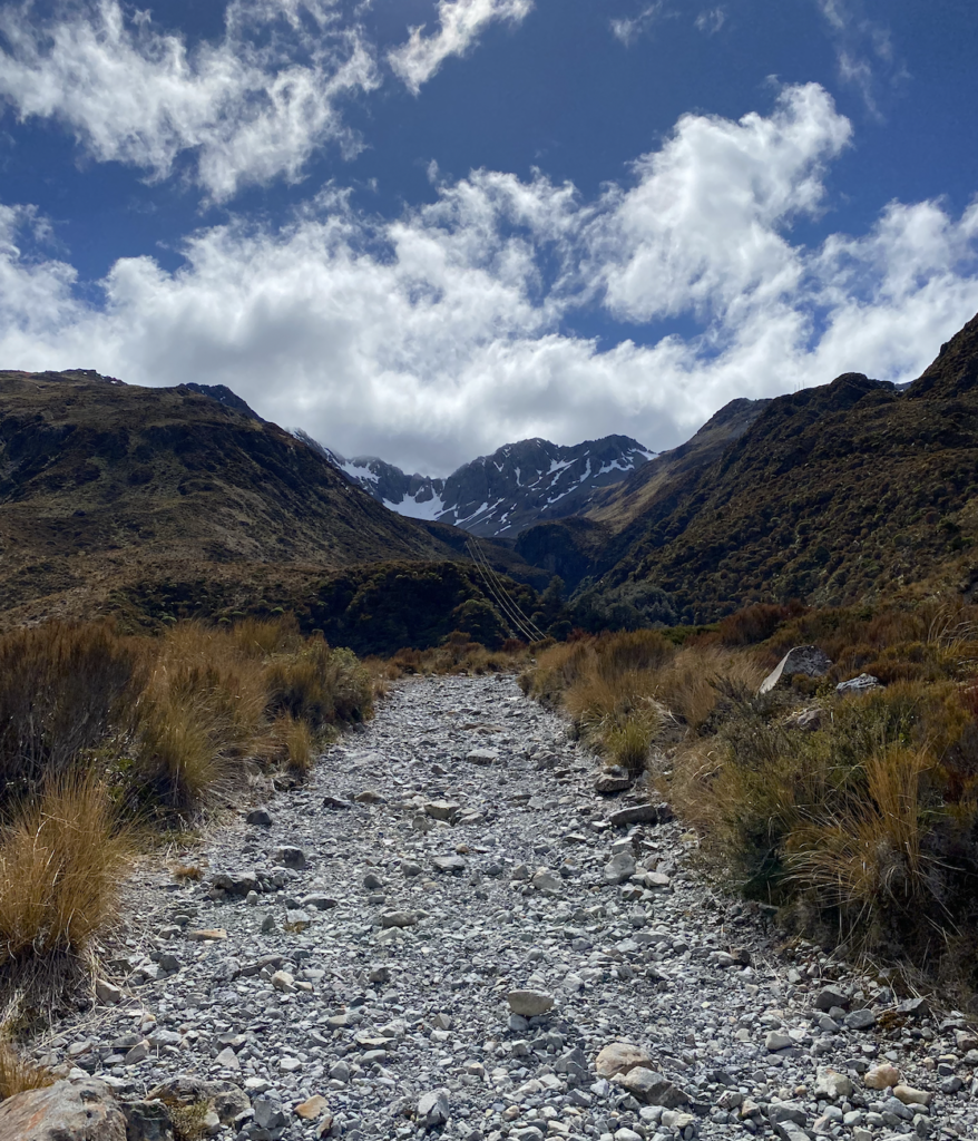
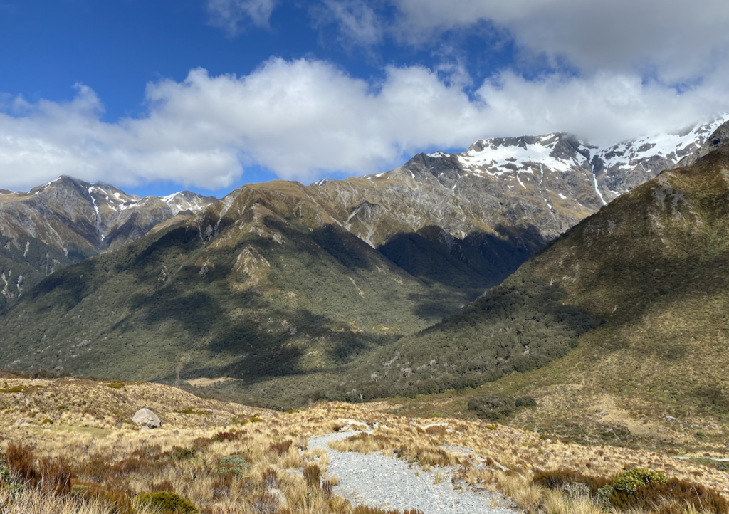
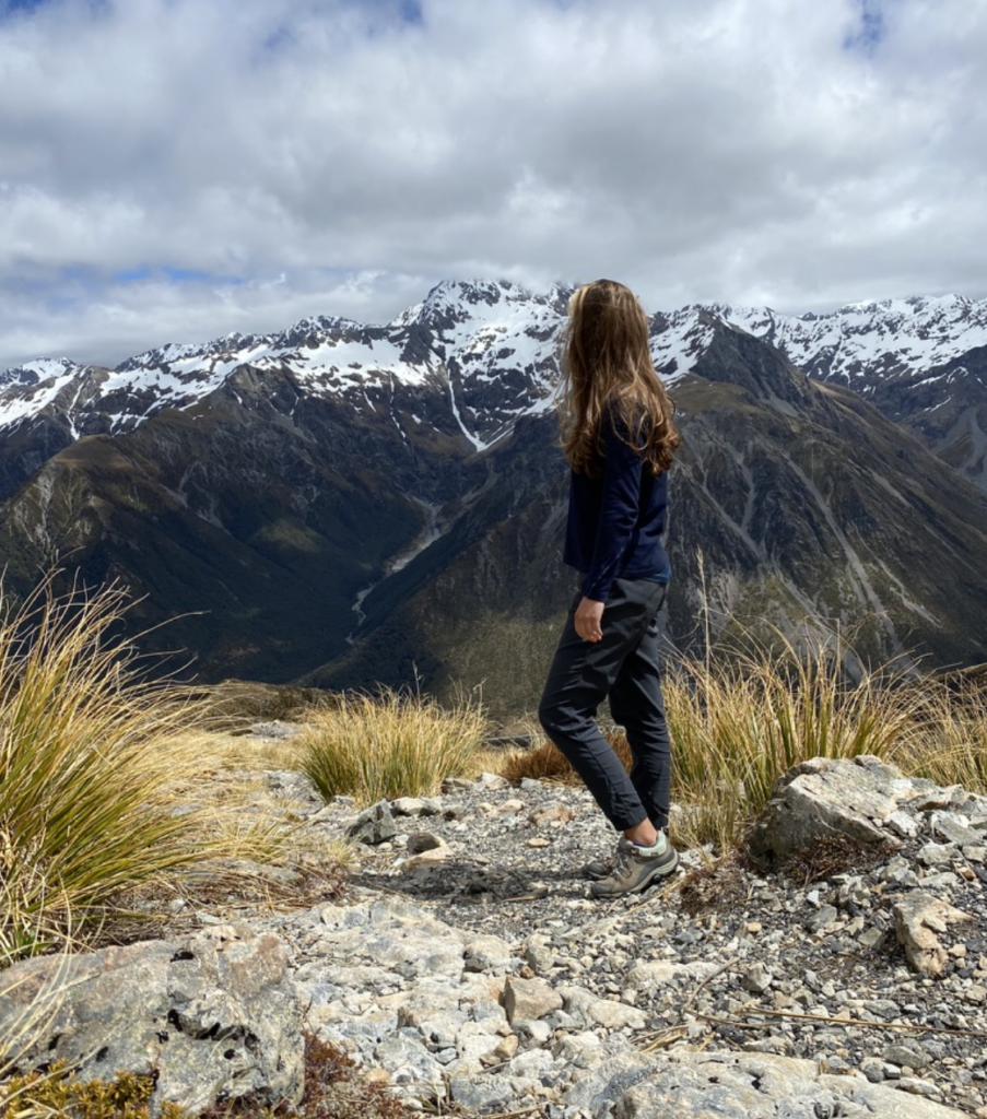
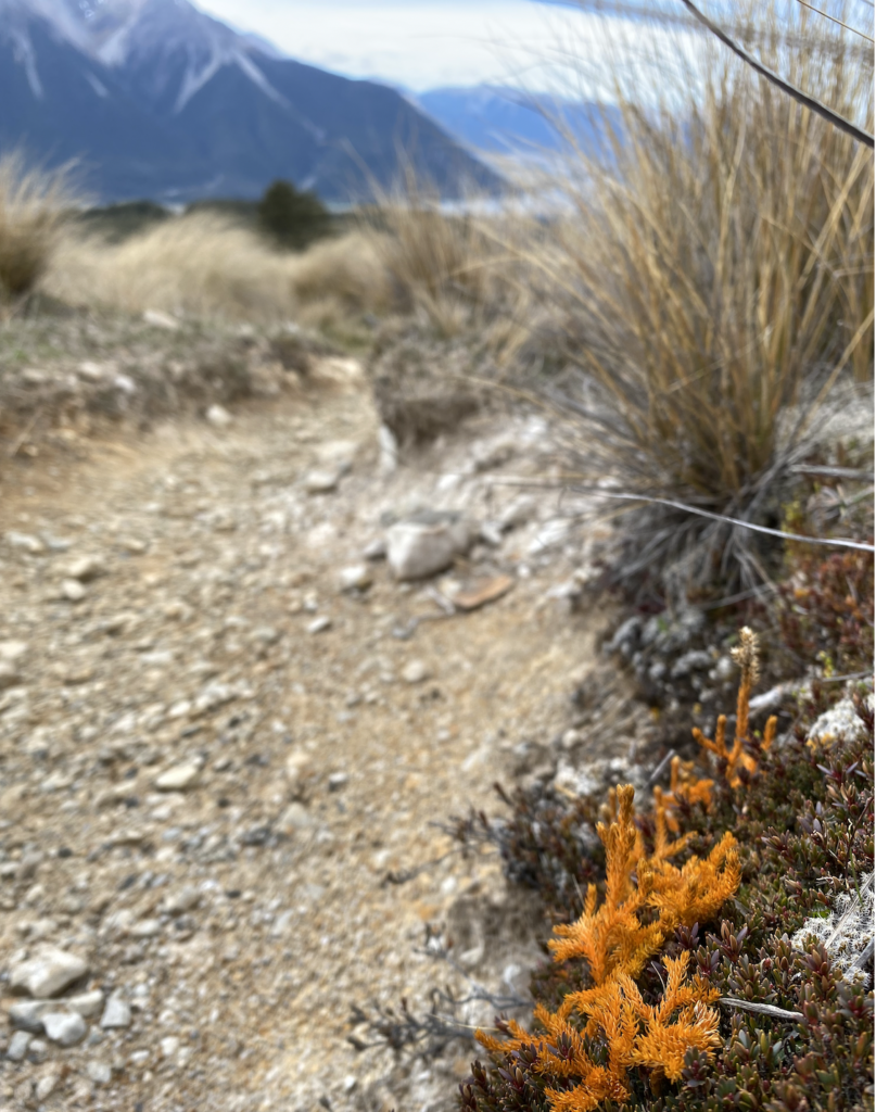
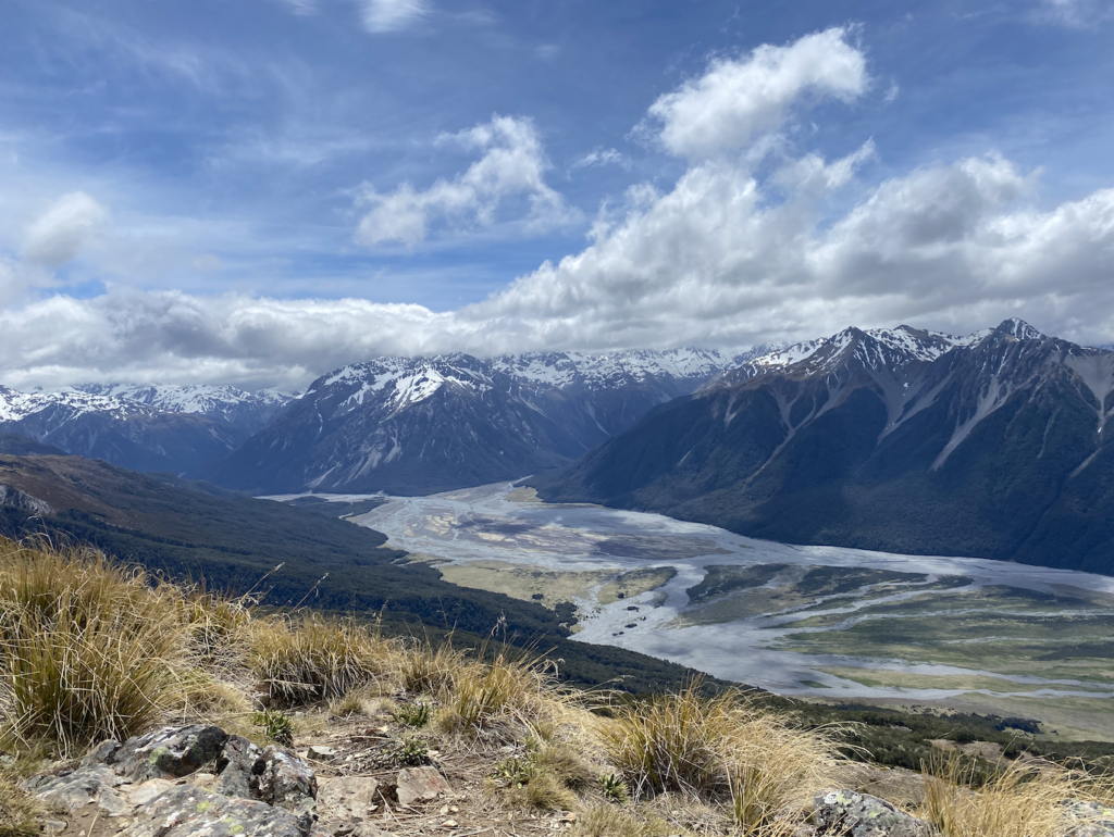
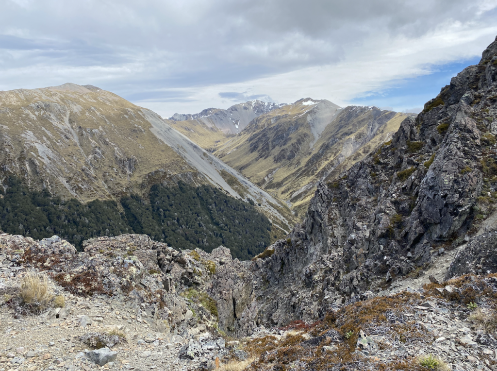
You know a valley is glacially carved because it is U shaped: a wide, flat bottom and steep sides. The narrow Arthur’s Pass Valley is a glacially carved valley, though not as wide and flat as many other glacial valleys in NZ. But the second feature–the steep sides–is very much present. My first hike was Temple Basin. Starting from the main highway, it climbs and climbs up a rock-strewn gravel road. Actually, I don’t even think it can be called a gravel road. It is a rock road. The road itself (which probably never actually sees vehicles other than possibly four wheelers) is entirely rocks ranging from the size of my fists to the size of my head. This part of the trail was actually the most difficult for me because the rocks move underfoot with every step, skidding and sliding so I was constantly half slipping back down the hill and teetering to stay balanced.
Later, the track lost it’s road-like feel and became a narrower and more stable trail, and also a steeper one. But by then I was too entranced with the scenery to notice. Finally I’d climbed high enough that the traffic zipping by on the road was no longer audible and the ribbon of road down below was starting to disappear.
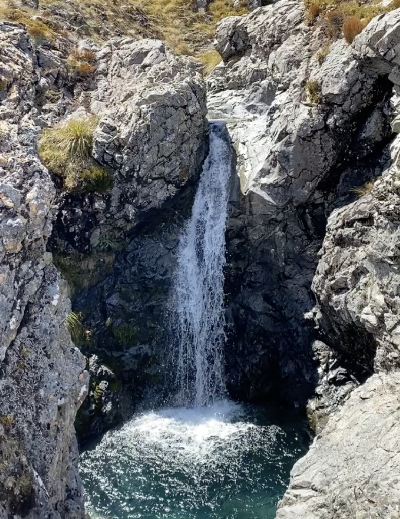
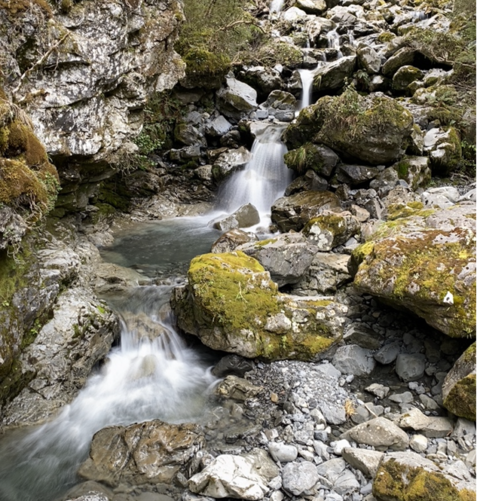
And there was a waterfall! The first, I would soon discover, of many.
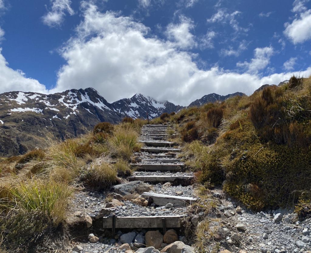
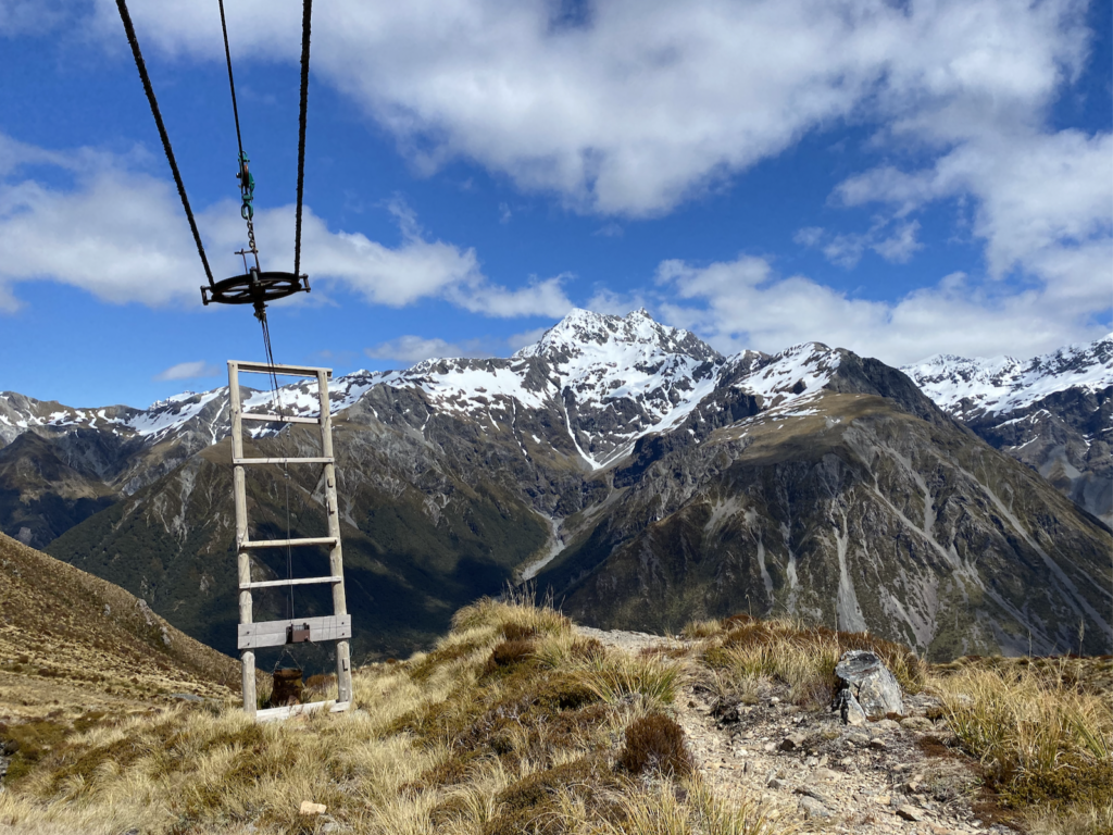
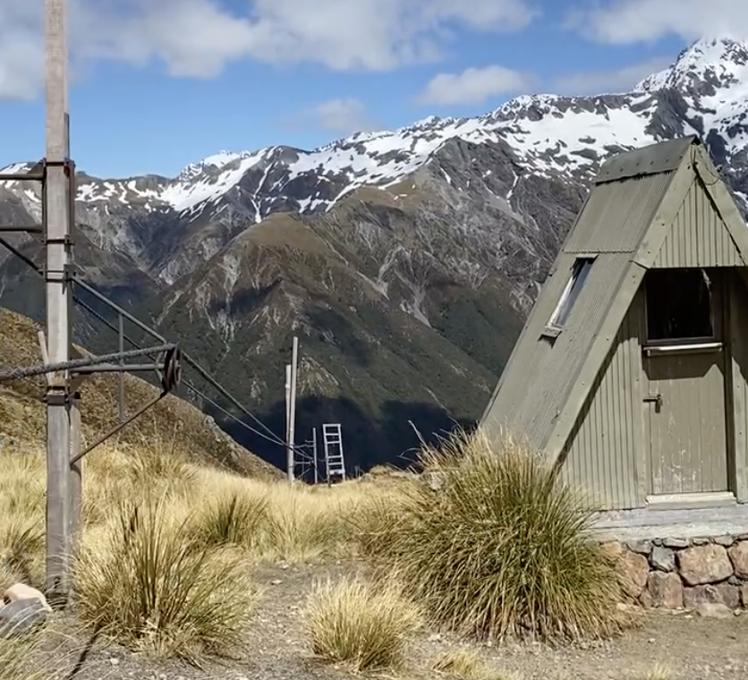
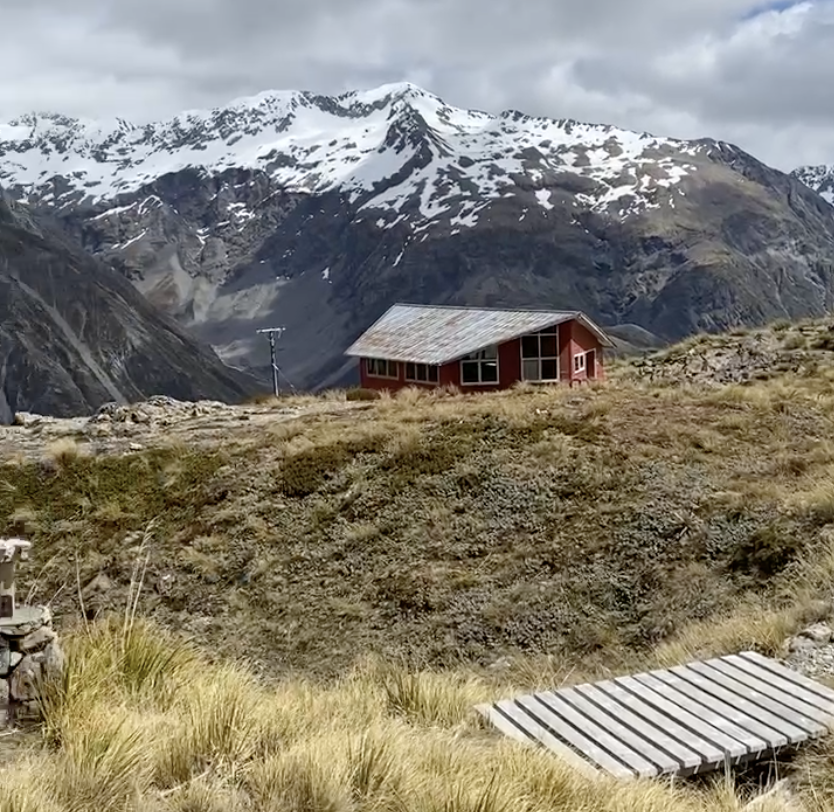
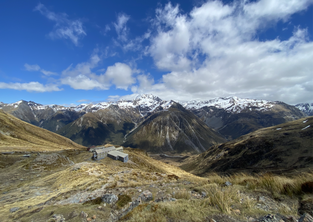
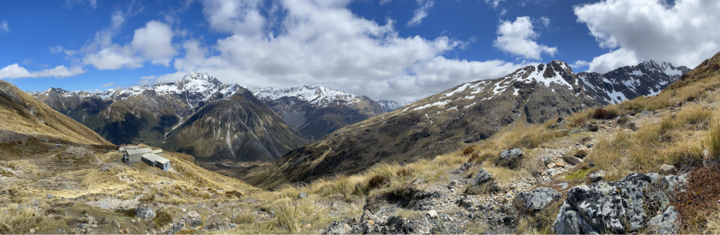
When I reached the end of the trail, I was shocked to find several sprawling lodges and chair lifts. I knew, sort of, that I was hiking in a ski field area because the parking lot had a sign for the Temple Basin Ski Field, but I hadn’t realized the track lead straight to it.
Part of my shock was because there is no way to drive to the base of the ski field. I’d just hiked an hour up steep terrain that is inaccessible to a car in the summer let alone in the winter. Turns out (I looked it up later) skiers and boarders do have to hike to the ski field. There is a goods lift about 800 feet away from the parking lot that will take up your bags and skis, but you physically have to hike yourself up the steep slope for an hour or two in the midst of winter just to reach the lodge and the base of the lifts.
That’s pretty cool.
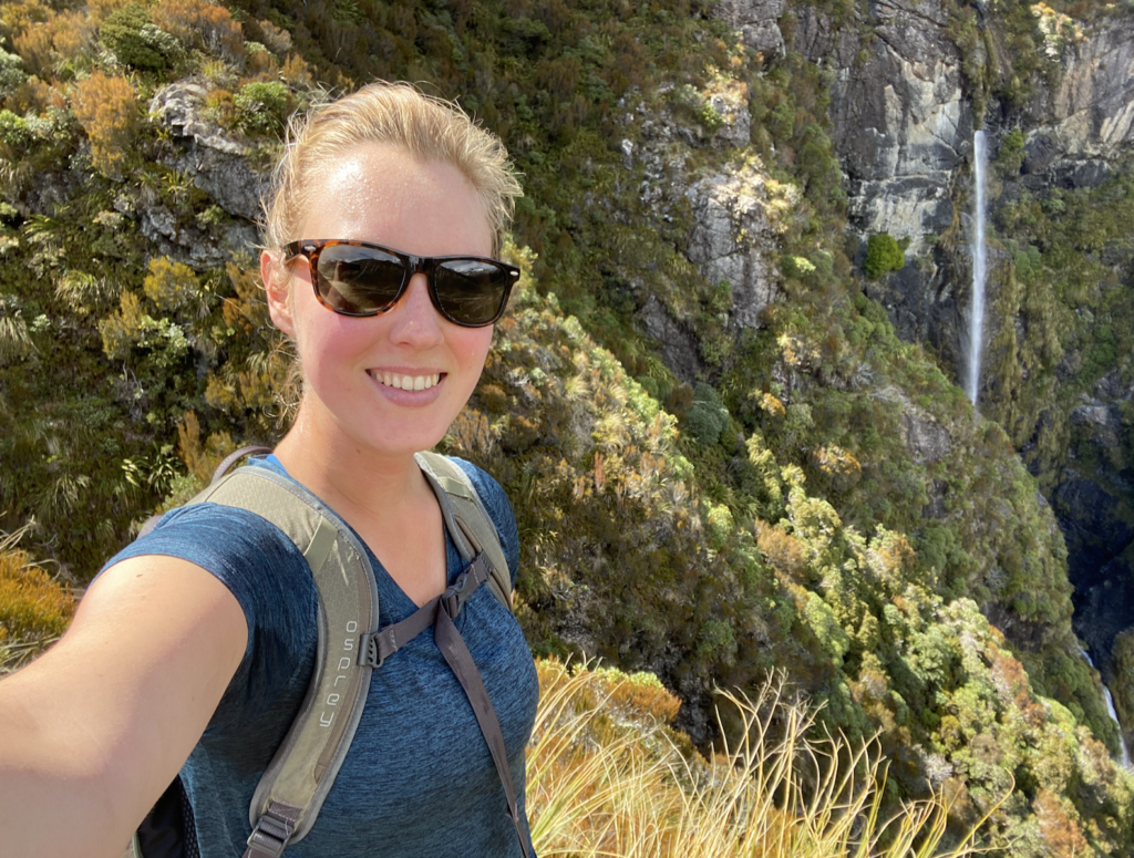
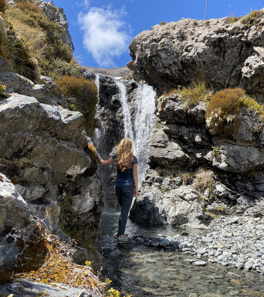
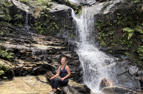
However, the best surprise was all of the water falls in the ski field basin. Most likely they are all seasonal snow-melt waterfalls, but maybe not. Either way, it’s clear that the water has been following these same paths for centuries. Deep canyons of at least 15 feet held crystalline roaring water. Many of the falls were impossible to really see the entirety of, but I was not to be completely deterred and managed to scramble my way down to the most accessible looking. It’s crazy how deep these canyons and sudden these cliffs are. The ski field must have to put up a lot of fences in the winter to stop skiers from falling into them.
The track ends at the ski buildings, but I scrambled up beyond them to take in the views down the valley. Doesn’t get much better than that.
Devil’s Punchbowl
The most famous attraction in the National Park is the Devil’s Punchbowl waterfall. Many blogs and tourist websites say it’s one of the most spectacular waterfalls in New Zealand. I agree that is it beautiful: 131 meters crashing down a vertical cliff face. But the amount of people…
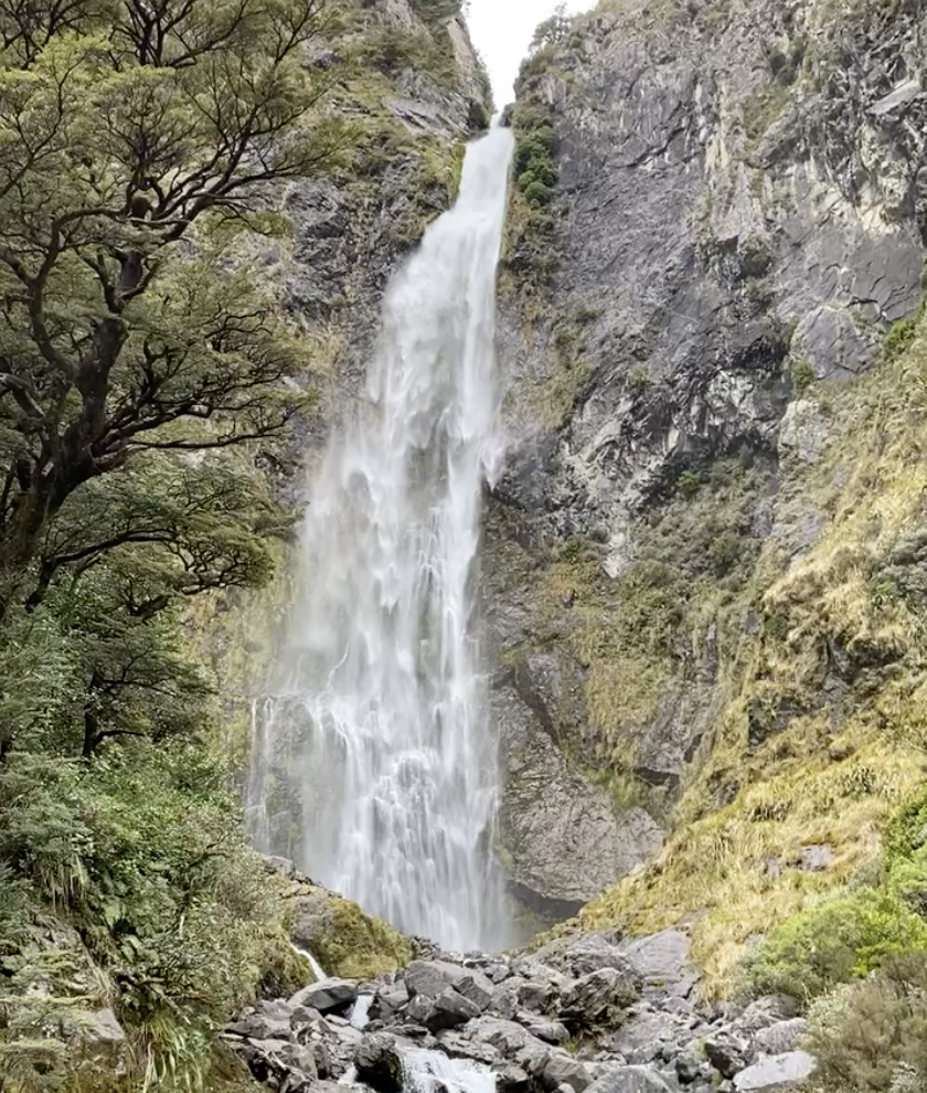
It’s definitely not one of my favorite NZ waterfalls. Especially not after having many smaller, unnamed waterfalls all to myself on the Temple Basin Track.
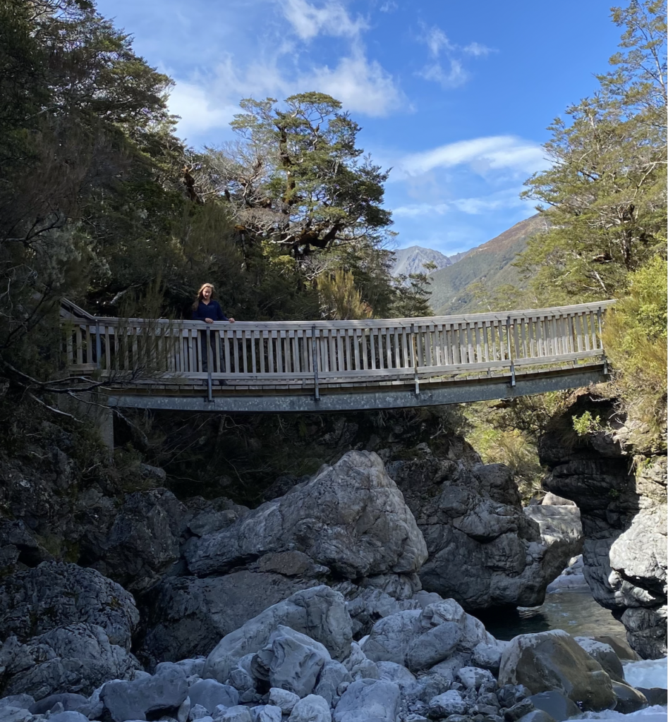
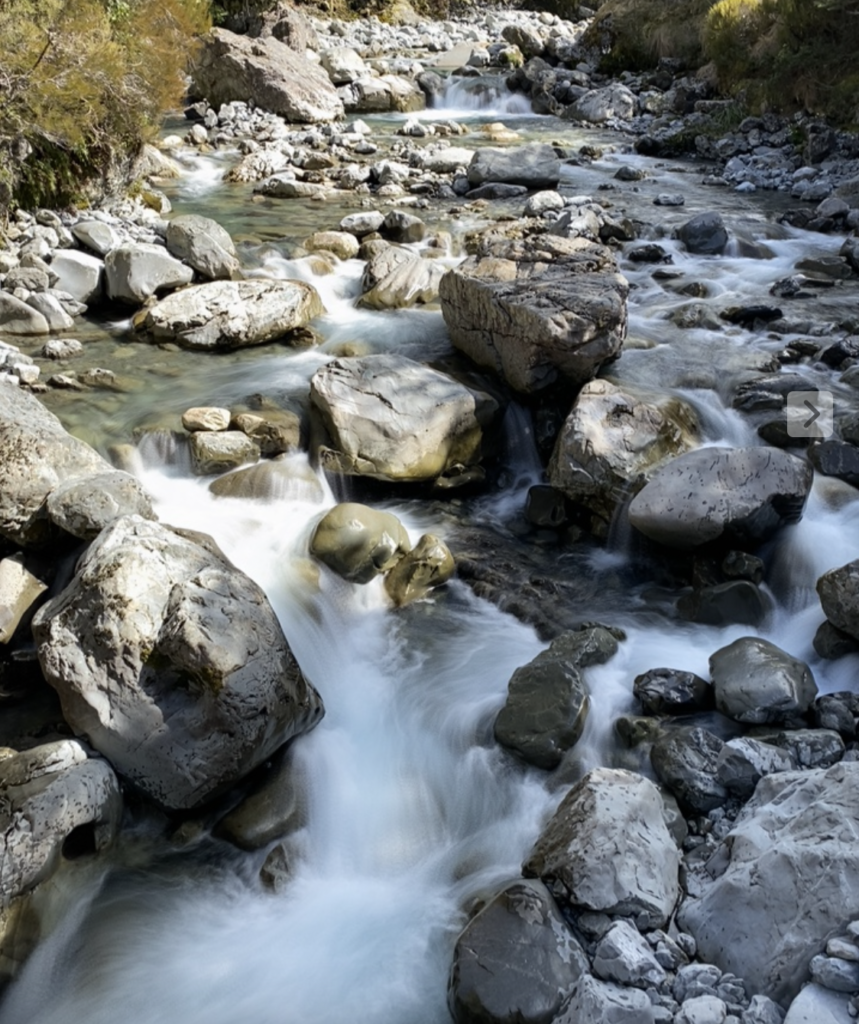
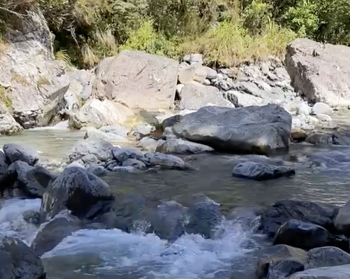
Bealey Chasm and Valley
A short walk near the top of the pass passes through stunning alpine forest to a river that contorts itself into a narrow rock chasm. Unfortunately, in my opinion, the bridge was really built in the wrong place. It’s the primary viewing platform, yet seems to block the most interesting parts of the chasm. I found the kea and the view beyond the chasm to be far more interesting.
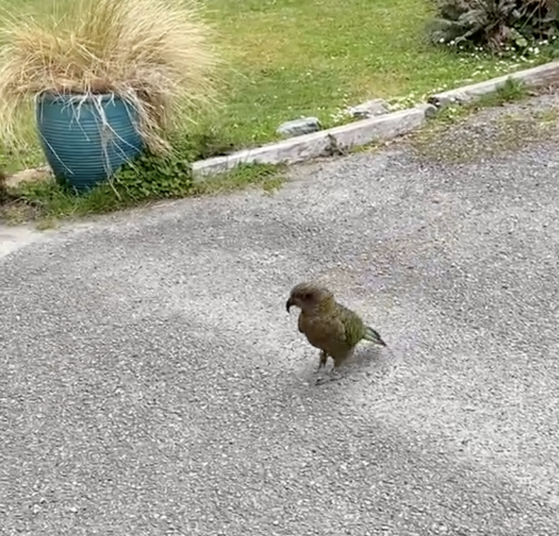
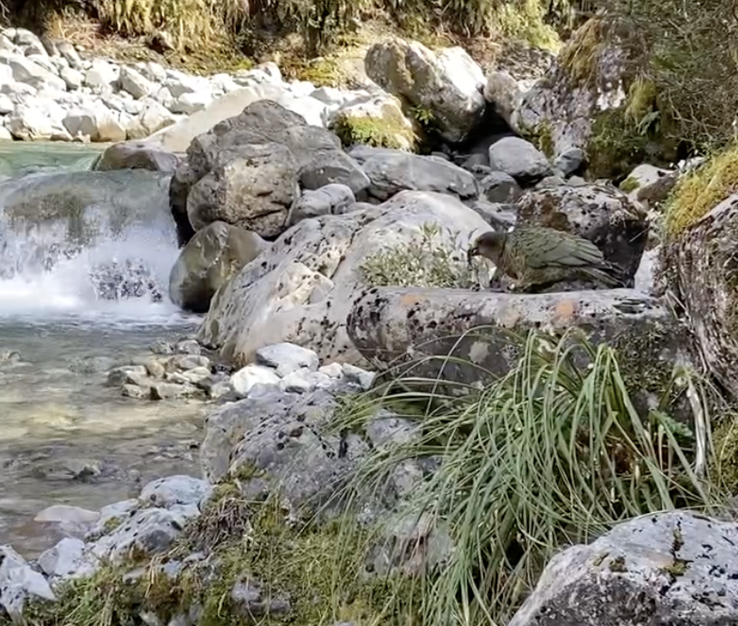
Kea are the worlds only alpine parrots and they can be found everywhere in Arthur’s Pass. Especially in the town itself. Kea are brilliant (with minds equivalent to that of a 4-year-old kid) and super mischievous. They love shiny things, will snatch sunglasses and gear that’s left unattended, and will destroy cars by pulling all of the rubber off the doors.
They are also beautiful: green with stunning red feathers beneath their wings.
I saw several in town, one even hopping after me in hot pursuit, like he was trying to shake me down. But I was also lucky enough to see one in the bush chowing down on a mouse. It’s good to see they don’t only eat stolen (or given) human food.

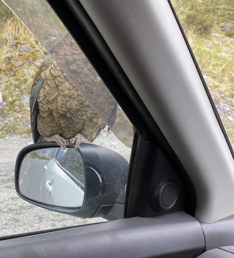
But NEVER feed a kea. Not only is it bad for them because human food doesn’t have the nutrients they need, but DOC research shows that it also makes them more likely to eat the poison pellets that DOC sometimes uses to deal with pests.
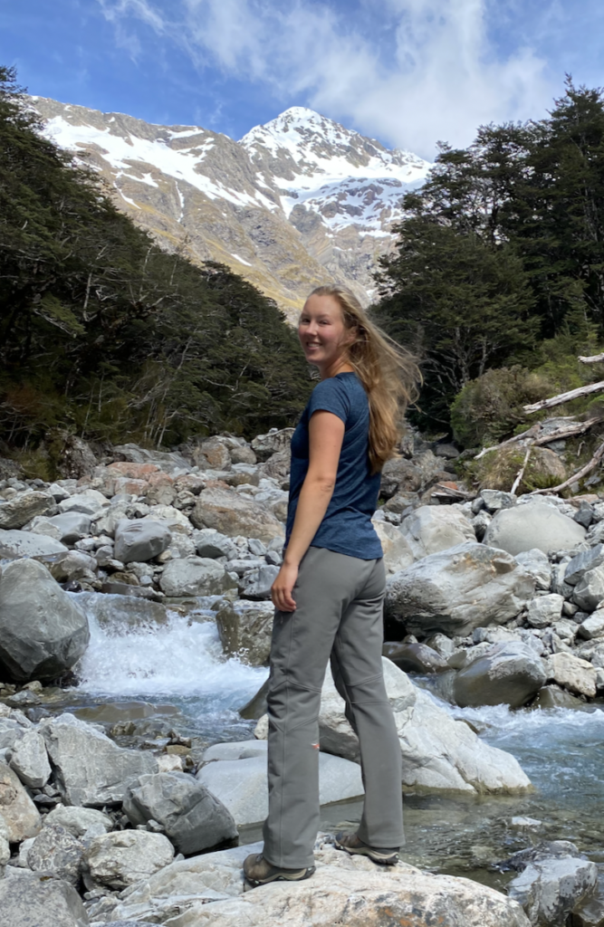
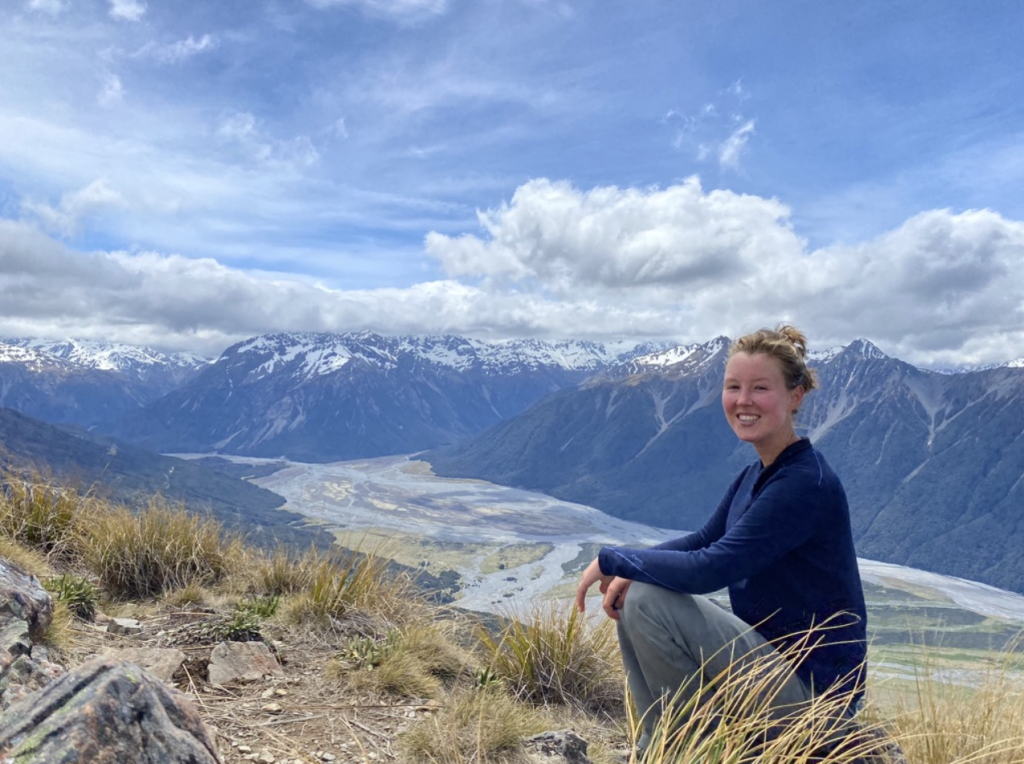
Bealey Spur
This hike is a bit further away, but the DOC website says it’s a great walk when the weather isn’t as nice high in the pass. Being further east, often it will be clear even when it’s raining and low visibility in Arthur’s Pass Village. That’s why I choose to walk it–to get some sun on a cloudy day–and I am so glad I did. This track makes my list of Top 5 Hikes I did in New Zealand (as does Temple Basin).
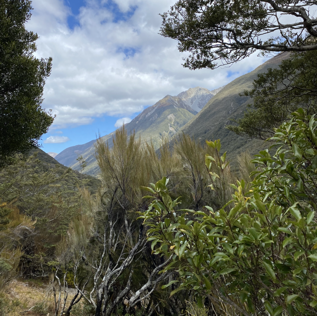
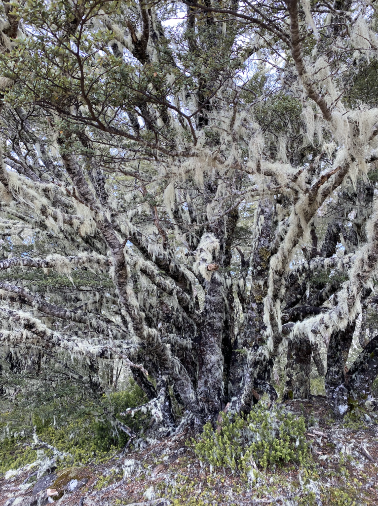
The track climbs steadily, though far less steeply than Temple Basin. It follows, as the name might suggest, a very long spur off of a mountain. The bush alternates between knotty pine forest, then scrubby bush and goblin trees, then high alpine beech forest (like the Bealey Chasm and Lewis Pass), and then scrubland, alpine wetland, and tussocks. The first half of the trail is entirely in the bush so the views are nonexistent, but the forest is beautiful (and varied, as I said). Additionally, after the Devil’s Punchbowl of the day before, I enjoyed that I only encountered a total of six other people on the ten mile return trail.
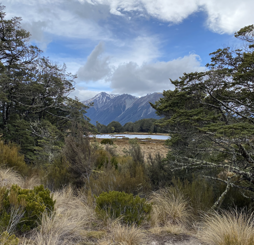
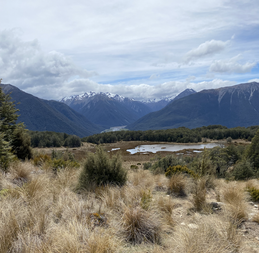
At about the halfway mark, the track passes through high mountain wetlands, and from there the views only grew more and more beautiful.
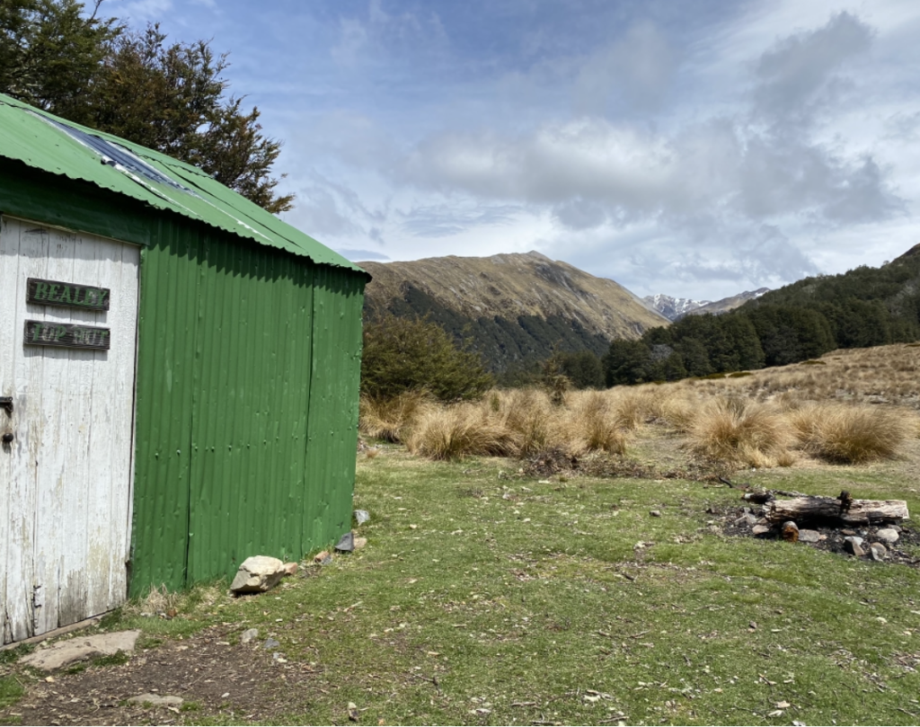
The track ends at a tiny green DOC hut (not one I’d ever want to stay at), but across the clearing I could see two people disappearing into another stand of trees. On the ground was a trail of footprints. So I followed.
Best decision ever.
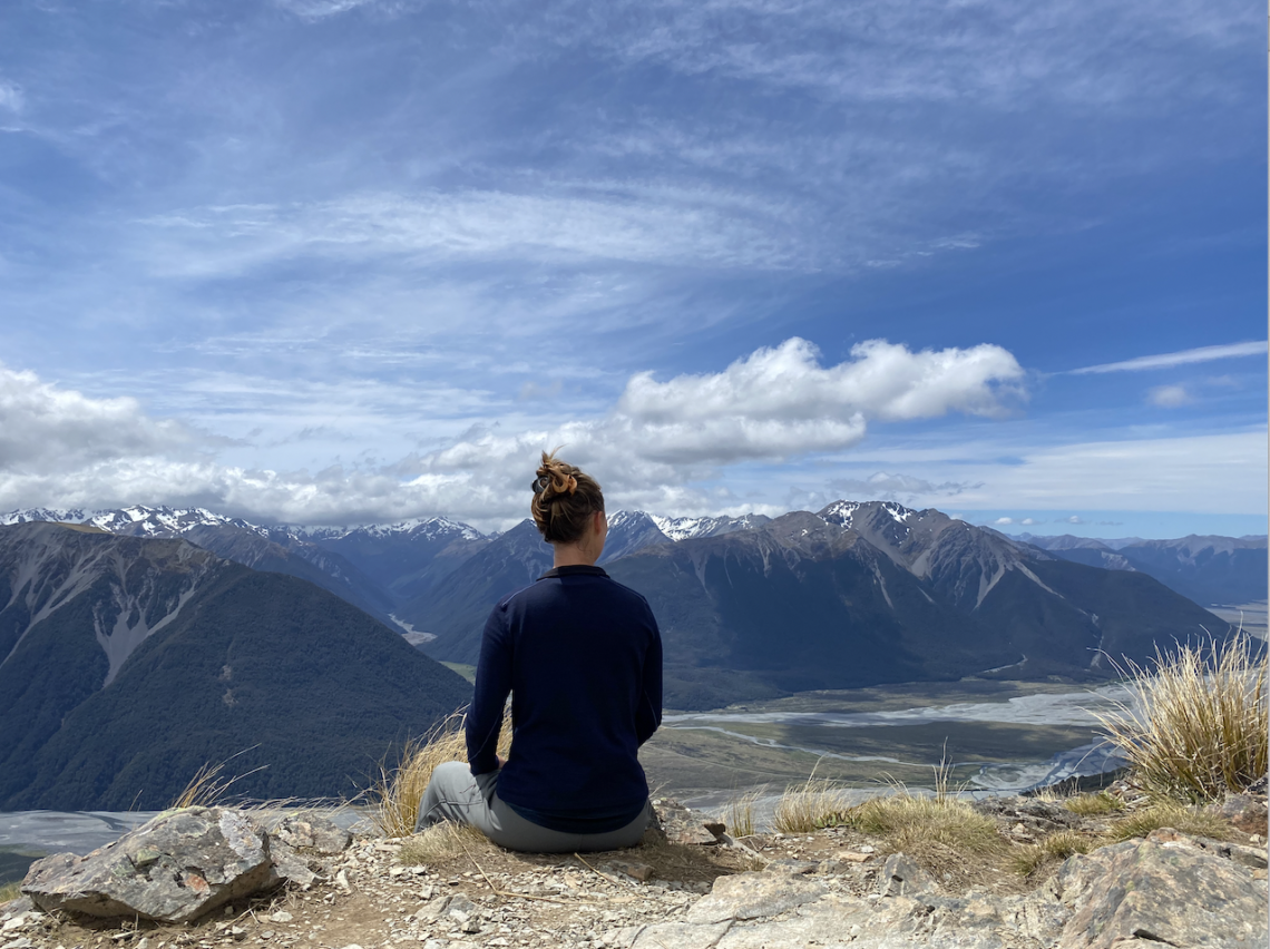
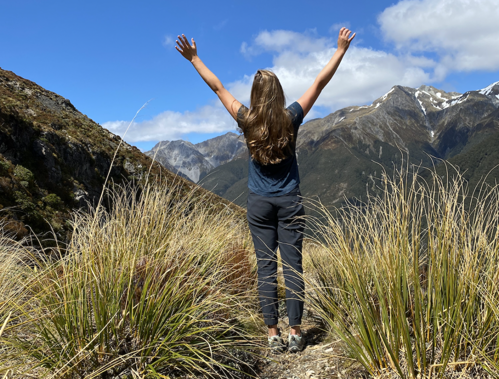
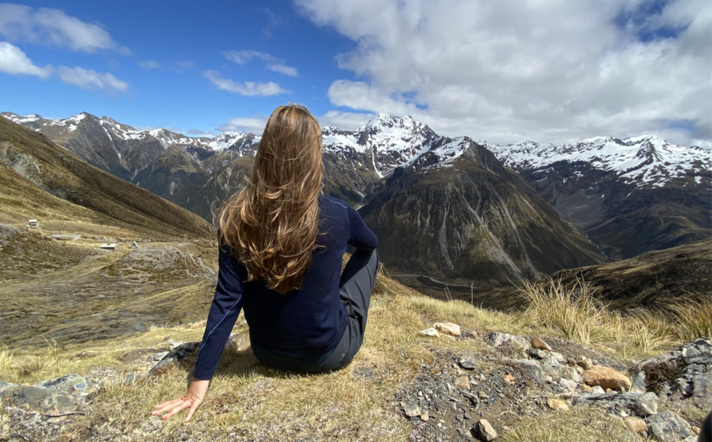
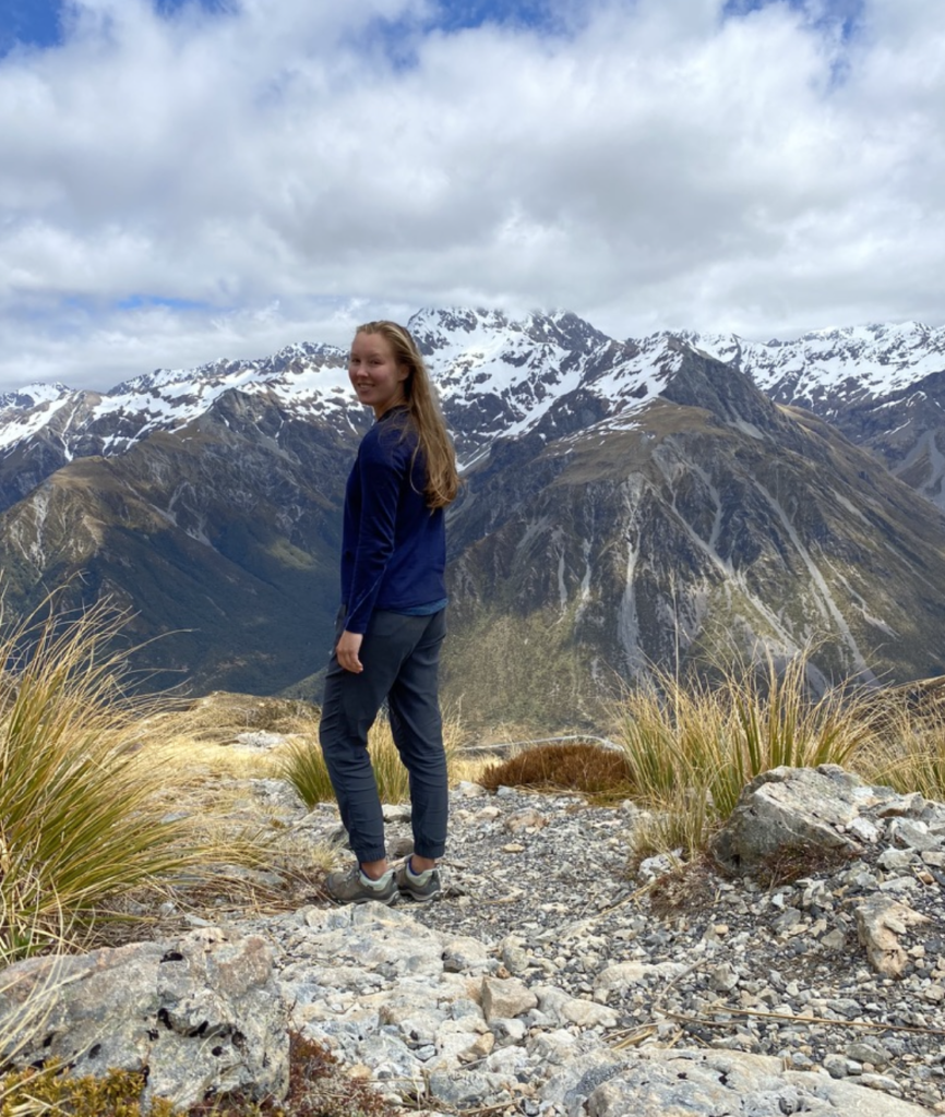
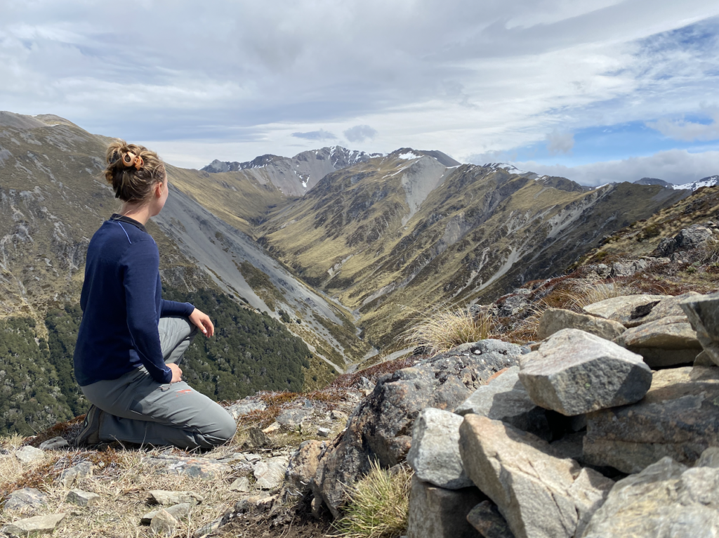
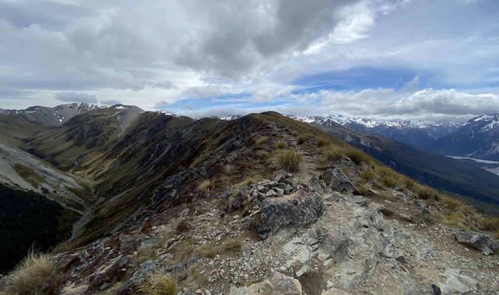
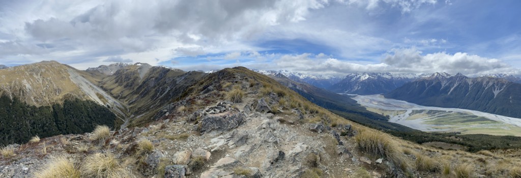
For another hour, I climbed and climbed, following the faintest remnants of a trail. But after a few stands of trees, the tops opened up into tussock-land and I could see the two figures ahead of me. In fact, I gained on them steadily, so they grew clearer and clearer. Finally, a few hundred feet from the top, I caught them. We chatted and they explained that a DOC ranger had told them about this secret extension to Bealey Spur Track.
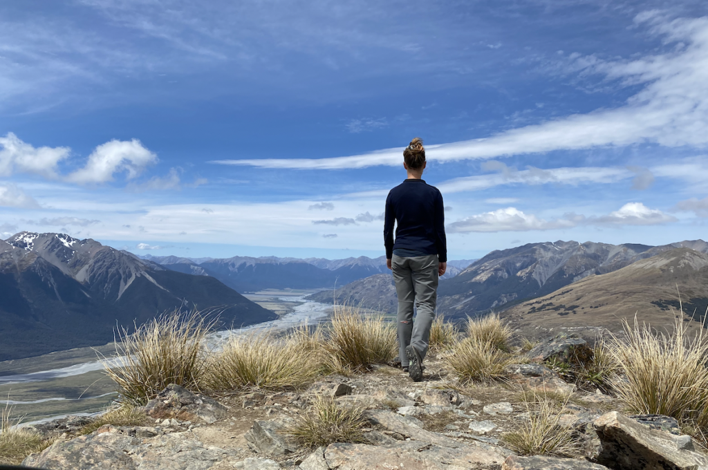
The track to the hut was a nice walk. The track beyond it is what elevates this to one of my best hikes in New Zealand. Not only was the climb through the tussocks lovely, but the views.
Well, I’ll just let you see them.

The Magic of Arthur’s Pass
The unassuming but brilliant tapestry of color in the rocks and vegetation
The massive rocks and narrow chasms
The crystal-clear water crashing from heights high and low
That almost everyone stops at the Devil’s Punchbowl and never steps foot on the other tracks
The mountains rising with such brash confidence out of perfectly flat glacial valleys
The dusting of snow like icing
Feeling like nothing exists except the land, the sky, the wind, and me
And my thoughts feel as though they could stretch as wide as the horizon
My awe at this place and this time and this world is, for endless moments, the most important thing about me


2 Comments
Robert Gamber
Sounds like the kind of place your Dad and I should visit in the winter? So glad to see you enjoying all the treasures they have to offer.
Maddie
Pretty cool to have to hike up to the lodge to ski. It wouldn’t be crowded, that’s for sure. Not to mention those views!